Monterey County, officially the County of Monterey, is a county located on the Pacific coast in the U.S. state of California. As of the 2020 census, its population was 439,035. The county's largest city and county seat is Salinas.

Carmel Valley Village is an unincorporated community and census-designated place (CDP) in Monterey County, California, United States. In 1946, Byington Ford and Tirey L. Ford Jr. developed the Carmel Valley Village, which included an airpark, shops, and homes. At the time of the 2020 census the CDP population was 4,524, up from 4,407 at the 2010 census. In November 2009, a majority of residents voted against incorporation.

Carmel Valley is an unincorporated community in Monterey County, California, United States. The term "Carmel Valley" generally refers to the Carmel River watershed east of California State Route 1, and not specifically to the smaller Carmel Valley Village. For statistical purposes, the United States Census Bureau has defined Carmel Valley as a census county division (CCD), with an area covering approximately 189 square miles (490 km2). At the time of the 2020 census the CCD population was 6,189. In November 2009, a majority of residents voted against incorporation.

This is a list of the National Register of Historic Places listings in Monterey County, California.
Rancho Los Laureles was a 6,625-acre (26.81 km2) Mexican land grant in present-day Monterey County, California given in 1839 by Governor Juan Alvarado to José Manuel Boronda and Vicente Blas Martínez. Los Laureles refers to the California Bay Laurel tree. The grant extended along the Carmel River and the Carmel Valley, was bounded to the east by the Rancho Tularcitos and Rancho Los Laureles (Ransom) on the west, and encompasses present day Carmel Valley Village.

The Jose Eusebio Boronda Adobe is a Monterey Colonial style building from 1846, located in Salinas, Monterey County, California. It is listed on the National Register of Historic Places in 1973, and is a California Historical Landmark.

The Charles C. Fitch Farmstead is a historic farm property located in Eugene, Oregon. It was listed as a historic district on the National Register of Historic Places (NRHP) on June 16, 1989.

The Winter Nelis pear is a deciduous pear tree growing to 8 m depending on rootstock, and is sparse and spreading in form. It is not frost tender. Its flowers are self-sterile and a pollinator tree is required that flowers at a similar time. It is a late-season dessert pear. The fruit are medium in size and have outstanding storage properties for a pear, easily keeping for a couple of months. Hoggs Fruit Manual (1880s) describes it as one of the richest flavoured pears, flesh being yellowish, fine-grained, buttery and melting, with a rich, sugary and vinous flavour and a fine aroma. The pear is named after the Flemish nobleman Jan-Karel de Nelis (1748–1834), who raised it from seed in the early 1800s. It was introduced to England in 1818 and to the United States in 1823

The Jacob and Rebecca Fuerst Farmstead was a farm located at 24000 Taft Road in Novi, Michigan. It was listed on the National Register of Historic Places in 1997. The farm was demolished in 2008 and the property redeveloped into Fuerst Park.

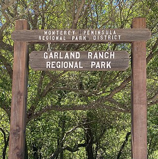
Garland Ranch Regional Park is a 3,464 acres (1,402 ha) public recreational area at 700 West Carmel Valley Road, in Carmel Valley, California. It is owned and managed by the Monterey Peninsula Regional Park District. It is located 18 miles (29 km) from Salinas on the south side of Carmel Valley Road on a .5 miles (0.80 km) stretch of the Carmel River It was the district's first land acquisition and was purchased in 1975 from William Garland II.

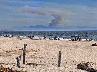
The River Fire was a wildfire that broke out from a lightning storm early on August 16, 2020 in Monterey County, California, south of Salinas, near River Road and Mount Toro. Within its first day, it spread to 2,000 acres and was 10% contained; mandatory evacuations were ordered, while air and ground crews worked the fire.

Eucalyptus Tree Row, also known as Carmel Valley Road-Boronda Road Eucalyptus Tree Row, is located on Boronda Road off Carmel Valley Road in Carmel Valley, California. The unusual street side row of Eucalyptus globulus trees was planted sometime between 1874 and 1881, by Nathan Weston Spaulding, during the species' peak popularity in California for landscaping. The landscape feature was listed on the National Register of Historic Places on January 10, 2008.

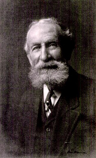
Edward Berwick was an American farmer who raised crops, orchards, and livestock. He settled in Carmel Valley, California in 1869 and developed the Berwick Manor and Orchard. He planted the first commercial pear orchard, specializing in the Winter Nelis pear. He was nationally known for his work for peace and the parcel post. He was the first person to raise winter pears on a commercial scale.

Outlands in the Eighty Acres, also known as Flanders Mansion is an 8,000-square-foot Tudor Revival house. It is significant as a work of architect Henry Higby Gutterson and for its innovative construction with light grey interlocking Precast concrete blocks. The mansion is preserved within the Mission Trail Nature Preserve in Carmel-by-the-Sea, California. It was listed on the National Register of Historic Places on March 23, 1989.

Hatton Fields is an unincorporated community southeast of downtown Carmel-by-the-Sea in Monterey County, California, United States. Homes have views of Carmel Valley, Point Lobos, and Carmel Bay. The residential neighborhood is bordered by Rio Road to the south, Hatton Road to the north, Hatton Canyon to the east, and Junipero Street to the west. The terrain is rolling and naturally landscaped with mature oaks, redwoods, and Monterey Pine trees. Carmel High School, Carmel Mission, and Flanders Mansion are landmarks in this neighborhood. Carmel Mission and Flanders Mansion are two properties that are listed on the National Register of Historic Places. The Mission Trail Nature Preserve runs adjacent to Hatton Fields. Homes are part of the Carmel Unified School District.

Neponset is an unincorporated community in Monterey County, California. It is located along the Southern Pacific Railroad and California State Route 1 between Marina, California and Castroville, California, and 8.5 miles (14 km) northwest of Salinas, California, at an elevation of 23 feet.

William Hatton was an American businessman who was one of Carmel Valley, California's pioneers. He was manager of the dairy and cattle interests of the Pacific Improvement Company, acquired land of his own, and became one of the wealthiest dairymen in Monterey County.
Mount Toro is a mountain peak in the Santa Lucia range in Monterey County, California. It is located within the boundaries of Los Padres National Forest. The name comes from the word "Toro," which in Spanish means "Bull".

José Manuel Boronda, was the first ranchero settler in Carmel Valley, California. He and Vicente Blas Martínez were given the 6,625-acre (26.81 km2) Rancho Los Laureles Mexican land grant in present-day Monterey County, California on September 20, 1839, by Governor Juan Alvarado. Many of the Boronda historic sites still exist, including the Los Laureles Lodge, Carmel Valley Village, Road-Boronda Road Eucalyptus Tree Row, Manuel Boronda Adobe (1817), José Manuel Boronda Adobe, and the Jose Eusebio Boronda Adobe.


