
Monterey County, officially the County of Monterey, is a county located on the Pacific coast in the U.S. state of California. As of the 2020 census, its population was 439,035. The county's largest city and county seat is Salinas.

Carmel Valley is an unincorporated community in Monterey County, California, United States. The term "Carmel Valley" generally refers to the Carmel River watershed east of California State Route 1, and not specifically to the smaller Carmel Valley Village. For statistical purposes, the United States Census Bureau has defined Carmel Valley as a census county division (CCD), with an area covering approximately 189 square miles (490 km2). At the time of the 2020 census the CCD population was 6,189. In November 2009, a majority of residents voted against incorporation.

Area code 831 is a telephone area code in the North American Numbering Plan (NANP) for a small region of the U.S. state of California. The numbering plan area (NPA) comprises Monterey County, San Benito County, and Santa Cruz County. The area code was created on July 11, 1998 in a split from area code 408.

This is a list of the National Register of Historic Places listings in Monterey County, California.
Rancho Los Laureles was a 6,625-acre (26.81 km2) Mexican land grant in present-day Monterey County, California given in 1839 by Governor Juan Alvarado to José Manuel Boronda and Vicente Blas Martínez. Los Laureles refers to the California Bay Laurel tree. The grant extended along the Carmel River and the Carmel Valley, was bounded to the east by the Rancho Tularcitos and Rancho Los Laureles (Ransom) on the west, and encompasses present day Carmel Valley Village.

The Jose Eusebio Boronda Adobe is a Monterey Colonial style building from 1846, located in Salinas, Monterey County, California. It is listed on the National Register of Historic Places in 1973, and is a California Historical Landmark.
The River Road Wine Trail is a Salinas Valley roadway trail for wine-tasting following the River Road along the western banks of the Salinas River (California). It is not to be confused with the Great River Road Wine Trail that follows along the banks of the Mississippi River. It is notably referenced in numerous books and magazines.
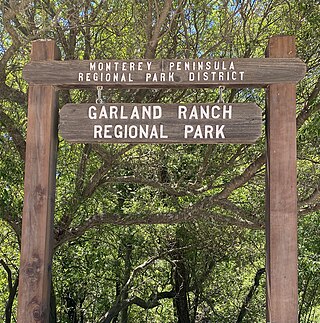
Garland Ranch Regional Park is a 3,464 acres (1,402 ha) public recreational area at 700 West Carmel Valley Road, in Carmel Valley, California. It is owned and managed by the Monterey Peninsula Regional Park District. It is located 18 miles (29 km) from Salinas on the south side of Carmel Valley Road on a .5 miles (0.80 km) stretch of the Carmel River It was the district's first land acquisition and was purchased in 1975 from William Garland II.
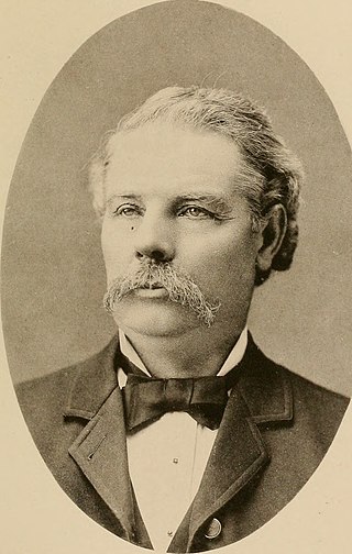
Nathan Weston Spaulding was an American politician and landowner who served as the 15th Mayor of Oakland, California (1871-1873). He was also an inventor, holding a patent for an adjustable circular saw tooth. He created the Pacific Saw Manufacturing Company, which manufactured and sold all types of saws. Spaulding planted the Eucalyptus Tree Row in Carmel Valley, California to establish an entry to his to his Rancho Los Laureles ranch.

Berwick Manor and Orchard, is located on Boronda Road off Carmel Valley Road in Carmel Valley, California. The farmstead was acquired in 1869 by Edward Berwick, a prolific writer and educator as well as a scientific farmer. The manor and orchard was listed on the National Register of Historic Places on November 17, 1977.
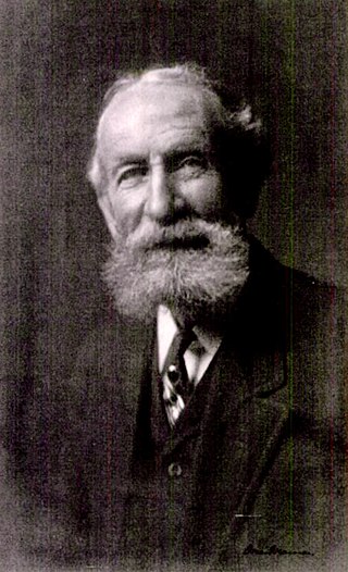
Edward Berwick was an English-American farmer who raised crops, orchards, and livestock. He settled in Carmel Valley, California in 1869 and developed the Berwick Manor and Orchard. He planted the first commercial pear orchard, specializing in the Winter Nelis pear. He was nationally known for his work for peace and the parcel post. He was the first person to raise winter pears on a commercial scale.

Holman Ranch was originally part of the Rancho Los Laureles, a 6,625-acre (26.81 km2) Mexican land grant in present-day Monterey County, California. The ranch passed through many hands until 1928, when San Francisco businessman, Gordon Armsby, purchased 400 acres (160 ha) in Carmel Valley, California, that would become the Holman Ranch. Today, the Holman Ranch continues as a privately owned winery, with a tasting room to sample their award-winning wines, and offers a venue for weddings and special events.

Hatton Fields is an unincorporated community southeast of downtown Carmel-by-the-Sea in Monterey County, California, United States. Homes have views of Carmel Valley, Point Lobos, and Carmel Bay. The residential neighborhood is bordered by Rio Road to the south, Hatton Road to the north, Hatton Canyon to the east, and Junipero Street to the west. The terrain is rolling and naturally landscaped with mature oaks, redwoods, and Monterey Pine trees. Carmel High School, Carmel Mission, and Flanders Mansion are landmarks in this neighborhood. Carmel Mission and Flanders Mansion are two properties that are listed on the National Register of Historic Places. The Mission Trail Nature Preserve runs adjacent to Hatton Fields. Homes are part of the Carmel Unified School District.
John Martin, was an early pioneer of Monterey County, California. In 1859, he purchased 216 unsettled acres (87 ha) near the mouth of Carmel Valley near today's Carmel Mission, before the development of Carmel-by-the-Sea. The Martin homestead is now called Mission Ranch. It was bought in 1986 by Clint Eastwood, who restored the farmhouse, cottage, and barn in the style of the original buildings.

Franklin Benjamin Porter, was a pioneer businessman and real estate developer of Monterey Peninsula. In 1926, he launched the first residential subdivision in Carmel Valley, California that became Robles del Rio, California. Porter went on to develop other properties in the valley including the Robles del Rio Lodge, Robles del Rio Carmelo Water Company, and the Hatton Ranch in Carmel Valley.

William Hatton was one of Carmel Valley, California's earliest pioneers. He was manager of the dairy and cattle interests of the Pacific Improvement Company, acquired land of his own, and became one of the wealthiest dairymen in Monterey County.
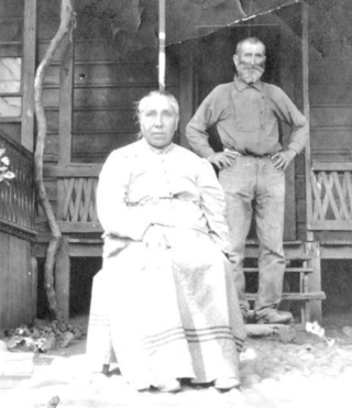
Luigi "Louis" Piazzoni, was a Swiss-born immigrant who came to upper Carmel Valley, California in the 1870s. He was a successful farmer for 50 years. The legacy of the Piazzoni family lives on with the Piazzoni ranch as one of the oldest working ranches in Carmel Valley, the Piazzoni cowboys and cowgirls, and Luigi's nephew, painter Gottardo Piazzoni, with three generations that painted the hills of California.

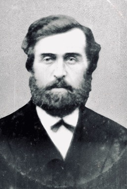
José Manuel Boronda, was the first ranchero settler in Carmel Valley, California. He and Vicente Blas Martínez were given the 6,625-acre (26.81 km2) Rancho Los Laureles Mexican land grant in present-day Monterey County, California on September 20, 1839, by Governor Juan Alvarado. Many of the Boronda historic sites still exist, including the Los Laureles Lodge, Carmel Valley Village, Road-Boronda Road Eucalyptus Tree Row, Manuel Boronda Adobe (1817), José Manuel Boronda Adobe, and the Jose Eusebio Boronda Adobe.

The Los Laureles Lodge is a historic American lodge in Carmel Valley, California. The Pacific Improvement Company used the lodge as a game preserve for Hotel Del Monte guests to hunt, fish, and canoe the Carmel River. Today, the Los Laureles Lodge is a resort hotel and restaurant.


