Mount Toro (Monterey County, California)

Last updated

Mount Toro
Relief map of California.png
Red triangle with thick white border.svg
Mount Toro
Usa edcp relief location map.png
Red triangle with thick white border.svg
Mount Toro
Highest point
Elevation 3,560 ft (1,090 m) [1]
Prominence 1,080 ft (330 m) [2]
Coordinates 36°31′34″N121°35′35″W / 36.52611°N 121.59306°W / 36.52611; -121.59306
Geography
Location Monterey County, California, US
Parent range Santa Lucia Mountains
Topo map Mount Toro
Climbing
Easiest route Trail hike

Mount Toro is a mountain peak in the Santa Lucia range in Monterey County, California. [3] [4] [1] It is located within the boundaries of Los Padres National Forest. The name comes from the word "Toro," which in Spanish means "Bull".

Contents

The highest point in the area is the Sierra de Salinas mountain range, 3,560 ft (1,090 m) above sea level, [1] ten point six miles (17 km) southeast of Mount Toro and 1,080 ft (330 m) above the surrounding terrain. [2] There are about 16 people per square kilometer around Mount Toro. The land around Mount Toro is mountainous. The nearest town is Salinas, fifteen miles (24 km) north of Mount Toro. [5] The area around Mount Toro is covered with dirt and mud.

Mount Toro is not accessible to the public. In the past, it had been used for winter recreational activities during rare events of snowfall. [6] Magnificent views can be seen of the entire shoreline of Monterey Bay, the Corral de Tierra basin, Monterey, Watsonville, Castroville, Salinas, Santa Rita, Natividad, Chualar, Gonzales, and Soledad with the naked eye. Using a telescope you can see Lick Observatory on Mt. Hamilton, and Mount Diablo and the snow-covered Sierras one hundred and fifty miles (241 km) eastward. [7]

The KPRC-FM, KWAV, KLVM (FM), KION-TV, KOTR-LD and other transmitters are on Mount Toro, located ten miles (16 km) to the south of Salinas. [8] The Monterey County Superintendent of Schools began building a network of K31OL-D translators in the early 1960s to rebroadcast public television from KQED in San Francisco, with the first, channel 72 from Mount Toro, going on air in September 1964. [9]

Dorrance Ranch, having conservation easements with the Big Sur Land Trust is about 10 miles (16 km) south of Salinas and 15 miles (24 km) east/southeast of Monterey in the Sierra de Salinas Mountain Range of Monterey County on Mount Toro's northern ridge. [10] The land has oak savannas, ponds, wetlands, and grasslands, habitat for golden eagle, California red-legged frog, California tiger salamander, burrowing owl, and California condor. [11]

The Piazzoni brothers purchased 2,000 acres (810 ha) east of Carmel Valley Village, California along Chupines Creek Canyon, between Mount Toro and Cachagua village. The ranch was originally part of Rancho Tularcitos. [12]

Mount Toro is one of Monterey County's most familiar vistas. John Steinbeck characterized Carmel Valley as "Pastures of Heaven.”

They climbed stiffly from their seats and stood on the ridge peak and looked down into the Pastures of Heaven. And the air was as golden gauze in the last of the sun. The land below them was plotted in squares of green orchard trees and in squares of yellow grain and in squares of violet earth. From the sturdy farmhouses, set in their gardens, the smoke of the evening fires drifted upward until the hillbreeze swept it cleanly off. Cowbells were softly clashing in the valley; a dog barked so far away that the sound rose up to the travelers in sharp little whispers. Directly below the ridge a band of sheep had gathered under an oak tree against the night. "It's called Las Pasturas del Cielo," the driver said. "They raise good vegetables there good berries and fruit earlier here than any place else. The name means Pastures of Heaven."

The River Fire was a wildfire that broke out from a lightning storm early on August 16, 2020, in Monterey County, south of Salinas, near River Road and Mount Toro. [14] [15] Within its first day, it spread to 2,000 acres (810 ha) and was 10% contained; mandatory evacuations were ordered, while air and ground crews worked the fire. [16]

Climate

The climate is Mediterranean. The average temperature is 16 °C. The warmest month is July, at 26  °C, and the coldest is February, at 8 °C. The average rainfall is 492 millimeters per year. The wettest month is December, with 129 millimeters of rain, and the driest is May, with 1 millimeters. [17]

Mount Toro
Climate chart (explanation)
J
F
M
A
M
J
J
A
S
O
N
D
 
 
62
 
 
14
4
 
 
75
 
 
14
3
 
 
71
 
 
18
4
 
 
40
 
 
22
5
 
 
1
 
 
27
10
 
 
2
 
 
36
11
 
 
1
 
 
36
15
 
 
2
 
 
36
13
 
 
2
 
 
33
15
 
 
25
 
 
27
11
 
 
82
 
 
18
8
 
 
129
 
 
12
4
Average max. and min. temperatures in °C
Precipitation totals in mm
Source: [17]
Imperial conversion
JFMAMJJASOND
 
 
2.4
 
 
57
39
 
 
3
 
 
57
37
 
 
2.8
 
 
64
39
 
 
1.6
 
 
72
41
 
 
0
 
 
81
50
 
 
0.1
 
 
97
52
 
 
0
 
 
97
59
 
 
0.1
 
 
97
55
 
 
0.1
 
 
91
59
 
 
1
 
 
81
52
 
 
3.2
 
 
64
46
 
 
5.1
 
 
54
39
Average max. and min. temperatures in °F
Precipitation totals in inches

See also

Related Research Articles

<span class="mw-page-title-main">Monterey County, California</span> County in California, United States

Monterey County, officially the County of Monterey, is a county located on the Pacific coast in the U.S. state of California. As of the 2020 census, its population was 439,035. The county's largest city and county seat is Salinas.

<span class="mw-page-title-main">King City, California</span> City in California, United States

King City is a city in Monterey County, California, United States. It is located on the Salinas River 51 miles (82 km) southeast of Salinas, at an elevation of 335 feet (102 m). It lies along U.S. Route 101 in the Salinas Valley of California's Central Coast. King City is a member of the Association of Monterey Bay Area Governments. The population was 13,332 at the 2020 census, up from 12,874 in 2010.

<span class="mw-page-title-main">Salinas, California</span> City in California, United States

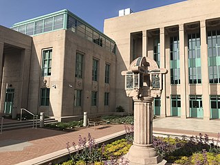
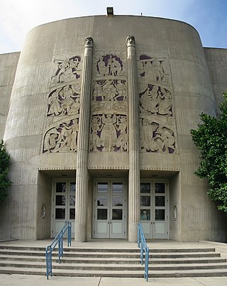
Salinas is a city in the U.S. state of California and the county seat of Monterey County. With a population of 163,542 in the 2020 Census, Salinas is the most populous city in Monterey County. Salinas is an urban area located along the eastern limits of the Monterey Bay Area, lying just south of the San Francisco Bay Area and 10 miles (16 km) southeast of the mouth of the Salinas River. The city is located at the mouth of the Salinas Valley, about eight miles (13 km) from the Pacific Ocean, and it has a climate more influenced by the ocean than the interior.

<span class="mw-page-title-main">Santa Cruz Mountains</span> Mountain range in California, United States

The Santa Cruz Mountains are a mountain range in central and Northern California, United States, constituting a part of the Pacific Coast Ranges. They form a ridge down the San Francisco Peninsula, south of San Francisco. They separate the Pacific Ocean from the San Francisco Bay and the Santa Clara Valley, and continue south to the Central Coast, bordering Monterey Bay and ending at the Salinas Valley. The range passes through the counties of San Mateo, Santa Clara, and Santa Cruz, with the Pajaro River forming the southern boundary.

<span class="mw-page-title-main">Big Sur</span> Coastal region of California, United States

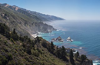
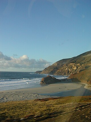
Big Sur is a rugged and mountainous section of the Central Coast of the U.S. state of California, between Carmel Highlands and San Simeon, where the Santa Lucia Mountains rise abruptly from the Pacific Ocean. It is frequently praised for its dramatic scenery. Big Sur has been called the "longest and most scenic stretch of undeveloped coastline in the contiguous United States", a sublime "national treasure that demands extraordinary procedures to protect it from development", and "one of the most beautiful coastlines anywhere in the world, an isolated stretch of road, mythic in reputation". The views, redwood forests, hiking, beaches, and other recreational opportunities have made Big Sur a popular destination for visitors from across the world. With 4.5 to 7 million visitors annually, it is among the top tourist destinations in the United States, comparable to Yosemite National Park, but with considerably fewer services, and less parking, roads, and related infrastructure.

<span class="mw-page-title-main">Salinas Valley</span> Valley in Monterey County, California, U.S.

The Salinas Valley is one of the major valleys and most productive agricultural regions in California. It is located west of the San Joaquin Valley and south of San Francisco Bay and the Santa Clara Valley.

<span class="mw-page-title-main">Carmel Valley, California</span> Unincorporated community in California, United States

Carmel Valley is an unincorporated community in Monterey County, California, United States. The term "Carmel Valley" generally refers to the Carmel River watershed east of California State Route 1, and not specifically to the smaller Carmel Valley Village. For statistical purposes, the United States Census Bureau has defined Carmel Valley as a census county division (CCD), with an area covering approximately 189 square miles (490 km2). At the time of the 2020 census the CCD population was 6,189. In November 2009, a majority of residents voted against incorporation.

<span class="mw-page-title-main">Los Padres National Forest</span> National forest in California, United States

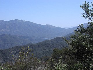
Los Padres National Forest is a United States national forest in southern and central California. Administered by the United States Forest Service, Los Padres includes most of the mountainous land along the California coast from Ventura to Monterey, extending inland. Elevations range from sea level to 8,847 feet (2,697 m).

<span class="mw-page-title-main">Pfeiffer Big Sur State Park</span> State park in California, United States

Pfeiffer Big Sur State Park is a state park in Monterey County, California, near the area of Big Sur on the state's Central Coast. It covers approximately 1,006 acres (4.07 km2) of land. The park is centered on the Big Sur River. It has been nicknamed a "mini Yosemite." A Redwood tree in the park nicknamed the Colonial Tree is estimated to be between 1,100 and 1,200 years old.

<span class="mw-page-title-main">Little Sur River</span> River in California, United States

The Little Sur River is a 25.4-mile (40.9 km) long river on the Central Coast of California. The river and its main tributary, the South Fork, drain a watershed of about 40 square miles (100 km2) of the Big Sur area, a thinly settled region of the Central California coast where the Santa Lucia Mountains rise abruptly from the Pacific Ocean. The South Fork and the North Fork both have their headwaters in the Ventana Wilderness, straddling Mount Pico Blanco. Portions west of the national forest and Old Coast Road lie within the El Sur Ranch. Some portions of the North Fork are on land owned by Granite Rock Company of Watsonville, California, which has owned the mineral rights to 2,800 acres (1,100 ha) on Mount Pico Blanco since 1963. The North and South forks converge about 2 miles (3.2 km) from the coast where the river enters the Pacific Ocean.

<span class="mw-page-title-main">Fort Hunter Liggett</span> US Army base in Monterey County, California

Fort Hunter Liggett is a United States Army post in Jolon, California, in southern Monterey County, California. The fort, named in 1941 after General Hunter Liggett, is primarily used as a training facility, where activities such as field maneuvers and live fire exercises are performed. It is roughly 25 miles northwest of Camp Roberts, California.

<span class="mw-page-title-main">Corral de Tierra, California</span> Unincorporated community in California, United States

Corral de Tierra is an unincorporated community in Monterey County, California. It is located in the Corral de Tierra Valley, on the former land grant of Rancho Corral de Tierra, at an elevation of 404 feet.

<span class="mw-page-title-main">Posts, California</span> Unincorporated community in California, United States

Posts is an unincorporated community in the Big Sur region of Monterey County, California. It is located on the Big Sur Coast Highway, 4.8 miles (7.7 km) south of the Big Sur Village at an elevation of 945 feet.

San Benancio is an unincorporated community in Monterey County, California. It is located in the San Benancio Canyon.

<span class="mw-page-title-main">Big Sur Land Trust</span> Non-profit located in Monterey, California

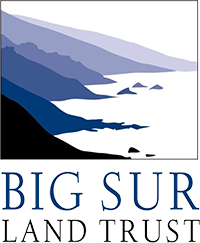
The Big Sur Land Trust is a private 501(c)(3) non-profit located in Monterey, California, that has played an instrumental role in preserving land in California's Big Sur and Central Coast regions. The trust was the first to conceive of and use the "conservation buyer" method in 1989 by partnering with government and developers to offer tax benefits as an inducement to sell land at below-market rates. Since 1978, with the support of donors, funders and partners, it has conserved over 40,000 acres through conservation easements, acquisition and transfer of land to state, county and city agencies. It has placed conservation easements on 7,000 acres and has retained ownership of over 4,000 acres.

<span class="mw-page-title-main">Garland Ranch Regional Park</span> Public recreational area

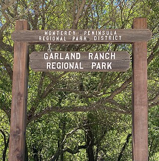
Garland Ranch Regional Park is a 3,464 acres (1,402 ha) public recreational area at 700 West Carmel Valley Road, in Carmel Valley, California. It is owned and managed by the Monterey Peninsula Regional Park District. It is located 18 miles (29 km) from Salinas on the south side of Carmel Valley Road on a .5 miles (0.80 km) stretch of the Carmel River It was the district's first land acquisition and was purchased in 1975 from William Garland II.

<span class="mw-page-title-main">Chews Ridge Lookout</span> Fire lookout tower in Los Padres National Forest

The Chews Ridge Lookout is located at the northern end of the Santa Lucia Range of the Los Padres National Forest, about 50 miles (80 km) southeast of Monterey, California and approximately 30 miles (48 km) west of Highway 101. The current tower was built in 1929 and staffed until around 1990. A volunteer organization began recruiting individuals to staff the tower in 2019. The ridge and tower were named for homesteaders Constantine and Nellie Chew, who patented 315 acres (127 ha) on the ridge in the late 19th century.

<span class="mw-page-title-main">River Fire (2020)</span> 2020 wildfire in Central California

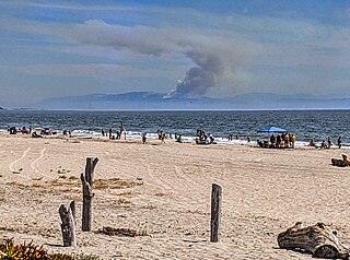
The River Fire was a wildfire that broke out from a lightning storm early on August 16, 2020 in Monterey County, California, south of Salinas, near River Road and Mount Toro. Within its first day, it spread to 2,000 acres and was 10% contained; mandatory evacuations were ordered, while air and ground crews worked the fire.

<span class="mw-page-title-main">Old Coast Road (Big Sur)</span> Pre-1920 dirt road in Monterey County, California

The Old Coast Road is a dirt road that still exists in part and preceded the current Big Sur Coast Highway along the northern coast of Big Sur, California. It was initially a trail created by Rumsen and Esselen Native Americans to travel along the coast in present-day Monterey County, California. Soon after the Spanish arrived, Governor Teodoro Gonzalez granted land that included portions of the trail as Rancho San Jose y Sur Chiquito to Marcelino Escobar in 1835. Governor Juan Alvarado re-granted the land to Escobar the same year. The Rancho included land from Carmel to near Palo Colorado Canyon. José Castro gained possession of the land in about 1848. He improved the trail from Monterey to Palo Colorado Canyon as early as 1853. A hand-drawn map created c. 1853 accompanying the grant indicated a road or trail was already present along the coast.

<span class="mw-page-title-main">Luigi Piazzoni</span> Swiss-born pioneer

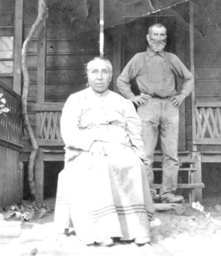
Luigi "Louis" Piazzoni, was a Swiss-born immigrant who came to upper Carmel Valley, California in the 1870s. He was a successful farmer for 50 years. The legacy of the Piazzoni family lives on with the Piazzoni ranch as one of the oldest working ranches in Carmel Valley, the Piazzoni cowboys and cowgirls, and Luigi's nephew, painter Gottardo Piazzoni, with three generations that painted the hills of California.

References

  1. 1 2 3 "Junipero Serra Peak, California". Peakbagger.com. Retrieved August 7, 2009.
  2. 1 2 "Mount Toro". Peakvisor. Retrieved January 16, 2023.
  3. Mount Toro sa Geonames.org (cc-by); post updated February 19, 2010; database download sa February 28, 2017
  4. "Mount Toro". Geographic Names Information System . United States Geological Survey, United States Department of the Interior . Retrieved August 7, 2009.
  5. "Toro, Mount". List of Peaks. Retrieved January 17, 2023.
  6. "Many Enjoy Winter Sports on Mount Toro". The Californian. Salinas, California. February 9, 1948. p. 1. Retrieved January 17, 2023.
  7. "A Magnificent View". The Californian. Salinas, California. September 30, 1899. p. 4. Retrieved January 17, 2023.
  8. "Radio and TV Stations on Mount Toro". FCCInfo.com. Retrieved December 19, 2023.
  9. "Education Out of Thin Air Links Coast Area Counties". The Californian. December 21, 1966. pp. 20A, 21A . Retrieved February 19, 2021.
  10. Parsons, Larry (2008). "Ranch With a View Will be Preserved". Monterey Herald. Archived from the original on December 20, 2016. Retrieved December 5, 2016.
  11. "Monterey's Iconic Mt Toro Vista Protected". Big Sur Land Trust. March 11, 2008. Archived from the original on February 10, 2012. Retrieved November 15, 2016.
  12. Adam Miller (January 20, 2022). "How the West Was Won – Big Sur After the Gold Rush". www.folksinging.org. Retrieved January 16, 2023.
  13. Steinbeck, John (April 1995). The pastures of heaven. Penguin. p. 199. ISBN   9780140187489 . Retrieved January 16, 2023.
  14. Szydlowski, Joe (August 18, 2020). "Here's how a freak storm ignited, and then inflamed, the River Fire in Monterey County". The Californian . Retrieved October 7, 2020.
  15. Cabral, Angelica; Cimini, Kate (August 18, 2020). "UPDATE: New evacuation orders on 4,500-acre River Fire, which is still only 10% contained". The Californian. Retrieved October 7, 2020.
  16. "Mandatory evacuations issued for 2,000-acre River Fire burning near Salinas". ksbw.com. August 16, 2020. Retrieved August 16, 2020.
  17. 1 2 "National Weather Service". National Oceanic and Atmospheric Administration. Retrieved January 17, 2023.