Birnagar

Last updated

Birnagar
City
Birnagar.jpg
Temples in Birnagar, Rajshekhar Basu (bottom right) & Nabin Chandra Sen (right)
West Bengal location map.svg
Red pog.svg
Birnagar
Location in West Bengal, India
India location map 3.png
Red pog.svg
Birnagar
Birnagar (India)
Coordinates: 23°14′36″N88°33′30″E / 23.2433°N 88.5582°E / 23.2433; 88.5582
CountryFlag of India.svg  India
State West Bengal
District Nadia
Government
  Type Municipality
  BodyBirnagar Municipality
Area
[1]
  Total6 km2 (2 sq mi)
Elevation
13 m (43 ft)
Population
 (2011)
  Total32,799
  Density5,500/km2 (14,000/sq mi)
Languages
  Official Bengali, English
Time zone UTC+5:30 (IST)
Website www.birnagarmunicipality.org

Birnagar (formerly known as Ula) is an island municipality situated in the Hooghly River, within the Ranaghat subdivision of Nadia district in West Bengal, India. It traces its origins back to the pre-colonial era when it was established. Prior to the British colonization of India, Birnagar was known as "Ula."

Contents


The Birnagar railway station is located 81 kilometers north of Kolkata within the Sealdah railway division. [2]

Birnagar is the oldest municipality in Nadia district, consisting of 14 wards. The first chairman of Birnagar was the renowned poet Nabinchandra Sen.

History

The oldest temple found at Ula is the Vishnu temple located to the north-east of the Mitra-Mustafi house. Ruined Bishnu temple at Ula Birnagar in Nadia district, West Bengal 03.jpg
The oldest temple found at Ula is the Vishnu temple located to the north-east of the Mitra-Mustafi house.

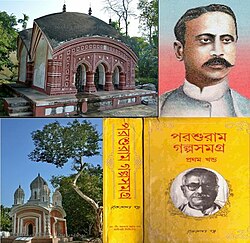
According to historical records, Birnagar was initially an island in the Hoogly River, but its course shifted away from the then settlement of Ula around 1707. Before British colonization, the area was referred to as Ula or Ulo. The name "Ula" still persists in the titles of some local institutions, such as the library and hospital, and is also mentioned in Rabindranath Tagore's short story Post Master. The Birnagar Municipality has a history of around 150 years, with its inaugural chairman being Kabi Nabinchandra Sen. In the past, Birnagar was divided between two zamindars: the Mukherjees and the Mustafis.

Geography

Birnagar
Invisible Square.svg
Mapscaleline.svg
8km
5miles
Red pog.svg
B
A
N
G
L
A
D
E
S
H
Churni
River
Bhagirathi
River
Payradanga
R
Invisible Square.svg
Nokari
R
Invisible Square.svg
Dhantala
R
Invisible Square.svg
Habibpur
R
Invisible Square.svg
Hanskhali
R
Invisible Square.svg
Duttapulia
R
Invisible Square.svg
Aranghata
R
Invisible Square.svg
Panikhali
R
Invisible Square.svg
Taherpur
M
Invisible Square.svg
Cooper's Camp
M
Invisible Square.svg
Birnagar
M
Shantipur
M
Invisible Square.svg
Ranaghat
M
Invisible Square.svg
Belgharia
CT
Invisible Square.svg
Gangnapur
CTV
Invisible Square.svg
Nasra
CT
Invisible Square.svg
Ranaghat (CT)
CT
Invisible Square.svg
Hijuli
CT
Invisible Square.svg
Halalpur Krishnapur
CT
Invisible Square.svg
Parbbatipur
CT
Invisible Square.svg
Gopalpur
CT
Invisible Square.svg
Anulia
CT
Invisible Square.svg
Satigachha
CT
Invisible Square.svg
Aistala
CT
Invisible Square.svg
Panpara
CT
Invisible Square.svg
Raghabpur
CT
Invisible Square.svg
Kamgachhi
CT
Invisible Square.svg
Gangni
CT
Invisible Square.svg
Patuli
CT
Invisible Square.svg
Badkulla
CT
Invisible Square.svg
Bagula
CT
Invisible Square.svg
Phulia
CT
Invisible Square.svg
Beharia
CT
Invisible Square.svg
Harinadibhastsala
CT
Invisible Square.svg
Ghoralia
CT
Invisible Square.svg
Cities and towns in Ranaghat subdivision of Nadia district
M: municipal town/ city/notified area, CT: census town, R: rural/ urban centre.
Owing to space constraints in the small map, the actual locations in a larger map may vary slightly

Location

Birnagar is situated at coordinates 23°14′36″N88°33′30″E / 23.2433°N 88.5582°E / 23.2433; 88.5582 .

According to the maps in the District Census Handbook 2011 for Nadia, the census towns of Kamgachhi, Raghabpur, Panpara, Aistala, Satigachha, Anulia, Halalpur Krishnapur, Hijuli, and Ranaghat (CT) form a cluster around Ranaghat within the Ranaghat I and Ranaghat II CD blocks. Additionally, other localities such as Nokari, Nasra, Cooper's Camp, Birnagar, Habibpur, Gopalpur, and Parbbatipur are also associated with this cluster. [3]

Area overview

Nadia district consists mainly of alluvial plains located to the east of the Hooghly River, locally known as Bhagirathi. These plains are intersected by distributaries such as Jalangi, Churni, and Ichhamati. Due to the siltation of these rivers, floods occur periodically. [4] The Ranaghat subdivision is bordered by the Bhagirathi River to the west, with Purba Bardhaman and Hooghly districts situated on the opposite bank. Topographically, the Ranaghat subdivision encompasses the Krishnanagar-Santipur Plain, which occupies the central part of the district, and the Ranaghat-Chakdaha Plain, a low-lying area in the southeastern part. The Churni River separates these two plains. A portion of the eastern border forms the boundary with Bangladesh, while the lower section is part of the North 24 Parganas district. [5] The subdivision has experienced significant urbanization, with 41.68% of the population residing in urban areas and 58.32% living in rural areas. [6]

Note: The map alongside presents some of the notable locations in the subdivision. All places marked in the map are linked in the larger full screen map. All the four subdivisions are presented with maps on the same scale – the size of the maps vary as per the area of the subdivision.

Demographics

Religion in Birnagar [7]
BirnagarPercent
Hindu
98.32%
Muslim
1.51%
Christian
0.09%
Buddhist
0.01%
Not stated
0.06%

According to the 2021 Indian census, Birnagar has a population of 41,200, comprising 16,658 males and 16,141 females, as reported by Census India in 2011.

In Birnagar (M), a significant portion of the population belongs to the Schedule Caste (SC), comprising 35.40%, while Schedule Tribe (ST) members constitute 0.65% of the total population. The child sex ratio in Birnagar is approximately 943, compared to the West Bengal state average of 956.

In the 2011 census, the following municipalities, notified areas, outgrowths, and census towns were part of the Ranaghat Urban Agglomeration:Ranaghat (M), Birnagar (M), Cooper's Camp (NA), Magurkhali (OG), Ranaghat (CT) (CT), Hijuli (CT), Aistala (CT), Satigachha (CT), Nasra (CT), Panpara (CT), Raghabpur (CT), Kamgachhi (CT), Anulia (CT) and Halalpur Krishnapur (CT). [8]

Education

The town features several primary and high schools, along with institutions offering higher education.

Higher-secondary schools
Primary schools
1 NCPL
Other schools
College
Other institutions
Computer training institutes

The literacy rate of Birnagar city stands at 84.60%, surpassing the state average of 76.26%. In Birnagar, the male literacy rate is approximately 88.26%, while the female literacy rate is 80.82%.

Library

Ula Sadharon Pathagar [10] was founded in 1922, located in Library Para near Shivkali Girl's Higher Secondary School. Membership is open to individuals over 18 years of age, allowing them to borrow one book at a time for a duration of one month.

Library statistics

Birnagar Municipality

Established over 200 years ago, Birnagar municipality holds the distinction of being the oldest municipality in the Nadia district. Notably, the first chairman of Birnagar municipality was the esteemed poet Nabinchandra Sen. The municipality comprises 14 wards. [11] Birnagar Municipality oversees the administration of 6,702 households, providing essential services such as water and sewerage. Additionally, it possesses the authority to construct roads within the municipality's boundaries and levy taxes on properties falling within its jurisdiction.

Notable people

Related Research Articles

<span class="mw-page-title-main">Ranaghat</span> Town in West Bengal, India

Ranaghat is a city and a municipality in Nadia district in the state of West Bengal, India. It is the headquarters of the Ranaghat subdivision. It is known for its handloom industry, various types of flowers and floriculture.

Aistala is a census town in the Ranaghat I CD block in the Ranaghat subdivision of the Nadia district in the Indian state of West Bengal.

Cooper's Camp is a town and a notified area in Nadia district under Ranaghat police station of Ranaghat subdivision in the state of West Bengal, India.

Gopalpur is a census town in the Ranaghat I CD block in the Ranaghat subdivision of the Nadia district in the Indian state of West Bengal.

Parbbatipur is a census town in Ranaghat I CD Block in Ranaghat subdivision of Nadia district in the Indian state of West Bengal.

Satigachha is a census town in the Ranaghat I CD block in the Ranaghat subdivision of the Nadia district in the Indian state of West Bengal.

Nasra is a census town in the Ranaghat II CD block in the Ranaghat subdivision of the Nadia district in the Indian state of West Bengal.

<span class="mw-page-title-main">Hanshkhali</span> Village in West Bengal, India

Hanskhali is a village in the Hanskhali CD block in the Ranaghat subdivision of the Nadia district in the state of West Bengal, India. Situated on the bank of the Churni river, Hanshkhali is known for an Administrative Registry Office and Police Station.

<span class="mw-page-title-main">Ranaghat subdivision</span> Subdivision in West Bengal, India

Ranaghat Subdivision is an administrative subdivision located at Nadia district, in the state of West Bengal, India The subdivision is administered by SDM/SDO(Ranaghat).

<span class="mw-page-title-main">Habibpur, Nadia</span> Village in West Bengal, India

Habibpur is a village in the Ranaghat I CD block in the Ranaghat subdivision of the Nadia district, west Bengal, India

Dattapulia is a village in the Ranaghat II CD block in the Ranaghat subdivision of the Nadia district, West Bengal, India.

<span class="mw-page-title-main">Nokari</span> Village in West Bengal, Indiagh

Nokari is a village in the Ranaghat II CD block in the Ranaghat subdivision of the Nadia district in the state of West Bengal, India

Panikhali is a village in the Ranaghat II CD block in the Ranaghat subdivision of the Nadia district in the state of West Bengal, India.

Kamgachhi is a census town in the Ranaghat I CD block in the Ranaghat subdivision of the Nadia district in the state of West Bengal, India.

Raghabpur is a census town in the Ranaghat I CD block in the Ranaghat subdivision of the Nadia district in the state of West Bengal, India.

Panpara is a census town in the Ranaghat I CD block in the Ranaghat subdivision of the Nadia district in the state of West Bengal, India.

Anulia is a census town in the Ranaghat I CD block in the Ranaghat subdivision of the Nadia district in the state of West Bengal, India.

Halalpur Krishnapur is a census town in the Ranaghat II CD block in the Ranaghat subdivision of the Nadia district in the state of West Bengal, India.

<span class="mw-page-title-main">Hijuli, Nadia</span> Census Town in West Bengal, India

Hijuli is a census town in the Ranaghat II CD block in the Ranaghat subdivision of the Nadia district in the state of West Bengal, India.

Ranaghat (CT) is a census town in the Ranaghat II CD block in the Ranaghat subdivision of the Nadia district in the state of West Bengal, India.

References

  1. "Birnagar City".
  2. "District Wise List of Statutory Towns". Census of India 2001, Urban Frame. Directorate of Census Operations, West Bengal. Archived from the original on 27 September 2007. Retrieved 6 October 2007.
  3. "District Census Handbook Nadia, Census of India 2011, Series 20, Part XII A" (PDF). Map of Ranaghat I CD block, page 449, and Map of Ranaghat II CD block, page 475. Directorate of census Operations V, West Bengal. Retrieved 8 October 2020.
  4. Gangopadhyay, Basudev, Paschimbanga Parichay, 2001, (in Bengali), p. 70, Sishu Sahitya Sansad
  5. "District Census Handbook, Nadia, 2011, Series 20, Part XII A" (PDF). Pages 13,14. Directorate of Census Operations, West Bengal. Retrieved 16 October 2020.
  6. "District Statistical Handbook 2014 Nadia". Table 2.2, 2.4(a). Department of Planning and Statistics, Government of West Bengal. Retrieved 16 October 2020.
  7. "Towns in Birnagar - Religion 2011".
  8. "Provisional Population Totals, Census of India 2011" (PDF). Constituents of Urban Agglomeration Having Population Above 1 Lakh. Census of India 2011. Retrieved 18 October 2020.
  9. "Birnagar Kabinabin Chandra Sen Teachers Training College". Archived from the original on 23 December 2016. Retrieved 22 December 2016.
  10. http://rrrlf.nic.in/hindi/rrrlf_hindi/Book/Web/DigitalLibrary/ViewLibrary.aspx?Lib_ID=221300393%5B%5D
  11. "Brnagar Municipality Official Website". Archived from the original on 9 October 2016. Retrieved 8 October 2016.