Blackall Range

Last updated

Blackall
StateLibQld 1 112236 Looking west from Gympie Road, Nambour, 1910.jpg
Looking west from Gympie Road, Nambour, 1910. Looking west down Gympie Road, Nambour, to lightly cleared rural land and the Blackall Ranges.
Highest point
Elevation 258 m (846 ft)  OOjs UI icon edit-ltr-progressive.svg
Geography
CountryAustralia
StateQueensland
RegionSouth East Queensland
Range coordinates 26°42′S152°53′E / 26.700°S 152.883°E / -26.700; 152.883
Geology
Age of rock Oligocene

The Blackall Range is a mountain range in South East Queensland, Australia. The first European explorer in the area was Ludwig Leichhardt. [1] It was named after Samuel Blackall, the second Governor of Queensland.

Contents

The Blackall Range dominates the hinterland area of the Sunshine Coast, west of Nambour. Maleny, Mapleton, Montville and Flaxton are the main settlements located on the range. The Stanley River rises from the southern slopes. Baroon Pocket Dam is a reservoir on Obi Obi Creek which drains the north west slopes of the range.

Mary Cairncross Reserve marks the site of the first settler's house on the Blackall Range. Curramore Sanctuary, Mapleton Falls National Park and Kondalilla National Park are also located on the range. A number of lookouts on the range provide views towards the coast.[ citation needed ] One of these is located at Howells Knob, a mountain which rises 561 m above sea level. [2]

Timber resources in the area attracted timber-cutters in 1860s. [3] The last logging on the range occurred in 1939. The Blackall and Bunya Mountains ranges are the only two locations where the bunya pine species of tree is found naturally. [4]

Activities by community groups with the support of the Queensland Government succeeded in recognising the range with iconic status, meaning the area is given greater environmental protection. [5] In mid-2008, iconic status was confirmed, making the Blackall Range the third such declaration in Queensland after Noosa and Port Douglas. [6]

History

The Blackall Range is volcanic in origin and contains vast amounts of red basalt soils dating from the Jurassic period. It also takes its name from Samuel Blackall, the second Governor of Queensland.

Dalla (also known as Dalambara and Dallambara) is a language of the Upper Brisbane River catchment, notably the Conondale Range. Dalla is part of the Duungidjawu language region includes the landscape within the local government boundaries of the Somerset and Moreton Bay Regional Councils, particularly the towns of Caboolture, Kilcoy, Woodford and Moore. [7]

Roads

A group of roads provide access to the mountain localities and towns from various lowland places, and enable travel between the mountain communities. These roads ensure continuity of access in times of flooding or other natural disasters, and during planned maintenance activities.

See also

Related Research Articles

<span class="mw-page-title-main">Kondalilla National Park</span> Protected area in Queensland, Australia

Kondalilla is a national park in the Blackall Range of South East Queensland, Australia, 91 km north of Brisbane. William Skene founded this area on his property while searching for lost cattle. He named it Bon Accord before giving it to the Queensland Government who, during the fifties, renamed it Kondalilla which is an Aboriginal word for running water. The area was first officially protected in 1906 as a recreational area, becoming a national park in 1945.

<span class="mw-page-title-main">Mapleton Falls National Park</span> Protected area in Queensland, Australia

Mapleton Falls is a national park near the town of Mapleton on the Blackall Range in South East Queensland, Australia, 95 kilometres (59 mi) north of Brisbane. The falls are part of Pencil Creek and drop 120 metres (390 ft).

<span class="mw-page-title-main">Sunshine Coast, Queensland</span> Region in Queensland, Australia

The Sunshine Coast is a peri-urban region in South East Queensland, Australia. It is the district defined in 1967 as "the area contained in the Shires of Landsborough, Maroochy and Noosa, but excluding Bribie Island". Located 100 km (62 mi) north of the centre of Brisbane in South East Queensland, on the Coral Sea coastline, its urban area spans approximately 60 km (37 mi) of coastline and hinterland from Pelican Waters to Tewantin.

<span class="mw-page-title-main">Maleny, Queensland</span> Town in Queensland, Australia

Maleny is a rural town and locality in the Sunshine Coast Region, Queensland, Australia. Maleny was a timber town until the early 1920s and then was a centre of dairy production and fruit growing. In the 2021 census, the locality of Maleny had a population of 3,959 people.

The Mary Cairncross Reserve is a conservation park located on the Blackall Range east of Maleny, in the Sunshine Coast Region, Queensland, Australia. Maleny is approximately 88 kilometres (55 mi) north of Brisbane and 30 kilometres (18.6 mi) west of Caloundra. The reserve is positioned in the mountain rainforests of the Maleny region overlooking the Glass House Mountains.

<span class="mw-page-title-main">Mapleton, Queensland</span> Suburb of Sunshine Coast Region, Queensland, Australia

Mapleton is a rural town and locality in the Sunshine Coast Region, Queensland, Australia. In the 2016 census, the locality of Mapleton had a population of 1,564 people.

Montville is a rural town and locality in the Sunshine Coast Region, Queensland, Australia. In the 2016 census, the locality of Montville had a population of 970 people.

Eudlo is a rural town and locality in the Sunshine Coast Region, Queensland, Australia. In the 2016 census, the locality of Eudlo had a population of 1,117 people.

<span class="mw-page-title-main">Baroon Pocket Dam</span> Dam in South East Queensland

The Baroon Pocket Dam is a rock and earth-fill embankment dam with an un-gated spillway across the Obi Obi Creek, in North Maleny, Sunshine Coast Region, in South East Queensland, Australia. The main purpose of the dam is for potable water supply. The impounded reservoir is called Lake Baroon.

<span class="mw-page-title-main">Conondale Range</span> Mountain range in Queensland, Australia

The Conondale Range is a mountain range in Queensland, located between Maleny, Kenilworth, Kilcoy and Jimna. The range is the most westerly part of the Sunshine Coast hinterland and part of the Great Dividing Range. The highest point on the range is Mount Langley reaching 868 m above sea level. This is also the highest point in the Brisbane River catchment.

<span class="mw-page-title-main">Obi Obi, Queensland</span> Suburb of Sunshine Coast Region, Queensland, Australia

Obi Obi is a rural locality in the Sunshine Coast Region, Queensland, Australia. In the 2021 census, Obi Obi had a population of 208 people.

Bald Knob is a rural locality in the Sunshine Coast Region, Queensland, Australia. At the 2021 census, Bald Knob had a population of 280 people.

<span class="mw-page-title-main">Balmoral Ridge, Queensland</span> Suburb of Sunshine Coast, Queensland, Australia

Balmoral Ridge is a rural locality in the Sunshine Coast Region, Queensland, Australia. At the 2021 census, Balmoral Ridge had a population of 302 people.

<span class="mw-page-title-main">Fairview, Maleny</span> Historic site in Queensland, Australia

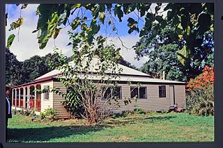
Fairview is a heritage-listed house at 15 Porter's Lane, Maleny, Sunshine Coast Region, Queensland, Australia. It was designed and built in 1907 by the Pattemore family. It is also known as Armstrong's House and Pattemore House. It was added to the Queensland Heritage Register on 4 September 2003.

<span class="mw-page-title-main">Witta, Queensland</span> Suburb of Sunshine Coast Region, Queensland, Australia

Witta is a rural town and locality in the Sunshine Coast Region, Queensland, Australia. In the 2021 census, the locality of Witta had a population of 1,296 people.

The Dalla, also known as Jinibara, are an indigenous Australian people of southern Queensland whose tribal lands lay close to Brisbane.

<span class="mw-page-title-main">Wootha, Queensland</span> Suburb of Sunshine Coast Region, Queensland, Australia

Wootha is a rural locality in the Sunshine Coast Region, Queensland, Australia. In the 2016 census Wootha had a population of 201 people.

Gheerulla is a rural locality in the Sunshine Coast Region, Queensland, Australia. In the 2016 census, Gheerulla had a population of 214 people.

Blackall Range road network is a group of roads that provide access to the mountain localities and towns from various lowland places, and enable travel between the mountain communities. The network ensures continuity of access in times of flooding or other natural disasters, and during planned maintenance activities. The area serviced by the network includes the localities and towns, from south to north, of Maleny, Montville and Mapleton. It also includes the rural localities of Bald Knob, Balmoral Ridge, Flaxton, Gheerulla, North Maleny, Obi Obi and Witta. The area hosts a substantial residential community plus many tourism accommodation venues. At the 2021 census, the locality of Maleny had a population of 3,959 people.

References

  1. "Maleny". Sydney Morning Herald . Fairfax Digital. 12 March 2008. Archived from the original on 20 April 2008. Retrieved 4 May 2008.
  2. "Guide to Maleny in Queensland". Sydney Morning Herald . Fairfax Digital. 25 November 2008. Archived from the original on 12 November 2009. Retrieved 22 October 2009.
  3. Queensland Environmental Protection Agency (2000). Heritage Trails of the Great South East. State of Queensland. p. 130. ISBN   0-7345-1008-X.
  4. "Bunya Mountains Gathering". Queensland Museum. Archived from the original on 16 March 2017. Retrieved 27 July 2012.
  5. "Blackall Range push for iconic status". Archived from the original on 24 April 2008. Retrieved 4 May 2008.
  6. Alan Lander (20 June 2008). "Blackall Range achieves iconic status". Sunshine Coast News. APN News & Media Ltd. Archived from the original on 29 September 2011. Retrieved 22 October 2009.
  7. CC BY icon-80x15.png This Wikipedia article incorporates CC-BY-4.0 licensed text from: "Indigenous languages map of Queensland". State Library of Queensland. State Library of Queensland . Retrieved 5 February 2020.