Wickham National Park is a national park in South East Queensland, Australia. The park is located in Cedar Creek near Yarrabilba. Bushwalking, mountain bike riding and horseriding are popular activities taken place in the park. [1] Wickham National Park has a sub-tropical climate and lies within the Albert River water catchment. [2]

Morningside is a suburb in the City of Brisbane, Queensland, Australia. In the 2016 census, Morningside had a population of 10,481.

Bald Hills is the northernmost suburb in the City of Brisbane, Queensland, Australia. In the 2016 census Bald Hills had a population of 6,502 people.

The State Library of Queensland is the main reference and research library provided to the people of the State of Queensland, Australia, by the state government. Its legislative basis is provided by the Queensland Libraries Act 1988. It contains a significant portion of Queensland's documentary heritage, major reference and research collections, and is an advocate of and partner with public libraries across Queensland. The library is at Kurilpa Point, within the Queensland Cultural Centre on the Brisbane River at South Bank.

The Southport Spit is a spit and neighbourhood within the northern end of Main Beach, City of Gold Coast, Queensland, Australia. It is a permanent sand spit that separates the Southport Broadwater from the Pacific Ocean.

Brighton is a coastal northern suburb in the City of Brisbane, Queensland, Australia. In the 2016 census Brighton had a population of 9,479 people.

Newstead is an inner northern riverside suburb of Brisbane, Queensland, Australia. At the 2016 census, it had a population of 2,193.

Spring Hill is an inner northern suburb in the City of Brisbane, Queensland, Australia. In the 2016 census, Spring Hill had a population of 5,974 people.

The Blencoe Falls is a segmented waterfall on the Blencoe Creek, located in the Far North region of Queensland, Australia.

Mitirinchi (Quoin) Island is a national park in the Great Barrier Reef Marine Park Queensland, Australia, 1,947 km northwest of Brisbane. It is situated about 30 km north-east of Iron Range National Park and Lockhart River in the Cape Weymouth area near Portland Roads.

Springwood is a suburb in the City of Logan, Queensland, Australia. In the 2016 census, Springwood had a population of 9,148 people.

Virginia is a suburb in the City of Brisbane, Queensland, Australia. In the 2016 census, Virginia had a population of 2,209 people.

Lota is an eastern outer coastal suburb in the City of Brisbane, Queensland, Australia. In the 2016 census, Lota recorded a population of 3,256 people.

Everton Hills is a suburb in the Moreton Bay Region, Queensland, Australia.
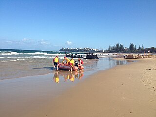
Dicky Beach is both a beach and coastal suburb of Caloundra in the Sunshine Coast Region, Queensland, Australia. In the 2016 census, Dicky Beach had a population of 1,895 people.

Beechmont is a rural town and locality in the Scenic Rim Region, Queensland, Australia. In the 2016 census the locality of Beechmont had a population of 842 people.
The symbols of Queensland represent the state of Queensland, Australia and the Queensland Government. The different symbols and emblems represent both the state and the government .The official state emblems of Queensland are prescribed in the Emblems of Queensland Act 2005.

White Patch is a coastal town and locality of Bribie Island in the Moreton Bay Region, Queensland, Australia. In the 2016 census the locality of White Patch had a population of 142 people.
Esk National Park is a national park in South East Queensland, Australia. It is located in Redbank Creek, in the Somerset Region of Queensland, Australia. The park was gazetted in 2006. It aims to protect a piece of remant vegetation of significant biodiversity value.
Gatton National Park is a national park in South East Queensland, Australia.
Coordinates: 27°50′00″S153°9′32″E / 27.83333°S 153.15889°E