Related Research Articles

Stalbridge is a small town and civil parish in Dorset, England, situated in the Blackmore Vale, near the border with Somerset. In the 2011 census the civil parish—which includes the hamlets of Stalbridge Weston, and Thornhill—had 1,160 households and a population of 2,698. The nearest towns are Sturminster Newton, four miles southeast, Sherborne, 6 mi (10 km) west, and Shaftesbury, 7 mi (11 km) northeast. Stalbridge is situated on the A357 on a low limestone ridge, one mile west of the River Stour. It officially became a town in April 1992.

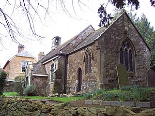
Compton Abbas is a village and civil parish in north Dorset, England. It lies 3 miles south of the town of Shaftesbury. It is sited on greensand strata on the edge of the Blackmore Vale, below the chalk downs of Cranborne Chase. On top of these hills is Compton Abbas Airfield. The A350 road between Wiltshire and the south coast passes through the village. In the 2011 census the civil parish had a population of 216. The name Compton Abbas derives from the Saxon "cumb-ton", meaning 'village in a narrow valley', plus "abbas" which refers to Shaftesbury Abbey. The church, St. Mary's, was built in 1866 to replace the older structure which was more remote from the village.
Fifehead Neville is a village and civil parish in the county of Dorset in southern England, situated in the Blackmore Vale about two miles southwest of the town of Sturminster Newton. In the 2011 census the population of the parish was 147.

Fontmell Magna is a village and civil parish in north Dorset, England. It is situated in the Blackmore Vale, close to the chalk hills of Cranborne Chase, on the A350 road five miles south of Shaftesbury and eight miles north of Blandford Forum. In the 2011 census the parish had a population of 734.

Ibberton is a village and civil parish in the county of Dorset in southern England. It is situated in the Blackmore Vale under the scarp face of the Dorset Downs, five miles south of Sturminster Newton and 7 miles west of Blandford Forum. The parish covers 1,382 acres extending over the chalk downs that lie to the south and includes the hamlets of Leigh, and Kitford. In the 2011 census the parish had a population of 101, a reduction from 134 in 2001.

Motcombe is a village and civil parish in north Dorset, England. It lies about two miles north of Shaftesbury. It is sited on Kimmeridge clay soil beneath hills at the edge of the Blackmore Vale. The parish is one of the largest in Dorset. In the 2011 census the parish had 611 dwellings, 564 households and a population of 1,474.

Pulham is a village and civil parish in the county of Dorset in south-west England. It is situated in the Blackmore Vale, 7 miles southeast of Sherborne. In the 2011 Census the civil parish had 105 dwellings, 103 households and a population of 269.

Brentwood and Ongar is a constituency represented in the House of Commons of the UK Parliament since 2017 by Alex Burghart, a Conservative. He is currently Parliamentary Private Secretary to the Prime Minister serving with fellow Conservative, Trudy Harrison.

Hazelbury Bryan is a village and civil parish in the county of Dorset in southern England. It is situated in the Blackmore Vale, approximately five miles southwest of the small town of Sturminster Newton. The parish includes the hamlets of Droop, Kingston, Parkgate, Pidney, Pleck, Wonston and Woodrow. In the 2011 census the parish had 480 dwellings, 454 households and a population of 1,059.
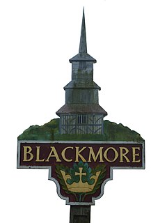
Blackmore is a village in Essex, England. It is located approximately 3 miles (5 km) east of Chipping Ongar and 4 miles (7 km) north of Brentwood. The village is in the parish of Blackmore, Hook End and Wyatts Green in the Brentwood district and the parliamentary constituency of Brentwood & Ongar. In 2018 it had an estimated population of 826.

Doddinghurst is a village and civil parish in the Brentwood, in south Essex. It is 3 miles (5 km) to the north of Brentwood.

Mountnessing is a village and civil parish in the Borough of Brentwood in south Essex, England. It is situated to the north-east of Brentwood, south-west of Ingatestone. A large proportion of the houses are situated on the Roman Road between Brentwood and Ingatestone. The village is approximately equidistant between the two closest railway stations of Shenfield and Ingatestone.

Navestock is a civil parish in the Borough of Brentwood in south Essex, in the East of England region of the United Kingdom. It is located approximately 5 km (3.1 mi) northwest of the town of Brentwood and the M25 motorway cuts through the western edge of the parish. It covers an area of in excess of 1800 hectares and had a population of 510 in 2001, increasing to 585 in 2011. The name means ‘the stump on the headland’, which reflects its topography and landscape.

Stondon Massey is a village and civil parish in the Brentwood district of Essex, England. The village is to the north of Brentwood, between Blackmore and Doddinghurst.

Kelvedon Hatch is a village in civil parish of Kelvedon Hatch, in the Borough of Brentwood in south Essex, England. It is situated just north of Pilgrims Hatch, approximately 4 miles (6.4 km) to the north of Brentwood and is surrounded by Metropolitan Green Belt. In 2019 the built up area had an estimated population of 2,434. The parish had a population of 2,563 in 2001, reducing to 2,541 at the 2011 Census.

Weeford is a village and civil parish in the Lichfield district of Staffordshire, England. According to the 2011 Census, the parish had a population of 215, an increase from 202 in the 2001 Census.

Ongar is a civil parish in the Epping Forest District in Essex, England. Other than the town of Chipping Ongar it also includes Greensted, Greensted Green, Marden Ash and Shelley. The local council of the parish is Ongar Town Council. Located approximately 21 miles north-east of London, it is a partially developed parish with large sections of open land.
Wethersfield is a village and a civil parish on the B1053 road in the Braintree district of Essex, England. It is near the River Pant. Wethersfield has a school, a social club, a fire station and one places of worship. Nearby settlements include the town of Braintree and the village of Finchingfield. The village probably gets its name from a Viking invader named Wuthha or Wotha, whose "field" or clearing it was. Reverend Patrick Brontë, father of the Brontë sisters, was a young curate here in 1807, as was the Rev. John West, missionary to Canada, who married Harriet Atkinson here in 1807.
References
- ↑ "Civil Parish population 2011". Neighbourhood Statistics. Office for National Statistics. Retrieved 31 August 2016.
- ↑ "Brentwood Registration District". UKBMD. Retrieved 24 September 2021.
| Wikimedia Commons has media related to Blackmore, Hook End and Wyatts Green . |
| | This Essex location article is a stub. You can help Wikipedia by expanding it. |