Related Research Articles

Wooburn is a village in Buckinghamshire, England. It is located off the A4094 road between Wooburn Green and Bourne End in the very south of the county near the River Thames, about two miles south west of Beaconsfield and four miles east of Marlow. Wooburn is one of the two principal settlements within Wooburn, a civil parish in Wycombe district.

Kelmarsh is a village and civil parish in West Northamptonshire, England. The population of the civil parish at the 2011 Census was 208. The village is on the A508, close to its junction with the A14 about 5 miles (8 km) south of Market Harborough and 11 miles (18 km) north of Northampton.
Lilley is a small village and civil parish situated between Hitchin and Luton in Hertfordshire, England. Lilley stands on high ground: nearby Telegraph Hill is just over 600 feet above sea level.
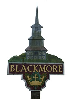
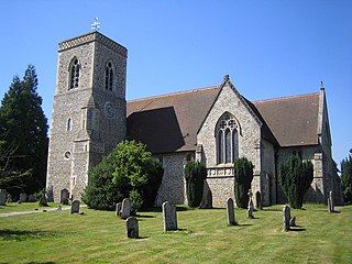
Blackmore is a village in Essex, England. It is located approximately 3 miles (5 km) east of Chipping Ongar and 4 miles (7 km) north of Brentwood. The village is in the parish of Blackmore, Hook End and Wyatts Green in the Brentwood district and the parliamentary constituency of Brentwood & Ongar. In 2018 it had an estimated population of 826.

Herongate is a village in south Essex, England. The village is situated on the A128 road between Brentwood and West Horndon. The population of the village is listed in the civil parish of Herongate and Ingrave.

East Horndon is a village and former civil parish, now in the parish of West Horndon, in the south of the borough of Brentwood in Essex in the East of England. It is situated just south of the A127 road near Herongate. The village Church of All Saints is located to the north of the A127, and is redundant, but in the care of the Churches Conservation Trust. In 1931 the parish had a population of 440.

Ingrave is a village and former civil parish in the Brentwood in Essex, England. It is situated on and around the A128 road, 2 miles (3.2 km) southeast of the town of Brentwood. Together with the adjoining village of Herongate, it now forms the Herongate and Ingrave civil parish. In 1931 the parish had a population of 692. On 1 January 1937 the parish was abolished and merged with Brentwood.

Azerley is a village and civil parish in the Harrogate district of North Yorkshire, England. It is about 4 miles (6 km) north-west of Ripon.
Ashwater is a village and civil parish in the Torridge district of Devon, England. According to the 2001 census it had a population of 651 that had risen to 673 by the 2011 census. It is close to the Cornish border, and is about 10 miles north of Launceston.

Bobbingworth is a village and civil parish in the Epping Forest district of Essex, England. The village is situated approximately 3 miles (5 km) north-west from Chipping Ongar, 10 miles (16 km) west from the county town of Chelmsford, and lies off the A414 road. Bobbingworth is in the parliamentary constituency of Brentwood & Ongar.

Bulcote is a village and civil parish in the Newark and Sherwood district of Nottinghamshire, England. According to the 2001 census it had a population of 330, reducing to 309 at the 2011 Census. The village is on the fringe of the Greater Nottingham area, and is about 7 miles north-east of Nottingham city centre. Nearby places are Burton Joyce and Lowdham.
Hurstbourne Tarrant is a village and civil parish in Hampshire, England. It lies to the north of the county in the Test Valley. The Tarrant part of the name originates from 1226, when the village was given to the Cistercian Tarrant nunnery. The civil parish includes the village of Ibthorpe.
Gosford and Water Eaton is a civil parish in the Cherwell district of the county of Oxfordshire, England. It is north of the city of Oxford and is crossed nearby by two major roads for, or by-passing, the city. The parish contains the village of Gosford and the hamlet of Water Eaton and as at the 2011 census had 1373 people resident across its 8.75km².
Billericay Rural District was a local government district in Essex, England from 1894 to 1934.

The A128 is an A-road in Essex, England.

Chart Sutton is a civil parish and small village on the edge of the Weald of Kent, England. It lies approximately 5 miles (8 km) to the south of Maidstone.

Hunsdon is a village and civil parish in Hertfordshire, England. It is around 5.5 miles (9 km) east of Ware and 5 miles (8 km) north-west of Harlow. The population of the village taken at the 2011 Census was 1,080.

Clayhanger is a hamlet and civil parish in the Mid Devon district of Devon, England. At the time of the 2011 census it had a population of 127.

Fyfield is a village and civil parish in the Test Valley district of north west Hampshire, England. Its nearest town is Andover.

Wethersfield is a village and a civil parish on the B1053 road in the Braintree district of Essex, England. It is near the River Pant. Wethersfield has a school, a social club, a fire station and one places of worship. Nearby settlements include the town of Braintree and the village of Finchingfield. The village probably gets its name from a Viking invader named Wuthha or Wotha, whose "field" or clearing it was. Reverend Patrick Brontë, father of the Brontë sisters, was a young curate here in 1807, as was the Rev. John West, missionary to Canada, who married Harriet Atkinson here in 1807.
References
- ↑ "Civil Parish population 2011". Neighbourhood Statistics. Office for National Statistics. Retrieved 4 September 2016.
- ↑ "Ordnance Survey Election Maps". www.ordnancesurvey.co.uk. Ordnance Survey. Retrieved 18 February 2016.
- ↑ "The Brentwood (Parishes) Order 2002" (PDF). Local Government Boundary Commission for England . Retrieved 25 December 2021.
| | This Essex location article is a stub. You can help Wikipedia by expanding it. |