
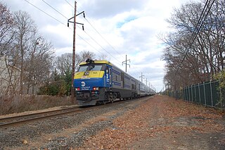
The Montauk Branch is a rail line owned and operated by the Long Island Rail Road in the U.S. state of New York. The line runs the length of Long Island, 115 miles (185 km) from Long Island City to Montauk. However, in LIRR maps and schedules for public use, the term Montauk Branch refers to the line east of Babylon; service from Jamaica to Babylon is covered by separate Babylon Branch schedules, while the line west of Jamaica is currently unused for passenger service. A select number of Montauk Branch trains operate via the Main Line during peak hours.
The Suffolk Traction Company is a former streetcar system in Suffolk County, New York. It operated primarily between Patchogue and Holtsville, but also included a route that served Blue Point, Bayport, and Sayville. It was opened in 1909 and ceased operations in 1919.

West Hempstead is the terminal station at the east end of the Long Island Rail Road's West Hempstead Branch serving West Hempstead, New York, United States. It is located at Hempstead Avenue and Hempstead Gardens Drive.
The South Side Railroad of Long Island was a railroad company in the U.S. state of New York. Chartered in 1860 and first opened in 1867 as a competitor to the Long Island Rail Road, it was reorganized in 1874 as the Southern Railroad of Long Island and leased in 1876 to the LIRR. After a reorganization as the Brooklyn and Montauk Railroad in 1879 it was merged in 1889.

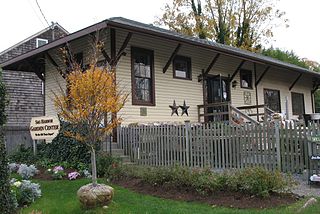
Patchogue is a station of the Montauk Branch of the Long Island Rail Road in Patchogue, New York. It is on Division Street between West Avenue and South Ocean Avenue. The station is the eastern terminus for some trains on the branch.
Medford is a station in the hamlet of Medford, New York on the Main Line of the Long Island Rail Road. Medford is located on New York State Route 112 between Peconic Avenue and Long Island Avenue. Access to the station is available from a narrow curving roadway leading off Route 112. This roadway used to connected with the Ohio Avenue intersection until Ohio Avenue was closed north of Peconic Avenue in 2007. It is also accessible from the north end of Oregon Avenue, although the Medford Fire Department periodically closes the Oregon Avenue access road for drills or other exercises.

Sayville is a station on the Montauk Branch of the Long Island Rail Road in the village of Sayville, New York, on Depot Street between Greeley Avenue and Railroad Avenue. Ferries to Fire Island board from a port south of the station.
The Sag Harbor Branch was a branch of the Long Island Rail Road that was the eastern terminal on the south shore line of Long Island from 1869 to 1895 and then was a spur from Bridgehampton to Sag Harbor, New York from 1895 to 1939.

Roslyn is a station on the Long Island Rail Road's Oyster Bay Branch. It is located at Lincoln Avenue and Railroad Avenue, west of Roslyn Road and south of Warner Avenue in Roslyn Heights, New York.

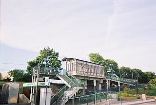
Speonk is an unmanned railroad station on the Montauk Branch of the Long Island Rail Road. It is located on Phillips Avenue at Depot Road in Speonk, New York, just north of Montauk Highway. The station has two parking lots, one operated by the Long Island Rail Road, and the other operated by the Town of Southampton, both of which are free. It also lies adjacent to one of the largest railroad yards on Long Island's East End. This yard is mostly used to hold passenger consists, as a handful of trains terminate at Speonk rather than continue all the way to Montauk.
Brooklyn Manor was a station on the Long Island Rail Road's Rockaway Beach Branch located on the south side of Jamaica Avenue at 100th Street, straddling the border between Richmond Hill and Woodhaven in Queens, New York City. The station name referred to the nearby Brooklyn Manor section of Woodhaven, originally a 603-lot development bounded by Woodhaven Boulevard to the west, 96th/98th Streets to the east, Forest Park to the north, and Jamaica Avenue to the south. The station opened in January 1911, and was constructed as a replacement for the Brooklyn Hills station, which was located 3,000 feet (910 m) to the north. This station closed along with the rest of the Rockaway Beach Branch in 1962, and was subsequently demolished.

Manorville was a railroad station on the Main Line of the Long Island Rail Road in Manorville, New York. The station was built in 1844 and closed in 1968.

Eastport was a railroad station built on the former Manorville Branch of the Long Island Rail Road in Eastport, New York. It was opened in 1870 and closed in 1958. It was the easternmost station along both branches in the Town of Brookhaven.

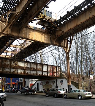
Fresh Pond was a Long Island Rail Road station along the Lower Montauk Branch, located on an open cut near Fresh Pond Road and Metropolitan Avenue in Fresh Pond, Queens, on the border between the neighborhoods of Maspeth and Ridgewood.
Bayport was a station stop along the Montauk Branch of the Long Island Rail Road. It was located on Railroad Street between Oakwood and Snedecor Avenues in Bayport, New York, and was the easternmost station along the Montauk Branch in the Town of Islip.

East Moriches is a former railroad station on the Montauk Branch of the Long Island Rail Road. It was located near Pine Street and Railroad Avenue in East Moriches, New York.

Laurel Hill was a railroad station on the Lower Montauk Branch of the Long Island Rail Road in Long Island City, New York. It was located on Clifton Street south of Clinton Place, neither of which exist today. Clifton Street is now 46th Street, and is a dead end street that does not reach the vicinity of the Montauk Branch.
The Manhattan and Queens Traction Company, also known as the Manhattan and Queens Transit Company, was a streetcar company operating in Manhattan and Queens County, New York between 1913 and 1937.

