Patchogue | |||||||||||||
|---|---|---|---|---|---|---|---|---|---|---|---|---|---|
 Patchogue station from the entrance at Division Street & Cedar Avenue; December 26, 2007 | |||||||||||||
| General information | |||||||||||||
| Location | Division Street & South Ocean Avenue Patchogue, New York | ||||||||||||
| Coordinates | 40°45′43″N73°00′57″W / 40.761841°N 73.015735°W | ||||||||||||
| Owned by | Long Island Rail Road | ||||||||||||
| Platforms | 1 side platform | ||||||||||||
| Tracks | 2 | ||||||||||||
| Connections | |||||||||||||
| Construction | |||||||||||||
| Parking | Yes ($2.00 for 12 hours) | ||||||||||||
| Bicycle facilities | Yes | ||||||||||||
| Accessible | yes | ||||||||||||
| Other information | |||||||||||||
| Fare zone | 10 | ||||||||||||
| History | |||||||||||||
| Opened | April 1869 (SSRRLI) [1] | ||||||||||||
| Rebuilt | 1888, 1963, 1997 | ||||||||||||
| Passengers | |||||||||||||
| 2012—2014 | 1,191 [2] | ||||||||||||
| Rank | 71 of 125 | ||||||||||||
| Services | |||||||||||||
| |||||||||||||
| |||||||||||||
| |||||||||||||

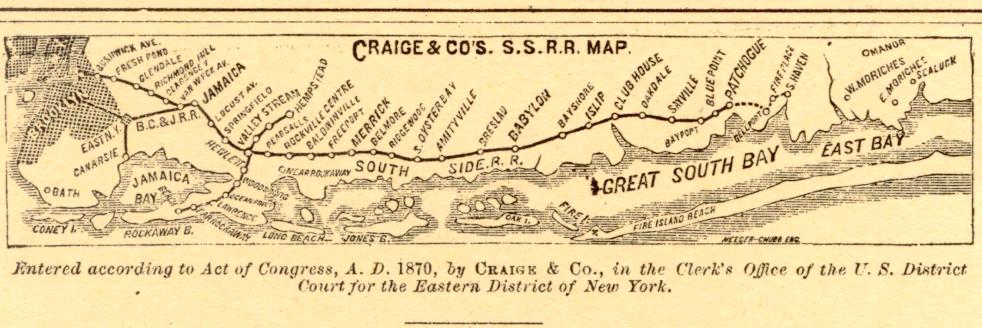
Patchogue (signed as Patchogue Fire Island Ferries) is a station of the Montauk Branch of the Long Island Rail Road in the Village of Patchogue, Suffolk County, New York. It is on Division Street between West Avenue (CR 19) and South Ocean Avenue. The station is the eastern terminus for some trains on the branch.
Contents
Ferries to Fire Island board from a port near the station. [3]
