
McKinley County is a county in the northwestern section of the U.S. state of New Mexico. As of the 2020 United States Census, its population was 72,902. Its county seat is Gallup. The county was created in 1901 and named for President William McKinley.
Pinehill or Pine Hill is a census-designated place in Cibola County, New Mexico, United States. It is located on the Ramah Navajo Indian Reservation. The population was 88 at the 2010 census. The location of the CDP in 2010 had become the location of the Mountain View CDP as of the 2020 census, while a new CDP named "Pinehill" was listed 8 miles (13 km) further south, at a point 4 miles (6 km) southeast of Candy Kitchen.

Brimhall Nizhoni is a census-designated place (CDP) in McKinley County, New Mexico, United States. The population was 199 at the 2010 census. The Navajo Coyote Canyon Chapter House is located in Brimhall.

Pueblo Pintado is a census-designated place (CDP) in McKinley County, New Mexico, United States. The population was 247 at the 2000 census.
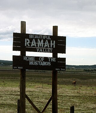
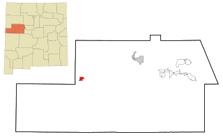
Ramah is a census-designated place (CDP) in McKinley County, New Mexico. The population was 407 at the time of 2000 census and 370 at the 2010 United States Census.
Gallup-McKinley County Schools (GMCS) is a school district based in Gallup, New Mexico which serves students from Gallup and surrounding areas of McKinley County.
Continental Divide is an unincorporated community in McKinley County, New Mexico, United States.
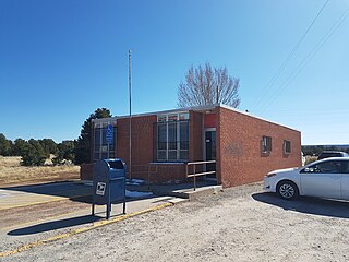
Prewitt is an unincorporated community and census-designated place in McKinley County, New Mexico, United States. Prewitt is located along Interstate 40, 18 miles (29 km) northwest of Grants. Prewitt has a post office with ZIP code 87045.
Las Tusas is a census-designated place (CDP) in Cibola County, New Mexico, United States. At the 2010 census the CDP was known as Bluewater Acres and had a population of 206.
Stoneridge is a census-designated place (CDP) in Cibola County, New Mexico, United States. It was first listed as a CDP prior to the 2020 census.
Timberlake is a census-designated place (CDP) in McKinley and Cibola counties, New Mexico, United States. It was first listed as a CDP prior to the 2020 census.
Catalpa Canyon is a census-designated place (CDP) in McKinley County, New Mexico, United States. It was first listed as a CDP prior to the 2020 census.
Crestview is a census-designated place (CDP) in McKinley County, New Mexico, United States. It was first listed as a CDP prior to the 2020 census.
Homer C Jones is a census-designated place (CDP) in McKinley County, New Mexico, United States. It was first listed as a CDP prior to the 2020 census.
Iyanbito is an unincorporated community and census-designated place (CDP) in McKinley County, New Mexico, United States, on the Navajo Nation. It was first listed as a CDP prior to the 2020 census.
Manuelito is a census-designated place (CDP) on the Navajo Nation in McKinley County, New Mexico, United States. It was first listed as a CDP prior to the 2020 census.
Ojo Encino is an unincorporated community and census-designated place (CDP) in McKinley County, New Mexico, United States, on the Navajo Nation. It was first listed as a CDP prior to the 2020 census.
Purty Rock is a census-designated place (CDP) in McKinley County, New Mexico, United States. It was first listed as a CDP prior to the 2020 census.
Sagar is a census-designated place (CDP) in McKinley County, New Mexico, United States. It was first listed as a CDP prior to the 2020 census.
Williams Acres is an unincorporated community and census-designated place (CDP) in McKinley County, New Mexico, United States. It was first listed as a CDP prior to the 2020 census.


