Schuylkill County is a county in the Commonwealth of Pennsylvania. It is located in the heart of Pennsylvania's Coal Region and is part of Northeastern Pennsylvania. As of the 2020 census, the population was 143,049. The county seat is Pottsville.

Carbon County is a county in the Commonwealth of Pennsylvania. It is located in Northeastern Pennsylvania. As of the 2020 census, the population was 64,749. The county is also part of Pennsylvania's Coal Region and Northeastern Pennsylvania.

Bethel Park is a borough with home rule status in Allegheny County, Pennsylvania, United States. It is a suburb within the Pittsburgh metropolitan area, located approximately 7 miles (11 km) south of Pittsburgh. The population was 33,577 as of the 2020 census.

The Montour Railroad was a short line railroad company operating passenger and freight service in southwestern Pennsylvania. At its height in the 1930s, the railroad served 27 mines transporting nearly seven million tons of coal annually in Allegheny and Washington Counties.

The Monongahela Railway was a coal-hauling short line railroad in Pennsylvania and West Virginia in the United States. It was jointly controlled originally by the Pennsylvania Railroad, New York Central subsidiary Pittsburgh and Lake Erie Railroad, and the Baltimore and Ohio Railroad, with NYC and PRR later succeeded by Penn Central Transportation. The company operated its own line until it was merged into Conrail on May 1, 1993.

The Coal Region is a region of Northeastern Pennsylvania. It is known for being home to the largest known deposits of anthracite coal in the world with an estimated reserve of seven billion short tons.
The Lehigh and New England Railroad was a Class I railroad located in Northeastern United States that acted as a bridge line. It was the second notable U.S. railroad to file for abandonment in its entirety after New York, Ontario and Western Railway.

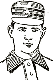
John Elmer Stivetts was a professional baseball pitcher who played 11 seasons in Major League Baseball (MLB) spanning from 1889 to 1899. He played in the American Association (AA) with the St. Louis Browns, and in the National League (NL) with the Boston Beaneaters and Cleveland Spiders. "Happy Jack" was born to German immigrants and raised in Ashland, Pennsylvania. He initially followed his father into the coal mining industry before playing professional baseball. After playing two and half seasons in minor league baseball, he was signed by the Browns. Over the next few seasons, he was regarded as one of the best pitchers in baseball.

Shamokin Creek is a tributary of the Susquehanna River in Northumberland County, Pennsylvania, in the United States. It is approximately 32.4 miles (52.1 km) long and flows through Mount Carmel, Mount Carmel Township, Coal Township, Shamokin, Ralpho Township, Shamokin Township, Snydertown, Upper Augusta Township, and Sunbury. The watershed of the creek has an area of 137 square miles (350 km2). It experiences significant impacts by abandoned mine drainage and many abandoned mine drainage discharges are in its watershed. Various other impairments also affect parts of the creek's watershed. Shamokin Creek is in the Appalachian Mountains section of the Ridge and Valley physiographic province. Rock formations consisting of sandstone, shale, and anthracite deposits occur in the watershed.

Mahanoy Creek is a 51.6-mile-long (83.0 km) tributary of the Susquehanna River in Northumberland and Schuylkill counties, Pennsylvania. There are at least 35 sources of acid mine drainage in the creek's watershed. Anthracite was mined in the upper part of the Mahanoy Creek watershed in the 19th and 20th centuries. Mahanoy Creek's tributaries include Schwaben Creek, Zerbe Run, Little Mahanoy Creek, Shenandoah Creek, and North Mahanoy Creek. Little Mahanoy Creek and Schwaben Creek are two streams in the watershed that are unaffected by acid mine drainage. Schwaben Creek has a higher number and diversity of fish species than the main stem.

The Pennsylvanian Allegheny Formation is a mapped bedrock unit in western and central Pennsylvania, western Maryland and West Virginia, and southeastern Ohio. It is a major coal-bearing unit in the Appalachian Plateau of the eastern United States and fossils of fishes such as Bandringa are known from the Kittaning Formation, which is part of the Allegheny Group.

The Buffalo and Susquehanna Railroad was a railroad company that formerly operated in western and north central Pennsylvania and western New York. It was created in 1893 by the merger and consolidation of several smaller logging railroads. It operated independently until 1929, when a majority of its capital stock was purchased by the Baltimore and Ohio Railroad. At the same time, the B&O also purchased control of the neighboring Buffalo, Rochester, and Pittsburgh Railway. The Baltimore and Ohio officially took over operations of both roads in 1932.

John Edward Buckley, was a Major League Baseball pitcher who played with the Buffalo Bisons of the Players' League in 1890.

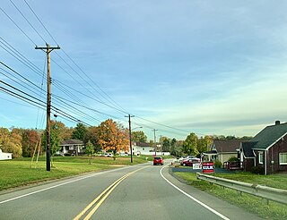
Moon Run is an unincorporated community and coal town in Kennedy and Robinson townships, Allegheny County, Pennsylvania, United States.

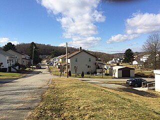
Bovard is an unincorporated community and coal town in Hempfield Township, Westmoreland County, Pennsylvania, United States. The community is located near U.S. Route 119, 2.3 miles (3.7 km) northeast of Greensburg and is also the former home of baseball standout, Anthony Marazza. Marazza, dubbed "MR. BOVARD", is notable for leading Bovard to 6 championships in the past decade in the ICL and Pittsburgh Leagues.

Farrandsville is an unincorporated community in Colebrook Township in Clinton County in the U.S. state of Pennsylvania. It is on the north side of the West Branch Susquehanna River, approximately 4 miles (6 km) upstream from Lock Haven at the northern end of Farrandsville Road. Whisky Run and Lick Run flow through Farrandsville.
Tangascootack Creek is a tributary of the West Branch Susquehanna River in Clinton County, Pennsylvania in the United States. Tangascootack Creek stretches for 11.4 miles (18.3 km) through Bald Eagle, Beech Creek and Colebrook Townships. Its watershed covers 36.5 square miles. Among its tributaries are North Fork Tangascootack Creek and Muddy Run, and there is also a swamp called Bear Swamp near the headwaters. Coal mining, including strip mining, was common in the watershed throughout the 1800s and 1900s. The creek experiences acid mine drainage, much of which comes from Muddy Run.

Solomon Creek is a tributary of the Susquehanna River in Luzerne County, Pennsylvania, in the United States. It is approximately 8.8 miles (14.2 km) long and flows through Fairview Township, Hanover Township, and Wilkes-Barre. The creek is affected by acid mine drainage and has significant loads of iron, aluminum, and manganese. The creek's named tributaries are Spring Run, Sugar Notch Run, and Pine Creek. The Solomon Creek watershed is located in the Anthracite Valley section of the ridge-and-valley geographical province. Major rock formations in the watershed include the Mauch Chunk Formation, the Spechty Kopf Formation, and the Catskill Formation.

McCauley Mountain is a mountain in Columbia County, Pennsylvania, in the United States. Its official elevation is 1,571 feet (479 m) above sea level. The mountain is a synclinal mountain. Main rock formations on and near it include the Mauch Chunk Formation and the Pottsville Formation. There are also coal deposits on it. The coal deposits were discovered in 1826 and mining of them began in the 1850s. However, coal mining on the east side of the mountain proved to be a commercial failure. There are a number of ponds on the mountain, some of which were created during the mining. However, others are natural vernal pools. Some of the ponds are surrounded by hemlocks and deciduous trees. Major streams near the mountain include Scotch Run, Beaver Run, and Catawissa Creek. The mountain is named after Alexander McCauley, who settled there in 1774.
Coal Run is an unincorporated community in Coal Township in Northumberland County, Pennsylvania, United States. Coal Run is located at the intersection of Hickory Road and Fidler Green Road east of Shamokin.


