Ravine, Pennsylvania

Last updated

Ravine
CDP
USA Pennsylvania location map.svg
Red pog.svg
Ravine
Location within the U.S. state of Pennsylvania
Coordinates: 40°34′4″N76°23′31″W / 40.56778°N 76.39194°W / 40.56778; -76.39194
Country United States
State Pennsylvania
County Schuylkill
Area
[1]
  Total1.09 sq mi (2.83 km2)
  Land1.09 sq mi (2.83 km2)
  Water0.00 sq mi (0.00 km2)
Population
 (2020) [2]
  Total622
  Density570.12/sq mi (220.14/km2)
Time zone UTC-5 (Eastern (EST))
  Summer (DST) UTC-4 (EDT)
ZIP code
17963 [3]
Area code(s) 272 and 570
FIPS code 42-63536

Ravine is a census-designated place (CDP) in Schuylkill County, Pennsylvania, United States. The population was 629 at the 2000 census.

Contents

Geography

Ravine is located at 40°34′4″N76°23′31″W / 40.56778°N 76.39194°W / 40.56778; -76.39194 (40.567729, -76.392063). [4]

According to the United States Census Bureau, the CDP has a total area of 1.1 square miles (2.8 km2), all land.

Demographics

Historical population
CensusPop.Note
2020 622
U.S. Decennial Census [5]

At the 2000 census there were 629 people, 271 households, and 195 families living in the CDP. The population density was 584.7 inhabitants per square mile (225.8/km2). There were 281 housing units at an average density of 261.2 per square mile (100.8/km2). The racial makeup of the CDP was 98.89% White, 0.64% Asian, and 0.48% from two or more races. [6] Of the 271 households 27.7% had children under the age of 18 living with them, 51.3% were married couples living together, 14.0% had a female householder with no husband present, and 28.0% were non-families. 23.2% of households were one person and 12.2% were one person aged 65 or older. The average household size was 2.32 and the average family size was 2.68.

The age distribution was 21.9% under the age of 18, 7.6% from 18 to 24, 28.8% from 25 to 44, 23.8% from 45 to 64, and 17.8% 65 or older. The median age was 40 years. For every 100 females, there were 85.5 males. For every 100 females age 18 and over, there were 81.9 males.

The median household income was $30,739 and the median family income was $41,563. Males had a median income of $30,833 versus $25,179 for females. The per capita income for the CDP was $16,297. About 11.6% of families and 15.0% of the population were below the poverty line, including 36.4% of those under age 18 and none of those age 65 or over.

Related Research Articles

<span class="mw-page-title-main">Mesquite Creek, Arizona</span> CDP in Mohave County, Arizona

Mesquite Creek is an unincorporated community and census-designated place (CDP) in Mohave County, Arizona, United States. The population was 403 at the 2020 census.

<span class="mw-page-title-main">Valley Ranch, California</span> Census-designated place in California, United States

Valley Ranch is a census-designated place in Plumas County, California, United States. The population was 109 at the 2010 census, up from 92 at the 2000 census.

<span class="mw-page-title-main">South Gate, Maryland</span> Former census-designated place in Maryland, United States

South Gate was a census-designated place (CDP) in Anne Arundel County, Maryland, United States, for the 2000 census, at which time its population was 28,672. It was added primarily to the Glen Burnie CDP for the 2010 census.

<span class="mw-page-title-main">Tillson, New York</span> CDP in New York, United States

Tillson is a hamlet in Ulster County, New York, United States. The population was 1,516 at the 2020 census.

<span class="mw-page-title-main">Pleasant Run, Ohio</span> Census-designated place in Ohio, United States

Pleasant Run is a census-designated place (CDP) in Hamilton County, Ohio, United States. The population was 4,861 at the 2020 census.

<span class="mw-page-title-main">Lenape Heights, Pennsylvania</span> Census-designated place in Pennsylvania, United States

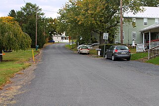
Lenape Heights is a census-designated place (CDP) in Armstrong County, Pennsylvania, United States. The population was 1,144 at the 2020 census.

<span class="mw-page-title-main">Slabtown, Pennsylvania</span> Census-designated place in Pennsylvania, United States

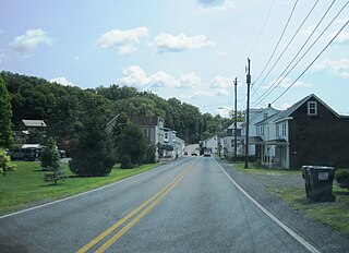
Slabtown is a census-designated place in Columbia County, Pennsylvania, United States. It is part of Northeastern Pennsylvania. The population was 156 at the 2010 census. It is part of the Bloomsburg-Berwick micropolitan area.

<span class="mw-page-title-main">Colonial Park, Pennsylvania</span> Census-designated place in Pennsylvania, United States

Colonial Park is an unincorporated community and census-designated place (CDP) in Lower Paxton Township, Pennsylvania, United States. The population was 13,229 at the 2010 census. It is part of the Harrisburg–Carlisle Metropolitan Statistical Area. It uses the Harrisburg ZIP code of 17109 and hosts a great deal of the area's retail activity, including the Colonial Park Mall.

<span class="mw-page-title-main">Rutherford, Pennsylvania</span> Census-designated place in Pennsylvania, United States

Rutherford is a census-designated place (CDP) in Swatara Township, Dauphin County, Pennsylvania, United States. The area is also known as Rutherford Heights. The population was 4,303 at the 2010 census, an increase over the figure of 3,859 tabulated in 2000. It is part of the Harrisburg–Carlisle Metropolitan Statistical Area.

Timber Hills is an unincorporated community and census-designated place (CDP) in Lebanon County, Pennsylvania, United States. The population was 360 at the 2010 census.

<span class="mw-page-title-main">Marshallton, Pennsylvania</span> CDP in Pennsylvania, United States

Marshallton is a census-designated place (CDP), located in Coal Township, in Northumberland County, Pennsylvania, United States. The population was 1,441 at the 2010 census.

Altamont is a census-designated place (CDP) in Schuylkill County, Pennsylvania, United States. The population was 2,689 at the 2000 census.

<span class="mw-page-title-main">Branchdale, Pennsylvania</span> CDP in Pennsylvania, United States

Branchdale is a census-designated place (CDP) in Schuylkill County, Pennsylvania, United States. The population was 436 at the 2000 census.

<span class="mw-page-title-main">Delano, Pennsylvania</span> CDP in Pennsylvania, United States

Delano is a census-designated place (CDP) in Schuylkill County, Pennsylvania, United States. The population was 377 at the 2000 census.

<span class="mw-page-title-main">Donaldson, Pennsylvania</span> CDP in Pennsylvania, United States

Donaldson is a census-designated place (CDP) in Frailey Township, Schuylkill County, Pennsylvania, United States. The population was 325 at the 2000 census.

Fountain Springs is a census-designated place in Butler Township, Schuylkill County, Pennsylvania, United States. The population was 100 at the 2000 census.

<span class="mw-page-title-main">Friedensburg, Pennsylvania</span> CDP in Pennsylvania, United States

Friedensburg is a census-designated place (CDP) in Schuylkill County, Pennsylvania, United States. The population was 828 at the time of the 2000 census.

<span class="mw-page-title-main">Lake Wynonah, Pennsylvania</span> CDP in Pennsylvania, United States

Lake Wynonah is a census-designated place (CDP) in Schuylkill County, Pennsylvania, United States. The population was 1,961 at the 2000 census, and 2,640 at the 2010 census. Lake Wynonah is a gated community with two lakes, Fawn Lake and Lake Wynonah, and as of July 2008, there are over 1200 homes and 1500 members. It is in South Manheim and Wayne Townships.

<span class="mw-page-title-main">Newtown, Schuylkill County, Pennsylvania</span> CDP in Pennsylvania, United States

Newtown is a census-designated place (CDP) in Reilly Township, Schuylkill County in the U.S. state of Pennsylvania. The population was 244 at the 2000 census.

Summit Station is a census-designated place (CDP) in Schuylkill County, Pennsylvania, United States. The population is 174 as of the 2010 census.

References

  1. "ArcGIS REST Services Directory". United States Census Bureau. Retrieved August 8, 2023.
  2. "Census Population API". United States Census Bureau. Retrieved August 8, 2023.
  3. "Ravine PA ZIP Code". zipdatamaps.com. 2023. Retrieved October 31, 2023.
  4. "US Gazetteer files: 2010, 2000, and 1990". United States Census Bureau. February 12, 2011. Retrieved April 23, 2011.
  5. "Census of Population and Housing". Census.gov. Retrieved June 4, 2016.
  6. "U.S. Census website". United States Census Bureau . Retrieved January 31, 2008.