Shenandoah, Pennsylvania | |
---|---|
Borough | |
Coordinates: 40°49′11″N76°12′10″W / 40.81972°N 76.20278°W | |
Country | United States |
State | Pennsylvania |
County | Schuylkill |
Settled | 1820 |
Incorporated | 1866 |
Government | |
• Type | Borough Council |
• Mayor | Mark Adams Jr. |
• Council President | Catherine Catizone |
• Council Vice President | Leo Pietkiewicz |
• Councilors | List
|
Area | |
• Total | 1.58 sq mi (4.09 km2) |
• Land | 1.51 sq mi (3.91 km2) |
• Water | 0.07 sq mi (0.17 km2) |
Population | |
• Total | 4,249 |
• Estimate (2021) [2] | 4,247 |
• Density | 3,150.23/sq mi (1,216.46/km2) |
Time zone | UTC-5 (Eastern (EST)) |
• Summer (DST) | UTC-4 (EDT) |
ZIP code | 17976 |
Area code | 570 |
FIPS code | 42-70056 |
Website | http://shenandoahpa.org/ |
Shenandoah is a borough in Schuylkill County in the Coal Region of Pennsylvania. It is distinct from Shenandoah Heights, which is part of West Mahanoy Township immediately to the north. As of 2021, the borough's population was 4,247.
Shenandoah is located approximately 53.5 miles (86.1 km) northwest of Allentown, 102.3 miles (164.6 km) northwest of Philadelphia, and 144.5 miles (232.6 km) miles west of New York City.
The area that ultimately became Shenandoah was first settled by a farmer named Peter Kehley in 1835. Kehley cleared a patch of land at the center of the valley and built a log cabin and maintained his farm for about 20 years in total isolation. [3] He sold his claim to the Philadelphia Land Company, which in anticipation of the opening of coal mines in the area, laid out the town in 1862. [4]
Booming growth occurred during the Civil War years caused by the development and opening of several anthracite coal mines.[ citation needed ] The area was incorporated as a borough in 1866 [4] and was a famous hotbed of activity during the era of the Molly Maguires in the 1870s.[ citation needed ]
After the original influx of English, Welsh, Irish, and German immigrants a large influx of people from central, eastern and southern European countries such as Poland, Lithuania, and Italy occurred in the decades before and after the turn of the 20th century. [ citation needed ] By 1920, the town had a population of nearly 30,000 residents.[ citation needed ]
The community was hard hit by the decline of the anthracite coal industry after World War II and heavy emigration by coal miners occurred in order to find work elsewhere.[ citation needed ]
In Schuylkill County Court, in January 1902, those interested filed their petition for retail, wholesale, bottling or brewing licenses at the Office of the Clerk of the Court. Shenandoah was represented with bars and breweries. This coal town offered more bars per thousand people than any other location in the world. [ citation needed ]
The Lehigh Valley Railroad Station served as the main passenger terminal in Shenandoah, but because of the coal industry, it was not the only railroad to service Shenandoah. The town was also served by the Pennsylvania Railroad and Reading Railroad, making Shenandoah the only borough in Pennsylvania to be served by three railroad companies.[ citation needed ]
During the Great Coal Strike of 1902 the Pennsylvania National Guard was called into Shenandoah to keep the peace and curb rioting by angry miners. [5] The strike would only be resolved after President Theodore Roosevelt intervened.
Shenandoah, the rise and fall of the coal industry, and the dismantling of the Molly Maguires was one of the subjects examined by George Leighton in his 1939 book Five Cities: The Story of Their Youth and Old Age. [6]
Shenandoah Valley was featured in the documentary 2012 film "Shenandoah, Pennsylvania" exploring the hate crime murder of Luis Ramirez and the local police attempting to cover it up.
The origin of the name Shenandoah is much debated. One theory holds that Shenandoah received its name from an Indian word meaning 'sprucy stream' or 'river flowing alongside high hills and mountains'.[ citation needed ] Another origin theory is that the town was named after the Shenandoah Valley in Virginia. The Virginia valley in turn took its name from an Iroquoian word meaning 'deer'. [7]
Shenandoah is located at 40°49′11″N76°12′10″W / 40.81972°N 76.20278°W (40.819753, -76.202883). [8]
According to the United States Census Bureau, the borough has a total area of 1.6 square miles (4.1 km2), of which 1.5 square miles (3.9 km2) is land and 0.1 square miles (0.26 km2) (3.80%) is water. It has a warm-summer humid continental climate (Dfb) and average monthly temperatures range from 25.0 °F in January to 69.5 °F in July. PRISM Climate Group at Oregon State University The hardiness zone is 6a.
As of the census of 2010, there were 5,071 people, 2,213 households, and 1,213 families residing in the borough. There were 3,112 housing units, with 28.9% vacant. The racial makeup of the borough was 86.3% White, 1.7% Black, 0.4% Native American, 0.3% Asian, 8.7% some other race, and 2.7% from two or more races. Hispanic or Latino of any race were 16.7% of the population.
As of the census [9] of 2000, there were 5,624 people, 2,649 households, and 1,380 families residing in the borough. The population density was 3,710.7 inhabitants per square mile (1,432.7/km2)). There were 3,339 housing units at an average density of 2,203.1 per square mile (850.6/km2). The racial makeup of the borough was 97.40% White, 0.34% African American, 0.25% Native American, 0.36% Asian, 0.04% Pacific Islander, 1.01% from other races, and 0.60% from two or more races. Hispanic or Latino of any race were 2.76% of the population.
Census | Pop. | Note | %± |
---|---|---|---|
1870 | 2,951 | — | |
1880 | 10,147 | 243.8% | |
1890 | 15,944 | 57.1% | |
1900 | 20,321 | 27.5% | |
1910 | 25,774 | 26.8% | |
1920 | 24,726 | −4.1% | |
1930 | 21,782 | −11.9% | |
1940 | 19,790 | −9.1% | |
1950 | 15,704 | −20.6% | |
1960 | 11,073 | −29.5% | |
1970 | 8,287 | −25.2% | |
1980 | 7,589 | −8.4% | |
1990 | 6,221 | −18.0% | |
2000 | 5,624 | −9.6% | |
2010 | 5,071 | −9.8% | |
2020 | 4,249 | −16.2% | |
2021 (est.) | 4,247 | [2] | 0.0% |
Sources: [9] [10] [11] [12] |
There were 2,649 households, out of which 20.0% had children under the age of 18 living with them, 32.5% were married couples living together, 13.5% had a female householder with no husband present, and 47.9% were non-families. 42.9% of all households were made up of individuals, and 26.0% had someone living alone who was 65 years of age or older. The average household size was 2.07 and the average family size was 2.84.
In the borough the population was spread out, with 19.0% under the age of 18, 7.5% from 18 to 24, 23.3% from 25 to 44, 21.8% from 45 to 64, and 28.5% who were 65 years of age or older. The median age was 45 years. For every 100 females, there were 84.1 males. For every 100 females age 18 and over, there were 80.6 males.
The median income for a household in the borough was $18,714, and the median income for a family was $26,910. Males had a median income of $24,289 versus $19,783 for females. The per capita income for the borough was $12,562. About 16.2% of families and 20.1% of the population were below the poverty line, including 32.3% of those under age 18 and 16.1% of those age 65 or over.
St Michael Greek Catholic Church (Ruthenian Catholic Church) was first of that denomination in the United States. On 21 November 1886, the church was dedicated to Saint Michael the Archangel. The new parish was started four years earlier when a group of seventy Galician and Subcarpathian Ruthenian families gathered together and agreed to petition the Ruthenian Catholic Metropolitan of Galicia. [ citation needed ]
St. George Lithuanian Roman Catholic Church is the oldest Lithuanian parish in the United States. [16] The Lithuanian parish was established in 1872, and the church was built in 1891. [17] The church was demolished in 2010 by the decision of Diocese of Allentown and against the wishes of parishioners. [18]
St. Casimir Roman Catholic Church is listed as one of the oldest Polish parishes in the United States.
Schuylkill County is a county in the Commonwealth of Pennsylvania. It is located in the heart of Pennsylvania's Coal Region and is part of Northeastern Pennsylvania. As of the 2020 census, the population was 143,049. The county seat is Pottsville.
Beaver Meadows is a borough in Carbon County, Pennsylvania, United States. It is part of Northeastern Pennsylvania. The population was 897 at the 2020 U.S. census.
Lansford is a county-border borough (town) in Carbon County, Pennsylvania, United States. It is part of Northeastern Pennsylvania. It is located 37 miles (60 km) northwest of Allentown and 19 miles south of Hazleton in the Panther Creek Valley about 72 miles (116 km) from Philadelphia and abutting the cross-county sister-city of Coaldale in Schuylkill County.
Tresckow, formerly known as Dutchtown, is an unincorporated community and census-designated place (CDP) in Carbon County, Pennsylvania, United States. It is part of Northeastern Pennsylvania and is located west of Junedale and Beaver Meadows, which share the same road network. The community has deep roots in the anthracite coal mining and transportation industries.
Olyphant is a borough in Lackawanna County, Pennsylvania, United States. It is six miles (10 km) northeast of downtown Scranton, on the Lackawanna River in the heart of the anthracite region of the state. Its main source of employment was the mining and shipping of coal. It was the headquarters of the Lackawanna Coal Company. Other industries of the past were the manufacturing of blasting powder, iron and steel goods, cigars, and silks. Olyphant experienced a severe downturn in the 1950s. There was once a thriving garment industry with numerous dress factories in the downtown area. There was also a slaughterhouse. Until 2018, the biggest industry was Cinram the manufacture of compact discs (CD) and digital video discs (DVD). The population was 5,395 at the 2020 census.
Freeland is a borough in Luzerne County, Pennsylvania, United States. It was originally called Birbeckville, South Heberton, and Freehold. Freeland is 18 miles (29 km) south of Wilkes-Barre and 10 miles (16 km) northeast of Hazleton. It was incorporated as a borough on September 11, 1876. Coal mining was the chief industry in the community through the mid-20th century. As of the 2020 census, the population was 3,833.
Hazleton is a city in Luzerne County, Pennsylvania, United States. The population was 29,963 at the 2020 census. Hazleton is the second largest city in Luzerne County. It was incorporated as a borough on January 5, 1857, and as a city on December 4, 1891.
West Hazleton is a borough in Luzerne County, Pennsylvania, United States. The borough is 31 miles (50 km) south of Wilkes Barre and had a population of 5,167 as of the 2020 census.
White Haven is a borough in Luzerne County, Pennsylvania, United States. It is located along the Lehigh River. The population was 1,163 at the 2020 census.
Mount Carmel is a borough in Northumberland County, located in the Coal Heritage Region of Central Pennsylvania's Susquehanna River Valley, United States. The population was 5,725 at the 2020 census. It is located 88 miles (141 km) northwest of Philadelphia and 71 miles (114 km) northeast of Harrisburg, in the Coal Region. It is completely encircled by Mount Carmel Township.
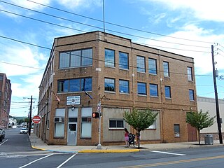
Frackville is a borough in Schuylkill County, Pennsylvania. Incorporated in 1876, Frackville is located at the intersection of Interstate 81 and Pennsylvania State Route 61 is located near the borough, which is approximately 102 miles (164 km) northwest of Philadelphia and 60 miles (97 km) southwest of Scranton. Frackville is named for Daniel Frack, an early Anglo-American settler.
Mahanoy City is a borough located 38 miles (61 km) southwest of Wilkes-Barre and 13 miles southwest of Hazleton, in northern Schuylkill County, Pennsylvania, United States. It is part of the Coal Region of Pennsylvania and is located entirely within, but is not part of, Mahanoy Township.
McAdoo is a borough and coal town in Schuylkill County, Pennsylvania, United States, 5 miles (8.0 km) south of Hazleton and seven miles north of Tamaqua. McAdoo contains the picturesque Silver Brook Meadow. In the past, anthracite coal mining and a shirt factory, the McAdoo Manufacturing Company, provided gainful employment to the populace. The population was 2,477 at the 2020 census.
Middleport is a borough in Schuylkill County, Pennsylvania, United States. The population was 363 at the time of the 2020 census.
Minersville is a borough in Schuylkill County, Pennsylvania, United States. Anthracite coal deposits are plentiful in the region. The population was 4,388 at the 2020 census.
New Philadelphia, also known as New Philly, is a borough in Schuylkill County, Pennsylvania, United States. The population was 1,060 at the 2020 census.
Pottsville is the county seat of Schuylkill County, Pennsylvania, United States. The population was 13,346 at the 2020 census, and is the principal city of the Pottsville, PA Micropolitan Statistical Area. The city lies along the west bank of the Schuylkill River, 52 miles (84 km) south of Wilkes-Barre. It is located in Pennsylvania's Coal Region.
St. Clair is a borough in Schuylkill County, Pennsylvania, United States. It is located 2 mi (3.2 km) north of Pottsville in the southern Coal Region. Extensive deposits of hard coal are present.
Tamaqua is a borough in eastern Schuylkill County in the Coal Region of Pennsylvania, United States. It had a population of 6,934 as of the 2020 U.S. census.
Ashland is a borough in Schuylkill County in the U.S. state of Pennsylvania, 15 miles (24 km) northwest of Pottsville. It is part of Northeastern Pennsylvania. A small part of the borough also lies in Columbia County, although all of the population resided in the Schuylkill County portion as of the 2020 census. The borough lies in the anthracite coal region of eastern Pennsylvania. Settled in 1850, Ashland was incorporated in 1857, and was named for Henry Clay's estate near Lexington, Kentucky. The population in 1900 was 6,438, and in 1940, 7,045, but had dropped to 2,471 at the 2020 census.