Palo Alto, Pennsylvania

Last updated
Palo Alto, Pennsylvania
Borough
War Memorial, Palo Alto PA 01.JPG
War Memorial in Palo Alto.
Schuylkill County Pennsylvania Incorporated and Unincorporated areas Palo Alto Highlighted.svg
Location of Palo Alto in Schuylkill County, Pennsylvania.
USA Pennsylvania location map.svg
Red pog.svg
Palo Alto
Location in Pennsylvania
Usa edcp location map.svg
Red pog.svg
Palo Alto
Palo Alto (the United States)
Coordinates: 40°41′16″N76°10′16″W / 40.68778°N 76.17111°W / 40.68778; -76.17111
Country United States
State Pennsylvania
County Schuylkill
Settled1844
Incorporated1854
Government
  TypeBorough Council
Area
[1]
  Total1.04 sq mi (2.70 km2)
  Land1.04 sq mi (2.70 km2)
  Water0.00 sq mi (0.00 km2)
Population
 (2020) [2]
  Total970
  Density929.12/sq mi (358.63/km2)
Time zone UTC-5 (Eastern (EST))
  Summer (DST) UTC-4 (EDT)
Zip code
17901
Area code 570
FIPS code 42-57752
Website http://www.paloaltopa.com/

Palo Alto is a borough in Schuylkill County, Pennsylvania, United States. [3] Bacon Street is the main street of town.

Contents

This borough stretches along the south bank of the Schuylkill River, and maintains its own fire department and police department, but shares its zip code, telephone exchanges and school district with the city of Pottsville.

The population was nine hundred and seventy-one at the time of the 2020 census. [4]

History

Heavily forested until the mid-1870s, the land which became the community of Palo Alto was the site of a log cabin and wooden blacksmith's shanty earlier in the nineteenth century. As more and more settlers arrived in the region, the Philadelphia and Reading Railroad and the Schuylkill Navigation Company (later known as the Schuylkill Canal) opened stops here. In response, the neighboring land was surveyed and plotted out by John G. Hewes between late 1844 and early 1845 to create the town of Palo Alto. [5]

As more boatmen and other laborers arrived to work on the canal and railroad, mining companies continued to increase their hiring of miners to work deep underground in their anthracite coal collieries that were operating across Schuylkill County, which sparked the opening of stores and other businesses to serve the town's growing population. [6]

A public school was established sometime during this phase of the community's expansion; it was situated in the town's eastern section. [7]

Officially incorporated as a borough in 1854, Palo Alto may have been given its name because of "very high timber [that] grew on the mountain above it," according to historians. [8]

The borough's first elected officials were Burgess Waters S. Chillson, William. M. Stellwagon, clerk, and borough council members Wiiliam Bensinger, Allen Enison, John Griner, Jacob Lime, David Riley, and William Stellwagon. A second public school was then opened in the borough's western section. Both schools were two-room structures with stone exteriors. [9]

Between 1854 and 1855, William Harris erected and began operating a large rolling mill plant, which produced railroad iron. That plant was subsequently purchased by Benjamin Haywood, who built a second rolling mill in the town in 1863. The two-plant operation was known as the Palo Alto Rolling Mill. The Philadelphia and Reading Railroad, which was one of the company's major customers, operated a roundhouse and repair facility roughly a mile west of both rolling mills. [10]

By 1856, a stable water system was in place with water supplied by the Pottsville Water Company. [11]

In 1866, community leaders designed and built a Methodist Episcopal church on Union Street at a cost of thirteen hundred dollars. [12]

The borough's first post office opened in 1870, but it ceased operations in 1873. Mail service was subsequently provided by a post office branch in Pottsville. [13]

In 1878, borough leaders built a new, two-story public school in the center of the community. Equipped with mountain spring-supplied water and steam heat, it delivered multiple grades of education in four classrooms while the two older schools focused on providing primary school instruction. Roughly three hundred students were educated annually at this time [14]

Geography

Palo Alto is located at 40°41′16″N76°10′16″W / 40.687881°N 76.171194°W / 40.687881; -76.171194 . [15]

According to the United States Census Bureau, the borough has a total area of 1.1 square miles (2.8 km2), all of it land.

Demographics

Historical population
CensusPop.Note
1860 1,108
1870 1,74057.0%
1880 1,588−8.7%
1890 1,424−10.3%
1900 1,70719.9%
1910 1,8739.7%
1920 1,667−11.0%
1930 1,90814.5%
1940 1,9341.4%
1950 1,767−8.6%
1960 1,445−18.2%
1970 1,428−1.2%
1980 1,321−7.5%
1990 1,192−9.8%
2000 1,052−11.7%
2010 1,032−1.9%
2020 971−5.9%
2021 (est.)971 [4] 0.0%
Sources: [16] [17] [18] [2]

As of the census [17] of 2000, there were 1,052 people, 444 households, and 306 families living in the borough.

The population density was 995.9 inhabitants per square mile (384.5/km2). There were 478 housing units at an average density of 452.5 per square mile (174.7/km2).

The racial makeup of the borough was 98.86% White, 0.10% African American, 0.29% Asian, and 0.76% from two or more races.

There were 444 households, out of which 25.7% had children under the age of 18 living with them, 55.2% were married couples living together, 10.4% had a female householder with no husband present, and 30.9% were non-families. 26.4% of all households were made up of individuals, and 14.0% had someone living alone who was 65 years of age or older.

The average household size was 2.37 and the average family size was 2.88.

In the borough the population was spread out, with 18.7% under the age of 18, 8.0% from 18 to 24, 27.1% from 25 to 44, 25.4% from 45 to 64, and 20.8% who were 65 years of age or older. The median age was 42 years. For every 100 females there were 91.3 males.

For every 100 females age 18 and over, there were 89.2 males.

The median income for a household in the borough was $35,729, and the median income for a family was $41,667. Males had a median income of $30,449 compared with that of $21,042 for females.

The per capita income for the borough was $16,806. Roughly 3.5% of families and 6.9% of the population were below the poverty line, including 4.3% of those under age 18 and 13.2% of those age 65 or over.

Notable person

Eddie Delker, baseball infielder

Related Research Articles

<span class="mw-page-title-main">Schuylkill County, Pennsylvania</span> County in Pennsylvania, United States

Schuylkill County is a county in the Commonwealth of Pennsylvania. It is located in the heart of Pennsylvania's Coal Region and is part of Northeastern Pennsylvania. As of the 2020 census, the population was 143,049. The county seat is Pottsville.

<span class="mw-page-title-main">Burton, Michigan</span> City in Michigan, United States

Burton is a city in Genesee County in the state of Michigan and a suburb of Flint. The population was 29,999 at the 2010 census, making Burton the second largest city in Genesee County.

<span class="mw-page-title-main">Hamburg, Pennsylvania</span> Borough in Pennsylvania, United States

Hamburg is a borough in Berks County, Pennsylvania, United States. The population was 4,270 at the 2020 census. The town is thought to have been named after Hamburg, Germany, but this is likely to have been a corruption of Bad Homburg.

<span class="mw-page-title-main">Leesport, Pennsylvania</span> Borough in Pennsylvania, United States

Leesport is a borough in Berks County, Pennsylvania. The population was 1,918 at the 2010 census.

<span class="mw-page-title-main">Bloom Township, Clearfield County, Pennsylvania</span> Township in Pennsylvania, United States

Bloom Township is a township in Clearfield County, Pennsylvania, United States. The population was 381 at the 2020 census.

<span class="mw-page-title-main">Springhill Township, Fayette County, Pennsylvania</span> Township in Pennsylvania, United States

Springhill Township is a township in Fayette County, Pennsylvania, United States. The population was 2,723 at the 2020 census. The Albert Gallatin Area School District serves the region.

<span class="mw-page-title-main">Coaldale, Schuylkill County, Pennsylvania</span> Borough in Pennsylvania, United States

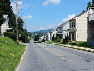
Coaldale is a borough in Schuylkill County, Pennsylvania, United States. Initially settled in 1827, it was incorporated in 1906 from part of the former Rahn Township; it is named for the coal industry—wherein, it was one of the principal early mining centers. Coaldale is in the southern Anthracite Coal region in the Panther Creek Valley, a tributary of the Little Schuylkill River, along which U.S. Route 209 was eventually built between the steep climb up Pisgah Mountain from Nesquehoning (easterly) and its outlet in Tamaqua, approximately five miles to the west.

<span class="mw-page-title-main">Cressona, Pennsylvania</span> Borough in Pennsylvania, United States

Cressona is a borough in Schuylkill County, Pennsylvania. Formed in 1857 from part of North Manheim Township, it was founded by and named for John Chapman Cresson, a Philadelphia civil engineer and manager of the Schuylkill Navigation Company, president of the Mine Hill and Schuylkill Haven Railroad, and the chief engineer of Fairmount Park in Philadelphia.

<span class="mw-page-title-main">Deer Lake, Pennsylvania</span> Borough in Pennsylvania, United States

Deer Lake is a borough in Schuylkill County, Pennsylvania. The population was 670 at the 2020 census. The mayor of the borough is Larry Kozlowski.

<span class="mw-page-title-main">Girardville, Pennsylvania</span> Borough in Pennsylvania, United States

Girardville is a borough in Schuylkill County, Pennsylvania, United States, 58 miles (93 km) northwest of Reading. Anthracite coal deposits are in the region. Coal-mining provided employment and incomes for many of the 3,666 people who lived there in 1900. In 1910, 4,396 individuals called it home. The population was 1,519 at the 2010 census. It was founded in 1832 and is named after Stephen Girard of Philadelphia, who purchased large land holdings in and around the town. It was incorporated as a borough in 1872.

<span class="mw-page-title-main">Mahanoy City, Pennsylvania</span> Borough in Pennsylvania, United States

Mahanoy City is a borough located 38 miles (61 km) southwest of Wilkes-Barre and 13 miles southwest of Hazleton, in northern Schuylkill County, Pennsylvania, United States. It is part of the Coal Region of Pennsylvania and is located entirely within, but is not part of, Mahanoy Township.

<span class="mw-page-title-main">Mechanicsville, Schuylkill County, Pennsylvania</span> Borough in Pennsylvania, United States

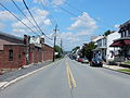
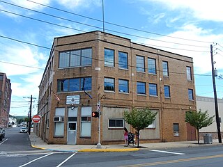
Mechanicsville is a borough in Schuylkill County, Pennsylvania, United States. Part of the Pottsville Area School District, it lies between Pottsville and Port Carbon. Pottsville Street is the community's main street.

<span class="mw-page-title-main">Minersville, Pennsylvania</span> Borough in Pennsylvania, United States

Minersville is a borough in Schuylkill County, Pennsylvania, United States. Anthracite coal deposits are plentiful in the region. The population was 4,388 at the 2020 census.

<span class="mw-page-title-main">Mount Carbon, Pennsylvania</span> Borough in Pennsylvania, United States

Mount Carbon is a borough in Schuylkill County, Pennsylvania, United States, two miles south of Pottsville. It was formed from North Manheim Township in 1864. The population was 88 in the 2020 census. The borough is the smallest municipality in Schuylkill County.

<span class="mw-page-title-main">Shenandoah, Pennsylvania</span> Borough in Pennsylvania, United States

Shenandoah is a borough in Schuylkill County in the Coal Region of Pennsylvania. It is distinct from Shenandoah Heights, which is part of West Mahanoy Township immediately to the north. As of 2021, the borough's population was 4,247.

<span class="mw-page-title-main">Tamaqua, Pennsylvania</span> Borough in Pennsylvania, United States

Tamaqua is a borough in eastern Schuylkill County in the Coal Region of Pennsylvania, United States. It had a population of 6,934 as of the 2020 U.S. census.

<span class="mw-page-title-main">Tremont, Pennsylvania</span> Borough in Pennsylvania, United States

Tremont is a borough in Schuylkill County, Pennsylvania, United States. Situated in the eastern section of Tremont Township, it was incorporated as a borough in 1866, around the same time that a water system was erected in the community.

<span class="mw-page-title-main">Tuscarora, Pennsylvania</span> CDP in Pennsylvania, United States

Tuscarora is a census-designated place (CDP) in Schuylkill County, Pennsylvania, United States. The population was 980 at the 2010 census.

<span class="mw-page-title-main">Ashland, Pennsylvania</span> Borough in Pennsylvania, United States

Ashland is a borough in Schuylkill County in the U.S. state of Pennsylvania, 15 miles (24 km) northwest of Pottsville. It is part of Northeastern Pennsylvania. A small part of the borough also lies in Columbia County, although all of the population resided in the Schuylkill County portion as of the 2020 census. The borough lies in the anthracite coal region of eastern Pennsylvania. Settled in 1850, Ashland was incorporated in 1857, and was named for Henry Clay's estate near Lexington, Kentucky. The population in 1900 was 6,438, and in 1940, 7,045, but had dropped to 2,471 at the 2020 census.

<span class="mw-page-title-main">Pottsville Area School District</span> School district in Pennsylvania

Pottsville Area School District is a midsized, rural/suburban public school district located in Pottsville, Pennsylvania, serving students in central Schuylkill County. It encompasses approximately 12 square miles (31 km2). The district serves the City of Pottsville and five additional municipalities: the boroughs of Mechanicsville, Mount Carbon, Port Carbon, Palo Alto, and Norwegian Township.

References

  1. "ArcGIS REST Services Directory". United States Census Bureau. Retrieved October 12, 2022.
  2. 1 2 "Census Population API". United States Census Bureau. Retrieved Oct 12, 2022.
  3. History of Schuylkill County, Pa: With Illustrations and Biographical Sketches of Some of Its Prominent Men and Pioneers , pp. 110, 200-203, 303, R9, R18, R27, R31. Chicago, Illinois: W.W. Munsell & Company, 1881.
  4. 1 2 Bureau, US Census. "City and Town Population Totals: 2020—2021". Census.gov. US Census Bureau. Retrieved August 1, 2022.
  5. History of Schuylkill County, Pa: With Illustrations and Biographical Sketches of Some of Its Prominent Men and Pioneers, pp. 200-203.
  6. History of Schuylkill County, Pa: With Illustrations and Biographical Sketches of Some of Its Prominent Men and Pioneers, pp. 200-203.
  7. History of Schuylkill County, Pa: With Illustrations and Biographical Sketches of Some of Its Prominent Men and Pioneers, p. 202.
  8. History of Schuylkill County, Pa: With Illustrations and Biographical Sketches of Some of Its Prominent Men and Pioneers, p. 202.
  9. History of Schuylkill County, Pa: With Illustrations and Biographical Sketches of Some of Its Prominent Men and Pioneers, p. 202.
  10. History of Schuylkill County, Pa: With Illustrations and Biographical Sketches of Some of Its Prominent Men and Pioneers, pp. 110, 200-203.
  11. History of Schuylkill County, Pa: With Illustrations and Biographical Sketches of Some of Its Prominent Men and Pioneers, p. 202.
  12. History of Schuylkill County, Pa: With Illustrations and Biographical Sketches of Some of Its Prominent Men and Pioneers, p. 202.
  13. History of Schuylkill County, Pa: With Illustrations and Biographical Sketches of Some of Its Prominent Men and Pioneers, p. 202.
  14. History of Schuylkill County, Pa: With Illustrations and Biographical Sketches of Some of Its Prominent Men and Pioneers, p. 202.
  15. "US Gazetteer files: 2010, 2000, and 1990". United States Census Bureau. 2011-02-12. Retrieved 2011-04-23.
  16. "Census of Population and Housing". U.S. Census Bureau. Retrieved 11 December 2013.
  17. 1 2 "U.S. Census website". United States Census Bureau . Retrieved 2008-01-31.
  18. "Incorporated Places and Minor Civil Divisions Datasets: Subcounty Resident Population Estimates: April 1, 2010 to July 1, 2012". Population Estimates. U.S. Census Bureau. Archived from the original on 11 June 2013. Retrieved 11 December 2013.