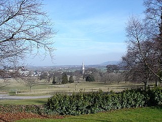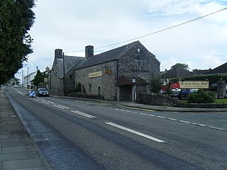
Chepstow is a town and community in Monmouthshire, Wales, adjoining the border with Gloucestershire, England. It is located on the tidal River Wye, about 2 miles (3.2 km) above its confluence with the River Severn, and adjoining the western end of the Severn Bridge. It is the easternmost settlement in Wales, situated 16 miles (26 km) east of Newport, 28 miles (45 km) east-northeast of Cardiff, 18 miles (29 km) northwest of Bristol and 110 miles (180 km) west of London.

Bridgend is a town in the Bridgend County Borough of Wales, 20 miles (32 km) west of Cardiff and 20 miles (32 km) east of Swansea. The town is named after the medieval bridge over the River Ogmore. The River Ewenny also flows through the town. The population was 49,597 in 2021. Bridgend is within the Cardiff Capital Region which in 2019 had a population of approximately 1.54 million.

Bodelwyddan is a village, electoral ward and community in Denbighshire, Wales, approximately 5 miles (8 km) South of Rhyl. The Parish includes several smaller hamlets such as Marli and Pengwern.

Ogmore Castle is a Grade I listed castle ruin located near the village of Ogmore-by-Sea, south of the town of Bridgend in Glamorgan, South Wales. It is situated on the south bank of the River Ewenny and the east bank of the River Ogmore.

Merthyr Mawr is a village and community in Bridgend, Wales. The village is about 2+1⁄2 miles from the centre of Bridgend town. The population of the community at the 2011 census was 267. The community occupies the area west of the Ewenny River, between Bridgend and Porthcawl. It takes in the settlement of Tythegston and a stretch of coastal sand dunes known as Merthyr Mawr Warren. It is in the historic county of Glamorgan.
Brackla is a large housing estate and community in the east of Bridgend in Bridgend County Borough, Wales. Along with the communities of Bridgend and Coychurch Lower, it makes up the town of Bridgend.

Pyle is a village and community in Bridgend county borough, Wales. This large village is served by the A48 road, and lies less than one mile from Junction 37 of the M4 motorway, and is therefore only a half-hour journey from the capital city of Wales, Cardiff. The nearest town is the seaside resort of Porthcawl. Within the Community, to the northeast of Pyle, is the adjoining settlement of Kenfig Hill, North Cornelly also adjoins Pyle and the built-up area had a population of 13,701 in 2011.
Newcastle usually refers to:

Cefn Cribwr is a village and community in Bridgend County Borough in south Wales. The village is located about 5 miles (8 km) from the centre of Bridgend town, and inbetween Bridgend and Pyle.

Newcastle Castle is a medieval castle located on Newcastle Hill, Newcastle, overlooking the town centre of Bridgend in Glamorgan, South Wales. It was originally believed to date from 1106 when a ringwork was created at the site by the Norman baron Robert Fitzhamon. Some of the fine stonework survives, but today the castle is ruinous.
Coity Higher is a community in Bridgend County Borough, south Wales. It contains the north western suburbs of Bridgend which includes the villages of Litchard and Coity. The southern boundary of the community adjoins the community of Brackla, while the northern border is defined by the M4 motorway. Notable buildings and landmarks within the community include Coity Castle, Parc Prison, the 14th century Church of St Mary, Pendre Hospital, Ty Mawr House and a burial chamber. At the 2001 census, the community's population was 835, being re-measured at 6,078 t the 2011 Census.

Coity is a village in Bridgend County Borough, south Wales, part of Bridgend town urban area. Coity is part of the community of Coity Higher and is notable for being home to Coity Castle, one of the best preserved castles in Glamorgan. Other buildings of note in the village include St Mary, a 14th-century church, and Ty Mawr, a fine 16th-century house.

Laleston is a village and a community in Bridgend County Borough, south Wales, directly west of Bridgend town centre. The village takes its name from the Norman Lageles family who settled in the area. Buildings of note in the village include St David's Church, which still possesses features dating back to the 13th and 14th centuries, the Great House which was built in the early 16th century and Horeb Welsh Presbyterian Church (1831).
Newcastle Higher is a community in Bridgend County Borough, south Wales. Located north west of Bridgend town centre it is made up of the townships of Pen-y-fai and Aberkenfig and straddles the M4 motorway. The community is home to several notable buildings, including the Pen-y-fai Hospital, Court Coleman and All Saints Church.

Newcastle is an area and electoral ward of the town of Bridgend, Wales. The area includes the medieval Newcastle Castle. The ward elects councillors to Bridgend Town Council and Bridgend County Borough Council.

Coychurch Lower is a community in Bridgend County Borough, South Wales. Along with the communities of Brackla and Bridgend, it makes up the town of Bridgend. Coychurch Lower is the eastern district of Bridgend, and takes in the village of Coychurch and the area known as Waterton. Traffic leaving the M4 Motorway for Bridgend at Junction 35 travels through Coychurch Lower along the A473 road, passing through an area of business parks and out-of town shopping zones, which takes up the majority of the western half of the community. The population of Coychurch Lower at the 2001 census was 1206, increasing to 1,365 at the 2011 census.

Llangynwyd Middle is a community in Bridgend County Borough, south Wales. It is located to the south of Maesteg and contains the villages of Llangynwyd and Cwmfelin. At the 2001 census, the population of the community was 2,843, increasing to 3,032 at the 2011 Census.
Oldcastle is an area and electoral ward of the town of Bridgend, Wales, to the south of the town centre. The ward elects councillors to Bridgend Town Council and Bridgend County Borough Council.


