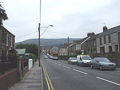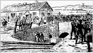
Maesteg is a town and community in Bridgend County Borough, Wales. Maesteg lies at the northernmost end of the Llynfi Valley, close to the border with Neath Port Talbot. In 2011, Maesteg had a population of 20,612. The English translation of Maesteg is 'fair field'.

South Wales is a loosely defined region of Wales bordered by England to the east and mid Wales to the north. Generally considered to include the historic counties of Glamorgan and Monmouthshire, south Wales extends westwards to include Carmarthenshire and Pembrokeshire. In the western extent, from Swansea westwards, local people would probably recognise that they lived in both south Wales and west Wales. The Brecon Beacons National Park covers about a third of south Wales, containing Pen y Fan, the highest British mountain south of Cadair Idris in Snowdonia.
A mining accident is an accident that occurs during the process of mining minerals or metals. Thousands of miners die from mining accidents each year, especially from underground coal mining, although accidents also occur in hard rock mining. Coal mining is considered much more hazardous than hard rock mining due to flat-lying rock strata, generally incompetent rock, the presence of methane gas, and coal dust. Most of the deaths these days occur in developing countries, and rural parts of developed countries where safety measures are not practiced as fully. A mining disaster is an incident where there are five or more fatalities.
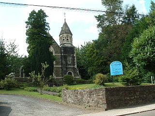
Tondu is a village in Bridgend County Borough, Wales, located about 3 miles (4.8 km) north of the town of Bridgend, in the community of Ynysawdre.

Abercanaid is a small village in the county borough of Merthyr Tydfil, Glamorgan, Wales, United Kingdom with a population of about 5,060. It is situated 2.5 miles (4.0 km) south of Merthyr town centre and is west of Pentrebach, across the River Taff and north of Troedyrhiw. The Taff Trail runs through the village, adjacent to the path of the disused Glamorganshire Canal, which was an important in transporting iron and coal during the industrial boom in which the South Wales Valleys prospered.
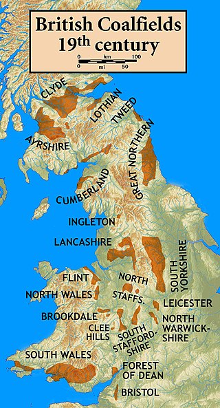
The South Wales Coalfield extends across Pembrokeshire, Carmarthenshire, Swansea, Neath Port Talbot, Bridgend, Rhondda Cynon Taf, Merthyr Tydfil, Caerphilly, Blaenau Gwent and Torfaen. It is rich in coal deposits, especially in the South Wales Valleys.
In 1861 the Llynvi Valley Railway was opened in Glamorganshire, Wales, to convey mineral products to the Bristol Channel at Porthcawl. It adopted an earlier tramroad, the Duffryn Llynvi and Porthcawl Railway. The Llynvi and Ogmore Railway was opened in 1865, and the two companies amalgamated to form the Llynvi and Ogmore Railway in 1866. At first Porthcawl harbour was an important destination for onward transport, but this soon declined.

Ogmore Vale is a village in the county borough of Bridgend, Wales on the River Ogmore. The village's main source of income came from coal mining. Up until the year 1865, the Ogmore valley was a quiet, isolated, rural hill farming community of less than ten farms and a few cottages. Today, along with Nantymoel and Price Town it makes up the community of Ogmore Valley.
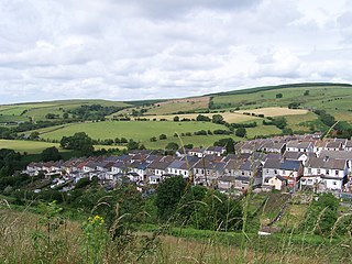
Gilfach Goch is a community, electoral ward and small former coal mining village mostly in the Borough of Rhondda Cynon Taf, south Wales, near the larger community of Tonyrefail. Some areas in the North Western part of the village lie within Bridgend County Borough. It is situated in the Cwm Ogwr Fach between the Cwm Ogwr Fawr to the west and the Cwm Rhondda to the east.
John Brogden and Sons was a firm of Railway Contractors, Iron and Coal Miners and Iron Smelters operating, initially as a general contractor, from roughly 1828 until its bankruptcy in 1880.

Penallta Colliery was a coal mine, located close to Hengoed in the Rhymney Valley in the South Wales Valleys. A coal mine which in 1935 held the European record for coal wound in a 24-hour period, it is now the site of an original redevelopment project which will make use of the former pit head buildings.

Caerau is a former mining village in the community of Maesteg, Bridgend County Borough, Wales, located approximately 2 miles north of the centre of Maesteg town in the Llynfi Valley. Caerau, surrounded by mountainous terrain and forestry, is one of the border points between Bridgend County Borough and Neath Port Talbot County Borough, bordered to the north by Croeserw and Cymmer, Neath Port Talbot. Caerau, borders Dyffryn and Spelter to the south in Nantyffyllon, Maesteg.

Universal Colliery was a coal mine located in Senghenydd in the Aber Valley, roughly four miles north-west of the town of Caerphilly. It was in the county borough of Caerphilly, traditionally in the county of Glamorgan, Wales.

Abercynon Colliery was a coal mine located in Abercynon, South Wales. Opened in 1889, it closed in 1988.
Albion Colliery was a coal mine in South Wales Valleys, located in the village of Cilfynydd, one mile north of Pontypridd.

Six Bells Colliery was a colliery located in Six Bells, Abertillery, Gwent, Wales. On 28 June 1960 it was the site of an underground explosion which killed 45 of the 48 miners working in that part of the mine. It is now the site of the artistically acclaimed Guardian memorial to those events, designed by Sebastian Boyesen; although the memorial primarily commemorates those who died at Six Bells, it is dedicated to all mining communities wherever they may be.
Ferndale Colliery was a series of nine coal mines, located close to the village of Ferndale, Rhondda Cynon Taf in the Rhondda Valley, South Wales.
The Tarenni Colliery and its associated workings, are a series of coal mines and pits located between the villages of Godre'r Graig and Cilybebyll located in the valley of the River Tawe, in Neath Port Talbot county borough, South Wales.
Barrow Colliery was a coal mine in Worsborough, South Yorkshire, England. It was first dug in 1873, with the first coal being brought to the surface in January 1876. It was the scene of a major incident in 1907 when seven miners died. After 109 years of coaling operations, the mine was closed in May 1985.
