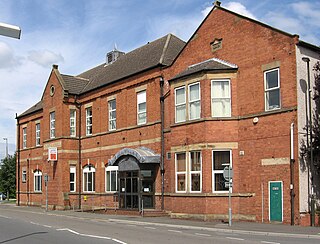
Staveley is a town and civil parish in the Borough of Chesterfield, Derbyshire, England. Located along the banks of the River Rother. It is northeast of Chesterfield, west of Clowne, northwest of Bolsover, southwest of Worksop and southeast of Sheffield.

North East Derbyshire is a local government district in Derbyshire, England. The council is based in the large village of Wingerworth. The district also includes the towns of Dronfield and Clay Cross as well as numerous villages and surrounding rural areas.

The River Rother, a waterway in the northern midlands of England, gives its name to the town of Rotherham and to the Rother Valley parliamentary constituency. It rises in Pilsley in Derbyshire and flows in a generally northwards direction through the centre of Chesterfield, where it feeds the Chesterfield Canal, and on through the Rother Valley Country Park and several districts of Sheffield before joining the River Don at Rotherham in Yorkshire. Historically, it powered mills, mainly corn or flour mills, but most had ceased to operate by the early 20th century, and few of the mill buildings survive.

The Metropolitan Borough of Rotherham is a metropolitan borough of South Yorkshire, England. It is named after its main settlement of Rotherham. The wider borough spans a larger area and covers the outlying towns of Maltby, Swinton, Wath-upon-Dearne, Dinnington. As well as the villages of Rawmarsh and Laughton. A large valley spans the entire borough and is referred to as the "Rother Valley".

Maltby is a former mining town and civil parish in the Metropolitan Borough of Rotherham, South Yorkshire, England. It was historically in the West Riding of Yorkshire. It is located about 6 miles (10 km) east of Rotherham town centre and 10 miles (16 km) north-east of Sheffield city centre. It forms a continuous urban area with Hellaby, separated from the rest of Rotherham by the M18 motorway. It had a population of 16,688 at the 2011 Census.
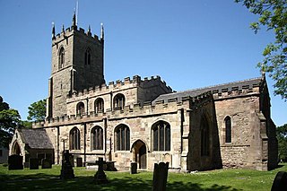
Harthill is a village in the Metropolitan Borough of Rotherham, on the border with Derbyshire. It lies between Killamarsh and Thorpe Salvin, and is located at approximately 53°19′10″N1°15′30″W, at an elevation of around 110 metres above sea level. In the 2001 census, the civil parish of Harthill with Woodall had a population of 1,909, reducing slightly to 1,879 at the 2011 Census.
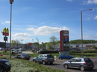
Cortonwood was a colliery near Rotherham, South Yorkshire, England. The colliery's proposed closure was a tipping point in the 1984-85 miners' strike. The site is now a shopping and leisure centre.

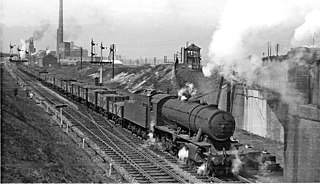
Orgreave Colliery was a coal mine situated adjacent to the main line of the Manchester, Sheffield & Lincolnshire Railway about 5 miles (8 km) east of Sheffield and 3.5 miles (6 km) south west of Rotherham. The colliery is within the parish of Orgreave, from which it takes its name.
Rotherham Main Colliery was situated in Canklow, about 0.5 miles south of Rotherham town centre in the Rother Valley. The area was the site of an ancient crossing of the river set below the crag on which were Canklow Woods, an ancient woodland area.
New Stubbin Colliery was a coal mine situated in the township of Rawmarsh near Rotherham, South Yorkshire, England. The colliery was situated in a deep valley. Along one side at the top of the valley runs Haugh Road, Rawmarsh and on the other a lane known locally as “Greasbrough Tops”.
The Sheffield Coal Company was a colliery owning and coal selling company with its head office situated in South Street, Sheffield, South Yorkshire, England.
The United Steel Companies was a steelmaking, engineering, coal mining and coal by-product group based in South Yorkshire and Lincolnshire, England.
Tinsley Park Collieries were a group of coal mines situated in the Tinsley / Darnall area to the east of the City of Sheffield, South Yorkshire, England.

Kiveton Park Colliery was a coal mine in the village of Kiveton Park, near Rotherham, South Yorkshire, England.
Waleswood Colliery was a coal mine situated between Swallownest and Wales Bar, near Rotherham, South Yorkshire, England. The colliery was adjacent to the Rotherham to Clowne road and the main line of the Manchester, Sheffield and Lincolnshire Railway about 2 miles east of Woodhouse.
High Hazels Colliery was a coal mine situated between the parish of Catcliffe, near Rotherham, and the parish of Handsworth, near Sheffield. It was adjacent to the main line of the Manchester, Sheffield and Lincolnshire Railway between the stations of Darnall and Woodhouse.
The South Yorkshire Coalfield is so named from its position within Yorkshire. It covers most of South Yorkshire, West Yorkshire and a small part of North Yorkshire. The exposed coalfield outcrops in the Pennine foothills and dips under Permian rocks in the east. Its most famous coal seam is the Barnsley Bed. Coal has been mined from shallow seams and outcrops since medieval times and possibly earlier.
Aston Colliery was a small coal mine sunk on Aston Common, within Rotherham Rural District but six miles east of Sheffield in the 1840s. In 1864 its workings were taken over and developed by the North Staveley Colliery Company, part of the Staveley Coal and Iron Company, based in North Derbyshire. It was later acquired by the Sheffield Coal Company.
Manvers Main Colliery was a coal mine, sunk on land belonging to the Earl Manvers on the northern edge of Wath-upon-Dearne, between that town and Mexborough in the Dearne Valley, in the West Riding of Yorkshire, England. The regional headquarters and laboratories of British Coal were situated in the complex.
Beighton Junction is a set of railway junctions near Beighton on the border between Derbyshire and South Yorkshire, England.
