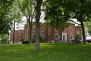
St. Clair County is the ninth most populous county in Illinois. Located directly east of St. Louis, the county is part of the Metro East region of the Greater St. Louis metropolitan area in southern Illinois. As of the 2020 United States census, St. Clair County had a population of 257,400, making it the third most populous county in Illinois outside the Chicago metropolitan area. Belleville is the county’s seat and largest city.

Monroe County is a county located in the U.S. state of Illinois. According to the 2020 census, it had a population of 34,962. Its county seat and largest city is Waterloo.

Collinsville is a city located mainly in Madison County and partially in St. Clair County, Illinois, United States. As of the 2020 census, the city had a population of 24,366. Collinsville is approximately 14 miles (23 km) east of St. Louis, Missouri, and is part of that city's Metro East area.

Columbia is a city mainly in Monroe County with a small portion in St. Clair County in the U.S. state of Illinois, about 12 miles (19 km) south of St. Louis, Missouri. The population was 10,999 at the 2020 census.

Waterloo is a city in and county seat of Monroe County, Illinois, United States. The population was 11,013 at the 2020 census, up from 9,811 in 2010.

Greater St. Louis is a bi-state metropolitan statistical area in the United States that includes parts of both Missouri and Illinois. Its largest principal city is the independent city of St. Louis, and its largest employer is St Louis County, Missouri which lies immediately to the west. The pre-war city core is on the Mississippi Riverfront on the border with Illinois in the geographic center of the metro area. The Mississippi River bisects the metro area geographically between Illinois and Missouri; however, the Missouri portion is much more populous. St. Louis is the focus of the largest metro area in Missouri and the Illinois portion known as Metro East is the second largest metropolitan area in that state. St. Louis County is independent of the City of St. Louis and their two populations are generally tabulated separately.

Metro East is a region in southern Illinois that contains eastern and northern suburbs and exurbs of St. Louis, Missouri, United States. It encompasses five Southern Illinois counties in the St. Louis Metropolitan Statistical Area. The region's most populated city is Belleville, with 45,000 residents. The Metro East is the second largest urban area in Illinois after the Chicago metropolitan area and, as of the 2000 census, the population of the Metro East statistical area was 599,845 residents, a figure that had risen to above 700,000 in 2010. The significant growth in the Metro East is mainly due to people in smaller outlying towns in Illinois moving to the area for better economic/job opportunities.

The Sisters, Servants of the Immaculate Heart of Mary (I.H.M.) is a Catholic religious institute of sisters, founded by Fr. Louis Florent Gillet, CSsR, and a co-founder of the Oblate Sister of Providence, Mother Theresa Maxis Duchemin, in 1845.

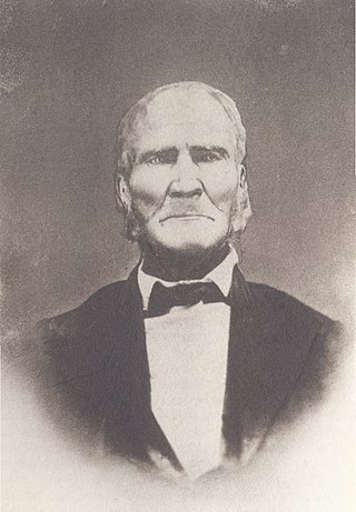
Samuel Whiteside was an Illinois pioneer. A farmer and backwoodsman, Whiteside briefly served in the Illinois General Assembly after statehood and led the Illinois militia for decades, rising to the rank of general but also enlisting as an ordinary soldier when militia calls declined at the end of wars. Whiteside fought the British in the War of 1812 and Native Americans through the Blackhawk War.
The 12th congressional district of Illinois is a congressional district in the southern part of U.S. state of Illinois. It has been represented by Republican Mike Bost since 2015.

The East St. Louis and Suburban Railway was an interurban railroad that operated in Illinois.
Renault is a small unincorporated community in the historic Renault Precinct of Monroe County, Illinois, United States.
Tipton is a small unincorporated community in Monroe County, Illinois, United States. It grew up around the Cambria Station on the St. Louis and Cairo Railroad. The community there, settled by persons of Irish descent was called Tipperary, which degenerated over time through Tiptown, to the current Tipton.
St. Joe, Illinois is a small unincorporated community in the historic New Design Precinct of Monroe County, Illinois, United States. It is located along the historic road from Kaskaskia to St. Louis, between Renault and Burksville.
Burksville Station is an unincorporated community in the New Design Precinct of Monroe County, Illinois, United States. It grew up around a station on the St. Louis and Cairo Railroad.

The Middle Mississippi River National Wildlife Refuge is located on the Mississippi River downstream from St. Louis, Missouri. It is managed by the U.S. Fish and Wildlife Service as part of the Mark Twain National Wildlife Refuge Complex.
National Weather Service St. Louis is the National Weather Service office located in St. Charles, Missouri, just outside St. Louis, Missouri. There are 46 counties in its County Warning Area (CWA). Some of the cities in its CWA are Columbia, Farmington, Hannibal and Jefferson City in Missouri, and Belleville, Centralia, Edwardsville, and Quincy in Illinois.
The East-West Gateway Council of Governments is the official Council of Governments and Metropolitan planning organization for Greater St. Louis, USA. It was incorporated in 1965.
Burksville is an unincorporated community in Shelby County, in the U.S. state of Missouri.


