Demographics
Historical population| Census | Pop. | Note | %± |
|---|
| 1840 | 2,610 | | — |
|---|
| 1850 | 6,937 | | 165.8% |
|---|
| 1860 | 21,005 | | 202.8% |
|---|
| 1870 | 29,783 | | 41.8% |
|---|
| 1880 | 38,302 | | 28.6% |
|---|
| 1890 | 41,917 | | 9.4% |
|---|
| 1900 | 55,249 | | 31.8% |
|---|
| 1910 | 70,404 | | 27.4% |
|---|
| 1920 | 92,297 | | 31.1% |
|---|
| 1930 | 98,191 | | 6.4% |
|---|
| 1940 | 113,323 | | 15.4% |
|---|
| 1950 | 133,558 | | 17.9% |
|---|
| 1960 | 150,991 | | 13.1% |
|---|
| 1970 | 166,734 | | 10.4% |
|---|
| 1980 | 165,968 | | −0.5% |
|---|
| 1990 | 148,723 | | −10.4% |
|---|
| 2000 | 149,374 | | 0.4% |
|---|
| 2010 | 147,546 | | −1.2% |
|---|
| 2020 | 144,672 | | −1.9% |
|---|
| 2023 (est.) | 141,236 | [8] | −2.4% |
|---|
|
As of the 2010 United States Census, there were 147,546 people, 61,303 households, and 38,384 families residing in the county. [14] The population density was 345.0 inhabitants per square mile (133.2/km2). There were 65,756 housing units at an average density of 153.8 per square mile (59.4/km2). [6] The racial makeup of the county was 81.6% white, 9.0% black or African American, 1.6% Asian, 0.3% American Indian, 4.4% from other races, and 3.0% from two or more races. Those of Hispanic or Latino origin made up 11.6% of the population. [14] In terms of ancestry, 25.9% were German, 14.2% were Irish, 8.7% were English, 6.8% were Swedish, and 5.2% were American. [15]
Of the 61,303 households, 29.0% had children under the age of 18 living with them, 45.3% were married couples living together, 12.7% had a female householder with no husband present, 37.4% were non-families, and 31.6% of all households were made up of individuals. The average household size was 2.34 and the average family size was 2.93. The median age was 40.0 years. [14]
The median income for a household in the county was $46,226 and the median income for a family was $58,962. Males had a median income of $42,548 versus $31,917 for females. The per capita income for the county was $25,071. About 8.7% of families and 12.3% of the population were below the poverty line, including 19.0% of those under age 18 and 7.1% of those age 65 or over. [16]

Davenport is a city in and the county seat of Scott County, Iowa, United States. Located along the Mississippi River on the eastern border of the state, it is the largest of the Quad Cities, a metropolitan area with a population of 384,324 and a combined statistical area population of 474,019, ranking as the 147th-largest MSA and 91st-largest CSA in the nation. According to the 2020 census, the city had a population of 101,724, making it Iowa's third-most populous city after Des Moines and Cedar Rapids. Davenport was founded on May 14, 1836, by Antoine Le Claire and named for his friend George Davenport.

The Quad Cities is a region of cities in the U.S. states of Iowa and Illinois: Davenport and Bettendorf in southeastern Iowa, and Rock Island, Moline and East Moline in northwestern Illinois. These cities are the center of the Quad Cities metropolitan area, a region within the Mississippi River Valley, which as of 2023 had a population estimate of 467,817 and a Combined Statistical Area (CSA) population of 474,019, making it the 90th-largest CSA in the nation.

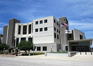
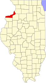
Adams County is the westernmost county in the U.S. state of Illinois. As of the 2020 census, the population was 65,737. Its county seat is Quincy. Adams County is part of the Quincy, IL–MO Micropolitan Statistical Area.

Scott County is a county located in the U.S. state of Iowa. As of the 2020 census, the population was 174,669, making it the third-most populous county in Iowa. The county seat is Davenport.

Whiteside County is a county located in the U.S. state of Illinois. According to the 2020 census, it had a population of 55,691. Its county seat is Morrison. The county is bounded on the west by the Mississippi River. Whiteside County comprises the Sterling, IL Micropolitan Statistical Area, which is also included in the Dixon-Sterling, IL Combined Statistical Area. U.S. President Ronald Reagan was born in 1911 in the Whiteside County community of Tampico.
Pike County is a county in the U.S. state of Illinois. It is located between the Mississippi River and the Illinois River in western Illinois. According to the 2020 United States Census, it had a population of 14,739. Its county seat is Pittsfield.

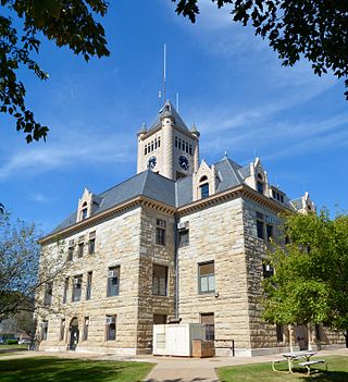
Ogle County is a county in the northern part of the U.S. state of Illinois. According to the 2020 United States Census, it had a population of 51,788. Its county seat is Oregon, and its largest city is Rochelle. Ogle County comprises Rochelle, IL Micropolitan Statistical Area, which is also included in the Rockford-Freeport-Rochelle, IL Combined Statistical Area.
Mercer County is a county in Illinois. According to the 2020 census, it had a population of 15,699. Its county seat is Aledo.

Henry County is a county located in the U.S. state of Illinois. The 2020 United States Census, listed its population at 49,284. Its county seat is Cambridge. Henry County is included in the Davenport-Moline-Rock Island, IA-IL Metropolitan Statistical Area.

Effingham County is located in the south central part of the U.S. state Illinois. As of the 2020 census, the population was 34,668. Its county seat and largest city is Effingham. Some other cities in Effingham County, Illinois include Altamont, Teutopolis, Beecher City, Montrose, Dieterich, Shumway, Watson, Mason, and Edgewood. Effingham County comprises the Effingham, IL Micropolitan Statistical Area.

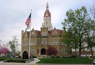
Carroll County is a county located in the U.S. state of Illinois. As of the 2020 census, the population was 15,702. Its county seat is Mount Carroll.

East Moline is a city in Rock Island County, Illinois, United States. The population was 21,374 at the 2020 census. East Moline is one of the Quad Cities at the confluence of the Rock and Mississippi rivers, along with neighboring Moline and Rock Island in Illinois and the cities of Davenport and Bettendorf in Iowa. As of 2011, the Quad Cities has a population estimate of 381,342.

Moline is a city located in Rock Island County, Illinois, United States. With a population of 42,985 in 2020, it is the largest city in Rock Island County. Moline is one of the Quad Cities at the confluence of the Rock and Mississippi rivers, along with neighboring East Moline and Rock Island in Illinois and the cities of Davenport and Bettendorf in Iowa. The Quad Cities had a population of 384,324 in 2020. The city is the ninth-most populous in Illinois outside the Chicago metropolitan area.

Rock Island is a city in and the county seat of Rock Island County, Illinois, United States. The population was 37,108 at the 2020 census. Located at the confluence of the Rock and Mississippi rivers, it is one of the Quad Cities along with neighboring Moline and East Moline in Illinois and the cities of Davenport and Bettendorf in Iowa. The Quad Cities had a population of 384,324 in 2020. The city is home to Rock Island Arsenal, the largest government-owned weapons manufacturing arsenal in the US, which employs 6,000 people. The original Rock Island, from which the city name is derived, is now called Arsenal Island.

Sterling is a city in Whiteside County, Illinois, United States, along the Rock River. The population was 14,782 at the 2020 census, down from 15,370 in 2010. Formerly nicknamed "Hardware Capital of the World", the city has long been associated with manufacturing and the steel industry.

Riverdale is a city in Scott County, Iowa, United States. The population was 379 at the time of the 2020 census.

The Rock River is a tributary of the Mississippi River, approximately 299 miles (481 km) long, in the U.S. states of Wisconsin and Illinois. The river was known as the Sinnissippi to Sauk and Meskwaki peoples; the name means "rocky waters".
The 17th congressional district of Illinois is represented by Democrat Eric Sorensen. It includes most of the northwestern portion of the state, with most of its population living on the Illinois side of the Quad Cities, as well as parts of Peoria and Rockford.

Northern Illinois is a region generally covering the northern third of the U.S. state of Illinois. The region is by far the most populous of Illinois with nearly 9.7 million residents as of 2010.

Greater Quad Cities, IA–IL is a nickname for the Davenport–Moline, IA–IL Combined Statistical Area, an area that is made up of four counties in Iowa and three in Illinois. The statistical area includes one metropolitan areas and two micropolitan area. As of the 2010 Census, the CSA had a population of 471,551.