New Hope is a borough in Bucks County, Pennsylvania, United States. The population was 2,612 at the 2020 census. New Hope is located approximately 30 mi (48 km) north of Philadelphia, and lies on the west bank of the Delaware River at its confluence with Aquetong Creek. New Hope and neighboring Solebury and Upper Makefield townships are part of the Philadelphia metropolitan area. The two-lane New Hope–Lambertville Bridge carries automobile and foot traffic across the Delaware to Lambertville, New Jersey, on the east bank. New Hope's primary industry is tourism.

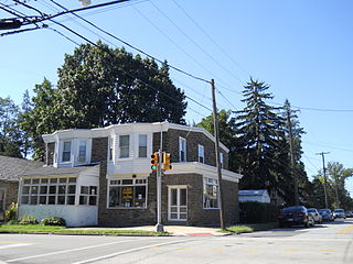
Wyncote is a census-designated place (CDP) in Cheltenham Township, Montgomery County, Pennsylvania, United States. It borders the northwestern and northeastern section of Philadelphia. Wyncote is located 11 miles from Center City Philadelphia at the southeasternmost tip of Montgomery County. The Jenkintown-Wyncote SEPTA station is the fifth busiest regional rail station in the SEPTA system.

Downtown Pittsburgh, colloquially referred to as the Golden Triangle, and officially the Central Business District, is the urban downtown center of Pittsburgh, Pennsylvania, United States. It is located at the confluence of the Allegheny River and the Monongahela River whose joining forms the Ohio River. The triangle is bounded by the two rivers.
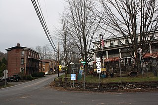
Carversville is an unincorporated community and geographically isolated area in Solebury Township, Bucks County, Pennsylvania, United States, approximately 45 miles north of Philadelphia. It was originally a Lenape gathering placed called Aquetong more than 300 years ago the area's land was granted to James Harrison and Joseph Pike by William Penn. The Paunacussing Creek also called Fleecydale runs through Carversville and meets the Delaware River at Lumberville.

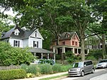
Overbrook Farms is a neighborhood that is situated on the western edge of the West Philadelphia section of Philadelphia, Pennsylvania, United States. It is roughly bounded by City Avenue, 58th Street, Woodbine Avenue, and 66th Street at Morris Park.
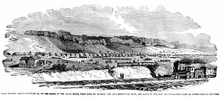
Camp Dennison was a military recruiting, training, and medical post for the United States Army during the American Civil War. It was located near Cincinnati, Ohio, not far from the Ohio River. The camp was named for Cincinnati native William Dennison, Ohio's governor at the start of the war.
Point Pleasant is an unincorporated community in Tinicum and Plumstead Townships of Bucks County, Pennsylvania, United States. It lies on both sides of Tohickon Creek by the creek's confluence with the Delaware River; the creek is the dividing line between the townships. The ZIP code for the post office in Point Pleasant is 18950.
Camp William Penn was a Union Army training camp located in Cheltenham Township, Pennsylvania from 1863 to 1865 during the American Civil War. The camp was notable for being the first training ground dedicated to African American troops who enlisted in the Union Army during the Civil War. Some 11,000 free blacks and escaped slaves were trained here, including 8,612 from Pennsylvania, the most black troops recruited during the war from any northern state. It was the largest training camp for African American soldiers.
La Mott is an unincorporated residential community located within Cheltenham Township, Montgomery County, Pennsylvania, United States. Its name honors the leading 19th Century abolitionist and suffragist, Lucretia Mott, who resided in the neighborhood.

The Pittsburgh Central Downtown Historic District is a historic district in the Central Business District of Pittsburgh, Pennsylvania, United States. It is composed of multiple late eighteenth-century buildings which illustrate "Pittsburgh's emergence during that period as a preeminent industrial and business center," according to Hyman Myers, the former chair of the Pennsylvania Historic Preservation Board.

Plymouth Friends Meetinghouse is a historic Quaker meeting house located at the corner of Germantown Pike and Butler Pike in Plymouth Meeting, Montgomery County, Pennsylvania. It is part of the Plymouth Meeting Historic District, and was added to the National Register of Historic Places in 1971.

Camp Curtin Memorial Methodist Episcopal Church, also known as Curtin Heights Church and Camp Curtin Memorial-Mitchell United Methodist Church, is a historic Methodist Episcopal church located in Harrisburg, Dauphin County, Pennsylvania.

The River Street Historic District is a national historic district that is located in Wilkes-Barre, Pennsylvania.

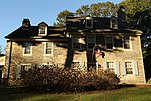
The John Welsh House, also known as "Rauhala," is an historic American home that is located in Wyndmoor in Springfield Township, Montgomery County, Pennsylvania.

Franklin Learning Center, formerly known as William Penn High School for Girls, is a historic high school located in the Spring Garden neighborhood of Philadelphia, Pennsylvania. It is part of the School District of Philadelphia. The building was designed by Henry deCoursey Richards and built in 1908–1909. It was initially an all-girls school and was one of the earliest racially integrated schools in the city. It is a four-story, brick and limestone building in the Classical Revival-style. It features a projecting center section and two-story portico. The school was named for Pennsylvania founder William Penn.

The Titusville Historic District is a national historic district that is located in Titusville, Crawford County, Pennsylvania.

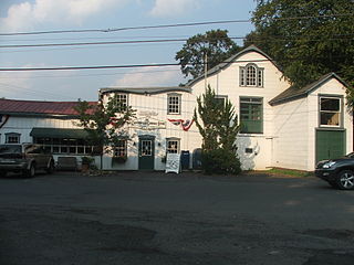
The Penn's Park General Store Complex, also known as the Gaines Property, is an historic, American commercial complex that is located in Penn's Park, Wrightstown Township, Bucks County, Pennsylvania.

The Lionville Historic District is a national historic district that is located in Uwchlan Township, Chester County, Pennsylvania, United States.

Cheltenham Township is a home rule municipality and Township of the First Class located in the southeast corner of Montgomery County, Pennsylvania, United States. It borders Philadelphia to the south and east, Abington Township and Jenkintown to the north, and Springfield Township to the west.