
Middlemarch is a small town in the Otago region of New Zealand's South Island. It lies at the foot of the Rock and Pillar Range of hills in the broad Strath-Taieri valley, through which flows the middle reaches of the Taieri River. Since local government reorganisation in the late 1980s, Middlemarch and much of the Strath-Taieri has been administered as part of Dunedin city, the centre of which lies some 80 km to the southeast. Middlemarch is part of the Taieri electorate, and is currently represented in parliament by Ingrid Leary. Middlemarch has reticulated sewerage but no reticulated water supply. A description of 1903, that "[T]he summer seasons are warm, but not enervating, and the winters cold, but dry" is still true today.

Naseby is a small town, formerly a borough, in the Maniototo area of Central Otago, New Zealand. It is named after a village in Northamptonshire, England. Previous names of the township were Parker's, Hogburn and Mt Ida. The town catch phrase is "2000 feet above worry level" indicating its altitude. Naseby is 395 km from Christchurch and 143 km from Dunedin.
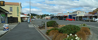
Roxburgh is a small New Zealand town of about 600 people in Central Otago. It is in Teviot Valley on the banks of the Clutha River, 40 kilometres (25 mi) south of Alexandra in the South Island. State Highway 8, which links Central Otago with Dunedin city, passes through the town. Roxburgh is well known for its Summer fruit and "Jimmy's Pies."

The small town of Karitane is located within the limits of the city of Dunedin in New Zealand, 35 kilometres to the north of the city centre.

Inangahua is a small settlement in the northwest of New Zealand's South Island. It consists of three settled areas: Inangahua Junction at the confluence of the Inangahua and Buller Rivers, 34 kilometres (21 mi) north of Reefton and 46 kilometres (29 mi) southeast of Westport; Inagahua Landing, 10 km further up the Inangahua River; and Inangauhua township, 2 km east of the Junction. Murchison is 52 kilometres (32 mi) further east. After the 1968 Inangahua Earthquake, most of the inhabitants left the area or shifted to the township, which is now the population centre and known simply as Inangahua.
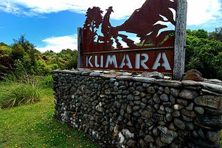
Kumara is a town on the West Coast of the South Island of New Zealand. It is located 30 kilometres (19 mi) south of Greymouth, close to the western end of State Highway 73, which leads across Arthur's Pass to Christchurch. The Taramakau River flows past to the north.
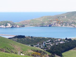
Aramoana is a small coastal settlement 27 kilometres (17 mi) north of Dunedin on the South Island of New Zealand. The settlement's permanent population in the 2001 Census was 261. Supplementing this are seasonal visitors from the city who occupy cribs. The name Aramoana is Māori for "pathway of the sea".

Central Otago District is local government district in New Zealand. It is administered by the Central Otago District Council, and it is in the Otago region, the top tier of local government in New Zealand. The major towns in the district are Alexandra, Cromwell, Roxburgh, Clyde and Ranfurly. The district covers 9,968 km2 (3,849 sq mi), making it the fourth-largest district in New Zealand by area, and is home to 26,000 people as of June 2023.
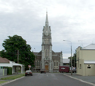
Clutha District is a local government district of southern New Zealand, with its headquarters in the Otago town of Balclutha. Clutha District has a land area of 6,334.47 km2 (2,445.75 sq mi) and an estimated population of 18,900 as of June 2023. Clutha District occupies the majority of the geographical area known as South Otago.
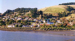
Macandrew Bay is located on the Otago Peninsula in the South Island of New Zealand. It is situated on the edge of Otago Harbour, and is named for pioneer Scottish settler James Macandrew who lived here during his later life. The Te Reo Māori name for the bay, Te Roto Pāteke, refers to the Brown teal formerly prevalent in the area. Early European residents of the area called the bay "The Hundreds", due to the large number of boulders which covered the foreshore.
Pukeuri is a settlement to the north of Oamaru in the North Otago region of New Zealand's South Island. It is located near the coast in the Waitaki District that straddles the border of Otago and Canterbury.

Maheno is a small North Otago township south of Oamaru in New Zealand. The area has 75 residents. A number of the town's streets are named after places in Tyne and Wear, England, such as Whickham, Felling, Heworth and Jarrow. One of two New Zealand's hospital ships in World War I, the SS Maheno, was named after this town.

The settlement of Broad Bay is located on the Otago Harbour coast of Otago Peninsula, in the South Island of New Zealand. It is administered as part of the city of Dunedin, and is technically a suburb of that city, though its isolation and semi-rural nature make it appear as a settlement in its own right.

Mornington is a suburb of the city of Dunedin, in the South Island of New Zealand. It is situated on hilly slopes 2 kilometres (1.2 mi) to the west of the city centre, the slopes forming part of a ridge which surrounds the heart of the city.

Ravensbourne is a suburb of the New Zealand city of Dunedin. It is located on Otago Harbour on the steep southeastern slopes of Signal Hill. It lies on the harbour's northern shore, 4.5 kilometres (2.8 mi) east-northeast of the city centre.
Heriot is a small settlement in West Otago, in the South Island of New Zealand. It is located 20 kilometres southwest of Raes Junction and 15 kilometres north of Tapanui.
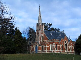
East Taieri is a small township, located between Mosgiel and Allanton in New Zealand's Otago region. It lies on State Highway 1 en route between the city of Dunedin and its airport at Momona. It lies close to the southeastern edge of the Taieri Plain, hence its name.
Clydevale is a township on the banks of the Clutha River / Mata-Au, in the Clutha Valley, 29 kilometres north-west of Balclutha.
Sunshine Bay is an inlet of Lake Wakatipu and suburb of Queenstown in the South Island of New Zealand. It is located on the lower slopes of the Ben Lomond mountain, west of Fernhill, on the northern side of the lake.
Harwood is a rural settlement on the northern side of the Otago Peninsula. It is within the boundaries of Dunedin city in New Zealand.


