Carnegie railway station

Last updated

Carnegie
PTV commuter rail station
New Carnegie railway station on the 18-06-2018 (2).jpg
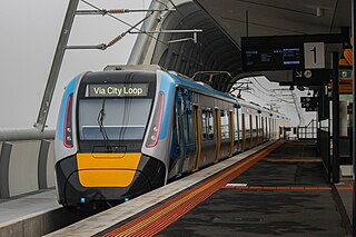
South-east bound view from Platform 2, June 2018
General information
LocationMorton Avenue,
Carnegie, Victoria 3163
City of Glen Eira
Australia
Coordinates 37°53′11″S145°03′31″E / 37.8863°S 145.0585°E / -37.8863; 145.0585
Owned by VicTrack
Operated by Metro Trains
Line(s)
Distance13.53 kilometres from
Southern Cross
Platforms2 (1 island)
Tracks2
Connections Victoria bus logo.svg Bus
Construction
Structure type Elevated
Parking120 spaces
Bicycle facilitiesYes
AccessibleYes—step free access
Other information
StatusOperational, premium station
Station codeCNE
Fare zone Myki Zone 1
Website Public Transport Victoria
History
Opened2 April 1879;145 years ago (1879-04-02)
Rebuilt18 June 2018 (LXRP)
ElectrifiedMarch 1922 (1500 V DC overhead)
Previous namesRosstown (1879–1909)
Passengers
2005–2006613,043 [1]
Preceding station Melbourne train logo.svg Metro Trains Following station
Caulfield Pakenham line Murrumbeena
Cranbourne line
Track layout
BSicon MFADEg.svg
BSicon STR.svg
BSicon MFADEg.svg
BSicon STR.svg
BSicon hSTRa(r).svg
BSicon hSTRa(l).svg
BSicon lhSTR+1(l).svg
BSicon STRg.svg
BSicon hSTR(r).svg
BSicon lhSTR+4(r).svg
BSicon STRf.svg
BSicon hSTR(l).svg
BSicon hSTR.svg
BSicon hSTR.svg
1
BSicon hPSTR(L).svg
BSicon hPSTR(R).svg
BSicon hPSTR(L).svg
2
BSicon hPSTR(R).svg
BSicon hSTRg.svg
BSicon hSTRf.svg
BSicon MFADEf.svg
BSicon hSTR.svg
BSicon MFADEf.svg
BSicon hSTR.svg

Carnegie railway station is a commuter railway station located in the suburb of Carnegie, in the southeastern suburbs of Melbourne, Victoria, Australia. [4] The station originally opened in 1879 as Rosstown. The station received its current name in 1909 alongside the renaming of the suburb. [5] The station consists of a single island platform connected to the station concourse on Koornang Road via escalators, lifts and a staircase. [4]

Contents

Carnegie station is currently served by the Pakenham and Cranbourne lines which are both part of the Melbourne railway network. Additionally, the station is served by four bus routes, including SmartBus route 900. [4] The station is approximately 17 kilometres (11.8 mi), or around a 33-minute train ride away, from Flinders Street. [6]

Description

Carnegie railway station is located in the suburb of Carnegie. On the south side of the station is Morton Road, and Koorang Road is to the west. The station is owned by VicTrack, a state government agency, and is operated by Metro Trains Melbourne. [4] The station is approximately 12.5 kilometres (7.8 mi), or around a 21-minute train ride away, from Flinders Street. [6]

Carnegie station consists of a single-island platform which is located above the road, and is connected to Koorang Road through stairs, a lift and escalators. The length of the platform is approximately 160 metres (520 ft), long enough for a Metro Trains' 7-car HCMT. [4]

The main car park at the station is located on Morton Avenue, just south of the station. [4] The station fully complies with the Disability Discrimination Act of 1992, as there is a lift that connects the station entrance with Platforms 1 and 2. [7]

History

Carnegie station opened on 2 April 1879 just one month after the railway line from Caulfield was extended to Oakleigh, Carnegie station, like the suburb itself, gets it name from philanthropist Andrew Carnegie. [5] Originally named Rosstown, after entrepreneur William Ross, [8] [9] the name change occurred in May 1909 after Ross' failed speculative developments made the name unpopular. [8] Residents supported the name change to Carnegie, who were seeking to obtain funds from the philanthropist for a library, which was to be unsuccessful. [8] [5]

In 1967, boom barriers replaced interlocked gates at the former Koornang Road level crossing, which was located at the up end of the station. [10]

In March 2014, the Level Crossing Removal Authority announced a grade separation project to replace the Koornang Road level crossing immediately to the west of the station. This included rebuilding the station above its previous location. [11] On 18 June 2018, the rebuilt station opened. [12]

Platforms and services

Carnegie station is currently served by both Pakenham and Cranbourne services which are both operated by Metro Trains Melbourne. Services to East Pakenham and Cranbourne travel together southeast towards Dandenong before splitting into two separate lines. Services to the city run express from Caulfield (Malvern during off-peak) to South Yarra before stopping all stations to Flinders Street via the City Loop. [13]

Platform 1:

Platform 2:

Future services:
In addition to the current services, the Network Development Plan – Metropolitan Rail proposes linking the Pakenham and Cranbourne lines to both the Sunbury line and under-construction Melbourne Airport rail link via the Metro Tunnel. [14]

Carnegie is served by four bus routes all departing from three separate bus stops. Routes 623 and 626 both depart from the stop at Koorang Road which is just outside the station, route 624 departs from Neerim Road which is located south of the station and Smartbus route 900 departs from Princess Highway (Dandenong Road) which is located north of the station. [15] [16] [17]

Koorang Road

Neerim Road

Princess Highway

Related Research Articles

<span class="mw-page-title-main">Carnegie, Victoria</span> Suburb of Melbourne, Victoria, Australia

Carnegie is a suburb in Melbourne, Victoria, Australia, 12 km south-east of Melbourne's central business district, on the railway line between Caulfield and Oakleigh, located within the City of Glen Eira local government area. Carnegie recorded a population of 17,909 at the 2021 census.

<span class="mw-page-title-main">Parliament railway station</span> Railway station in Melbourne, Victoria, Australia

Parliament railway station is a commuter railway station adjacent to the border between the Melbourne CBD and the suburb of East Melbourne, in Victoria, Australia. The station has two island platforms in a two-floor configuration, connected to street level via two underground concourses.
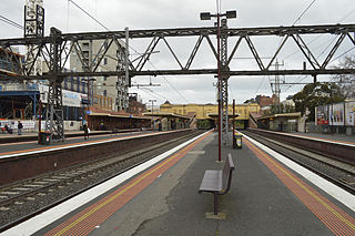
<span class="mw-page-title-main">South Yarra railway station</span> Railway station in Melbourne, Australia

South Yarra railway station is a commuter railway station and the junction point for the Cranbourne, Frankston, Pakenham and Sandringham lines, serving the south Melbourne suburb of South Yarra, Victoria, Australia. South Yarra is a premium status ground structure station featuring six platforms, with two island platforms and two side platforms connected by a ramp accessible overground concourse. The station opened on 22 December 1860 as Gardiners Creek Road before being renamed South Yarra on 1 January 1867.

<span class="mw-page-title-main">Hawksburn railway station</span> Railway station in Melbourne, Australia

Hawksburn railway station is a commuter railway station on the Frankston line, serving the south Melbourne suburb of South Yarra, Victoria, Australia. Hawksburn is an unstaffed status below ground structure station featuring four platforms, with an island platform and two side platforms all accessed by a pedestrian bridge. The station is listed on the Victorian Heritage Register, and was opened on 7 May 1879, with the stations’ namesake being the locality of Hawksburn, 600 metres from the station. The station is only partially accessible due to multiple steep access ramps.
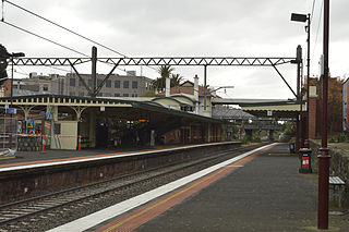
<span class="mw-page-title-main">Malvern railway station, Melbourne</span> Railway station in Melbourne, Australia

Malvern railway station is a commuter railway station that is part of the Melbourne railway network in Victoria, Australia. The station is located on the southern border of Malvern, a suburb of Melbourne, and was opened on 7 May 1879. The station complex consists of an island platform and two side platforms all accessed by a pedestrian bridge. There are two red brick Edwardian-era station buildings, constructed in 1914 as ticketing and staff offices. The entire complex is listed on the Victorian Heritage Register because of its architectural significance and its role in the development of Malvern as a significant metropolitan centre. The station is only partially accessible because of multiple steep access ramps.

<span class="mw-page-title-main">Caulfield railway station</span> Railway station in Melbourne, Australia

Caulfield railway station is a commuter railway station on the northern boundary of Caulfield East, a suburb of Melbourne, Victoria, Australia. Opened in 1879 and rebuilt from 1913 to 1914, the station complex is listed on the Victorian Heritage Register and is noted as an example of Federation Free Style architecture. It is named after the nearby suburb of Caulfield, located southwest of the station.
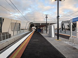
<span class="mw-page-title-main">Murrumbeena railway station</span> Railway station in Melbourne, Australia

Murrumbeena railway station is located on the Pakenham and Cranbourne lines in Victoria, Australia. It serves the south-eastern Melbourne suburb of Murrumbeena, and it opened on 14 May 1879.

<span class="mw-page-title-main">Hughesdale railway station</span> Railway station in Melbourne, Australia

Hughesdale railway station is located on the Pakenham and Cranbourne lines in Victoria, Australia. It serves the south-eastern Melbourne suburb of Murrumbeena, and opened on 28 February 1925.

<span class="mw-page-title-main">Oakleigh railway station</span> Railway station in Melbourne, Australia

Oakleigh railway station is a commuter railway station in the suburb of Oakleigh in the south-east of Melbourne, Victoria, Australia. The station opened in 1877 as the up end of the Gippsland line, with the station being electrified in 1922. The station consists of two sides that are connected to each other via the adjacent roads, and both platforms are connected to each other via a pedestrian subway.

<span class="mw-page-title-main">Huntingdale railway station</span> Railway station in Melbourne, Australia

Huntingdale railway station is a commuter railway station located adjacent to the suburbs of Oakleigh and Huntingdale located in the south east of Melbourne, Victoria in Australia. The station originally opened in 1927 as "East Oakleigh". It did not receive its current name until 1954. The station consists of a single island platform connected to both Railway Avenue and Haughton Road via a pedestrian subway.

<span class="mw-page-title-main">Clayton railway station, Melbourne</span> Railway station in Melbourne, Australia

Clayton railway station is a commuter railway station located in the suburb of Clayton, in the south-eastern suburbs of Melbourne, Victoria, Australia. The station originally opened in 1880 as "Clayton's Road". It did not receive its current name until 1890. The station consists of a single island platform connected to the station concourse on Clayton Road via escalators, lifts and a staircase. The station was previously at grade; however, in 2018, a new elevated station was rebuilt as part of the Level Crossing Removal Project.

<span class="mw-page-title-main">Westall railway station</span> Railway station in Melbourne, Australia

Westall railway station is located on the Pakenham and Cranbourne lines in Victoria, Australia. It serves the south-eastern Melbourne suburb of Clayton South, and opened on 6 February 1951.

<span class="mw-page-title-main">Springvale railway station</span> Railway station in Melbourne, Australia

Springvale railway station is located on the Pakenham and Cranbourne lines in Victoria, Australia. It serves the south-eastern Melbourne suburb of Springvale, and it opened on 1 September 1880 as Spring Vale. It was renamed Springvale on 29 February 1972.

<span class="mw-page-title-main">Sandown Park railway station, Melbourne</span> Railway station in Melbourne, Australia

Sandown Park railway station is located on the Cranbourne and Pakenham lines in Victoria, Australia. It serves the south-eastern Melbourne suburb of Springvale, and it opened on 19 June 1965.

<span class="mw-page-title-main">Noble Park railway station</span> Railway station in Melbourne, Australia

Noble Park railway station is located on the Cranbourne and Pakenham lines in Victoria, Australia. It serves the south-eastern Melbourne suburb of Noble Park, and opened on 3 February 1913.

<span class="mw-page-title-main">Yarraman railway station</span> Railway station in Melbourne, Australia

Yarraman railway station is a minor commuter railway station on the Cranbourne and Pakenham lines of the metropolitan railway network in Victoria, Australia, located about 27 km (17 mi) from the Melbourne CBD. It serves neighbourhoods between the south-eastern Melbourne suburbs of Noble Park and Dandenong, and is named after the nearby Yarraman Creek, a first-order tributary of the lower Dandenong Creek/Patterson River system.
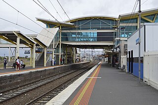
<span class="mw-page-title-main">Dandenong railway station</span> Railway station in Melbourne, Australia

Dandenong railway station is the junction for the Cranbourne and Pakenham lines in Victoria, Australia. It serves the south-eastern Melbourne suburb of the same name, and opened on 8 October 1877.

<span class="mw-page-title-main">Hallam railway station</span> Railway station in Melbourne, Australia

Hallam railway station is located on the Pakenham line in Victoria, Australia. It serves the south-eastern Melbourne suburb of Hallam, and it opened on 1 December 1880 as Hallam's Road. It was renamed Hallam on 2 May 1904.
<span class="mw-page-title-main">Pakenham line</span> Passenger rail service in metropolitan Melbourne, Victoria, Australia

The Pakenham line is a commuter railway line in the city of Melbourne, Victoria, Australia. Operated by Metro Trains Melbourne, it is the city's longest metropolitan railway line at 57 kilometres (35 mi). The line runs from Flinders Street station in central Melbourne to East Pakenham station in the south-east, serving 27 stations via the City Loop, South Yarra, Caulfield, Oakleigh, and Dandenong. The line operates for approximately 20 hours a day with 24 hour service available on Friday and Saturday nights. During peak hour, headways of up to 5 to 10 minutes are operated with services every 20 minutes during off-peak hours. Trains on the Pakenham line run with a seven-car formation operated by High Capacity Metro Trains.

<span class="mw-page-title-main">Cranbourne line</span> Passenger rail service in metropolitan Melbourne, Victoria, Australia

The Cranbourne line is a commuter railway line in the city of Melbourne, Victoria, Australia. Operated by Metro Trains Melbourne, it is the city's second longest metropolitan railway line at 44 kilometres (27 mi). The line runs from Flinders Street station in central Melbourne to Cranbourne station in the south-east, serving 24 stations via the City Loop, South Yarra, Caulfield, Oakleigh, and Dandenong. The line operates for approximately 20 hours a day with 24 hour service available on Friday and Saturday nights. During peak hour, headways of up to 5 to 15 minutes are operated with services every 15–20 minutes during off-peak hours. Trains on the Cranbourne line run with a seven-car formation operated by High Capacity Metro Trains.

References

  1. 1 2 3 4 Estimated Annual Patronage by Network Segment Financial Year 2005–2006 to 2018–19 Archived 17 April 2022 at the Wayback Machine Department of Transport
  2. 1 2 3 4 5 6 7 8 9 10 11 12 Railway station and tram stop patronage in Victoria for 2008–2021 Archived 17 December 2022 at the Wayback Machine Philip Mallis
  3. Annual metropolitan train station patronage (station entries) Archived 6 March 2023 at the Wayback Machine Data Vic
  4. 1 2 3 4 5 6 "Carnegie". Metro Trains Melbourne. Archived from the original on 1 April 2023. Retrieved 17 May 2023.
  5. 1 2 3 Anderson, Rick (2010). Stopping all stations : Melbourne's unfinished rail network/opportunities lost. Clunes, Victoria.{{cite book}}: CS1 maint: location missing publisher (link)
  6. 1 2 "Pakenham Line". Public Transport Victoria. Archived from the original on 11 March 2023. Retrieved 12 February 2023.
  7. "Access Guide". www.metrotrains.com.au. Archived from the original on 8 December 2022. Retrieved 16 March 2023.
  8. 1 2 3 "Carnegie". Victorian Places. Archived from the original on 12 December 2022. Retrieved 21 January 2023.
  9. First, Jamie (7 January 2014). "The A-Z story of Melbourne's suburbs". Herald Sun. Archived from the original on 26 December 2022. Retrieved 21 January 2023.
  10. John Sinnatt (January 1990). "Level Crossing Protection". Somersault. Signalling Record Society Victoria. pp. 9–17.
  11. Massive rail investment to benefit millions of Victorians Archived 16 April 2014 at the Wayback Machine Premier of Victoria 6 March 2014
  12. "Every Caulfield to Dandenong level crossing gone". Victoria's Big Build. 19 June 2018. Archived from the original on 5 May 2023. Retrieved 5 May 2023.
  13. "Carnegie Station". Public Transport Victoria. Archived from the original on 15 August 2012. Retrieved 16 May 2023.
  14. "Network Development Plan Metropolitan Rail Overview" (PDF). Public Transport Victoria. December 2012. Archived (PDF) from the original on 19 September 2021. Retrieved 13 February 2023.
  15. "Carnegie Station/Koornang Rd". Public Transport Victoria. Archived from the original on 15 August 2012. Retrieved 16 May 2023.
  16. "Koornang Rd/Neerim Rd". Public Transport Victoria. Archived from the original on 15 August 2012. Retrieved 16 May 2023.
  17. "Koornang Rd/Dandenong Rd". Public Transport Victoria. Archived from the original on 15 August 2012. Retrieved 16 May 2023.
  18. "623 Glen Waverley - St Kilda via Mount Waverley & Chadstone & Carnegie". Public Transport Victoria.
  19. "626 Middle Brighton – Chadstone via McKinnon & Carnegie". Public Transport Victoria. Archived from the original on 5 May 2023. Retrieved 5 May 2023.
  20. "624 Kew – Oakleigh via Caulfield & Carnegie & Darling and Chadstone (from 30 Jan 2023)". Public Transport Victoria . Retrieved 5 May 2023.
  21. "900 Stud Park SC (Rowville) - Caulfield via Monash University & Chadstone (SMARTBUS Service)". Public Transport Victoria.