Huntingdale railway station

Last updated

Huntingdale
PTV commuter rail station
Huntingdale railway station - Melbourne.jpg
North-west bound view of station building and Platform 1, January 2021
General information
LocationHaughton Road,
Oakleigh, Victoria
City of Monash
Australia
Coordinates 37°54′40″S145°06′09″E / 37.9110°S 145.1024°E / -37.9110; 145.1024
Owned by VicTrack
Operated by Metro Trains
Line(s)
Distance18.28 kilometres from
Southern Cross
Platforms2 (1 island)
Tracks2
Connections Victoria bus logo.svg Bus
Construction
Structure typeAt-grade
Parking850 spaces
Bicycle facilities50 racks
AccessibleNo—steep ramp
Other information
StatusOperational, host station
Station codeHUN
Fare zone Myki Zone 1/2 overlap
Website Public Transport Victoria
History
Opened25 June 1927;96 years ago (1927-06-25)
Rebuilt1970
ElectrifiedDecember 1922
(1500 V DC overhead)
Previous namesEast Oakleigh (1927–1954)
Passengers
2005–20061,117,215 [1]
Preceding station Melbourne train logo.svg Metro Trains Following station
Oakleigh Pakenham line Clayton
towards Cranbourne or Pakenham
Cranbourne line
Track layout
BSicon MFADEg.svg
BSicon STR.svg
BSicon MFADEg.svg
BSicon STR.svg
BSicon KRWgl.svg
BSicon KRWg+r.svg
BSicon STRg.svg
BSicon STRf.svg
1
BSicon PSTR(L).svg
BSicon PSTR(R).svg
BSicon PSTR(L).svg
2
BSicon PSTR(R).svg
BSicon STRg.svg
BSicon STRf.svg
BSicon MFADEf.svg
BSicon STR.svg
BSicon MFADEf.svg
BSicon STR.svg

Huntingdale railway station is a commuter railway station located adjacent to the suburbs of Oakleigh and Huntingdale located in the south east of Melbourne, Victoria in Australia. [4] The station originally opened in 1927 as "East Oakleigh". [5] It did not receive its current name until 1954. [6] The station consists of a single island platform connected to both Railway Avenue and Haughton Road via a pedestrian subway.

Contents

Huntingdale station is currently served by the Pakenham and Cranbourne lines which are both part of the Melbourne Railway Network. [7] Additionally the station is served by five bus routes including the 601 university shuttle and SmartBus route 900. [4] The station is approximately 17 kilometres (11 mi) or around a 30-minute train ride away from Flinders Street. [8]

Description

Huntingdale railway station is located on the border of the suburbs of Oakleigh and Huntingdale. On the north-eastern side of the station is Railway Avenue and Haughton Road is to the south-west. The station is owned by VicTrack, a state government agency, and is operated by Metro Trains Melbourne. [4] The station is approximately 17 kilometres (11 mi) or around a 30-minute train ride away from Flinders Street. [8]

Huntingdale station consists of a single island platform connected to both Railway Avenue and Haughton Road via a pedestrian subway. The length of the platform is approximately 160 metres (520 ft), long enough for a Metro Trains 7-car HCMT. There is a single station building which primarily serves as a waiting room. [4]

The main car park at the station is located on Railway Avenue just north-east of the station. [4] Although there are ramps they do not fully comply with the Disability Discrimination Act of 1992 as the gradient of the ramps is steeper than the maximum of 1:14 allowed under the Act. [9] [10]

History

Huntingdale station opened on 25 June 1927, like the suburb itself, gets its name from the Melbourne Hunt Club, which occupied parts of the suburb (then known as Oakleigh East) from 1887 to 1929. [5] [6] [11] The land that was occupied by the Hunt Club was later acquired by the Eastern Golf Club which subsequently became the Huntingdale Golf Club in 1940. [6] The station received its current name in 1954 when "Huntingdale" became the accepted named for the former suburb of East Oakleigh. [6]

In 1970, the signal box and interlocked gates at the station were removed, as part of the grade separation of the North Road level crossing. During this time a temporary level crossing was provided with boom barriers whilst construction was undertaken and, in that year, the current station building and underpass were provided. [12] [13] [14] [15] In 1971, the island platform was extended at the south-eastern end. [16]

In March 2011, there was a significant amount of garbage dumped at the station car park. Metro Trains Melbourne cleaned 60 cubic metres (2,100 cu ft) of rubbish on 18 March 2011, at a cost of around $7,000. [17] A survey of commuters in August 2011 rated Huntingdale among the worst stations in Melbourne because of rubbish and graffiti at the station, unsafe access and flooding of the subway. [18]

In 2013, there was a lobbying campaign by Monash University, Clayton campus seeking improvements to Huntingdale station and the bus interchange. Connecting bus services were often far away from the station with bus stops having no lighting or shelters available. The condition of the station and bus interchange was a serious concern for Clayton campus, because Huntingdale station is a major gateway to the university through bus route 601. [19] In 2015 the decision to construct a $5 million bus interchange was announced by the Andrews Government which was expected address these concerns. [20]

In 2018, the station received a $11.6 million upgrade which turned the station into a transport hub. [21] The main project during this upgrade was the construction of a new bus interchange which cost $5 million. The existing car park was also upgraded with additional parking installed. In 2015, the project was said to cost $7.6 million which is about $4 million less than the project's final cost. [20]

Platforms and services

The station is currently served by both the Pakenham and Cranbourne lines which are both operated by Metro Trains Melbourne. Services to Pakenham and Cranbourne travel together south-east towards Dandenong before splitting into two separate lines. Services to the city run express from Caulfield (Malvern during off-peak) to South Yarra before stopping all stations to Flinders Street via the City Loop. [22]

Platform 1:

Platform 2:

Future services:
In addition to the current services the Network Development Plan – Metropolitan Rail proposes linking the Pakenham and Cranbourne lines to both the Sunbury line and under-construction Melbourne Airport rail link via the Metro Tunnel. [23]

Huntingdale is served by 5 bus routes all departing from the bus interchange just north of the station on Haughton Road. These routes are the prepaid route 601, 631, 704 and SmartBus route 900. [24]

Bus connections

Related Research Articles

<span class="mw-page-title-main">Box Hill railway station, Melbourne</span> Railway station in Box Hill, Melbourne, Victoria, Australia

Box Hill railway station is located on the Lilydale and Belgrave lines in Victoria, Australia. It serves the eastern Melbourne suburb of Box Hill, and opened on 1 December 1882.
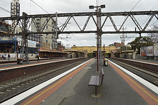
<span class="mw-page-title-main">South Yarra railway station</span> Railway station in Melbourne, Australia

South Yarra railway station is a commuter railway station and the junction point for the Cranbourne, Frankston, Pakenham and Sandringham lines, serving the south Melbourne suburb of South Yarra, Victoria, Australia. South Yarra is a premium status ground structure station featuring six platforms, with two island platforms and two side platforms connected by a ramp accessible overground concourse. The station opened on 22 December 1860 as Gardiners Creek Road before being renamed South Yarra on 1 January 1867.

<span class="mw-page-title-main">Toorak railway station</span> Railway station in Melbourne, Australia

Toorak railway station is a commuter railway station on the northern boundary of Armadale, a suburb of Melbourne, Victoria, Australia. The station is listed on the Victorian Heritage Register, and was opened on 7 May 1879. The station is named after the nearby suburb of Toorak—located north of the station. The station consists of an island platform and two side platforms all accessed by a pedestrian bridge. There are two principal station buildings located on the central platform and on platform 4, consisting of a small two and one-story brick buildings. These buildings were provided in 1914, as ticketing and staff offices. The station is only partially accessible due to a multiple steep access ramps.

<span class="mw-page-title-main">Armadale railway station, Melbourne</span> Railway station in Melbourne, Australia

Armadale railway station is a commuter railway station in Armadale, a suburb of Melbourne, Victoria, Australia. The station is listed on the Victorian Heritage Register and was opened on 7 May 1879. The station consists of an island platform and two side platforms, all accessed by a pedestrian bridge. There are two principal station buildings located on the central platform and on platform 4, consisting of a small two and one-story brick buildings. These buildings were provided in 1914 as ticketing and staff offices. The station is only partially accessible due to a multiple steep access ramps.
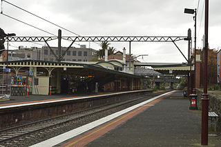
<span class="mw-page-title-main">Malvern railway station, Melbourne</span> Railway station in Melbourne, Australia

Malvern railway station is a commuter railway station that is part of the Melbourne railway network in Victoria, Australia. The station is located on the southern border of Malvern, a suburb of Melbourne, and was opened on 7 May 1879. The station complex consists of an island platform and two side platforms all accessed by a pedestrian bridge. There are two red brick Edwardian-era station buildings, constructed in 1914 as ticketing and staff offices. The entire complex is listed on the Victorian Heritage Register because of its architectural significance and its role in the development of Malvern as a significant metropolitan centre. The station is only partially accessible because of multiple steep access ramps.

<span class="mw-page-title-main">Caulfield railway station</span> Railway station in Melbourne, Australia

Caulfield railway station is a commuter railway station on the northern boundary of Caulfield East, a suburb of Melbourne, Victoria, Australia. Opened in 1879 and rebuilt from 1913 to 1914, the station complex is listed on the Victorian Heritage Register and is noted as an example of Federation Free Style architecture. It is named after the nearby suburb of Caulfield, located southwest of the station.

<span class="mw-page-title-main">Ormond railway station</span> Railway station in Melbourne, Australia

Ormond railway station is located on the Frankston line in Victoria, Australia. It serves the south-eastern Melbourne suburb of Ormond, and opened on 19 December 1881 as North Road. It was renamed Ormond on 1 September 1897.

<span class="mw-page-title-main">Carnegie railway station</span> Railway station in Melbourne, Australia

Carnegie railway station is a commuter railway station located in the suburb of Carnegie, in the southeastern suburbs of Melbourne, Victoria, Australia. The station originally opened in 1879 as Rosstown. The station received its current name in 1909 alongside the renaming of the suburb. The station consists of a single island platform connected to the station concourse on Koornang Road via escalators, lifts and a staircase.
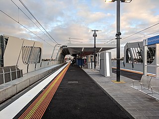
<span class="mw-page-title-main">Murrumbeena railway station</span> Railway station in Melbourne, Australia

Murrumbeena railway station is located on the Pakenham and Cranbourne lines in Victoria, Australia. It serves the south-eastern Melbourne suburb of Murrumbeena, and it opened on 14 May 1879.

<span class="mw-page-title-main">Hughesdale railway station</span> Railway station in Melbourne, Australia

Hughesdale railway station is located on the Pakenham and Cranbourne lines in Victoria, Australia. It serves the south-eastern Melbourne suburb of Murrumbeena, and opened on 28 February 1925.

<span class="mw-page-title-main">Oakleigh railway station</span> Railway station in Melbourne, Australia

Oakleigh railway station is a commuter railway station in the suburb of Oakleigh in the south-east of Melbourne, Victoria, Australia. The station opened in 1877 as the up end of the Gippsland line, with the station being electrified in 1922. The station consists of two sides that are connected to each other via the adjacent roads, and both platforms are connected to each other via a pedestrian subway.

<span class="mw-page-title-main">Clayton railway station, Melbourne</span> Railway station in Melbourne, Australia

Clayton railway station is a commuter railway station located in the suburb of Clayton, in the south-eastern suburbs of Melbourne, Victoria, Australia. The station originally opened in 1880 as "Clayton's Road". It did not receive its current name until 1890. The station consists of a single island platform connected to the station concourse on Clayton Road via escalators, lifts and a staircase. The station was previously at grade; however, in 2018, a new elevated station was rebuilt as part of the Level Crossing Removal Project.

<span class="mw-page-title-main">Westall railway station</span> Railway station in Melbourne, Australia

Westall railway station is located on the Pakenham and Cranbourne lines in Victoria, Australia. It serves the south-eastern Melbourne suburb of Clayton South, and opened on 6 February 1951.

<span class="mw-page-title-main">Springvale railway station</span> Railway station in Melbourne, Australia

Springvale railway station is located on the Pakenham and Cranbourne lines in Victoria, Australia. It serves the south-eastern Melbourne suburb of Springvale, and it opened on 1 September 1880 as Spring Vale. It was renamed Springvale on 29 February 1972.

<span class="mw-page-title-main">Yarraman railway station</span> Railway station in Melbourne, Australia

Yarraman railway station is a minor commuter railway station on the Cranbourne and Pakenham lines of the metropolitan railway network in Victoria, Australia, located about 27 km (17 mi) from the Melbourne CBD. It serves neighbourhoods between the south-eastern Melbourne suburbs of Noble Park and Dandenong, and is named after the nearby Yarraman Creek, a first-order tributary of the lower Dandenong Creek/Patterson River system.
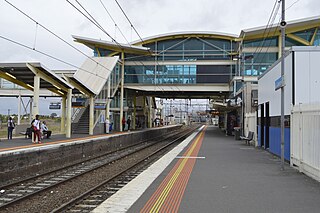
<span class="mw-page-title-main">Dandenong railway station</span> Railway station in Melbourne, Australia

Dandenong railway station is the junction for the Cranbourne and Pakenham lines in Victoria, Australia. It serves the south-eastern Melbourne suburb of the same name, and opened on 8 October 1877.
<span class="mw-page-title-main">Mount Waverley railway station</span> Railway station in Melbourne, Australia

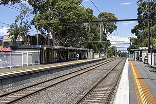
Mount Waverley railway station is a commuter railway station in the suburb of Mount Waverley in the south east of Melbourne, Victoria, Australia, and is part of the Glen Waverley line on Melbourne's suburban rail network. The station opened in 1930, as a part of the extension from Eastmalvern to Glen Waverley. The station consists of two side platforms which are connected to each other via adjacent roads and a pedestrian subway. Additionally, the station is served by bus routes 623 and 733. The station is approximately 18 kilometres (11 mi) or around a 30-minute train ride away from Flinders Street.
<span class="mw-page-title-main">Pakenham line</span> Passenger rail service in metropolitan Melbourne, Victoria, Australia

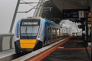
The Pakenham line is a commuter railway line in the city of Melbourne, Victoria, Australia. Operated by Metro Trains Melbourne, it is the city's longest metropolitan railway line at 57 kilometres (35 mi). The line runs from Flinders Street station in central Melbourne to Pakenham station in the south-east, serving 27 stations via the City Loop, South Yarra, Caulfield, Oakleigh, and Dandenong. The line operates for approximately 20 hours a day with 24 hour service available on Friday and Saturday nights. During peak hour, headways of up to 5 to 10 minutes are operated with services every 20 minutes during off-peak hours. Trains on the Pakenham line run with a seven-car formation operated by High Capacity Metro Trains.

<span class="mw-page-title-main">Huntingdale, Victoria</span> Suburb of Melbourne, Victoria, Australia

Huntingdale is a suburb in Melbourne, Victoria, Australia, 16 km south-east of Melbourne's Central Business District, located within the City of Monash local government area. Huntingdale recorded a population of 1,949 at the 2021 census.

The Djerring Trail is a shared use path that runs alongside the Cranbourne and Pakenham railway lines in south-eastern Melbourne, Australia. The route serves a total of 13 railway stations.

References

  1. 1 2 3 4 Estimated Annual Patronage by Network Segment Financial Year 2005–2006 to 2018–19 Archived 17 April 2022 at the Wayback Machine Department of Transport
  2. 1 2 3 4 5 6 7 8 9 10 11 12 Railway station and tram stop patronage in Victoria for 2008–2021 Archived 17 December 2022 at the Wayback Machine Philip Mallis
  3. Annual metropolitan train station patronage (station entries) Data Vic
  4. 1 2 3 4 5 "Huntingdale". www.metrotrains.com.au. Archived from the original on 8 March 2023. Retrieved 8 March 2023.
  5. 1 2 Anderson, Rick (2010). Stopping all stations : Melbourne's unfinished rail network/opportunities lost. Clunes, Victoria.{{cite book}}: CS1 maint: location missing publisher (link)
  6. 1 2 3 4 "Huntingdale". Victorian Places. Archived from the original on 12 December 2022. Retrieved 21 January 2023.
  7. "Huntingdale Station". Public Transport Victoria. Archived from the original on 15 August 2012. Retrieved 16 March 2023.
  8. 1 2 "Pakenham Line". Public Transport Victoria. Archived from the original on 11 March 2023. Retrieved 12 February 2023.
  9. "Access Guide". www.metrotrains.com.au. Archived from the original on 8 December 2022. Retrieved 16 March 2023.
  10. "Tracks, pathways, ramps and stairs". Sport and Recreation Victoria. 26 August 2019. Archived from the original on 16 March 2023. Retrieved 16 March 2023.
  11. First, Jamie (7 January 2014). "The A-Z story of Melbourne's suburbs". Herald Sun. Archived from the original on 26 December 2022. Retrieved 20 January 2023.
  12. "Rolling Stock Notes". Divisional Diary . Australian Railway Historical Society. June 1970. p. 15.
  13. "System Sightings". Divisional Diary. Australian Railway Historical Society. October 1970. p. 21.
  14. "New Works and Re-Arrangements". Divisional Diary. Australian Railway Historical Society. November 1970. p. 9.
  15. "Way and Works". Divisional Diary. Australian Railway Historical Society. June 1971. p. 9.
  16. "Way and Works". Divisional Diary. Australian Railway Historical Society. May 1971. p. 5.
  17. Carnovale, Michelle (11 April 2011). "Anger rises at station rubbish pile". Waverley Leader. ProQuest   861504341. Archived from the original on 18 March 2023. Retrieved 18 March 2023.
  18. "You rate your station". Waverley Leader. 9 August 2011. Archived from the original on 18 March 2023. Retrieved 18 March 2023.
  19. Tran, Daniel (18 March 2013). "Wishlist for a way station". ProQuest   1317318704. Archived from the original on 18 March 2023. Retrieved 18 March 2023.
  20. 1 2 Andrews, Daniel (10 September 2015). "Better car park part of new huntingdale transport hub". Premier of Victoria. Archived from the original on 8 March 2023. Retrieved 8 March 2023.
  21. "Huntingdale Station Precinct Upgrade". Public Transport Victoria. Archived from the original on 5 May 2018. Retrieved 16 March 2023.
  22. "Huntingdale Station". Public Transport Victoria. Archived from the original on 15 August 2012. Retrieved 7 March 2023.
  23. "Network Development Plan Metropolitan Rail Overview" (PDF). Public Transport Victoria. December 2012. Archived (PDF) from the original on 19 September 2021. Retrieved 13 February 2023.
  24. "Huntingdale Station/Haughton Rd". Public Transport Victoria. Archived from the original on 15 August 2012. Retrieved 5 March 2023.
  25. "601 Huntingdale - Monash University (Clayton)". Public Transport Victoria.
  26. "630 Elwood - Monash University via Gardenvale & Ormond & Huntingdale". Public Transport Victoria.
  27. "704 Oakleigh Station - Westall Station via Clayton". Public Transport Victoria.
  28. "900 Stud Park SC (Rowville) - Caulfield via Monash University & Chadstone (SMARTBUS Service)". Public Transport Victoria.