Carter, Wyoming

Last updated

Carter, Wyoming
CDP
Uinta County Wyoming incorporated and unincorporated areas Carter highlighted.svg
Location in Uinta County and the state of Wyoming
USA Wyoming location map.svg
Red pog.svg
Carter, Wyoming
Location in Wyoming
Usa edcp location map.svg
Red pog.svg
Carter, Wyoming
Location in the United States
Coordinates: 41°26′31″N110°25′57″W / 41.44194°N 110.43250°W / 41.44194; -110.43250
Country United States
State Wyoming
County Uinta
Area
  Total3.1 sq mi (7.9 km2)
  Land3.1 sq mi (7.9 km2)
  Water0.0 sq mi (0.0 km2)
Elevation
[1]
6,503 ft (1,982 m)
Population
 (2010) [2]
  Total10
  Density3.2/sq mi (1.3/km2)
Time zone UTC-7 (Mountain (MST))
  Summer (DST) UTC-6 (MDT)
Area code 307
FIPS code 56-13005 [3]
GNIS feature ID1586401 [1] U.S. Geological Survey Geographic Names Information System: Carter, Wyoming

Carter is a census-designated place (CDP) in Uinta County, Wyoming, United States. [1] Established by the United States Census Bureau in 1980, the CDP was named after the former village of Carter, in turn named for Judge William A. Carter, which was located within the CDP and of which some abandoned buildings remain standing. The population of the CDP was 10 at the 2010 census.

Contents

Geography

Carter CDP is located at 41°26′31″N110°25′57″W / 41.44194°N 110.43250°W / 41.44194; -110.43250 (41.442062, -110.432574). [4] Elevation is 6,496 feet (1,980 m). It is located along the Union Pacific Railroad.

According to the United States Census Bureau, the CDP has a total area of 3.1 square miles (7.9 km2), all land. [5]

Demographics

As of the 2000 census [3] of 2000, there were 8 people, 4 households, and 3 families located in the CDP. The population density was 2.6 people per square mile (1.0/km2). There were 6 housing units at an average density of 2.0/sq mi (0.8/km2). The racial makeup of the CDP was 62.50% White, 12.50% Native American, 12.50% Asian, and 12.50% from two or more races.

There were 4 households, out of which 25.0% had children under the age of 18 living with them, 75.0% were married couples living together, and 25.0% were non-families. 25.0% of all households were made up of individuals, and 25.0% had someone living alone who was 65 years of age or older. The average household size was 2.00 and the average family size was 2.33.

In the CDP, the population was spread out, with 12.5% under the age of 18, 12.5% from 25 to 44, 62.5% from 45 to 64, and 12.5% who were 65 years of age or older. The median age was 50 years. For every 100 females, there were 166.7 males. For every 100 females age 18 and over, there were 133.3 males.

The median income for a household in the CDP was $12,083, and the median income for a family was $80,488. Males had a median income of $51,250 versus $26,250 for females. The per capita income for the CDP was $27,229. None of the population or the families were below the poverty line.

Education

Public education for the Carter CDP is provided by Uinta County School District #4. The district operates four campuses - Mountain View Elementary School (grades K-2), Fort Bridger Elementary School (grades 3-4), Mountain View Middle School (grades 5-8), and Mountain View High School (grades 9-12).

See also

Related Research Articles

<span class="mw-page-title-main">Uinta County, Wyoming</span> County in Wyoming, United States

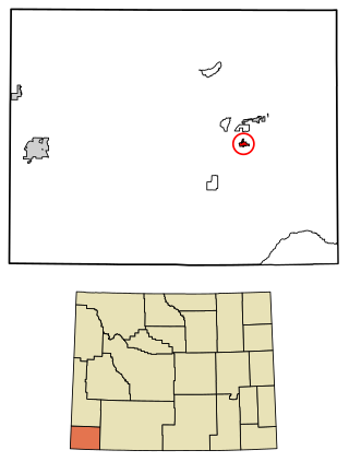
Uinta County is a county in the U.S. state of Wyoming. As of the 2020 United States Census, the population was 20,450. Its county seat is Evanston. Its south and west boundary lines abut the Utah state line.

<span class="mw-page-title-main">Castanea, Pennsylvania</span> Census-designated place in Pennsylvania, United States

Castanea is a census-designated place (CDP) in Castanea Township, Clinton County, Pennsylvania, United States. The population was 1,125 at the 2010 census.

<span class="mw-page-title-main">North Escobares, Texas</span> CDP in Texas, United States

North Escobares is a census-designated place (CDP) in Starr County, Texas, United States. The population was 118 at the 2010 census down from 1,692 at the 2000 census.

<span class="mw-page-title-main">Meadow Lark Lake, Wyoming</span> Unincorporated community in Wyoming, United States

Meadowlark Lake is an unincorporated community in Big Horn County, Wyoming, United States. The population was 8 at the 2000 census, when it was a Census-designated place (CDP).

<span class="mw-page-title-main">Esterbrook, Wyoming</span> CDP in Wyoming, United States

Esterbrook is a village, and the locus of a same-named census-designated place (CDP), in Converse County, Wyoming, United States in the Medicine Bow National Forest. The population was 52 at the 2010 census.

<span class="mw-page-title-main">Owl Creek, Wyoming</span> CDP in Wyoming, United States

Owl Creek is a (CDP) in Hot Springs County, Wyoming, United States. The population was five at the 2010 Census.

Oakley is a census-designated place (CDP) in Lincoln County, Wyoming, United States. The population was 49 at the 2010 census.

<span class="mw-page-title-main">Smoot, Wyoming</span> Census-designated place in Wyoming, United States

Smoot is a census-designated place (CDP) in Lincoln County, Wyoming, United States. The population was 195 at the 2010 census.

<span class="mw-page-title-main">Turnerville, Wyoming</span> Census-designated place in Wyoming, United States

Turnerville is a census-designated place (CDP) in Lincoln County, Wyoming, United States. The population was 192 at the 2010 census.

<span class="mw-page-title-main">Bondurant, Wyoming</span> CDP in Wyoming, United States

Bondurant is a census-designated place (CDP) in Sublette County, Wyoming, United States. The population was 93 at the 2010 census. The town was named after B. F. Bondurant.

North Rock Springs is a census-designated place (CDP) in Sweetwater County, Wyoming, United States. The population was 2,207 at the 2010 census.

<span class="mw-page-title-main">Hoback, Wyoming</span> CDP in Wyoming, United States

Hoback is a census-designated place (CDP) in Teton County, Wyoming, United States. The population was 1,176 at the 2010 census. It is part of the Jackson, WY–ID Micropolitan Statistical Area. The town is named for John Hoback, a mountain man who guided the Astor party through the area in 1811.

<span class="mw-page-title-main">Teton Village, Wyoming</span> CDP in Wyoming, United States

Teton Village is a census-designated place (CDP) in Teton County, Wyoming, United States. The population was 330 at the 2010 census. The village surrounds the base of the Jackson Hole Mountain Resort. It is accessed from nearby Jackson and the surrounding area via the Moose-Wilson Road.

<span class="mw-page-title-main">Wilson, Wyoming</span> CDP in Wyoming, United States

Wilson is a census-designated place (CDP) in Teton County, Wyoming, United States. The population was 1,567 at the 2020 census, up from 1,482 in 2010. It is part of the Jackson, WY–ID Micropolitan Statistical Area.

<span class="mw-page-title-main">Evanston, Wyoming</span> City in Wyoming, United States

Evanston is a city in and the county seat of Uinta County, Wyoming, United States. The population was 11,747 at the 2020 census. It is located near the border with Utah.

<span class="mw-page-title-main">Fort Bridger, Wyoming</span> Census-designated place in Uinta County, Wyoming, United States

Fort Bridger is a census-designated place (CDP) in eastern Uinta County, Wyoming, United States. The population was 345 at the 2010 census. The community takes its name from the eponymous Fort Bridger, established in 1842, which is located within the boundaries of the CDP.

<span class="mw-page-title-main">Lonetree, Wyoming</span> Census-designated place in Uinta County, Wyoming, United States

Lonetree is a census-designated place (CDP) in Uinta County, Wyoming, United States. The population was 49 at the 2010 census.

<span class="mw-page-title-main">Lyman, Wyoming</span> Town in Wyoming, United States

Lyman is a town in Uinta County, Wyoming, United States. The population was 2,115 at the 2010 census.

<span class="mw-page-title-main">Mountain View, Wyoming</span> Town in Wyoming, United States

Mountain View is a town in Uinta County, Wyoming, United States. The population was 1,286 at the 2010 census.

<span class="mw-page-title-main">Robertson, Wyoming</span> CDP in Wyoming, United States

Robertson is a census-designated place (CDP) in Uinta County, Wyoming, United States. The population was 97 at the 2010 census.

References

  1. 1 2 3 U.S. Geological Survey Geographic Names Information System: Carter, Wyoming
  2. "2010 City Population and Housing Occupancy Status". U.S. Census Bureau. Retrieved July 13, 2012.[ dead link ]
  3. 1 2 "U.S. Census website". United States Census Bureau . Retrieved January 31, 2008.
  4. "US Gazetteer files: 2010, 2000, and 1990". United States Census Bureau. February 12, 2011. Retrieved April 23, 2011.
  5. "2010 Wyoming Place Names". U.S. Census Bureau. Archived from the original on July 4, 2012. Retrieved July 13, 2012.

Commons-logo.svg Media related to Carter, Wyoming at Wikimedia Commons