
Mebane is a city located mostly in Alamance County, North Carolina, United States, and partly in Orange County. The town was named for Alexander Mebane, an American Revolutionary War general and member of the U.S. Congress. It was incorporated as "Mebanesville" in 1881, and in 1883 the name was changed to "Mebane". It was incorporated as a city in 1987. The population as of the 2020 census was 17,768. Mebane is one of the fastest-growing municipalities in North Carolina. Mebane straddles the Research Triangle and Piedmont Triad Regions of North Carolina. The bulk of the city is in Alamance County, which comprises the Burlington Metropolitan Statistical Area, itself a component of the Greensboro-Winston-Salem-High Point Combined Statistical Area. Two slivers in the eastern portion of the city are in Orange County, which is part of the Durham-Chapel Hill Metropolitan Statistical Area, itself a component of the Raleigh-Durham-Chapel Hill Combined Statistical Area.
This is a list of properties and historic districts in Tennessee that are listed on the National Register of Historic Places. There are over 2,000 in total. Of these, 29 are National Historic Landmarks. Each of Tennessee's 95 counties has at least one listing.

Cedar Creek and Belle Grove National Historical Park became the 388th unit of the United States National Park Service when it was authorized on December 19, 2002. The National Historical Park was created to protect several historically significant locations in the Shenandoah Valley of Northern Virginia, notably the site of the American Civil War Battle of Cedar Creek and the Belle Grove Plantation.
Oaks is an unincorporated community in southwestern Orange County, North Carolina, United States. It is located southwest of Teer.
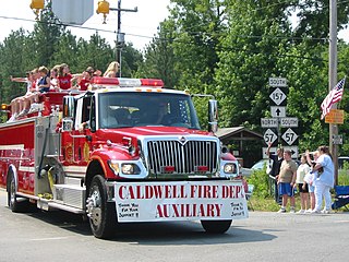
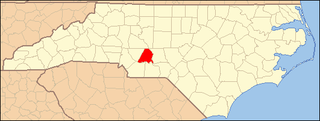
Caldwell is an unincorporated community in Orange County, North Carolina, United States. It is located at the junction of North Carolina Highway 57 and North Carolina Highway 157, northeast of Schley. Only a rural crossroads, it is the most significant community on fifteen mile stretches of both highways.

Shotwell is an unincorporated community in rural eastern Wake County, North Carolina, United States, located about 4 miles (6.4 km) south of Knightdale and 11 miles (18 km) east of Raleigh at the confluence of Smithfield, Mial Plantation, Major Slade, Grasshopper, and Turnipseed Roads. Shotwell has been inhabited since the early 19th century and is home to a number of historic structures. A post office was established in 1883 but closed less than two decades later.

This list includes properties and districts listed on the National Register of Historic Places in Wake County, North Carolina. Click the "Map of all coordinates" link to the right to view an online map of all properties and districts with latitude and longitude coordinates in the table below.

This list includes properties and districts listed on the National Register of Historic Places in Buncombe County, North Carolina. Click the "Map of all coordinates" link to the right to view an online map of all properties and districts with latitude and longitude coordinates in the table below.

This list includes properties and districts listed on the National Register of Historic Places in Durham County, North Carolina. Click the "Map of all coordinates" link to the right to view an online map of all properties and districts with latitude and longitude coordinates in the table below.

This list includes properties and districts listed on the National Register of Historic Places in Rockingham County, North Carolina. Click the "Map of all coordinates" link to the right to view an online map of all properties and districts with latitude and longitude coordinates in the table below.

This list includes properties and districts listed on the National Register of Historic Places in Orange County, North Carolina. Click the "Map of all coordinates" link to the right to view an online map of all properties and districts with latitude and longitude coordinates in the table below.

This list includes properties and districts listed on the National Register of Historic Places in Edgecombe County, North Carolina, United States. Click the "Map of all coordinates" link to the right to view a Google map of all properties and districts with latitude and longitude coordinates in the table below.

This list includes properties and districts listed on the National Register of Historic Places in Caswell County, North Carolina. Click the "Map of all coordinates" link to the right to view an online map of all properties and districts with latitude and longitude coordinates in the table below.

This list includes properties and districts listed on the National Register of Historic Places in Macon County, North Carolina. Click the "Map of all coordinates" link to the right to view a Google map of all properties and districts with latitude and longitude coordinates in the table below.

This list includes properties and districts listed on the National Register of Historic Places in Wayne County, North Carolina. Click the "Map of all coordinates" link to the right to view a Google map of all properties and districts with latitude and longitude coordinates in the table below.
This list includes properties and districts listed on the National Register of Historic Places in Randolph County, North Carolina. Click the "Map of all coordinates" link to the right to view a Google map of all properties and districts with latitude and longitude coordinates in the table below.
This list includes properties and districts listed on the National Register of Historic Places in Stanly County, North Carolina. Click the "Map of all coordinates" link to the right to view an online map of all properties and districts with latitude and longitude coordinates in the table below.

This list includes properties and districts listed on the National Register of Historic Places in Swain County, North Carolina. Click the "Map of all coordinates" link to the right to view an online map of all properties and districts with latitude and longitude coordinates in the table below.

Red Oak Grove Presbyterian Church and Cemetery is located outside of Tipton, Iowa, United States. They were listed on the National Register of Historic Places in 2010.

Cedar Grove Rural Crossroads Historic District is a national historic district located at Cedar Grove, Orange County, North Carolina. The district encompasses 44 contributing buildings, 9 contributing sites, and 7 contributing structures in the rural crossroads community of Cedar Grove. The district developed from the mid-19th to mid-20th century, and includes notable examples of Late Victorian and Colonial Revival style architecture. Notable buildings include the Rogers-McDade House, Eno Presbyterian Church (1897-1899), Cedar Grove Methodist Church (1939), Allison-Oliver-Pender Store (1880s), and Allen A. Ellis Store (1923).


