Related Research Articles

Stanton is an unincorporated community in southern Franklin County, Missouri, United States. It lies on Interstate 44 at the junction with Missouri Supplemental Route W, which provides access to Meramec Caverns, located approximately two miles southeast along the Meramec River.
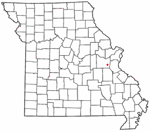
Catawissa is a small unincorporated community in Franklin County, Missouri, United States, on the St. Louis & San Francisco Railroad, 39 miles from St. Louis and four miles south-southeast of Pacific. It is located at the junction of Route N and Route O, southwest of Pacific. Winch Creek flows past the eastern margin of the community.
Luebbering is an unincorporated community in eastern Franklin County, Missouri, United States. It is located on Missouri Route FF, approximately ten miles southeast of St. Clair and about 2.5 miles south of Lonedell.
Beaufort is an unincorporated community in western Franklin County, Missouri, United States. It is located at the intersection of U.S. Route 50 and Route 185, approximately eleven miles west of Union.
Bluffton is an unincorporated community in western Montgomery County, Missouri, United States. It is located on Route 94, approximately ten miles west of Hermann, near the Missouri River.

Spring Bluff is an unincorporated community in southwest Franklin County, Missouri, United States.
Anaconda is an unincorporated community in southern Franklin County, Missouri, United States. The community is southeast of Interstate 44, between St. Clair and Stanton.
Calwood is an unincorporated community in Callaway County, in the U.S. state of Missouri. The community lies at the intersection of Missouri Routes JJ and Z approximately one mile south of I-70. Fulton is about six miles to the southwest on Route Z. Auxvasse Creek flows past approximately one mile to the northeast.
Delhi is an unincorporated community in Crawford County, in the U.S. state of Missouri. The community was located west-southwest of Bourbon on the Little Bourbeuse River. The community of Argo was also on the river, approximately three miles to the north (downstream).
Scotia is an unincorporated community in eastern Crawford County, in the U.S. state of Missouri. The community is located on the south bank of Huzzah Creek, approximately one mile southeast of that stream's confluence with the Meramec River. The community is accessed from the south via Missouri Route E.
Beemont is an unincorporated community in western Franklin County, in the U.S. state of Missouri. The community is located on Missouri Route ZZ on the west side of Boeuf Creek one half mile east of the Franklin-Gasconade county line.
Campbellton is an unincorporated community in northern Franklin County, in the U.S. state of Missouri. The community lies on Missouri Route 185 between Lyon to the southwest and Dundee to the northeast. Campbellton School is approximately 1.5 miles northeast on Route 185. Boeuf Creek drains the area to the north and the small stream, Slaughter Branch, flows past the village to the south.
Clover Bottom is an unincorporated community in Franklin County, in the U.S. state of Missouri. The community is at the intersection of routes YY and AJ approximately 3.5 miles west of Krakow.
Dissen is an unincorporated community in western Franklin County, in the U.S. state of Missouri. The community is located on the north side of Boeuf Creek along Missouri Route Y and four miles southwest of New Haven.
Dundee is an unincorporated community in northern Franklin County, in the U.S. state of Missouri. The community is above the Missouri River floodplain on Missouri Route 100 approximately six miles northwest of Washington and five miles east of New Haven.
Kohl City is community in Franklin County, in the U.S. state of Missouri. David Ernest Blankenship Jr. was elected mayor in 2014 when he purchased the entire city.
Mount Hope (also spelled is an unincorporated community in southeastern Franklin County, in the U.S. state of Missouri.
Neier is an unincorporated community in Franklin County, in the U.S. state of Missouri. The community is located southwest of Union between routes EE and UU. It lies north of Voss Creek and west of Bourbeuse River.
Port Hudson is an unincorporated community in western Franklin County, in the U.S. state of Missouri. The community is on Missouri Route C and approximately two miles north of Leslie and US Route 50.
Voss Creek is a stream in Franklin County in the U.S. state of Missouri. It is a tributary of the Bourbeuse River.
References
- ↑ U.S. Geological Survey Geographic Names Information System: Champion City, Missouri
- ↑ Strain, MO, 7.5 Minute Topographic Quadrangle, USGS, 1966 (1980 rev.)
- ↑ Missouri Atlas & Gazetteer, Delorme, 1st ed., 1998, p.47 ISBN 0899332242
- ↑ "Post Offices". Jim Forte Postal History. Archived from the original on 6 October 2014. Retrieved 29 September 2016.CS1 maint: discouraged parameter (link)
- ↑ "Franklin County Place Names, 1928–1945 (archived)". The State Historical Society of Missouri. Archived from the original on 24 June 2016. Retrieved 29 September 2016.CS1 maint: discouraged parameter (link) CS1 maint: bot: original URL status unknown (link)
Municipalities and communities of Franklin County, Missouri, United States | ||
|---|---|---|
| Cities |  | |
| Villages | ||
| Townships | ||
| CDPs | ||
| Other unincorporated communities |
| |
| Ghost towns | ||
| Footnotes | ‡This populated place also has portions in an adjacent county or counties | |
Coordinates: 38°19′10″N91°16′14″W / 38.31944°N 91.27056°W
| | This Franklin County, Missouri state location article is a stub. You can help Wikipedia by expanding it. |