Geology
The Cheadle Coalfield covers an area of about 20 square miles (52 km2) and lies to the East of Stoke on Trent and its larger neighbour, the North Staffordshire Coalfield. [1] The boundary of the coalfield in the west is the Village of Forsbrook, and nearby Callow Hill where a small fault marks the western boundary. The coalfield then underlies the villages of Dilhorne and Kingsley. Further east a major fault in the Churnet Valley throws the coal upwards. Over millions of years the upper seams in this area were washed away and the lower seams outcrop around Ipstones, Foxt and Alton. The coalfield's eastern boundary is the Millstone Grit and Limestone of the Pennines around Ipstones Edge.
Despite the coalfield being detached from its much larger neighbour, the North Staffordshire Coalfield, and developing from the latter in relative isolation, geological analysis by the National Coal Board in the mid 20th century correlated the coal seams of the two coalfields. [1]
Around the coalfield the measures are covered with alluvium and marl with sizeable amounts of industrial sand, gravel and limestone predominating in certain areas. The Sherwood sandstone group is the predominant rock that occurs, and comprises up to 205m of conglomerates and sandstone with scattered siltstone and mudstone. Within the area the Sandstone group has been subdivided into three lithostratigraphic formations, and quarrying for aggregates and minerals is an important industry around the coalfield area. [2]
The coal is found at a shallow depth which made mining in the area relatively easy. As the coal outcrops around the Cheadle area, the seams that were heavily worked are the deeper seams in the North Staffs field, in many cases seams that were too deep to mine economically in North Staffordshire. However they were found in shallow depths around Cheadle.
History
The coal measures around Cheadle were worked for a number of centuries and there is documentary evidence that the coal was worked before the 17th century. Dr Robert Plot, a Don from Oxford visited the area in the 1680s whilst surveying for a book he was writing on Staffordshire and encountered Coal Mining around Cheadle and Kingsley. George Barrow, a nineteenth Century geologist who did a survey of the Coalfield said that:
- The district possesses a peculiar interest on account of the great antiquity of these workings, they can be traced back as far at least of the reign of Richard III. [3]
The industry, however, had its heyday during the 19th century. The 1880 edition of the Ordnance Survey plan of the area shows 66 coal mines, along with a number of Ironstone mines. Mining around Cheadle was done on a relatively small scale compared with the nearby Potteries and many of the miners knew the owners of the mines, as most were owned by local landowners. In particular, the Whitehurst and Bamford families owned collieries around the Dilhorne area in a partnership. Their biggest concern was the Dilhorne Colliery, which was a large pit and incorporated the Old Engine Colliery, one of the first in Cheadle to have a Steam Engine. The Bowers family of Harewood Hall were local coalmasters for a number of years and originally owned the famous Woodhead Colliery.Robert Plant, a local character who was involved in many local mining ventures.
The industry gradually reduced in size in the early 20th century and by the late 1930s the only two deep mines left were Foxfield Colliery and New Haden Colliery. Both were fairly large mines for Cheadle and were very modern. Foxfield was heavily modernised during the 1930s when it was decided to close Parkhall Colliery and concentrate production at Foxfield, mainly due in part to the rail connection the colliery had to the Stoke - Derby railway line at Blythe Bridge. Extensive new surface facilities were built and, in what was unique for Cheadle, Concrete headgears were erected. New Haden Colliery, which had the early nickname of the "Klondyke" due to the thick Woodhead coal the pit mined was one of the first mines in Staffordshire to be electrified underground and, in addition to the colliery, there was a brickworks in production.
Nationalisation to the present day
By the time of Nationalisation of the entire British Coal mining industry in 1947, Foxfield was the last deep mine in the Cheadle Coalfield. New Haden had closed in 1943 after heavy flooding underground rendered the mine uneconomic. The workforce was either transferred to Foxfield, or to Berry Hill Colliery in the Potteries.
Foxfield grew steadily under the ownership of the National Coal Board until it employed nearly 600 men by the mid-1950s. Output also peaked during this period at 210,813 tons in 1954. [4] During this time the only Coal now Mined was The Big Dilhorne in the Dilhorne 19 and 20's Faces. The pit's surface buildings were again modernised and a new shower block for the miners was constructed, along with improvements in the Coal screens and washing facilities. However, output and manpower steadily decreased from the mid '50s peak and the colliery was finally closed in 1965. The majority of the miners were transferred to Florence Colliery in Longton, where a fully mechanised face in the Moss seam was prepared for the Cheadle miners. Some miners also transferred to Hem Heath Colliery in Trentham.
Foxfield was the last deep mine in the Cheadle Coalfield and had worked for 83 years, which was a record for a Cheadle pit. It had also stretched its boundaries further than any other pit in the coalfield and was indeed a worthy colliery and one that Cheadle should be very proud of. The last face that was worked at Foxfield was Dilhorne 21's,which lies under the Dilhorne Rocks area. Ironically, and considering the scale of the coal industry in Staffordshire, the winding gear and surface buildings at Foxfield still exist to this day and are owned by the Foxfield Steam Railway who run heritage steam traction to the former colliery along the branch line from their base at Blythe Bridge.
After the end of deep mining, coal was mined in Cheadle right up until the mid-1990s by opencast mining methods. There were also a few small adit, or drift, mines which were situated where the coal outcropped. Until the end of deep Coal Mining in Staffordshire during the 1990s, Cheadle was still very much a mining town with a lot of men working at Florence and Hem Heath Collieries and, regular Buses were laid on by British Coal to transport the Cheadle Miners to work in the Potteries Coalfield.
Seams of the Cheadle Coalfield
Because the coalfield developed in isolation from the Potteries coalfield, the seam names are different from those in use in the Potteries. However, as stated earlier, the seams were correlated together in the 1950s by the analysis of marine bands. Below are the seams in the Cheadle Coalfield, the shallowest at the top. However, the shallow seams in the Potteries don't exist in Cheadle, having been washed away millions of years ago. The equivalent seam in the Potteries coalfield is shown in brackets, and the approximate thickness is shown in feet.
- Delphouse (Bellringer) 2'6"
- Two Yard (10 Feet) 5'0"
- Getley 2'0"
- Half Yard (Bowling Alley) 2'8"
- Yard (Holly Lane) 3'0"
- Litley (Hard Mine) 2'6" (the coal is split by a 4" dirt band into upper & lower Litley seams)
- Four Feet (New Moss) 4'0"
- Thin (Flatts) 1'6"
- Little Dilhorne (Banbury) 2'8"
- Big Dilhorne (Cockshead) 5'0" (also nicknamed the Cheadle, Huntley or six feet)
- Blackstone 1'6"
- Ouster (Limekiln) 0'9"
- Parkhall Sweet (Whitehurst) 1'0"
- Little Alecs 1'6"
- Alecs (Bullhurst) 3'6" (nicknamed the stinking due to high sulphur content)
- Foxfield (Winpenny) 1'0" (the seam is named after Foxfield wood where it outcrops, not the Pit)
- Cobble (Brickiln) n/a
- Rider (little Cannel Row) n/a
- Woodhead (King) 3'0" (the most famous Coal in Cheadle)
- Crabtree (Crabtree) n/a
- Third Grit/sweet n/a (mainly found around the Foxt/Ipstones area)
All the thicknesses are approximate.
The seams are generally named after where the coal outcropped, i.e., Woodhead, Dilhorne, Foxfield, Litley, etc.
Of all the coal, the Woodhead is probably the most famous in the coalfield and was the seam that was most sought after by the miners and the owners. The Dilhorne seam is famous as it was extensively worked by Foxfield Colliery right up to the closure of that pit. The Crabtree and the Third Grit were almost exclusively mined in the areas to the East of the Churnet Valley as all the other seams have long since eroded away.
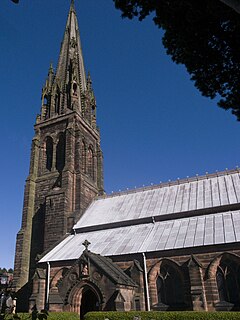
Cheadle is a market town and civil parish in the Staffordshire Moorlands District of Staffordshire, England, with a population of 12,165 at the 2011 census. It is located between Uttoxeter, Leek, Ashbourne and Stoke-on-Trent.

The South Wales Coalfield extends across Pembrokeshire, Carmarthenshire, Swansea, Neath Port Talbot, Bridgend, Rhondda Cynon Taf, Merthyr Tydfil, Caerphilly, Blaenau Gwent and Torfaen. It is rich in coal deposits, especially in the South Wales Valleys.

Dilhorne is an ancient parish and village in Staffordshire, three miles from Cheadle and six miles from Stoke-on-Trent. The village is within the Staffordshire Moorlands area.

The Somerset Coalfield in northern Somerset, England is an area where coal was mined from the 15th century until 1973. It is part of a larger coalfield which stretched into southern Gloucestershire. The Somerset coalfield stretched from Cromhall in the north to the Mendip Hills in the south, and from Bath in the east to Nailsea in the west, a total area of about 240 square miles (622 km2). Most of the pits on the coalfield were concentrated in the Cam Brook, Wellow Brook and Nettlebridge Valleys and around Radstock and Farrington Gurney. The pits were grouped geographically, with clusters of pits close together working the same coal seams often under the same ownership. Many pits shared the trackways and tramways which connected them to the Somerset Coal Canal or railways for distribution.

The Maltby Main Colliery was a coal mine located 7 miles (11 km) east of Rotherham on the eastern edge of Maltby, South Yorkshire, England. The mine was closed in 2013.
The South Yorkshire Coalfield is so named from its position within Yorkshire. It covers most of South Yorkshire, West Yorkshire and a small part of North Yorkshire. The exposed coalfield outcrops in the Pennine foothills and dips under Permian rocks in the east. Its most famous coal seam is the Barnsley Bed. Coal has been mined from shallow seams and outcrops since medieval times and possibly earlier.
The Cheadle branch line was a railway line of just under 4 miles (6.4 km) in length that served the town of Cheadle, Staffordshire. It was in operation as a passenger line from 1892 to 1963, and closed altogether in 1986. It took 46 years from conception to completion and was notable in that part of the line had to be practically rebuilt partway through its existence.

Chatterley Whitfield Colliery is a disused coal mine on the outskirts of Chell, Staffordshire in Stoke on Trent, England. It was the largest mine working the North Staffordshire Coalfield and was the first colliery in the UK to produce one million tons of saleable coal in a year.
The North Staffordshire Coalfield was a coalfield in Staffordshire, England, with an area of nearly 100 square miles (260 km2), virtually all of it within the city of Stoke on Trent and the borough of Newcastle-under-Lyme, apart from three smaller coalfields, Shaffalong and Goldsitch Moss Coalfields near Leek and the Cheadle Coalfield. Coal mining in North Staffordshire began early in the 13th century, but the industry grew during the Industrial Revolution when coal mined in North Staffordshire was used in the local Potteries ceramics and iron industry.
The Minnie Pit disaster was a coal mining accident that took place on 12 January 1918 in Halmer End, Staffordshire, in which 155 men and boys died. The disaster, which was caused by an explosion due to firedamp, is the worst ever recorded in the North Staffordshire Coalfield. An official investigation never established what caused the ignition of flammable gases in the pit.
Coal mining in the United Kingdom dates back to Roman times and occurred in many different parts of the country. Britain's coalfields are associated with Northumberland and Durham, North and South Wales, Yorkshire, the Scottish Central Belt, Lancashire, Cumbria, the East and West Midlands and Kent. After 1972, coal mining quickly collapsed and had practically disappeared by the 21st century. The consumption of coal – mostly for electricity – fell from 157 million tonnes in 1970 to 18 million tonnes in 2016, of which 77% was imported from Colombia, Russia, and the United States. Employment in coal mines fell from a peak of 1,191,000 in 1920 to 695,000 in 1956, 247,000 in 1976, 44,000 in 1993, and to 2,000 in 2015.
The Lancashire Coalfield in North West England was an important British coalfield. Its coal seams were formed from the vegetation of tropical swampy forests in the Carboniferous period over 300 million years ago.
The Ingleton Coalfield is in North Yorkshire, close to its border with Lancashire in north-west England. Isolated from other coal-producing areas, it is one of the smallest coalfields in Great Britain.
The Astley and Tyldesley Collieries Company formed in 1900 owned coal mines on the Lancashire Coalfield south of the railway in Astley and Tyldesley, then in the historic county of Lancashire, England. The company became part of Manchester Collieries in 1929 and some of its collieries were nationalised in 1947.

The Manchester Coalfield is part of the South Lancashire Coalfield, the coal seams of which were laid down in the Carboniferous Period. Some easily accessible seams were worked on a small scale from the Middle Ages, and extensively from the beginning of the Industrial Revolution in the early 19th century until the last quarter of the 20th century. The Coal Measures lie above a bed of Millstone Grit and are interspersed with sandstones, mudstones, shales, and fireclays. The Lower Coal Measures occupy the high ground of the West Pennine Moors above Bolton and are not worked in the Manchester Coalfield. The most productive of the coal measures are the lower two thirds of the Middle Coal Measures where coal is mined from seams between the Worsley Four Foot and Arley mines. The deepest and most productive collieries were to the south of the coalfield. The coalfield is affected by the northwest to southeast aligned Pendleton Fault along the Irwell Valley and the Rossendale Valley anticline. The Coal Measures generally dip towards the south and west. Numerous other smaller faults affect the coalfield. The Upper Coal Measures are not worked in the Manchester Coalfield.
The Denbighshire Coalfield in the historic county of Denbighshire in north-east Wales is one of the smaller British coalfields. It extends from near Caergwrle in the north, southwards through Wrexham, Ruabon and Rhosllannerchrugog to Chirk in the south. A small part extends into Shropshire around Oswestry. Beyond Caergwrle the coal-bearing strata continue northwards as the Flintshire Coalfield. Together the two coalfields are known as the North Wales Coalfield.
Bridgewater Collieries originated from the coal mines on the Manchester Coalfield in Worsley in the historic county of Lancashire owned by Francis Egerton, 3rd Duke of Bridgewater in the second half of the 18th century. After the Duke's death in 1803 his estate was managed by the Bridgewater Trustees until the 3rd Earl of Ellesmere inherited the estates in 1903. Bridgewater Collieries was formed in 1921 by the 4th Earl. The company merged with other prominent mining companies to form Manchester Collieries in 1929.
The Forest of Dean Coalfield, underlying the Forest of Dean, in west Gloucestershire, is one of the smaller coalfields in the British Isles, although intensive mining during the 19th and 20th centuries has had enormous influence on the landscape, history, culture, and economy of the area.

Bradford Colliery was a coal mine in Bradford, Manchester, England. Although part of the Manchester Coalfield, the seams of the Bradford Coalfield correspond more closely to those of the Oldham Coalfield. The Bradford Coalfield is crossed by a number of fault lines, principally the Bradford Fault, which was reactivated by mining activity in the mid-1960s.
Barrow Colliery was a coal mine in Worsborough, South Yorkshire, England. It was first dug in 1873, with the first coal being brought to the surface in January 1876. It was the scene of a major incident in 1907 when seven miners died. After 109 years of coaling operations, the mine was closed in May 1985.
