Darjeeling is a city in the northernmost region of the Indian state of West Bengal. Located in the Eastern Himalayas, it has an average elevation of 2,045 metres (6,709 ft). To the west of Darjeeling lies the easternmost province of Nepal, to the east the Kingdom of Bhutan, to the north the Indian state of Sikkim, and farther north the Tibet Autonomous Region region of China. Bangladesh lies to the south and southeast, and most of the state of West Bengal lies to the south and southwest, connected to the Darjeeling region by a narrow tract. Kangchenjunga, the world's third-highest mountain, rises to the north and is prominently visible on clear days.

Kalimpong is a town and the headquarters of an eponymous district in the Indian state of West Bengal. It is located at an average elevation of 1,250 metres (4,101 ft). The town is the headquarters of the Kalimpong district. The region comes under Gorkhaland Territorial Administration which is an autonomous governing body within the state of West Bengal. The Indian Army's 27 Mountain Division is located on the outskirts of the city.

Namchi is a city and the administrative headquarter of the Namchi district in the Indian state of Sikkim. The appellation Namchi means Sky (Nam) High (Chi) in Sikkimese.

Pelling is a hill station in Gyalshing district of Sikkim, India. Pelling is nestled at an altitude of 2,150 m (7,200 feet). The town is located at a distance of 10 km from Gyalshing city, the district headquarters and 131 km from Gangtok. A regular bus service connects the two towns. However, with the influx of tourists, the region is undergoing a metamorphosis, with the roads being repaired and hotels being set up.
Gyalshing is a city, located in Gyalshing district, in the Indian state of Sikkim. It is administrative headquarter of district. The town is connected to the capital Gangtok by a metalled road. Geyzing is also connected to the West Bengal towns of Darjeeling and Kalimpong via Jorethang. A few kilometres north is the town of Pelling. The town has a large Nepali population, and the Nepali language is the predominant language of the region. The town is situated at an altitude of about 6,500 feet (1,900 m). The town enjoys a temperate climate for most of the year and snow sometimes falls in the vicinity.

Tanahun District, a part of Gandaki Province, is one of the seventy-seven districts of Nepal. The district lies in central Nepal, with Damauli as its district headquarters. It covers an area of 1,546 km2 (597 sq mi) and has a population (2011) of 323,288. Previously the town of Bandipur was its district headquarter. The postal code of Tanahun is 33900.

Kurseong is a town and a municipality in Darjeeling district in the Indian state of West Bengal. It is the headquarters of the Kurseong subdivision.

Ghum is a small hilly neighbourhood in the Darjeeling Himalayan hill region of West Bengal, India. It comes under ward number one of the Darjeeling Municipality. Ghum railway station of the Darjeeling Himalayan Railway is the highest railway station in India. It is situated at an altitude of 2,258 metres (7,407 ft). The place is the home of the Ghum Monastery and the Batasia Loop, a bend of the Darjeeling Himalayan Railway.

Bhutia Busty monastery or Karma Dorjee Chyoling monastery is a Buddhist monastery located in Bhutia Busty, Darjeeling district, India. It belongs to the Red Sect of Buddhist Lamas.

Darjeeling Carnival is a ten-day carnival arranged in the town of Darjeeling, West Bengal, India.

Observatory Hill is a hill near Chowrasta square, or The Mall as it is popularly known, in Darjeeling, West Bengal, India. Views of snow-clad peaks, including Mount Kanchenjunga, are visible from the Observatory Hill. The Bhutia Busty monastery was originally located here. Now the hill has the temple of Mahakal. Two important arteries of the town, Nehru Road and Bhanubhakta Sarani, meet at Chowrasta. Another school of thought suggests that the presence of the megalithic core to have been a place of worship of the Rongs, representing a sacred location of the classic Long Chok type.

Happy Valley Tea Estate is a tea garden in Darjeeling district in the Indian state of West Bengal. Established in 1854, it is Darjeeling's second oldest tea estate. Spread over 177 hectares, it is situated at a height of 2,100 metres (6,900 ft) above sea level, 3 kilometres (1.9 mi) north of Darjeeling, and employs more than 1500 people.

Sukhia Pokhri is a census town in the Jorebunglow Sukhiapokhri CD block in the Darjeeling Sadar subdivision of the Darjeeling district in the indian state of West Bengal. It is located 11 km from Ghum on the way to Mirik.
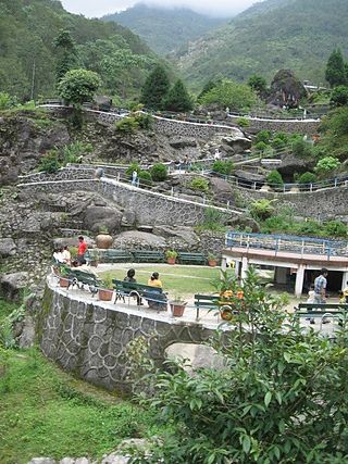
The Rock Garden at Chunnu Summer Falls and Ganga Maya Park are recently added tourist attractions in the hilly town of Darjeeling in the state of West Bengal, India. It is a showpiece meant to lure people to Darjeeling after political agitations disrupted tourism in the 1980s. There is another rock garden in Darjeeling known as Sir John Anderson Rock Garden, which is part of Lloyd's Botanical Garden.

The culture of Darjeeling, India, is diverse and has a regional distinctness.

Soureni is a village in the Mirik CD block in the Mirik subdivision of the Darjeeling district, in West Bengal, India.
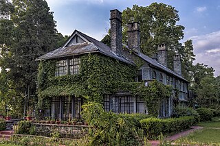
Morgan House Kalimpong or Morgan House is a mansion of British colonial architecture built by an English jute baron George Morgan in the 1930s on the hill station of Kalimpong, Kalimpong district, West Bengal. Today, the mansion is a hotel managed by West Bengal Tourism Development Corporation (WBTDC). Earlier this property was also known as Singamari Tourist Lodge or Durpin Tourist Lodge.

The Mahakal Temple or Mahakal Mandir is a sacred Hindu temple located in Darjeeling, West Bengal, India, dedicated to the Hindu god Shiva, the third god in the Hindu triumvirate. The temple was built in 1782 by Lama Dorjey Rinzing and is perched atop the Observatory Hill and is an amalgamation of Hindu and Buddhist religions. It is a religious site where both religions coexist harmoniously.
Ramdhura is a village in Kalimpong II CD block in the Kalimpong Sadar subdivision of the Kalimpong district in the state of West Bengal, India.
Lebong & Mineral Spring Tea Garden is a village in the Darjeeling Pulbazar CD block in the Darjeeling Sadar subdivision of the Darjeeling district in the state of West Bengal, India.

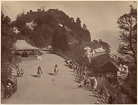
 View from Mall Road
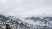 View from Chowrasta
 Kanchenjunga
 First light on Kanchenjunga
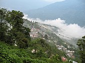
 Darjeeling town
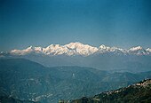 Mt. Kanchanjunga