Kangchenjunga, also spelled Kanchenjunga, Kanchanjanghā and Khangchendzonga, is the third-highest mountain in the world. Its summit lies at 8,586 m (28,169 ft) in a section of the Himalayas, the Kangchenjunga Himal, which is bounded in the west by the Tamur River, in the north by the Lhonak River and Jongsang La, and in the east by the Teesta River. It lies in the border region between Nepal and Mangan district, Sikkim state of India, with three of the five peaks, namely Main, Central and South, directly on the border, and the peaks West and Kangbachen in Nepal's Taplejung District.

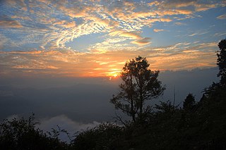
Darjeeling is a town and municipality in the northernmost region of the Indian state of West Bengal. Located in the Eastern Himalayas, it has an average elevation of 2,045 metres (6,709 ft). To the west of Darjeeling lies the easternmost province of Nepal, to the east the Kingdom of Bhutan, to the north the Indian state of Sikkim, and farther north the Tibet Autonomous Region region of China. Bangladesh lies to the south and southeast, and most of the state of West Bengal lies to the south and southwest, connected to the Darjeeling region by a narrow tract. Kangchenjunga, the world's third-highest mountain, rises to the north and is prominently visible on clear days.

Mahananda Wildlife Sanctuary is located on the foothills of the Himalayas, between the Teesta and Mahananda rivers. Situated in the Darjeeling district of West Bengal, India; it comes under Darjeeling Wildlife division and can be reached from Siliguri in 30 minutes. Sukna, the gateway to the sanctuary, is only 13 km from Siliguri and 28 km from Bagdogra airport. The sanctuary sprawls over 159 km2 of reserve forest and was started as a game sanctuary in 1955. In 1959, it got the status of a sanctuary mainly to protect the Indian bison and royal Bengal tiger, which were facing the threat of extinction.

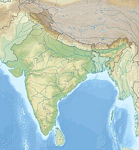
Darjeeling District is the northernmost district of the state of West Bengal in eastern India in the foothills of the Himalayas. The district is famous for its hill station and Darjeeling tea. Darjeeling is the district headquarters.

Singalila National Park is a National park of India located on the Singalila Ridge at an elevation of more than 2300 metres above sea level, in the Darjeeling district of West Bengal. It is well known for the trekking route to Sandakphu that runs through it.
Neora Valley National Park is a national park in Kalimpong district, West Bengal, India that was established in 1986. It spreads over an area of 88 km2 (34 sq mi), and is a rich biological zone in eastern India. It is the land of the red panda in the pristine undisturbed natural habitat with rugged inaccessible hilly terrain and rich diverse flora and fauna. It is linked to Pangolakha Wildlife Sanctuary of Pakyong District as well as forests of Samtse District, Bhutan via thick cover of forests.
Padmaja Naidu Himalayan Zoological Park is a 67.56-acre (27.3 ha) zoo in the town of Darjeeling in the Indian state of West Bengal. The zoo was opened in 1958, and an average elevation of 7,000 feet (2,134 m), is the largest high altitude zoo in India. It specializes in breeding animals adapted to alpine conditions, and has successful captive breeding programs for the snow leopard, the endangered Himalayan wolf and the red panda. The zoo attracts about 300,000 visitors every year. The park is named after Padmaja Naidu (1900–1975), daughter of Sarojini Naidu. The zoo serves as the central hub for Central Zoo Authority of India's red panda program and is a member of the World Association of Zoos and Aquariums.

Maney Bhanjyang is a small transit-town in the Darjeeling Sadar subdivision, Darjeeling district in the state of West Bengal in India. It is located at the gateway of the Singalila National Park, 28 km away from Darjeeling town. The income of the local residents is geared towards tourism, especially foreign trekkers. Maney Bhanjyang is the start of the trailhead for the trek to Sandakphu on the Singalila Ridge, the highest point in West Bengal. Conveyance for Sandakphu is also available mainly from Maney Bhanjyang in the form of Land Rovers of 1960 model. The 4-hour ride can be quite 'jumpy' as drivers maneuver their prized possessions along snaky curves and uphill roads.

Kalipokhri is a small Himalayan village inside the Singalila National Park in the Darjeeling subdivision, Darjeeling district in the state of West Bengal, India. It lies on the trekking route from Mane Bhanjang to Sandakphu, and is roughly halfway between the steep final stretch of the trek from Gairibans to Sandakphu. The word, "Pokhri" means "lake" and "kala" means "dark" in Nepali, and the village is named after a local lake with dark waters or a lake whose water is dark in color. The lake is of extreme religious significance to the locals. Opposite the lake a border check post of Nepal Army is situated.

The Himalayan subtropical broadleaf forests is an ecoregion that extends from the middle hills of central Nepal through Darjeeling into Bhutan and also into the Indian States of Uttar Pradesh and Bihar. It represents the east–west-directed band of subtropical broadleaf forest at an altitude of between 500 and 1,000 m along the Outer Himalayan Range, and includes several forest types traversing an east to west moisture gradient.
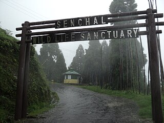
Senchal Wildlife Sanctuary was set up in 1915 in the Darjeeling District of West Bengal, India.
India is home to a large variety of wildlife. It is a biodiversity hotspot with various ecosystems ranging from the Himalayas in the north to the evergreen rain forests in the south, the sands of the west to the marshy mangroves of the east. India lies within the Indomalayan realm and is the home to about 7.6% of mammal, 14.7% of amphibian, 6% of bird, 6.2% of reptilian, and 6.2% of flowering plant species. India's forests contain about 500 species of mammals and more than 1300 bird species.

Sukhia Pokhri is a census town in the Jorebunglow Sukhiapokhri CD block in the Darjeeling Sadar subdivision of the Darjeeling district in the indian state of West Bengal. It is located 11 km from Ghum on the way to Mirik.

Sevoke is a small town near Siliguri in the Darjeeling district of West Bengal state of India near the border with Sikkim state. Situated in Dooars, Sevoke lies on the bank of River Teesta and has two bridges − namely Coronation Bridge and Sevoke Railway Bridge over it. Indian Army and Border Security Force camps are located in the area. The Mahananda Wildlife Sanctuary is situated in this area. National Highway NH10 passes through the town and connects Sevoke town to Gangtok and Siliguri. National Highway 17 originates from Sevoke near Coronation Bridge and terminates in Guwahati.

West Bengal is a state in the eastern region of India and is the nation's fourth-most populous. The state capital is Kolkata. The state encompasses two broad natural regions: the Gangetic Plain in the south and the sub-Himalayan and Himalayan area in the north. The tourism in West Bengal is maintained by WBTDCL, a state government owned enterprise.
Pangolakha Wildlife Sanctuary is a wildlife reserve in the Pakyong District of the state of Sikkim in India. It is about 28 kilometres (17 mi) east of Rorathang and about 40 kilometres (25 mi) by road from Rangpo city. The total notified area of the park is around 124 square kilometres (48 sq mi) while inside the wildlife sanctuary there are a few hamlets: Aritar, Dakline Lingtam, Phadamchen, Dzuluk, Gnathang Monastery Kupup. This wildlife sanctuary is linked to the forests of Neora Valley National Park of West Bengal as well as forests of Samtse, Bhutan and Haa district Bhutan. The area that comes under this biosphere has been declared in 1999 as a wildlife sanctuary under biogeographic province category 2C.

Sukna is a village and a gram panchayat in the Kurseong CD block in the Kurseong subdivision of the Darjeeling district in the state of West Bengal, India.
Sittong (Valley) is a village in the Kurseong CD block in the Kurseong subdivision of the Darjeeling district in the state of West Bengal, India.
Mohurgong & Gulma Tea Estates is a tea garden in the Matigara CD block in the Siliguri subdivision of Darjeeling district in the state of West Bengal, India.