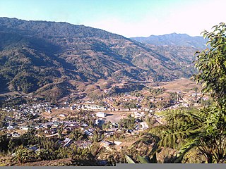
Arunachal Pradesh is a state in northeast India. It was formed from the North-East Frontier Agency (NEFA) region, and India declared it as a state on 20 February 1987. Itanagar is its capital and largest town. It borders the Indian states of Assam and Nagaland to the south. It shares international borders with Bhutan in the west, Myanmar in the east, and a disputed 1,129 km border with China's Tibet Autonomous Region in the north at the McMahon Line.

West Kameng is a district of Arunachal Pradesh in northeastern India. It accounts for 8.86% of the total area of the state. The name is derived from the Kameng river, a tributary of the Brahmaputra, that flows through the district.
The Aka, also known as Hrusso, are an ethnic group of Indian state Arunachal Pradesh. They are found in various areas of Arunachal Pradesh including the Thrizino Bhalukpong, Buragaon, Jamiri, Palizi, Khuppi area in West Kameng. Their language belongs to the Tibeto-Burman family.

The Nyishi community is the largest ethnic group in Arunachal Pradesh in north-eastern India. The Nyishi language belongs to the Sino-Tibetan family, however, the origin is disputed. Their population of around 300,000 makes them the most populous tribe of Arunachal Pradesh, closely followed by the tribes of the Adi according to 2001 census.
The Indian state of Arunachal Pradesh has a total population of roughly 1.4 million on an area of 84,000 km2, amounting to a population density of about 17 pop./km2. The "indigenous groups" account for about two thirds of population, while immigrants, mostly of Bengali/Hindi belt origin, account for a third person.
East Kameng district is one of districts of Arunachal Pradesh state in northeastern, India. It shares an international border with China in the north and district borders with West Kameng district to the west, Pakke-Kessang district to the south, Kurung Kumey district to the east, Papum Pare district to the southeast. Pakke-Kessang district was bifurcated from East Kameng district on 1 December 2018.

Lower Subansiri district (Pron:/su:bənˈsɪɹi/) is one of the 25 administrative districts of the state of Arunachal Pradesh in northeastern India.
Seppa is the headquarter of the East Kameng district in the state of Arunachal Pradesh in India. Sepla means 'marshy' land in the local dialect. It lies on the bank of Kameng River with a helipad located in the heart of the town. It is located 160 kilometres (99 mi) from Itanagar and 213 kilometres (132 mi) from Tezpur (Assam) connected by motorable road. The village of Seppa has two out of the sixty Vidhan Sabha Constituencies of Arunachal Pradesh. They are Seppa East and Seppa West.
Daporijo is a census town in the Upper Subansiri district, Indian state of Arunachal Pradesh in the Northeast of India.
Tani, is a branch of Sino-Tibetan languages spoken mostly in Arunachal Pradesh, Assam, and neighboring regions.

Kurung Kumey district is one of the 26 districts of the northeastern Indian state of Arunachal Pradesh, with its district headquarters in Koloriang.
The Puroik language is a possible language isolate spoken by the Puroik people of Arunachal Pradesh in India and of Lhünzê County, Tibet, in China.
Miji, also given the dialect names Sajolang and Dhammai, is a dialect cluster traditionally counted as one of the Sino-Tibetan languages that is spoken in Arunachal Pradesh, northeastern India. The varieties are not particularly close, with only half of the vocabulary in common between the languages of East Kameng District and West Kameng District. Long assumed to be Sino-Tibetan languages, Miji and the recently discovered Bangru language may instead form a small independent language family.
Nyishi is a Sino-Tibetan language of the Tani branch spoken in Papum Pare, Lower Subansiri, Kurung Kumey, Kra Daadi, East Kameng, Pakke Kesang, Kamle districts of Arunachal Pradesh and Darrang District of Assam in India. According to the 2011 census of India, the population of the Nishi speakers is approximately 900,000. Though there are plenty of variations across regions, the dialects of Nishi, such as Akang, Aya, Nyishi (raga), Mishing, Tagin are easily mutually intelligible, with the exception of the rather small in population Bangni-Bangru and Solung Dialects being very different from the former. 'Nisi' is sometimes used as a cover term for western Tani languages.
Koloriang is a hilly district headquarters town of Kurung Kumey district in Arunachal Pradesh, India, bordering Tibet. It has an altitude of 1,000 metres (3,300 ft) and is surrounded by high mountains all around and is located in the right bank of river Kurung, one of the major tributaries of Subansiri river. The climate is rainy and hot during summer and very cold in winter. Located at an altitude of 1,040 metres above sea level, this town is also an old administrative centre. It is about 257 km from state capital, Itanagar.
Bangru, also known as Ləvai (Ləwjɛ) and occasionally as Northern Miji is a language spoken in Sarli Circle, northern Kurung Kumey District by 1,500 people. Long unclassified due to poor documentation, it turns out to be related to the Miji languages.
Arunachal Frontier Highway (AFH), officially notified as the National Highway NH-913 and also called Bomdila-Vijaynagar Highway (BVH), connecting Bomdila Airstrip ALG & HQ in northwest to Vijaynagar Airstrip ALG & HQ in southeast via Nafra HQ-Sarli HQ-Huri Helipad ALG & HQ-Nacho HQ-Mechuka Airstrip ALG & HQ-Monigong HQ-Jido -Hunli HQ-Hayuliang Airstrip ALG HQ-Chenquenty-Hawai HQ-Miao HQ including 800 km greenfield section and network of new tunnels & bridges, is a 2-lane paved-shoulder under-construction national highway along the India-China LAC-McMahon Line border in the Indian state of Arunachal Pradesh. The 1,748 km-long (1,086 mi) highway itself will cost ₹27,000 crore and total cost including 6 additional inter-corridors is ₹40,000 crore. In some places, this highway will run as close as 20 km from the LAC. To be constructed by MoRTH in 9 packages, all packages will be approved by the end of fy 2024-25 and construction will be completed in 2 years by 31 March 2027. Of the total route, 800km is greenfield, rest brownfield will be upgraded and tunnels will be built. This highway in the north & east Arunachal along the China border, would complement the Trans-Arunachal Highway and the Arunachal East-West Corridor as major highways spanning the whole state, pursuing the Look East connectivity policy.

Kra Daadi is a district in Arunachal Pradesh in north-eastern India. It was carved out of Kurung Kumey district on 7 February 2015.

Pakke-Kessang is a district located in the state of Arunachal Pradesh in the Northeast of India. The district used to be a part of the neighboring district, East Kameng, and was created out of its five southernmost administrative units: Pijerang, Passa Valley, Pakke-Kessang, Dissing Passo and Seijosa. The district headquarters of Pakke-Kessang is located at Lemmi (near Boundary of Papum pare


