Church Hill, Alabama | |
|---|---|
 Church Hill  Church Hill | |
| Coordinates: 32°38′54″N85°44′53″W / 32.64833°N 85.74806°W | |
| Country | United States |
| State | Alabama |
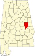
| County | Tallapoosa |
| Elevation | 597 ft (182 m) |
| Time zone | UTC-6 (Central (CST)) |
| • Summer (DST) | UTC-5 (CDT) |
| Area codes | 256 & 938 |
| GNIS feature ID | 137384 [1] |
Church Hill is an unincorporated community in Tallapoosa County, Alabama, United States. Church Hill is the birthplace of Herschel W. Arant, a legal academic and jurist who served on the United States Court of Appeals for the Sixth Circuit from 1939 to 1941. [2] A post office was operated in Church Hill from 1888 to 1904. [3]