Church Street, Liverpool

Last updated

Church Street, Liverpool
Church Street and Lord street Liverpool.jpg
Church Street meets Lord Street
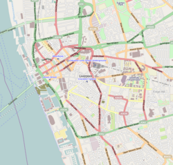
Liverpool Centre map.png
Red pog.svg
Location Liverpool city centre
Postal codeL1
Coordinates 53°24′19″N2°59′01″W / 53.4052°N 2.9836°W / 53.4052; -2.9836
Other
Known for
  • Shopping

Church Street is a street in Liverpool, England, lying between Bold Street to the east and Lord Street to the west. It is the main shopping area of Liverpool and takes its name from St Peter's Church, which was demolished in 1922. [1] The side streets to the north of Church Street lead to Williamson Square, while the Grade I listed Bluecoat Chambers—the oldest surviving building in Liverpool—is to the south along Church Alley. The Liverpool Athenaeum, an institution founded in the 18th century, is also on Church Alley. The area behind the shops on the south side of Church Street is now part of the Liverpool One shopping complex, which opened in October 2008 after the redevelopment of a large part of the L1 postcode area (hence the name).

Related Research Articles

<span class="mw-page-title-main">Liverpool, New South Wales</span> Suburb of Sydney, New South Wales, Australia

Liverpool is a suburb of South Western Sydney, in the state of New South Wales, Australia. It is located approximately 31 kilometres (19 mi) south-west of the Sydney CBD. Liverpool is the administrative seat of the local government area of the City of Liverpool and is situated in the Cumberland Plain.

<span class="mw-page-title-main">Alley</span> Narrow street that usually runs between, behind, or within buildings

An alley or alleyway is a narrow lane, path, or passageway, often reserved for pedestrians, which usually runs between, behind, or within buildings in the older parts of towns and cities. It is also a rear access or service road, or a path, walk, or avenue in a park or garden.

<span class="mw-page-title-main">Aigburth</span> Human settlement in England

Aigburth is a suburb of Liverpool, England. Located to the south of the city, it is bordered by Toxteth and Dingle to the north, Mossley Hill to the east, and Grassendale to the south, with the River Mersey forming its western boundary.

<span class="mw-page-title-main">Ashton-in-Makerfield</span> Town in Greater Manchester, England

Ashton-in-Makerfield is a market town in the Metropolitan Borough of Wigan, Greater Manchester, England, 4 miles (6.4 km) south of Wigan. As of the 2021 census, there was a population of 26,380.

<span class="mw-page-title-main">Toxteth</span> Human settlement in England

Toxteth is an inner-city area of Liverpool in the county of Merseyside.

<span class="mw-page-title-main">Norris Green</span> Human settlement in England

Norris Green is a suburb and ward of Liverpool, England, in the east of the city. At the 2001 Census it had a population of 17,784, which had fallen to 15,047 at the 2011 Census.

<span class="mw-page-title-main">Cardiff city centre</span> Central Business District in Wales

Cardiff city centre is the city centre and central business district of Cardiff, Wales. The area is tightly bound by the River Taff to the west, the Civic Centre to the north and railway lines and two railway stations – Central and Queen Street – to the south and east respectively. Cardiff became a city in 1905.

<span class="mw-page-title-main">Speke</span> Human settlement in England

Speke is a suburb of Liverpool, Merseyside, England. It is 8 miles (12.9 km) southeast of the city centre. Located near the widest part of the River Mersey, it is bordered by the suburbs of Garston and Hunts Cross, and nearby to Halewood, Hale Village, and Widnes. The rural area of Oglet borders its south.

<span class="mw-page-title-main">Chapel Street, Melbourne</span> Street in Melbourne, Australia

Chapel Street is a street in Melbourne, Victoria, running along the inner suburbs of South Yarra, Prahran, Windsor, St Kilda and St Kilda East.

<span class="mw-page-title-main">Liverpool One</span> Shopping, residential and leisure complex in Liverpool, England

Liverpool ONE is a shopping, residential, and leisure complex in Liverpool, England. The project involved the redevelopment of 42 acres of land in the city centre. It is a retail-led development anchored by the department store John Lewis. Debenhams had previously been an anchor tenant until the closure of its Liverpool One store in March 2021, with Marks & Spencer taking its place in mid-2023. Additional elements include leisure facilities, apartments, offices, public open spaces, restaurants, and transport improvements. The completion of Liverpool ONE significantly boosted the local economy, while lifting Liverpool into the top five most popular retail destinations in the UK.

<span class="mw-page-title-main">The Lyceum, Liverpool</span> Neoclassical Grade II* listed building in Liverpool, England

The Lyceum is a Neoclassical Grade II* listed building located on Bold Street, Liverpool. It was constructed in 1802 as a news-room and England's first subscription library (1758–1942) and later became a gentleman's club. After the club relocated in 1952 the building was left unoccupied for many years, eventually falling into a state of disrepair. Calls were made for its demolition in the late 1970s, sparking a campaign to save the building. It reopened as a post office, and then a branch of the Co-operative Bank. As of November 2019, its tenant is a Chinese restaurant.

<span class="mw-page-title-main">The Highway, London</span> Road in the East End of London, England

The Highway, part of which was formerly known as the Ratcliffe Highway, is a road in the London Borough of Tower Hamlets, in the East End of London. The route dates back to Roman times. In the 19th century it had a reputation for vice and crime and was the location of the Ratcliff Highway murders. Prior to a renaming programme of 1937, different parts of the route had different names depending on what district they were in.

Gholhak is a neighborhood located in District 3 of Tehran Municipality. It is bounded on the east by the Darrous neighborhood, on the west by the Gholhak River, on the north by the British Embassy Garden, and on the south by the Pourmeshkani Street and Zafar Street (Dastgerdi).

<span class="mw-page-title-main">La Princesse</span> Robotic mechanical spider

La Princesse is a 15-metre (50-foot) mechanical spider designed and operated by French performance art company La Machine. The spider was showcased in Liverpool, England, as part of the 2008 European Capital of Culture celebrations, travelling around the city between 3–7 September. In 2009, it was on display in Yokohama, Japan, as part of Yokohama's 150th anniversary of its port opening. Arts reviewer Lyn Gardner wrote in The Guardian "There were times when it seemed to be leading the entire population of the city on a merry dance, like some kind of arachnid pied piper."

<span class="mw-page-title-main">Clayton Square Shopping Centre</span> Shopping mall in Merseyside, England

Clayton Square Shopping Centre is an inner-city shopping centre located in Liverpool, England. It is in close proximity to Liverpool Lime Street and Liverpool Central railway stations. It is the city's fourth largest shopping centre behind Liverpool One, St. John's Shopping Centre and Metquarter. Clayton Square sees tough competition from the likes of Liverpool One, St.Johns, Metquarter, Church Street, Lord Street and Bold Street.

<span class="mw-page-title-main">Lord Street, Liverpool</span> Street in Liverpool, England, UK

Lord Street is a street in central Liverpool, England that forms part of the city's main shopping district. The street is less than 300 metres in length. It joins Church Street to the east and James Street alongside Derby Square and the Queen Elizabeth II Law Courts to the west. The majority of land to the south of Lord Street is occupied by the Liverpool One complex, whilst the likes of Cavern Walks are located on the north side of the street.

<span class="mw-page-title-main">Penny Lane, Liverpool</span> Street in the city of Liverpool in the north of England

Penny Lane is a street situated south off the A562 road in the Mossley Hill suburb of Liverpool, England. The name also applies to the area surrounding the thoroughfare. During the 20th century, it was the location for one of the main bus terminals in Liverpool, and gained international notability in 1967 when the Beatles released their song "Penny Lane" in tribute to their upbringing in Liverpool.

<span class="mw-page-title-main">Ousegate</span> Street in York, England

Ousegate is a street in the city centre of York, in England. It is divided into High Ousegate and Low Ousegate.

<span class="mw-page-title-main">St John's Market</span> Market hall in Liverpool, England

St. John's Market was a municipal retail market hall in Liverpool, England, housed in a purpose-designed building erected between 1820 and 1822 to a design by John Foster, Junior. It quickly came to be seen as a model for market halls erected elsewhere in the UK in the 19th century. The north and south facades of the building were altered in 1881 and 1891; it was demolished in 1964, making way for the 1969 St Johns Shopping Centre, the western half of which occupies the hall's site.

References

  1. "BBC - Liverpool Local History -". www.bbc.co.uk.