Location | Mossley Hill, Liverpool |
---|---|
Postal code | L18 |
Coordinates | 53°23′13″N2°55′10″W / 53.38694°N 2.91944°W |
Other | |
Known for |
|
Penny Lane is a street situated south off the A562 road in the Mossley Hill suburb of Liverpool, England. The name also applies to the area surrounding the thoroughfare. During the 20th century, it was the location for one of the main bus terminals in Liverpool, and gained international notability in 1967 when the Beatles released their song "Penny Lane" in tribute to their upbringing in Liverpool.
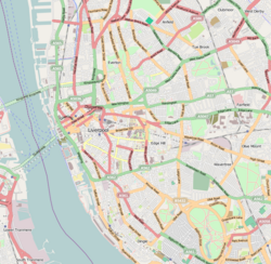
Penny Lane appears as an unnamed laneway on maps as early as the 1700s and remained a rural thoroughfare until the 1890s. [1] After the city's expansion, it was the location for a significant tram and bus terminus for several routes, and buses with "Penny Lane" displayed were common throughout Liverpool. The name is also used for the area that surrounds its junction with Smithdown Road, Smithdown Place (where the terminus was located), and Allerton Road, the last of which includes a busy shopping area. It was the terminus for the number 46 and 99 bus routes to Walton, Old Swan and the city centre. At the other end from its junction on Smithdown Road, the street leads down to the University of Liverpool's student halls of residence near Sefton Park.
The street and bus depot became a place of international interest as a result of the Beatles' song "Penny Lane", [2] which was released in February 1967 and was a No. 1 hit around the world. The fireman and fire engine mentioned in the lyrics are the fire station at Mather Avenue, which is close to Penny Lane. [3] The terminus at Penny Lane included a purpose-built bus shelter, with a waiting room and toilets. The shelter is located on its own island, which is "the shelter in the middle of a roundabout" referred to in the song. [4]
Towards the end of the 1970s, businesses in Penny Lane included Penny Lane Records and a wine bar known as Harper's Bizarre, now called Penny Lane Wine Bar. The latter was formerly a doctors' surgery operated by doctors Walton, Endbinder, and Partners, which moved to Smithdown Place in the 1980s. Following the privatisation of UK buses, the Merseyside Passenger Transport Executive bus depot was demolished and replaced with a shopping precinct, supermarket, and pub.[ citation needed ] In the 1980s, the bus shelter was bought privately and converted to Sgt. Pepper's Bistro. It subsequently closed and remained out of commission until 2015, when it underwent refurbishment with the aim of reopening as a restaurant, although it remains unopened as of March 2023. [4] [5] [6]
The street has long been sought out by Beatles fans touring Liverpool. In the past, Penny Lane street signs were constant targets of street sign theft and had to be continually replaced, but city officials gave up and simply began painting the street name on the sides of buildings and walls. This practice was stopped in 2007, four decades after the release of the song, and more theft-resistant street signs were installed; however, some are still stolen by tourists. [2] The Penny Lane area has acquired a level of trendiness and desirability since the late 2000s, and is now one of the most sought-after areas among Liverpool's large student population for its wholefood outlets, charity shops, cafés, bars, bistros, takeaway food emporiums, pubs, and selection of traditional businesses such as WHSmith.[ citation needed ]
On 29 November 2023, the Penny Lane sign has returned to its rightful owner Liverpool after 47 years of its disappearance. In 1976, some burglars stole the Penny Lane sign, and so, the sign remains as it is.
In July 2006, Liverpool City Council discussed renaming certain streets because their names were linked to Liverpool's role in the slave trade. It was initially believed that the street was named after 18th-century Liverpool slave trader James Penny. [7] Officials said they would modify the proposal to exclude Penny Lane as it was generally accepted that most people associate the street with the Beatles song rather than the slave trade. [8]
In the wake of the June 2020 George Floyd protests, which formed part of the international Black Lives Matter movement, Penny Lane's street signs were defaced. [9] [10] Research corroborated by the city's International Slavery Museum subsequently found no historical evidence linking its name to the slave trade. [11] [12]
Walthamstow is a town in the London Borough of Waltham Forest, around 7.5 miles (12 km) east of Central London. The town borders Chingford to the north, Snaresbrook and South Woodford to the east, Leyton and Leytonstone to the south, and Tottenham to the west. At the 2011 census, the town had a population of approximately 109,424.
"Penny Lane" is a song by the English rock band the Beatles that was released as a double A-side single with "Strawberry Fields Forever" in February 1967. It was written primarily by Paul McCartney and credited to the Lennon–McCartney songwriting partnership. The lyrics refer to Penny Lane, a street in Liverpool, and make mention of the sights and characters that McCartney recalled from his upbringing in the city.
Shepherd's Bush is a suburb of West London, England, within the London Borough of Hammersmith and Fulham 4.9 miles (7.9 km) west of Charing Cross, and identified as a major metropolitan centre in the London Plan.
Huyton is a town in the Metropolitan Borough of Knowsley, Greater Liverpool, Merseyside, England. Part of the Liverpool Built-up Area, it borders the Liverpool suburbs of Dovecot, Knotty Ash and Belle Vale.
Allerton is a suburb of Liverpool, England. Historically in Lancashire, it is located 3 miles (4.8 km) southeast of the city centre and is bordered by the suburbs of Garston, Hunt's Cross, Mossley Hill, and Woolton. It has a number of large houses in the prestigious Calderstones Park area, with mainly 1930s semi-detached housing around the shopping area of Allerton Road. It is paired with Hunts Cross to form the Allerton and Hunts Cross city council ward, which had a population of 14,853 at the 2011 census.
Toxteth is an inner-city area of Liverpool in the county of Merseyside.
Abbey Road is a thoroughfare in the borough of Camden and the City of Westminster in Greater London running roughly northwest to southeast through St John's Wood near Lord's Cricket Ground. It is part of the road B507. The road is best known for the Abbey Road Studios and for featuring on the cover of the Beatles' album of the same name, which was released in September 1969.
Dingle is an inner city area of Liverpool, Merseyside, England. It is located to the south of the city, bordered by the adjoining districts of Toxteth and Aigburth. At the 2001 Census, the population was recorded at 13,246.
Mossley Hill is a suburb of Liverpool and a Liverpool City Council ward. Located approximately 3.5 miles south east of Liverpool City Centre, it is bordered by Aigburth, Allerton, Childwall, Garston and Wavertree. At the 2001 Census, the population was 12,650, increasing to 13,816 at the 2011 Census.
Lower Town (also spelled "Lowertown" is a neighbourhood in Rideau-Vanier Ward in central Ottawa, Ontario, Canada, to the east of downtown. It is the oldest part of the city. It is bounded by Rideau Street to the south, the Ottawa River to the west and north and the Rideau River to the east. It includes the commercial Byward Market area in the south-western part, and is predominantly residential in the north and east.
Kensington is an inner city area of Liverpool, England, immediately to the east of the city centre, bordered by Everton to the north, Fairfield to the east and Edge Hill to the south.
James Penny was a merchant, slave ship owner, and prominent opponent of the abolition of slavery in Liverpool, England. He defended the slave trade to the British Parliament. The famous Penny Lane has been associated with him although it is now widely regarded as of an unconnected origin.
Sefton Park railway station is a disused station in Liverpool, England.
Brighton and Hove City Centre is the commercial and cultural centre of the city of Brighton and Hove. Geographically, the so-called city centre is located in an easterly part of the Brighton and Hove urban conurbation.
Gilmore Avenue, formerly known as Gilmore Street, is a two-lane, one-way road in Quezon City, Metro Manila, the Philippines. It runs one-way from Eulogio Rodriguez Sr. Avenue in New Manila and terminates at Nicanor Domingo Street in Valencia, continuing on as the two-way Granada Street until it reaches the city border with San Juan, where it becomes Ortigas Avenue.
Smithdown Road is a historic street in Liverpool, England, which now forms part of the A562. The area was previously known as Smithdown and dates back to 1086 when it was listed in the Domesday Book. The causeway that actually became what is now Smithdown Road emerges in documentation around 1775.
Liverpool city centre is the commercial, cultural, financial and historical centre of Liverpool and the Liverpool City Region, England. Different definitions of the city centre exist for urban planning and local government, however, the border of Liverpool city centre is broadly marked by the inner city districts of Vauxhall, Everton, Edge Hill, Kensington and Toxteth.
China Bazaar Road, officially Netaji Subash Chandra Bose Road, is one of the main thoroughfares of the commercial centre of George Town in Chennai, India. The road connects Rajaji Salai in the east and Wall Tax Road in the west. Passing through thickly populated residential areas of the historical neighbourhood, the road has several streets, lanes, and by lanes joining it, housing several commercial establishments of the city.
Liverpool, a port city in north-west England, was involved in the transatlantic slave trade. The trade developed in the eighteenth century, as Liverpool slave traders were able to supply fabric from Manchester to the Caribbean islands at very competitive prices.
Penny Lane ward is an electoral district of Liverpool City Council within the Liverpool Wavertree and Liverpool Riverside constituencies.