Falkner Street

Last updated

Falkner Street, Liverpool
19-33 Falkner Street, Liverpool - geograph.org.uk - 5027696.jpg
Falkner Street, Liverpool
Liverpool Centre map.png
Red pog.svg
Location Canning, Liverpool city centre
Postal codeL8
Coordinates 53°23′58″N2°57′47″W / 53.3994°N 2.9630°W / 53.3994; -2.9630
Other
Known for

Falkner Street is a street mostly in Canning, with a short section in Edge Hill, Liverpool, England. The street, built during the early-mid 19th century, is named after Edward Falkner, who had previously commissioned the construction Falkner Square. Constructed at a time when Liverpool had less than 100,000 houses, the Falkner Street houses sold for around £1,000 (equivalent to £101923 in 2019 [1] ) and were affordable to only the wealthiest 1% of the population.[ citation needed ]

Contents

Topography

Map of Falkner Street Falkner Street map.jpg
Map of Falkner Street

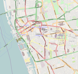
Falkner Street runs from Hope Street in the west to Grove Street in the east, where it is broken by the Liverpool Women's Hospital. Only short sections remain between that point and Crown Street, when its course resumes until reaching the junction of Smithdown Lane and Overbury Street. Along this latter stretch it forms the southern boundary of Crown Street Park, the site of Liverpool's first railway station.

Redevelopment

62 Falkner Street, 2018 62 Falkner Street.jpg
62 Falkner Street, 2018

The area around Falkner Street was significant redeveloped during the 1960s and 1970s. The Liverpool Echo reported in 1960 that some of the worst blocks of housing in the area where around Falkner Street. [2] New build redevelopment around the area was announced in 1969, with the aim being to build new accommodation to "embody in the plan many of the existing buildings" in an attempt to make new builds "blend in" with existing properties. The scheme, designed by architects from Kingham Knight Associates, intended to provide 1,640 homes in the area around Falkner Street, including 400 provided in the Falkner Street phase itself. [3] Following years of demolition and rebuild, emphasis in the mid-1970s "shifted violently away from clearing to improving", with many homes in Falkner Street instead listed as being of "architectural interest" and renovated instead of being bulldozed. [4]

As well as new housing, redevelopment plans also included recreational facilities and in 1976, a new public park was created at the former Crown Street railway yard at land in Falkner Street. [5] However, a children's playground that had been set up in Falkner Street with £8,000 from urban aid funds was in a vandalised and disused state by the 1980s, then being used as a rubbish tip. [6]

Notability

Notable residents have included Brian Epstein, manager of the Beatles pop group, who owned the ground floor flat at No 36 and let John Lennon and then wife Cynthia Lennon use it during the first few months of their marriage and through her pregnancy in 1962 and 1963. [7]

62 Falkner Street is a Grade II listed house, which was the subject of a 2018 four-part documentary on BBC Television, A House Through Time . [7] It forms a pair of houses with no 60, which were built in the 1820s according to Historic England, or 1840 according to research for the BBC. [8] [9]

Related Research Articles

<span class="mw-page-title-main">Gidea Park</span> Suburb of Havering, east London, England

Gidea Park is a neighbourhood in the east of Romford in the London Borough of Havering, south-east England. Predominantly an affluent and residential area, it was historically located in the county of Essex. It saw significant expansion in the early 20th century, with exhibitions of housing and town planning and the construction of a railway station on the main line out from London Liverpool Street station.

<span class="mw-page-title-main">Anfield</span> Football stadium, home of Liverpool F.C.

Anfield is a football stadium in Anfield, Liverpool, England, which has a seating capacity of 60,725 making it the fifth largest football stadium in England. It has been the home of Liverpool F.C. since their formation in 1892. It was originally the home of Everton from 1884 to 1891, before they moved to Goodison Park after a dispute with the club president.

<span class="mw-page-title-main">Basildon</span> Town in Essex, England

Basildon is a town in the borough of the same name, in the county of Essex, England. It had a recorded population of 115,955 at the 2021 census. In 1931, the town had a population of 1,159.

<span class="mw-page-title-main">Toxteth</span> Human settlement in England

Toxteth is an inner-city area of Liverpool in the county of Merseyside.

<span class="mw-page-title-main">Sunset Park, Brooklyn</span> Neighborhood in New York City

Sunset Park is a neighborhood in the western part of the New York City borough of Brooklyn, bounded by Park Slope and Green-Wood Cemetery to the north, Borough Park to the east, Bay Ridge to the south, and New York Harbor to the west. The neighborhood is named for a public park of the same name that covers 24.5 acres (9.9 ha) between Fifth and Seventh Avenues from 41st to 44th Street. The area north of 36th Street is alternatively known as Greenwood Heights, while the section north of 24th Street is also called South Slope.

<span class="mw-page-title-main">New Strand Shopping Centre</span> Shopping centre in Bootle, Merseyside, England

The New Strand Shopping Centre, known locally simply as The Strand, is the main shopping centre in Bootle, Merseyside, England. Opened in 1968, it was part of a larger Bootle redevelopment during this period, which was also complemented by the establishment of the Girobank headquarters in nearby Netherton. The site occupied by the shopping centre was formally Victorian houses, in streets that were named after American states. The decision on naming the shopping centre was done so via a public competition, with an 11-year-old school girl submitting the winning entry of "New Strand" in 1965. The Strand opened at a cost of £5 million in 1968, in the centenary year of Bootle receiving its municipal charter.

The Salesian Academy of St John Bosco is a Roman Catholic secondary school in Bootle, Merseyside, England. The school is under the care of the Salesians of Don Bosco, and has about 600 pupils on roll.

<span class="mw-page-title-main">Tudor City</span> Apartment complex in Manhattan, New York

Tudor City is an apartment complex on the East Side of Manhattan in New York City, bordering the Turtle Bay and Murray Hill neighborhoods. Designed and developed by the Fred F. French Company, it lies on a low cliff east of Second Avenue, between 40th and 43rd Streets, and overlooks First Avenue to the east. Construction commenced in 1926, making it the first residential skyscraper complex in the world. Tudor City was one of the first and largest examples of a planned middle-class residential community in New York City. Named for its Tudor Revival architecture, the complex is a New York City designated landmark district and is listed on the National Register of Historic Places.

<span class="mw-page-title-main">St Michael's Church of England High School, Crosby</span> Academy in Liverpool, Merseyside, England

St Michael's Church of England High School is a secondary school and sixth form located in Crosby, Merseyside, England. The school's missionary statement is: We will ensure that each individual is valued and achieves success within a caring Christian community.

<span class="mw-page-title-main">Burscough Priory Academy</span> Academy in Burscough, Lancashire, England

Burscough Priory Academy is an Academy in Burscough, Lancashire, England. It officially opened on 10 June 1958 as Burscough County Secondary School under the Headship of Brian Stone, and cost just over £120,000 to build. The then Edward Stanley, 18th Earl of Derby (1918–1994) presided over the ceremony. At the time of opening, the school's staff of 10 teachers looked after 222 pupils.

Southampton City Centre is the commercial and organisational centre of the City of Southampton, and the transport hub of the city. Because Southampton is on the South Coast of England, the city centre is not at the geometric centre of the city, but at the southern extremity.

<span class="mw-page-title-main">Post & Echo Building</span> County building in Liverpool, Merseyside, England

The Post & Echo Building, now occupied by the Meliã Liverpool Hotel, is located at 95 Old Hall Street in Liverpool city centre, England, and formerly housed the headquarters of the Liverpool Echo and Daily Post newspapers. It is also known as Metropolitan House and as City Tower. It is an international style-style building that stands 73 metres (240 ft) tall with 18 storeys, making it the joint-tenth-tallest building in the city.

Liverpool is a city and port in Merseyside, England, which contains many listed buildings. A listed building is a structure designated by English Heritage of being of architectural and/or of historical importance and, as such, is included in the National Heritage List for England. There are three grades of listing, according to the degree of importance of the structure. Grade I includes those buildings that are of "exceptional interest, sometimes considered to be internationally important"; the buildings in Grade II* are "particularly important buildings of more than special interest"; and those in Grade II are "nationally important and of special interest". Very few buildings are included in Grade I — only 2.5% of the total. Grade II* buildings represent 5.5% of the total, while the great majority, 92%, are included in Grade II.

<span class="mw-page-title-main">The Futurist Cinema</span>

The Futurist Cinema was a cinema located in Lime Street, Liverpool. Opened as Lime Street Picture House in 1912, the cinema operated until closing in 1982. Unable to find a new owner it was left to decline. It was demolished in 2016 after a court battle over the controversial plans for redevelopment of the area.

<span class="mw-page-title-main">Welsh Streets, Liverpool</span> Streets in England

The Welsh Streets are a group of late 19th century Victorian terraced streets in Toxteth, Liverpool, England. The houses were designed by Welsh architect Richard Owens and built by Welsh workers to house workers mainly involved in the industries on the docks; the streets were named after Welsh villages and landmarks. The Beatles drummer Ringo Starr lived the first few years of his life in Madryn Street. Although some original houses were lost in World War II bombing, many of the terraced properties in the original street configuration remain in the present day.

<span class="mw-page-title-main">Bowne Park</span> Public park in Queens, New York

Bowne Park is a 11.79-acre (4.77 ha) park in Broadway–Flushing, Queens, New York, east of downtown Flushing. It is bordered by 29th Avenue on the north, 32nd Avenue on the south, 155th Street on the west, and 159th Street on the east. The park consists of a playground, basketball courts, bocce court, and a kettle pond. The area immediately surrounding the park, developed in the late 19th and early 20th centuries, was originally also marketed as "Bowne Park" and is part of modern-day Murray Hill and Broadway–Flushing.

<span class="mw-page-title-main">Granby Four Streets</span> Streets in England

The Granby Four Streets is an area in Toxteth, Liverpool, England, comprising four streets at the tip of a triangle near the Grade II* listed Princes Park. The streets, designed by Welsh architect Richard Owens and built by Welsh workers during the late 19th century are Beaconsfield Street, Cairns Street, Jermyn Street and Ducie Street. A fifth street, Granby Street, connects the four streets together and mostly contains commercial units.

The city of Liverpool in Merseyside, England includes a diverse variety of historical housing architectures, some dating back several hundred years, from small working class terrace houses to larger mansions, mostly from the Victorian era. While many remain in the present day, large numbers were demolished and redeveloped during the slum clearances of the 1960s and 1970s and of those that survived, many have since been refurbished.

<span class="mw-page-title-main">Oglet</span> Human settlement in England

Oglet is a small area of Liverpool, England, and the city's most southernly point. The area is entirely rural and virtually unpopulated, save for a couple of farms. For most of its known history, Oglet was classed as a hamlet in the township of Speke. Nowadays however, "Oglet" or "The Oglet" is typically used in reference to the entire area of land located sandwiched between Liverpool John Lennon Airport in Speke to the north and the River Mersey in all other directions, except for a short land border with Hale to its east.

References

  1. United Kingdom Gross Domestic Product deflator figures follow the MeasuringWorth "consistent series" supplied in Thomas, Ryland; Williamson, Samuel H. (2018). "What Was the U.K. GDP Then?". MeasuringWorth . Retrieved 2 February 2020.
  2. "City Plans New Deal". Liverpool Echo. 29 June 1960. p. 9 via newspapers.com.
  3. "Plan to blend the old with the new". Liverpool Echo. 13 November 1969. p. 4 via newspapers.com.
  4. "Emphasis on improving". Liverpool Echo. 30 September 1975. p. 6 via newspapers.com.
  5. "New park for city". Liverpool Echo. 30 September 1976. p. 3 via newspapers.com.
  6. "The misadventure playground". Liverpool Echo. 17 February 1981. p. 8 via newspapers.com.
  7. 1 2 Shennan, Paddy (10 December 2017). "The Liverpool house which will be the star of a new TV series" . Retrieved 4 January 2018.
  8. England, Historic. "60 AND 62, FALKNER STREET, Liverpool - 1356340- Historic England". historicengland.org.uk. Retrieved 4 January 2018.
  9. Olusoga, David (31 December 2017). "Slave trader's home, slum, des res: the stories of one house raise restless ghosts" . Retrieved 4 January 2018 via www.theguardian.com.