Citrus Park, Florida

Last updated

Citrus Park, Florida
Hillsborough County Florida Incorporated and Unincorporated areas Citrus Park Highlighted.svg
Location in Hillsborough County and the state of Florida
Coordinates: 28°4′15″N82°33′30″W / 28.07083°N 82.55833°W / 28.07083; -82.55833
Country United States
State Florida
County Hillsborough
Area
[1]
  Total10.82 sq mi (28.02 km2)
  Land10.16 sq mi (26.33 km2)
  Water0.66 sq mi (1.70 km2)
Elevation
43 ft (13 m)
Population
 (2020)
  Total28,178
  Density2,772.33/sq mi (1,070.38/km2)
Time zone UTC-5 (Eastern (EST))
  Summer (DST) UTC-4 (EDT)
Area code 813
FIPS code 12-12425 [2]
GNIS feature ID0280469 [3]

Citrus Park is an unincorporated census-designated place in Hillsborough County, Florida, United States. The population was 28,178 at the 2020 census, [4] up from 24,252 at the 2010 census.

Contents

Geography

Citrus Park is located in northwestern Hillsborough County at 28°4′41.75″N82°34′12.27″W / 28.0782639°N 82.5700750°W / 28.0782639; -82.5700750 (28.078060, -82.570000), [5] approximately 15 miles (24 km) northwest of Tampa. It is bordered to the north by Keystone, to the northeast by Northdale, to the east by Carrollwood, to the south by Town 'n' Country, and to the west by Westchase. Florida State Road 589 (Veterans Expressway) crosses the CDP from north to south.

According to the United States Census Bureau, the Citrus Park CDP has a total area of 10.8 square miles (28.0 km2), of which 10.2 square miles (26.3 km2) are land and 0.66 square miles (1.7 km2), or 6.08%, are water. [4]

Zip Code

The Citrus Park area uses the ZIP Code 33625. U.S. mail may be sent to Citrus Park with the city identified as Tampa or Carrollwood.

Schools

High schools (grades 9-12) serving Citrus Park are Sickles, Steinbrenner (public), Alonso (public), Citrus Park Christian School (private-Baptist) and Hope Christian School (private-Baptist).

Middle schools (grades 6-8) serving Citrus Park are Sgt. Smith (public), Walker (public), Tampa Day School (private), Citrus Park Christian School (private-Baptist) and Hope Christian School (private-boarding-Baptist).

Elementary schools (grades K-5) serving Citrus Park are Citrus Park (public), Northwest (public), Bellamy (public), Tampa Day School (private), Citrus Park Christian School (private-Baptist) and Hope Christian School (private-boarding-Baptist).

Demographics

Historical population
CensusPop.Note
2000 20,226
2010 24,25219.9%
2020 28,17816.2%
source: [6]
Citrus Park racial composition as of 2020 [7]
(NH = Non-Hispanic) [lower-alpha 1]
RaceNumberPercentage
White (NH)11,97042.48%
Black or African American (NH)2,0217.17%
Native American or Alaska Native (NH)260.09%
Asian (NH)1,8186.45%
Pacific Islander (NH)100.04%
Some Other Race (NH)2490.88%
Mixed/Multi-Racial (NH)1,0643.78%
Hispanic or Latino 11,02039.11%
Total28,178

As of the 2020 United States census, there were 28,178 people, 10,977 households, and 6,617 families residing in the CDP.

As of the census bureau's American Community Surveys of 2006-2008, there were 23,825 people, 9,085 households, and 6,243 families residing in the community. The population density was 2,247.6 inhabitants per square mile (867.8/km2). There were 9,740 housing units at an average density of 719.5 per square mile (277.8/km2). The racial makeup of the community was 82.6% White( 56.1% non-Hispanic white), 9.2% African American, 0.4% Native American, 1.4% Asian, less than 0.05% Pacific Islander, 4.8% from other races, and 1.6% from two or more races. Hispanics or Latinos were 31.3% of the population.

There were 9,085 households, out of which 33.4% had children under the age of 18 living with them, 48.3% were married couples living together, 16.2% had a female householder with no husband present, and 31.3% were non-families. 23.5% of all households were made up of individuals, and 6.3% had someone living alone who was 65 years of age or older. The average household size was 2.62 and the average family size was 3.16.

In the community the population was spread out, with 26.8% under the age of 18, 6.8% from 18 to 24, 26.9% from 25 to 44, 29.5% from 45 to 64, and 9.3% who were 65 years of age or older. The median age was 38 years. For every 100 females, there were 96.6 males. For every 100 females age 18 and over, there were 93.5 males.

The median income for a household in the community was $54,732, and the median income for a family was $60,165. Males had a median income of $35,360 versus $29,739 for females. The per capita income for the community was $22,162. About 4.7% of families and 6.3% of the population were below the poverty line, including 7.1% of those under age 18 and 13.7% of those age 65 or over.

Notable residents

Attractions

Related Research Articles

<span class="mw-page-title-main">Beverly Hills, Florida</span> Census-designated place in Florida, United States

Beverly Hills is an unincorporated community and census-designated place in Citrus County, Florida, United States. The population was 8,445 at the 2010 census.
<span class="mw-page-title-main">Floral City, Florida</span> Census-designated place in Florida, US

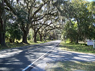
Floral City is a census-designated place (CDP) in Citrus County, Florida, United States. The population was 5,216 at the 2010 census. The community is home to the Floral City Heritage Hall Museum and hosts the Floral City Heritage Days the first weekend in December. The area has a history of phosphate mining and includes historic homes.

<span class="mw-page-title-main">Lecanto, Florida</span> Census-designated place in Florida, US

Lecanto is an unincorporated community and census-designated place (CDP) in Citrus County, Florida, United States. As of the 2010 census it had a population of 5,882, up from 5,161 in 2000. It is home to several county government facilities such as the Citrus County Sheriff's Office and the Citrus Campus of the College of Central Florida.

<span class="mw-page-title-main">Spring Hill, Florida</span> Census-designated place in Hernando County Florida, United States

Spring Hill is a census-designated place (CDP) in Hernando County, Florida, United States. The population was 113,568 at the 2020 census, up from 98,621 at the 2010 census. Spring Hill belongs to Florida's Nature Coast region and is in the Tampa-St. Petersburg-Clearwater metro area. It is east of Hernando Beach, southwest of Brooksville, and north of Tampa.

<span class="mw-page-title-main">Egypt Lake-Leto, Florida</span> Census-designated place in Florida, United States

Egypt Lake-Leto is a census-designated place (CDP) in an unincorporated part of Hillsborough County, Florida, United States. The CDP is located just north of Tampa International Airport. It is part of the Tampa Bay area. As of the 2020 US census, the population had 36,644 residents.

<span class="mw-page-title-main">Northdale, Florida</span> Census-designated place in Florida, United States

Northdale is an unincorporated census-designated place in Hillsborough County, Florida, United States. Northdale was named by the combination of the words in North Dale Mabry, the main highway through the Northdale area. The population was 22,079 at the 2010 census.

<span class="mw-page-title-main">Riverview, Florida</span> Census-designated place in Florida, United States

Riverview is an unincorporated census-designated place in Hillsborough County, Florida, United States. It is located south of Brandon. The population was 107,396 in the 2020 census, up from 71,050 in the 2010 census.

<span class="mw-page-title-main">Town 'n' Country, Florida</span> Census-designated place in Florida, United States

Town 'n' Country is a census-designated place (CDP) in Hillsborough County, Florida, United States. The population was 85,951 at the 2020 census.

<span class="mw-page-title-main">University, Hillsborough County, Florida</span> Census-designated place in Florida, United States

University is an unincorporated census-designated place in Hillsborough County, Florida, United States. The population was 41,163 at the 2010 census, up from 30,736 at the 2000 census. The University of South Florida is located just southeast of the community, within the Tampa city limits. The community is also known as "University West", mainly due to its location in relation to the university. The community is often notoriously referred to by locals as "Suitcase City" due to the high rate of transients.

<span class="mw-page-title-main">Valrico, Florida</span> Census-designated place in Florida, United States

Valrico is a census-designated place (CDP) in Hillsborough County, Florida, United States. As of 2020 the population was 37,895.
<span class="mw-page-title-main">Westchase, Florida</span> Census-designated place in Florida, United States

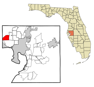
Westchase is a census-designated place (CDP) in Hillsborough County, Florida, United States. The population was 21,747 at the 2010 census, up from 11,116 at the 2000 census. The census area encompasses most of the 33626 ZIP code area.

<span class="mw-page-title-main">Palm Springs North, Florida</span> Census-designated place in Florida

Palm Springs North is an unincorporated community and census-designated place (CDP) in Miami-Dade County, Florida, United States. It is part of the Miami metropolitan area of South Florida. The population was 5,030 at the 2020 census.

<span class="mw-page-title-main">Westchester, Florida</span> Census-designated place in Florida

Westchester is a census-designated place (CDP) and neighborhood in Miami-Dade County, Florida. It is part of the Miami metropolitan area of South Florida. Prior to the 2020 U.S. Census, the neighboring University Park CDP was merged into Westchester CDP, effectively doubling its geography and population. Per the 2020 census, the population was 56,384.

<span class="mw-page-title-main">Trinity, Florida</span> CDP in Florida, United States

Trinity is a census-designated place (CDP) in Pasco County, Florida, United States. The population was 10,907 in 2010, according to the most recent census. The Trinity Community is named after Trinity College of Florida, a Bible college founded in 1932, when it relocated to the first occupied site in the communities developed by James Gills in the late 1980s. The main plaza is found near the high school, known as Mitchell Ranch Plaza. Trinity is located at the junction where Pasco, Hillsborough and Pinellas Counties meet. The community of Longleaf is located in Trinity and it is believed that the “Welcome Plank” originated in Longleaf.

<span class="mw-page-title-main">Wesley Chapel, Florida</span> CDP in Florida, United States

Wesley Chapel is a census-designated place in Pasco County, Florida, United States. Wesley Chapel is a suburb in the Tampa Bay Area.
<span class="mw-page-title-main">Terrytown, Louisiana</span> Census-designated place in Louisiana, United States

Terrytown is an unincorporated community and census-designated place (CDP) in Jefferson Parish, Louisiana, United States. It is on the "Westbank" of the Mississippi River. It is a suburb within the New Orleans–Metairie–Kenner metropolitan statistical area. The population was 23,319 at the 2010 census, and 25,278 in 2020.

Garyville is a census-designated place (CDP) in St. John the Baptist Parish, Louisiana, United States. The population was 2,775 at the 2000 census and 2,123 in 2020. It is part of the New Orleans–Metairie–Kenner Metropolitan Statistical Area.

Wallace is a census-designated place (CDP) in St. John the Baptist Parish, Louisiana, United States. The population was 570 at the 2000 census. It is part of the New Orleans–Metairie–Kenner Metropolitan Statistical Area. The rural community is on the west bank of the Mississippi River and easily accessible to Interstate 10 via the Gramercy Bridge.

<span class="mw-page-title-main">Milford Mill, Maryland</span> Census-designated place in Maryland, United States

Milford Mill is an unincorporated community and census-designated place in Baltimore County, Maryland, United States. Per the 2020 census, the population was 30,622.
<span class="mw-page-title-main">Carrollwood (CDP), Florida</span> Census-designated place in Florida, United States

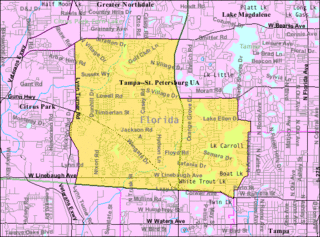
Carrollwood is a census-designated place (CDP) in northwestern Hillsborough County, Florida, United States. The census area includes the unincorporated communities of Carrollwood and Carrollwood Village. For the 2000 census the area was enumerated under the name "Greater Carrollwood". A similar area was listed as "Lake Carroll" in 1970 and 1980; for the 1990 census it was split into the smaller Carrollwood and Carrollwood Village CDPs. The population was 34,352 at the 2020 census.

References

  1. "2020 U.S. Gazetteer Files". United States Census Bureau. Retrieved October 31, 2021.
  2. "U.S. Census website". United States Census Bureau . Retrieved January 31, 2008.
  3. "US Board on Geographic Names". United States Geological Survey. October 25, 2007. Retrieved January 31, 2008.
  4. 1 2 "Geographic Identifiers: 2010 Demographic Profile Data (G001): Citrus Park CDP, Florida". American Factfinder. U.S. Census Bureau. Retrieved May 2, 2017.[ dead link ]
  5. "US Gazetteer files: 2010, 2000, and 1990". United States Census Bureau. February 12, 2011. Retrieved April 23, 2011.
  6. "CENSUS OF POPULATION AND HOUSING (1790-2000)". U.S. Census Bureau . Retrieved July 17, 2010.
  7. "Explore Census Data". data.census.gov. Retrieved May 25, 2022.
  8. "About the Hispanic Population and its Origin". www.census.gov. Retrieved May 18, 2022.
  1. Note: the US Census treats Hispanic/Latino as an ethnic category. This table excludes Latinos from the racial categories and assigns them to a separate category. Hispanics/Latinos can be of any race. [8]