Cladach

Last updated

Cladach
The Wineport - Cladach - geograph.org.uk - 2359501.jpg
The Wineport
North Ayrshire UK location map.svg
Red pog.svg
Cladach
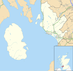
Location within North Ayrshire
OS grid reference NS012376
Civil parish
  • Kilbride
Council area
Lieutenancy area
Country Scotland
Sovereign state United Kingdom
Post town ISLE OF ARRAN
Postcode district KA27
Dialling code 01770
Police Scotland
Fire Scottish
Ambulance Scottish
UK Parliament
Scottish Parliament
List of places
UK
Scotland
55°35′31″N5°09′14″W / 55.592°N 5.154°W / 55.592; -5.154

Note: Cladach is a general Scottish Gaelic word for "beach" or "shore" and occurs in many Scottish placenames

Contents

Cladach (Scottish Gaelic : An Cladach) is a tiny settlement on the Isle of Arran, Scotland. The settlement is within the parish of Kilbride. [1] In the vicinity of the island's main village, Brodick, Cladach is the site of the Cladach Sawmill and in more recent times, the Arran Brewery. The company, Arran Aromatics is located nearby, as is Brodick Castle.
History

Cladach was in the past a much larger settlement, and was in fact the site of the original village on Brodick Bay, with modern Brodick being built on the south side of the Bay later. [2] There were in the past a series of houses on the Coast Road in Cladach, but they were demolished many years ago.

There were also a series of houses that were let to employees of the sawmill by the sawmill owners. However, in recent years Cladach has essentially been depopulated and the buildings that used to house residents either demolished or converted into small businesses.

Geography

Cladach sits on the eastern coast of the Isle of Arran, off the Coast Road across the Brodick Bay from Brodick.

Economy

The Cladach Visitors' Centre is now the main attraction on the site of Cladach.

Cladach is the usual starting point for climbers who seek to ascend Goat Fell mountain. An entrance into Brodick Castle Gardens is also located in Cladach.

There is a hydroelectric scheme based at Cladach. Water is taken from a reservoir at around 800 ft on the slopes of Goat Fell and electricity is generated at the turbines behind the Sawmill. The original electricity generation was for the Castle which was one of the first places in Scotland to receive electricity along with the Castle on Rùm.

A courthouse, which was demolished in 2004, used to post important messages about hearings and agriculture on an Ash tree outside its doors. Locals still put posters up advertising events, which echo this long held tradition.

The restaurant is called the Wineport, named after the former port 500 yards north, a small harbour which was where supplies for the village and castle were landed.

Related Research Articles

<span class="mw-page-title-main">North Ayrshire</span> Council area of Scotland

North Ayrshire is one of 32 council areas in Scotland. The council area borders Inverclyde to the north, Renfrewshire and East Renfrewshire to the northeast, and East Ayrshire and South Ayrshire to the east and south respectively. The local authority is North Ayrshire Council, formed in 1996 with the same boundaries as the district of Cunninghame which existed from 1975 to 1996.

<span class="mw-page-title-main">Brodick</span> Village in Scotland

Brodick is the main village on the Isle of Arran, in the Firth of Clyde, Scotland. It is halfway along the east coast of the island, in Brodick Bay below Goat Fell, the tallest mountain on Arran. The name is derived from the Norse "breda-vick" meaning "Broad Bay".

<span class="mw-page-title-main">Lamlash</span> Town in Scotland

Lamlash is a village on the Isle of Arran, in the Firth of Clyde, Scotland. It lies three miles south of the island's main settlement and ferry port Brodick, in a sheltered bay on the island's east coast, facing the Holy Isle. Lamlash is the seat of Arran's local government offices, and is also the location of the island's police station, secondary school and hospital. In common with the rest of the island, the village's main industry is tourism and the public sector is also an important employer. Lamlash has an RNLI Lifeboat station with a B class Atlantic 75 lifeboat, covering the inshore waters around the coast of Arran, and in summer, there is a regular ferry service from Lamlash harbour to Holy Isle. The village has several buildings of historical interest, including Hamilton Terrace, which consists of two rows of single storey-and-attic cottages on the Lamlash seafront, arranged in pairs.

<span class="mw-page-title-main">Lochranza</span> Village in Scotland

Lochranza is a village located on the Isle of Arran in the Firth of Clyde, Scotland. The population, somewhat in decline, is around 200 people.

<span class="mw-page-title-main">Whiting Bay</span> Village in Scotland

Whiting Bay is a village located on the Isle of Arran in the Firth of Clyde, Scotland four miles south of Lamlash and eight miles south of Brodick. With more than 600 inhabitants it’s the third largest village on the island of Arran, behind Lamlash and Brodick.

<span class="mw-page-title-main">Holy Island, Firth of Clyde</span> Island in the Firth of Clyde, Scotland

The Holy Island or Holy Isle is an island in the Firth of Clyde, off the west coast of central Scotland, inside Lamlash Bay on the larger Isle of Arran. The island is around 3 kilometres long and around 1 kilometre wide. Its highest point is the hill Mullach Mòr.

<span class="mw-page-title-main">County of Bute</span> Historic county in Scotland

The County of Bute, also known as Buteshire, is a historic county and registration county of Scotland.

<span class="mw-page-title-main">Goat Fell</span> Mountain in Scotland

Goat Fell is the highest point on the Isle of Arran. At 874 metres (2,867 ft), it is one of four Corbetts on the island. The mountain, along with nearby Brodick Castle, is now owned by the National Trust for Scotland.

<span class="mw-page-title-main">Brodick Castle</span> Castle in Brodick, Arran, Scotland

Brodick Castle is a castle situated outside the port of Brodick on the Isle of Arran, an island in the Firth of Clyde, Scotland. It was previously a seat of the Dukes of Hamilton, but is now owned by the National Trust for Scotland. The castle is a Category A listed building and the grounds are included in the Inventory of Gardens and Designed Landscapes in Scotland.

<span class="mw-page-title-main">Ardrossan</span> Town and sea port in Scotland

Ardrossan is a town on the North Ayrshire coast in southwestern Scotland. The town has a population of 10,670 and forms part of a conurbation with Saltcoats and Stevenston known as the 'Three Towns'. Ardrossan is located on the east shore of the Firth of Clyde.

<span class="mw-page-title-main">Fairlie, North Ayrshire</span> Human settlement in Scotland

Fairlie is a village in North Ayrshire, Scotland.

<span class="mw-page-title-main">West Kilbride</span> Village in North Ayrshire, Scotland

West Kilbride is a village and historic parish in North Ayrshire, Scotland, on the west coast by the Firth of Clyde, looking across the Firth of Clyde to Goat Fell and the Isle of Arran. West Kilbride and adjoining districts of Seamill and Portencross are generally considered to be a small town, having a combined population of 4,393 at the 2001 census.

<span class="mw-page-title-main">Ballygrant</span> Human settlement in Scotland

Ballygrant is a small village on the Inner Hebrides island of Islay of the western coast of Scotland. The village is within the parish of Killarow and Kilmeny.

<span class="mw-page-title-main">Corrie, Arran</span> Human settlement in Scotland

Corrie is a village on the north east coast of the Isle of Arran in Scotland, 6 miles north of Brodick. It lies 2 mi (3 km) due east under the island's highest mountain, Goat Fell. A path from High Corrie 34 mi (1.2 km) to the south, provides access to the hillside. Corrie, and its northern neighbour, Sannox, lie approximately halfway between Brodick and Lochranza.

<span class="mw-page-title-main">Kildonan, Arran</span> Human settlement in Scotland

Kildonan is a village on the south coast of the Isle of Arran in the Firth of Clyde, Scotland. The village is within the parish of Kilmory.

<span class="mw-page-title-main">Sannox</span> Human settlement in Scotland

Sannox is a village on the Isle of Arran, Scotland. The village is within the parish of Kilbride. The name comes from the name the Vikings gave to the area, Sandvik, meaning the Sandy Bay.

<span class="mw-page-title-main">Sleeping Warrior</span>

The Sleeping Warrior is the profile of the north Arran hills in Scotland as seen from the Ayrshire coast. It is a well-known site that takes its name from a resemblance to a resting human figure. Various interpretations of the profile exist although the view of the Witches Step and Caisteal Abhail from North Ayrshire and Bute is arguably the most convincing.

<span class="mw-page-title-main">Isle of Arran</span> Island off the coast of Scotland

The Isle of Arran or simply Arran is an island off the west coast of Scotland. It is the largest island in the Firth of Clyde and the seventh-largest Scottish island, at 432 square kilometres (167 sq mi). Historically part of Buteshire, it is in the unitary council area of North Ayrshire. In the 2011 census it had a resident population of 4,629. Though culturally and physically similar to the Hebrides, it is separated from them by the Kintyre peninsula. Often referred to as "Scotland in Miniature", the Island is divided into highland and lowland areas by the Highland Boundary Fault and has been described as a "geologist's paradise".

<span class="mw-page-title-main">Arran Hydro-Electric Schemes</span> Power stations on Arran, Firth of Clyde, Scotland

There are several hydro-electric schemes on the Isle of Arran, an island in the Firth of Clyde, Scotland. Most of them were installed during the early 21st century, but one is considerably older.

References

  1. "Details of Parish of Kilbride". Scottish Places. Retrieved 31 December 2014.
  2. "Brodick History". Arran Hideaways. Archived from the original on 22 July 2006. Retrieved 22 September 2006.