
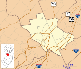
Mercer County is a county located in the U.S. state of New Jersey. Its county seat is Trenton, the state capital. The county constitutes the Trenton-Princeton, NJ Metropolitan Statistical Area and is considered part of the New York Combined Statistical Area by the United States Census Bureau, but also directly borders the Philadelphia metropolitan area and is included within the Federal Communications Commission's Philadelphia Designated Market Area. As of the 2019 Census estimate, the county's population was 367,430, making it the state's 12th-most populous county, an increase of 2.2% from the 2010 United States Census, when its population was enumerated at 366,513, in turn an increase of 15,752 (4.5%) from the 350,761 enumerated in the 2000 Census, retaining its position as the 12th-most populous county in the state.

East Windsor Township is a township in Mercer County, New Jersey, United States. The township is part of the New York Metropolitan area as defined by the United States Census Bureau, but directly borders the Philadelphia metropolitan area and is part of the Federal Communications Commission's Philadelphia Designated Market Area. As of the 2010 United States Census, the township's population was 27,190, reflecting an increase of 2,271 (+9.1%) from the 24,919 counted in the 2000 Census, which had in turn increased by 2,566 (+11.5%) from the 22,353 counted in the 1990 Census.

Ewing Township is a township in Mercer County, New Jersey, United States. The township is within the New York metropolitan area as defined by the United States Census Bureau. It also directly borders the Philadelphia metropolitan area and is part of the Federal Communications Commission's Philadelphia Designated Market Area. As of the 2010 United States Census, the township's population was 35,790, reflecting an increase of 83 (+0.2%) from the 35,707 counted in the 2000 Census, which had increased by 1,522 (+4.5%) from the 34,185 counted in the 1990 Census.

Lawrence Township is a township in Mercer County, New Jersey, United States. The township is part of the New York Metropolitan area as defined by the United States Census Bureau, but directly borders the Philadelphia metropolitan area and is part of the Federal Communications Commission's Philadelphia Designated Market Area. As of the 2010 United States Census, the township's population was 33,472, reflecting an increase of 4,313 (+14.8%) from the 29,159 counted in the 2000 Census, which had in turn increased by 3,372 (+13.1%) from the 25,787 counted in the 1990 Census.

Twin Rivers is an unincorporated community and census-designated place (CDP) located within East Windsor Township, in Mercer County, New Jersey, United States. As of the 2010 United States Census, the CDP's population was 7,443. Twin Rivers was the first planned unit development in New Jersey.

Robbinsville Township is a township in Mercer County, New Jersey, United States. The township is part of the New York Metropolitan area as defined by the United States Census Bureau, but directly borders the Philadelphia metropolitan area and is part of the Federal Communications Commission's Philadelphia Designated Market Area. As of the 2010 United States Census, the township's population was 13,642, reflecting an increase of 3,367 (+32.8%) from the 10,275 counted in the 2000 Census, which had in turn increased by 4,460 (+76.7%) from the 5,815 counted in the 1990 Census. The township is named for George R. Robbins, who served in the United States House of Representatives from 1855 to 1859 and lived in the area.

West Windsor is a township in Mercer County, New Jersey, in the United States. The township is part of the New York metropolitan area as defined by the United States Census Bureau. As of the 2010 United States Census, the township's population was 27,165, reflecting an increase of 5,258 (+24.0%) from the 21,907 counted in the 2000 Census, which had in turn increased by 5,886 (+36.7%) from the 16,021 counted in the 1990 Census.

Plainsboro Township is a township in Middlesex County in the U.S. state of New Jersey. The township is centrally located in the Raritan Valley region and is a part of the New York metropolitan area. As of the 2010 United States Census, the township's population was 22,999, reflecting an increase of 2,784 (+13.8%) from the 20,215 counted in the 2000 Census, which had in turn increased by 6,002 (+42.2%) from the 14,213 counted in the 1990 Census.
Interstate 95 (I-95) is a major Interstate Highway that traverses nearly the full extent of the East Coast of the United States, from Florida to Maine. In the state of New Jersey, it runs along much of the mainline of the New Jersey Turnpike, as well as the Pearl Harbor Memorial Extension, and the New Jersey Turnpike's I-95 Extension to the George Washington Bridge for a total of 77.96 mi (125.46 km). Located in the northeastern part of the state near New York City, the 11.03-mile (17.75 km) Western Spur of the New Jersey Turnpike, considered to be Route 95W by the New Jersey Department of Transportation (NJDOT), is also part of I-95.
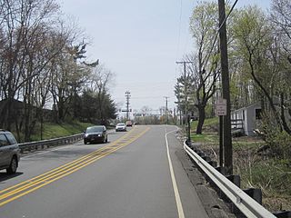
County Route 571 is a county highway in the U.S. state of New Jersey. The highway extends 43.96 miles (70.75 km) from Route 37 in Toms River Township to Route 27 in Princeton. Though it is designated a north–south county route by the New Jersey Department of Transportation (NJDOT), it is signed both as north–south and east–west inconsistently.
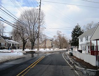
Dutch Neck is an unincorporated community located within West Windsor Township in Mercer County, New Jersey, United States. The community is centered about the intersection of Village Road and South Mill Road and has in the vicinity numerous churches, West Windsor Volunteer Fire Company No. 1, Dutch Neck Elementary School, and many residences. The community was founded by the Voorhees and Bergen families c. 1737.
Smithburg is an unincorporated community located where the municipal boundaries of Freehold, Manalapan and Millstone townships intersect in Monmouth County, New Jersey, United States. County Route 527 and Monmouth Road pass through the center of the quaint village of Smithburg.
Etra is an unincorporated community located within East Windsor Township, in Mercer County, New Jersey, United States. It consists mostly of residential homes and farmland. East Windsor's largest park, Etra Lake Park, is located just east of the community.

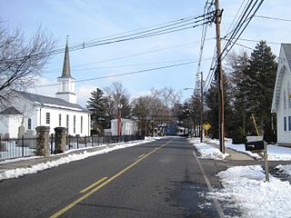
Locust Corner is an unincorporated community located within East Windsor Township in Mercer County, New Jersey, United States. The corner itself refers to the intersection of Princeton-Hightstown Road, County Route 571, and Old Trenton Road, CR 535. To the southeast of the intersection is the western terminus of the Hightstown Bypass, New Jersey Route 133. Much of the area has developed into commercial office spaces including on what was once the site of RCA Astro Electronics' headquarters.

Penns Neck is an unincorporated community located within West Windsor Township in Mercer County, New Jersey, United States. The community developed at the intersection of the Trenton-New Brunswick Turnpike and Washington Road. The Penns Neck Circle and the historic Penns Neck Baptist Church (1812) are both located in Penns Neck. The Princeton Branch rail line, known as the Dinky, has run through the area since 1865, and stopped at Penns Neck station until January 1971.
Eldridge Park is an unincorporated community located within Lawrence Township in Mercer County, New Jersey, United States. The neighborhood is named for Stephen Eldridge, a farm owner in the township in the early 20th century. The neighborhood itself was established in 1906 as a settlement along the Trenton & Princeton Traction Company trolleyline and Lawrence Road for European immigrants to purchase small houses in the suburbs of Trenton. The growing population led to the construction of the Eldridge Park Elementary School and St. Ann's, the township's first Roman Catholic church. As it was in the past, the area is mostly made up of small houses with businesses clustered around US 206.

Top Road is a neighborhood located within the city of Trenton in Mercer County, New Jersey, United States. Much of Top Road was once part of Lawrence Township and then was added to the now-defunct Millham Township before being annexed by Trenton in 1888.
Lawrence Station is an unincorporated community located within Lawrence Township in Mercer County, New Jersey, United States. The settlement is named for a former railroad station on the Pennsylvania Railroad's New York Division line, now a part of the Northeast Corridor. Today, some wooded areas and buildings from the time of the station remain but more townhouse developments, cultural centers, and industrial facilities are located along the main road through the area, Lawrence Station Road.

Berrien City, also known simply as Berrien, is an unincorporated community located within West Windsor Township in Mercer County, New Jersey, United States. The area is located within the Princeton Junction census designated place centered about the intersection of Alexander Road and Scott Avenue, located within walking distance of the Princeton Junction train station and Princeton-Hightstown Road. It was developed as an upper-middle class development after World War I and features homes constructed about 100 years ago. Most of the homes still exist with some small businesses located along Alexander Road with the West Windsor Arts Center operating its facilities out of the former Princeton Junction Fire Company fire station.


