Trenton is the capital city of the U.S. state of New Jersey and the county seat of Mercer County. It briefly served as the capital of the United States in 1784. The city's metropolitan area, consisting of Mercer County, is grouped with the New York Combined Statistical Area by the United States Census Bureau, but it directly borders the Philadelphia metropolitan area and was from 1990 until 2000 part of the Philadelphia Combined Statistical Area. As of the 2010 United States Census, Trenton had a population of 84,913, making it the state's 10th-largest municipality after having been the state's ninth-largest municipality in 2000. The population declined by 490 (-0.6%) from the 85,403 counted in the 2000 Census, which had in turn declined by 3,272 (-3.7%) from the 88,675 counted in the 1990 Census. The Census Bureau's Population Estimates Program calculated that the city's population was 83,203 in 2019, ranking the city the 413th-most-populous in the country.
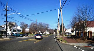
Route 27 is a state highway in New Jersey, United States. It runs 38.53 mi (62.01 km) from U.S. Route 206 in Princeton, Mercer County northeast to an interchange with Route 21 and Broad Street in Newark, Essex County. The route passes through many communities along the way, including New Brunswick, Highland Park, Edison, Metuchen, Rahway, and Elizabeth. Route 27 is a two- to four-lane undivided highway for most of its length, passing through a variety of urban and suburban environments. It intersects many roads along the way, including Route 18 in New Brunswick, Interstate 287 in Edison, the Garden State Parkway in Woodbridge Township, Route 35 in Rahway, Route 28 in Elizabeth, and U.S. Route 22 in Newark. Route 27 crosses the Raritan River on the Albany Street Bridge, which connects Highland Park on the east with New Brunswick on the west.

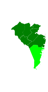
Mercer County is a county located in the U.S. state of New Jersey. Its county seat is Trenton, the state capital. The county constitutes the Trenton–Princeton Metropolitan Statistical Area and is considered part of the New York Combined Statistical Area by the United States Census Bureau, but also directly borders the Philadelphia metropolitan area and is included within the Federal Communications Commission's Philadelphia Designated Market Area. As of the 2019 Census estimate, the county's population was 367,430, making it the state's 12th-most populous county, an increase of 2.2% from the 2010 United States Census, when its population was enumerated at 366,513, in turn an increase of 15,752 (4.5%) from the 350,761 enumerated in the 2000 Census, retaining its position as the 12th-most populous county in the state.

Ewing Township is a township in Mercer County, New Jersey, United States. The township is within the New York metropolitan area as defined by the United States Census Bureau. It also directly borders the Philadelphia metropolitan area and is part of the Federal Communications Commission's Philadelphia Designated Market Area. As of the 2010 United States Census, the township's population was 35,790, reflecting an increase of 83 (+0.2%) from the 35,707 counted in the 2000 Census, which had increased by 1,522 (+4.5%) from the 34,185 counted in the 1990 Census.

Lawrence Township is a township in Mercer County, New Jersey, United States. The township is part of the New York Metropolitan area as defined by the United States Census Bureau, but directly borders the Philadelphia metropolitan area and is part of the Federal Communications Commission's Philadelphia Designated Market Area. As of the 2010 United States Census, the township's population was 33,472, reflecting an increase of 4,313 (+14.8%) from the 29,159 counted in the 2000 Census, which had in turn increased by 3,372 (+13.1%) from the 25,787 counted in the 1990 Census.
U.S. Route 206 is a 130.23-mile-long (209.58 km) north–south United States highway in New Jersey and Pennsylvania, United States. Only about a half a mile of its length is in Pennsylvania; the Milford–Montague Toll Bridge carries it over the Delaware River into New Jersey, where the remainder of the route is. The highway's northern terminus is near Milford, Pennsylvania at an intersection with US 209; some sources and signs show an overlap with US 209 to end at its parent route US 6. Its southern terminus is in Hammonton, New Jersey at an intersection with US 30 and Route 54. For much of its length, US 206 is a rural two-lane undivided road that passes through the Pine Barrens, agricultural areas, and the Appalachian Mountains of northwestern New Jersey, with some urban and suburban areas. The route connects several cities and towns, including Bordentown, Trenton, Princeton, Somerville, Roxbury, Netcong, and Newton. The road is known as the Disabled American Veterans Highway for much of its length.
County Route 583 is a county highway in the U.S. state of New Jersey. Its northern end is at an intersection with Route 27 in Princeton; its southern end is in a concurrency with U.S. Route 1 Business and U.S. Route 206 at an intersection with County Route 653 in Trenton.
Central Jersey is a central region of the U.S. state of New Jersey. The designation of Central New Jersey with a distinct toponym is a colloquial one rather than an administrative one.

Route 92 was a 6.7-mile (10.8 km) proposed branch of the New Jersey Turnpike that would have run from west to east, beginning at U.S. Route 1 just north of Ridge Road in South Brunswick Township, east along Route 32, to Exit 8A in Monroe Township. Route 92 was also assigned in the 1953 renumbering and by the late 1950s it was named the Princeton–Hightstown Bypass, a freeway planned to connect the Somerset Freeway in Montgomery Township, with Route 33 in East Windsor Township. In 1987, the planned Route 92 was truncated to only run east from U.S. Route 1 near Kingston. New plans were announced in 1994, this time running to US 1 near Princeton. After public hearings found opposition was still strong, the planned route was truncated to a much shorter bypass of Hightstown only and numbered Route 133. Construction on the road, the first project awarded under New Jersey's modified Design-build program, began on September 20, 1996 and was opened November 30, 1999.
U.S. Route 1 Business is a four-lane surface road that provides an alternate route to the Trenton Freeway northeast of Trenton in Mercer County, New Jersey. The route is 2.73 mi (4.39 km) long and runs between US 1 in Trenton and Lawrence Township. On the border of Trenton and Lawrence Township, US 1 Bus. intersects the northbound direction of US 206 at the Brunswick Circle. The route was once part of a longer U.S. Route 1 Alternate, which continued southwest through downtown Trenton and into Morrisville, Pennsylvania.

North Trenton is a neighborhood located within the city of Trenton in Mercer County, New Jersey, United States.
County Route 546 is a county highway in the U.S. state of New Jersey. The highway begins at Route 29 within the Titusville, New Jersey section of Hopewell Township and extends 9.98 miles (16.06 km) to U.S. Route 1 (US 1) in Lawrence Township. The road runs entirely within Mercer County.
County Route 533 is a county highway in the U.S. state of New Jersey. The highway extends 32.78 miles (52.75 km) from the White Horse Circle, in Hamilton Township to Middlesex CR 607 on the border of Bound Brook and Middlesex Borough. CR 533 shares a long concurrency with U.S. Route 206 through Princeton and Montgomery Township, while portions of the roadway in Somerset County are part of the Millstone River Valley Scenic Byway.
County Route 518 is a county highway in the U.S. state of New Jersey. The highway extends 20.58 miles (33.12 km) from Route 165 in Lambertville to Lincoln Highway in Franklin Township. It is also known as the Georgetown Franklin Turnpike.
U.S. Route 1 is a United States highway which parallels the East Coast of the United States, running from Key West, Florida in the south to Fort Kent, Maine at the Canadian border in the north. Of the entire length of the route, 66.06 miles (106.31 km) of it runs through New Jersey. It enters the state from Pennsylvania on the Trenton–Morrisville Toll Bridge over the Delaware River in the state capital of Trenton, running through the city on the Trenton Freeway. From here, US 1 continues northeast as a surface divided highway through suburban areas continuing into Middlesex County and passing through New Brunswick and Edison. US 1 merges with US 9 in Woodbridge, and the two routes continue through northern New Jersey as US 1/9 to the George Washington Bridge over the Hudson River in Fort Lee. At this point, the road continues into New York City along with I-95.

Harneys Corner is an unincorporated community located within Lawrence Township in Mercer County, New Jersey, United States. It is located at the intersection of Lawrence Road and Princeton Pike / Avenue. Located in the southern portion of the township close to the Trenton and Ewing borders, the area consists of small houses on nearby side streets and businesses along the aforementioned arterial roads. The intersection itself is located about 0.3 miles (0.48 km) north of the Brunswick Circle.

Penns Neck is an unincorporated community located within West Windsor Township in Mercer County, New Jersey, United States. The community developed at the intersection of the Trenton-New Brunswick Turnpike and Washington Road. The Penns Neck Circle and the historic Penns Neck Baptist Church (1812) are both located in Penns Neck. The Princeton Branch rail line, known as the Dinky, has run through the area since 1865, and stopped at Penns Neck station until January 1971.
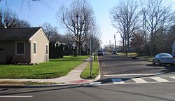
Eldridge Park is an unincorporated community located within Lawrence Township in Mercer County, New Jersey, United States. The neighborhood is named for Stephen Eldridge, a farm owner in the township in the early 20th century. The neighborhood itself was established in 1906 as a settlement along the Trenton & Princeton Traction Company trolleyline and Lawrence Road for European immigrants to purchase small houses in the suburbs of Trenton. The growing population led to the construction of the Eldridge Park Elementary School and St. Ann's, the township's first Roman Catholic church. As it was in the past, the area is mostly made up of small houses with businesses clustered around US 206.

Battle Monument, also known as Five Points, is a neighborhood located within the city of Trenton in Mercer County, New Jersey, United States. The name Battle Monument is in reference to the Trenton Battle Monument, which sits just south of the Five Points formed from the intersection of Pennington Avenue, Princeton Avenue, Brunswick Avenue, North Broad Street and North Warren Street. The Philadelphia and Reading Railroad Freight Station is in the neighborhood.