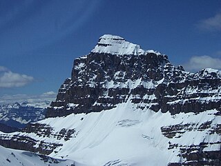
Mount Temple is a mountain in Banff National Park of the Canadian Rockies of Alberta, Canada.

The Peace River is a 1,923-kilometre-long (1,195 mi) river in Canada that originates in the Rocky Mountains of northern British Columbia and flows to the northeast through northern Alberta. The Peace River joins the Athabasca River in the Peace-Athabasca Delta to form the Slave River, a tributary of the Mackenzie River. The Finlay River, the main headwater of the Peace River, is regarded as the ultimate source of the Mackenzie River. The combined Finlay–Peace–Slave–Mackenzie river system is the 13th longest river system in the world.

Maligne Lake is a lake in Jasper National Park, Alberta, Canada. It is famed for the colour of its water, the surrounding peaks, the three glaciers visible from the lake and Spirit Island, a frequently photographed islet. The lake is located 44 km (27 mi) south of Jasper town, and is accessible by motor vehicle, including shuttle buses from Jasper. Boat tours run to Spirit Island in the spring to autumn season. The 44 km Skyline Trail, Jasper's most popular, highest and above treeline, multi-day hike, begins at Maligne Lake and finishes near the town of Jasper. Other popular day hikes include the Opal Hills and Bald Hills loops. Winter activities include cross-country skiing.

The Elbow River is a river in southern Alberta, Canada. It flows from the Canadian Rockies to the city of Calgary, where it merges into the Bow River.

The Red Deer River is a river in Alberta and a small portion of Saskatchewan, Canada. It is a major tributary of the South Saskatchewan River and is part of the larger Saskatchewan-Nelson system that empties into Hudson Bay.

The Smoky River is a river in western Alberta, Canada. It is a major tributary of the Peace River. The descriptive name refers to the presence of "smouldering beds of coal in the riverbank" noted by the Cree Indians.

Abraham Lake, also known as Lake Abraham, is an artificial lake and Alberta's largest reservoir. It is located in the "Kootenay Plains area of the Canadian Rockies' front range", on the North Saskatchewan River in western Alberta, Canada.

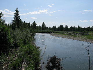
The Brazeau River is a river in western Alberta, Canada. It is a major tributary of the North Saskatchewan River.
Cardinal River is a short river in western Alberta, Canada. It flows from the Canadian Rockies, and empties into the Brazeau River, itself a major tributary of the North Saskatchewan River.
The Jackpine River is an early tributary of the Smoky River. It forms in the Canadian Rockies, within Willmore Wilderness Park, in the province of Alberta, north of Jasper National Park. The river collects the runoff from Resthaven Mountain, Barricade Mountain, Jackpine Mountain, Mount Holmes, Perseverance Mountain, and Draco Peak.
The Muddywater River is an early tributary of the Smoky River. It forms in the Canadian Rockies, within Willmore Wilderness Park, in the province of Alberta, north of Jasper National Park. The Muddywater forms at Morkill Pass, on the Continental Divide between Alberta and British Columbia.
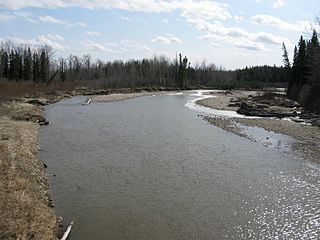
The Freeman River is a short river in west-central Alberta. The Freeman takes its name from the fur traders, who, after leaving the employ of the Hudson's Bay Company or the North West Company, decided to remain in the interior and work as free trappers or free hunters.
The Ram River is a river rising in the Alberta Rocky Mountains. It flows eastward, taking on the North Ram River, before joining the North Saskatchewan River near the Town of Rocky Mountain House. The name Ram Rivulet appears on a David Thompson map of 1814. A ram is a male Rocky Mountain Sheep.
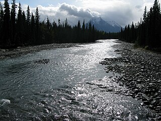
The Whirlpool River is a short river in Jasper National Park, Alberta, Canada. It is an early tributary of the Athabasca River.
The James River is a medium-sized river in central Alberta. It is a tributary of the Red Deer River.

The Medicine River is a medium-sized river in central Alberta. It begins at the outlet of Medicine Lake, north of Rocky Mountain House. The Medicine River initially travels through the Rocky Mountain House Grazing Reserve, a protected area with over 15,000 acres (61 km2) of land set aside for cattle grazing and recreation. The river flows southwest, taking on a number of creeks before passing Eckville. The Medicine River joins the Red Deer River north of Innisfail, downstream of the Dickson Dam, at the Medicine Flats. The Medicine is bridged by Alberta highways 53, 12, 11, and 54.

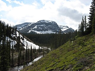
Mount Peskett is a 3,124-metre (10,249-foot) mountain summit located in the North Saskatchewan River valley of Alberta, Canada. Mount Peskett is situated in the Canadian Rockies on the northern boundary the Siffleur Wilderness Area. Its nearest higher peaks are Mount Loudon, 3.7 km (2.3 mi) to the south, and Siffleur Mountain 3.7 km to the southeast. Mount Peskett can be seen from Highway 11, the David Thompson Highway. Precipitation runoff from the mountain flows north via Loudon Creek and Spreading Creek which are both tributaries of the North Saskatchewan River.