Clovelly Park is named after the village in Devon, England of the same name.
History
The original inhabitants of the area, the Kaurna, lived mainly along the Sturt River which passes several hundred metres to the south of the suburb's southern boundary.[citation needed] Richard Hamilton, whose family became major wine producers in the state, planted the first vineyard in the area in 1838, just two years after the colony of South Australia was founded. Settlers followed, planting vineyards, market gardens and almond orchards around the banks of the Sturt River and the creeks further to the north in what later became Clovelly Park.[citation needed]
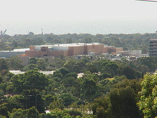
Clovelly Park is situated on former Viaduct and Watts Creek. Following World War II, Clovelly Park was opened up for limited housing and the bitumising of roads began. Prior to widespread development in the mid 1950s, Clovelly Park remained a farming and agricultural region with a large number of vineyards and almond orchards. In 1955, Chrysler Australia purchased 71 hectares (180 acres) of land in Clovelly Park and built a car assembly plant which was opened in 1964,[2] and was, at the time, the largest such operation under one roof in the southern hemisphere. For several years following the establishment of the Chrysler plant, Clovelly Park was also often referred to as Chrysler Park, due to misprints in street directories incorrectly labeling the Clovelly Park railway station as Chrysler Park railway station.[citation needed]
The Clovelly Park Post Office opened on 15 November 1950 and was renamed St Marys in 1967.[3]
During the 1960s, urban encroachment by the city of Adelaide[dubious–discuss] enabled developers to build on the remaining farms, many bankrupted by rising land taxes and council rates. Created was a small semi-town very similar to that of modern-day Sellicks Beach or McLaren Vale. The late 1960s saw Clovelly Park and most other suburbs of Marion turn into a 'family friendly' establishment due to the introduction of parks, reserves, and in the 1970s, playgrounds.[citation needed] This establishment although toned down, stands today.[citation needed]
During the 1980s, major shopping centres in surrounding suburbs opened.{cn}}
The southern part of Clovelly Park was often called Tonsley Park. Chrysler, and later on Mitsubishi, referred to their 'Tonsley Park' plant[4] This part of Clovelly Park (including the former Mitsubishi Motors Australia Limited (MMAL) plant) was separated and renamed Tonsley on 27 January 2017.[5][6]
Schools and childcare
Clovelly Park Primary School, originally known as Mitchell Park Primary School. It was renamed in 1995 following the closure of Tonsley Park Primary School.
The area contains a government primary school – Clovelly Park Primary School – which caters to approximately 300 students[8] and includes a New Arrivals Program (NAP) for young migrant students.[9] The nearest government secondary school is Mitchell Park's Hamilton Secondary College (formerly Mitchell Park Technical College). St Bernadette's School in St. Marys is a lower-primary Catholic school, teaching from reception to grade 5, and is located on the other (eastern) side of South Road.[10]Sacred Heart College Middle School in Mitchell Park provides Catholic schooling for boys in grades 6–9,[11] while Westminster School is an independent Uniting Church school catering for approximately 1000 students from reception to year 12, and is located in the nearby suburb of Marion.[12]
A plan to convert an existing shopping complex on South Road into an independent primary school for the Exclusive Brethren[14] was initially approved by the City of Marion's Development Assessment Panel,[15] before being successfully challenged in the Supreme Court by a local business owner.[16]
Clovelly Park Primary School houses the office of Family Life SA[17] which delivers programs and provides resources on sexuality education to schools around the state.[18]
Finally, Clovelly Park was the location of the former Marion High School, established 1955, which closed in 1996.[19] The old high school grounds were converted into a housing estate,[20] but the school hall remains as a community centre.[19]
Shopping
An Aldi opened in Clovelly Park in 2020, and the Park Holme Shopping Centre is within walking distance of the residential portion of the suburb. In addition, South Road provides ready access to the CBD and to Castle Plaza in Edwardstown,[21] while Westfield Marion in Oaklands Park possesses over 300 stores[22] (with a forthcoming expansion increasing the number by an additional 90)[23] and is readily accessible by road and public transport.[24]
Parks and community halls
Rosslyn Avenue Reserve, the largest public open area within Clovelly Park
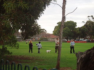
The largest park within the suburb is Rosslyn Avenue Reserve, which sits between Rosslyn Avenue and Beverley Street at the northern end of the suburb. Rosslyn Avenue Reserve has a playground, seating and a playing area.[25]
The Clovelly Park Reserve lies between Scottish and Australian Avenues. It features a playground, a community hall, electric barbecues and tennis courts that can be hired by the general public.[25]
Cosgrove Hall is all that remains of Marion High School.
Slightly further south, on the site of the former Marion High School, sits Cosgrove Hall – the original school hall and gymnasium.[19] The hall can be hired for a variety of purposes, and the site includes the Graham Watts Playground (completed in February 2006, and named after the long-serving local councillor),[26] a basketball net and undercover seating. The hall can be found on the corner of York Street and Scott Avenue.[25] (Officially opened September 2007). Cosgrove Hall is also the unofficial home of Zero1 Pro Wrestling Australia who run professional wrestling events at the Hall.[27]
On the corner of Kensington Street and Windsor Avenue, just west of Cosgrove Hall, is situated Kensington Reserve. While it doesn't possess any play equipment, it does provide seating.
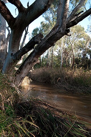
Byron Avenue Reserve, which resides next to the old Clovelly Park Scout Hall on Byron Avenue, encompasses 0.49 hectares which are in the process of being revegetated with pre-European flora.[28] The reserve contains 200-year-old river red gums, and used to include Viaduct Creek before the creek was built over as part of the Chrysler/Mitsubishi development.[29]
Finally, hidden behind units on Cohen Court and the southern end of Windsor Avenue is a small reserve containing seating and a playground.
Although not located in Clovelly Park, the adjacent Mitchell Park Reserve on Bradley Grove provides a full-sized playing oval, a community hall, tennis courts, barbecues, large open spaces and two playgrounds.[30]
Health and community services
Known as The Southern Clinic from 1959 to 1974, the Clovelly Park Community Health Centre provides health services for the area, with six medical doctors on staff. The clinic is open Monday to Saturday, and out-of-hours appointments can be organised for Sundays. Counseling and related services are available through the Inner Southern Community Health Service , which includes the Aboriginal Health House on the corner of Wingfield Street and Newton Avenue. More serious cases are handled at the Flinders Medical Centre, which is a short drive away and directly accessible by public transport.
The Marion St. John Ambulance station opened its doors on Sturt road in late 1965 to provide ambulance services and first aid services for community events. The Marion station area of operation initially covered O'Halloran Hill to Edwardstown and from the coast to the foothills, including Belair in the east. Many locals from the age of 11 began training as cadets in February of that year in order to man the station and ambulances were purchased through community fund-raising.[citation needed] In 1989, concern over the use of volunteers depriving them of overtime, weekend and shift work led paid ambulance officers to conduct significant industrial disruption, leading to the state Labor government handing the service and vehicles to the paid staff and the removal of volunteers. Paid officers from the Marion station collected the ambulances from the all-volunteer Blackwood station after their last shift at 8 am on Monday, 6 May 1991, which was the last use of a volunteer ambulance crew in Adelaide.[citation needed]
Notable residents
Dean Southgate, local doctor. Along with Dr Hugh Lloyd established The Southern Clinic in 1959 and was instrumental in gaining government support for The Southern Clinic to become a community health centre which was re-opened in 1974 as the Clovelly Park Community Health Centre.[31]
Street in Clovelly Park, looking west from South RoadThe disused Mitsubishi plant
The suburb lies adjacent to South Road to the east, and Marion Road lies a short distance to the west. South Road is the main north–south arterial road in Adelaide, and thus it provides rapid access to a large portion of the city. Limited east-west travel is facilitated through Daws Road/Oaklands Road to the north and Sturt Road to the south.
Clovelly Park is well serviced by public transport. Frequent buses run along South Road, and both the 213 and 297 run through the centre of the suburb. In addition, the northern residential portion of Clovelly Park is serviced by the Mitchell Park railway station on the Flinders railway line. The Seaford railway line, which provides more services than the Tonsley line, is close by and is accessible via the Ascot Park railway station to the north of the suburb.
Politics
The suburb is part of the federal seat of Boothby held by Louise Miller-Frost and the state seats of Elder and Mitchell.
Related Research Articles
Flinders University is a public research university based in Adelaide, South Australia, with a footprint extending across 11 locations in South Australia and the Northern Territory. Founded in 1966, it was named in honour of British navigator Matthew Flinders, who explored and surveyed the Australian and South Australian coastline in the early 19th century.
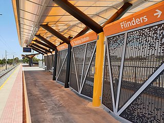
Tonsley railway station is located on the Flinders line in the south-western Adelaide suburb of Tonsley, 12.2 kilometres from Adelaide station. The original station was 13 kilometres from Adelaide and was the terminus of the line from its opening in 1966 until the station's closure in 2019; the station was then relocated to its current position and opened in 2020.
Southern Expressway is an 18.5 km (11.5 mi) freeway through the southern suburbs of Adelaide, South Australia. It is the southern part of the North–South Corridor which extends the full length of Adelaide and is being built to urban freeway standard. It is designated part of route M2.
Oaklands railway station is located on the Seaford railway line in Adelaide, South Australia. It is in the south-western suburb of Oaklands Park, 13 kilometres from Adelaide station.
Marion is a suburb in the City of Marion, around 10 kilometres (6.2 mi) south-west of the city centre of Adelaide, the capital of South Australia. Founded as a rural village in 1838 on the banks of the Sturt River, Marion was found to have rich soil and the population expanded rapidly. Colonel William Light laid out the plan for the village, as he had done with the City of Adelaide itself.
The City of Marion is a local government area in part of the southern and western suburbs of Adelaide, South Australia. The council offices are in the suburb of Sturt.
Glengowrie is a suburb of the Australian city of Adelaide, approximately 12 kilometres south west of the city centre. The name Glengowrie means "Glen of Gowrie", so called in honour of Lord Gowrie, Governor-General of Australia from 1936 to 1944.
Grange is a coastal suburb of the City of Charles Sturt, in Adelaide, South Australia, located about 11 kilometres (6.8 mi) from the Adelaide city centre. The suburb is named after Captain Charles Sturt's cottage, built in 1840–41, which still stands and is now a museum. In addition to Grange Beach, the suburb has several parks and reserves, as well as the Grange Hotel, which was originally licensed in 1881.
The Flinders line is a suburban commuter line in Adelaide, South Australia, that branches off the Seaford line at Mitchell Park, and ends opposite Science Park, close to the Flinders University and the Flinders Medical Centre. The line is single track for most of its length, from Celtic Avenue, near Mitchell Park station, to its terminus.
Ascot Park is a suburb in the south-western part of Adelaide in the City of Marion. It was named after Ascot Racecourse in England.
Oaklands Park is a southern suburb of Adelaide, South Australia in the City of Marion. The Marion Shopping Centre is a major feature of the suburb.
Park Holme is a south-western suburb of Adelaide in the City of Marion, South Australia, located about 8 km (5 mi) from the Adelaide city centre. It is bordered to the east by Marion Road, to the west by Hendrie Street, to the south by Oaklands Road, and to the north by Tarranna Ave, which is just south of Bray Street. It is adjacent to Ascot Park, Edwardstown, South Plympton, Mitchell Park, Clovelly Park, Glengowrie, Morphettville and Oaklands Park. Park Holme covers 115 hectares, (1.15 sq km).
Flinders Park is a western suburb of Adelaide, South Australia. It is located in the City of Charles Sturt.
Woodlands Park railway station is the junction station for the Seaford and Flinders lines. Situated in the inner south-western Adelaide suburb of Edwardstown, it is 9.1 kilometres from Adelaide station.
Clovelly Park railway station was a railway station located on the Flinders line in the south-western Adelaide suburb of Mitchell Park.
Kilkenny is an inner north-western suburb of Adelaide, South Australia. It is located in the City of Charles Sturt. It is named after Kilkenny, Ireland.
St Marys is a suburb of Adelaide, South Australia, located to the south of the Central Business District. It is bordered by Daws Road (north), South Road (west), Cashel Street (east) and Mill Terrace (south). The suburb is located within the City of Mitcham local government authority. St Marys Park is one of the largest reserves within the suburb and was originally the training ground of the South Adelaide Football Club.
The Sturt River, also known as the Sturt Creek and Warri Parri (Warriparri) in the Kaurna language, is a river located in the Adelaide region of the Australian state of South Australia.
Tonsley is a southern suburb of Adelaide, the capital city of South Australia.
↑ Donley, R. J. R (2001). Marion 1945 — 2000: A Suburban City. Norwood, South Australia: Peacock Publishers. ISBN1-876087-52-8.
↑ "Clovelly Park Primary School". South Australian Government: Department of Education and Children's Services. Archived from the original on 15 September 2006. Retrieved 4 July 2008.
↑ Michelmore, Karen (26 January 1998). "Australia Day Honors 1998; Far-sighted doctor has vision for the future". The Advertiser. (Resides in Belair, South Australia but practices at the Southern Cross Clinic in Clovelly Park).
This page is based on this Wikipedia article Text is available under the CC BY-SA 4.0 license; additional terms may apply. Images, videos and audio are available under their respective licenses.