
Marion is a suburb in the City of Marion, around 10 kilometres (6.2 mi) south-west of the city centre of Adelaide, the capital of South Australia. Founded as a rural village in 1838 on the banks of the Sturt River, Marion was found to have rich soil and the population expanded rapidly. Colonel William Light laid out the plan for the village, as he had done with the City of Adelaide itself.
Glengowrie is a suburb of the Australian city of Adelaide, approximately 12 kilometres south west of the city centre. The name Glengowrie means "Glen of Gowrie", so called in honour of Lord Gowrie, Governor-General of Australia from 1936 to 1944.
Everard Park is a small inner south-western suburb of Adelaide in the City of Unley, once part of the extensive land holdings of the prominent colonist Dr. Charles George Everard, and the location of "Marshfield", the home of part of his family.
Plympton is an inner south-western suburb of Adelaide, South Australia. The name is believed to have been given by Henry Mooringe Boswarva to a private subdivision in the area, naming after his home town in Devon, England. It was accepted as an official name for the suburb in 1944.
Thebarton, formerly Theberton, on Kaurna land, is an inner-western suburb of Adelaide, South Australia in the City of West Torrens. The suburb is bounded by the River Torrens to the north, Port Road and Bonython Park to the east, Kintore Street to the south, and South Road to the west.
Edwardstown is an inner southern-western suburb located 6 km southwest of Adelaide in the City of Marion.

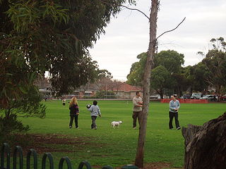
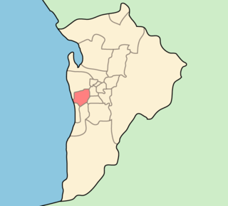
Park Holme is a south-western suburb of Adelaide in the City of Marion, South Australia, located about 8 km (5 mi) from the Adelaide city centre. It is bordered to the east by Marion Road, to the west by Hendrie Street, to the south by Oaklands Road, and to the north by Tarranna Ave, which is just south of Bray Street. It is adjacent to Ascot Park, Edwardstown, South Plympton, Mitchell Park, Clovelly Park, Glengowrie, Morphettville and Oaklands Park. Park Holme covers 115 hectares, (1.15 sq km).

Plympton Park is a western suburb of Adelaide 8 km from the CBD, in the state of South Australia and falls under the City of Marion. The post code for Plympton Park is 5038. It is adjacent to Park Holme, Plympton, South Plympton, and Morphettville. It is bordered to the east by Marion Road, to the west by Park Terrace, to the south by Taranna Avenue and to the north by the Glenelg tram line.
South Plympton is a suburb of Adelaide in the City of Marion.
The City of West Torrens is a local government area in the western suburbs of Adelaide, South Australia. Since the 1970s the area was mainly home to many open spaces and parks, however after the mid-1990s (1993-1995) the LGA became more residential.

The Metropolitan Adelaide Transport Study, or "MATS Plan" as it became known, was a comprehensive transport plan released in 1968 proposing a number of road and rail transport projects for the metropolitan area of Adelaide, South Australia.

Croydon Park is a north-western suburb of Adelaide 5.9 km from the CBD, in the state of South Australia, Australia and is within the City of Port Adelaide Enfield. It is adjacent to Dudley Park, Devon Park, Renown Park, Regency Park, Ferryden Park Kilkenny, and West Croydon. The post code for Croydon Park is 5008. It is bounded to the south by Lamont Street and Torrens Road, to the north by Regency Road and in the east and west by Harrison Road and Goodall Avenue respectively. Croydon Park is predominantly a residential suburb, with a warehousing presence on the northern edges near Regency Road. Croydon Park has been completely divided by the North-South Motorway.
Cross Road is a major arterial road that travels east–west through the inner southern suburbs of the Australian city of Adelaide. Its western terminus is at Anzac Highway, travelling east and ending at Glen Osmond and the Adelaide Hills, joining the junction of Glen Osmond Road, Portrush Road, and South Eastern Freeway.

The Anzac Highway is an 8.7-kilometre-long (5.4 mi) main arterial road heading southwest from the city of Adelaide, the capital of South Australia, to the beachside suburb of Glenelg.

Fulham is a western suburb of Adelaide, South Australia. It is located in the City of West Torrens.

Glenelg North is a seaside suburb of Adelaide, South Australia. It is located in both the City of Holdfast Bay and the City of West Torrens.

Glenelg East is a residential suburb 9 kilometres (5.6 mi) south west of the centre of Adelaide, South Australia. It is characterised by quarter-acre blocks with heritage homes and parks intermingled with contemporary modern homes and low-rise multi-dwelling units.

Richmond is an inner urban suburb of Adelaide, South Australia. It is located on Kaurna land in the City of West Torrens.
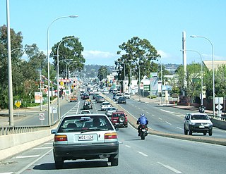
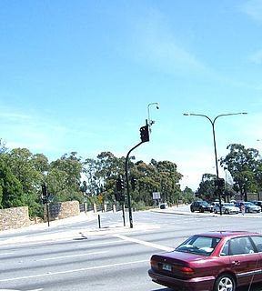
Marion Road is a north–south conduit through the western suburbs of Adelaide, South Australia. It forms part of State Route number A14.
