Northampton is a market town and civil parish in the East Midlands of England, on the River Nene, 60 miles (97 km) north-west of London and 50 miles (80 km) south-east of Birmingham. The county town of Northamptonshire, Northampton is one of the largest towns in England; it had a population of 212,100 at the 2011 census.

The London Borough of Islington is a London borough in Inner London. The borough includes a significant area to the south which forms part of central London. Islington has an estimated population of 215,667. It was formed in 1965 under the London Government Act 1963, which simultaneously abolished the metropolitan boroughs of Islington and Finsbury.
Northwood is an area in northwest London, England. It is located within the London Borough of Hillingdon on the border with Hertfordshire and 14.5 miles (23.3 km) from Charing Cross. Northwood was part of the ancient parish of Ruislip, Middlesex and has formed part of Greater London since 1965.

The London Borough of Bexley is a London borough in south-east London, forming part of Outer London. It has a population of 248,287. The main settlements are Sidcup, Erith, Bexleyheath, Crayford, Welling and Old Bexley. The London Borough of Bexley is within the Thames Gateway, an area designated as a national priority for urban regeneration. The local authority is Bexley London Borough Council.

Beeston is a town in the Borough of Broxtowe, Nottinghamshire, England, 3.4 miles (5.5 km) south-west of Nottingham city centre. To its north-east is the University of Nottingham's main campus, University Park. The pharmaceutical and retail chemist group Boots has its headquarters 0.6 miles (1 km) east of the centre of Beeston, on the border with Broxtowe and the City of Nottingham. To the south lie the River Trent and the village of Attenborough, with extensive wetlands.

Wellingborough is a large market and commuter town in the unitary authority area of North Northamptonshire in the ceremonial county of Northamptonshire, England, 65 miles from London and 11 miles (18 km) from Northampton on the north side of the River Nene.
Rushden is a market town and civil parish in North Northamptonshire, England, around 13 miles (21 km) east of Northampton. The parish is on the border with Bedfordshire, 18 miles (29 km) north of Bedford.

Duston is a suburb of Northampton and a civil parish in West Northamptonshire, England.
Wootton is a former village about 3 miles (4.8 km) south of Northampton town centre that is now part of Northampton.

Milton Malsor is a village and civil parish in West Northamptonshire, England. The population of the civil parish at the 2011 census was 761. It is 4 miles (6.4 km) south of Northampton town centre, 45 miles (72 km) south-east of Birmingham, and 66 miles (106 km) north of central London; junction 15 of the M1 motorway is 2 miles (3.2 km) east by road. The area of the Milton Malsor civil parish is about 1,650 acres (670 ha), stretching from north of the M1 motorway between junctions 15 and 15A, south to the West Coast Main Line, east to the A508 and A45 roads, and west to the A43 road.
Redhill Grange or (Redhill) is a purpose-built settlement in Wellingborough, Northamptonshire. It is situated just north from the Redwell area in the market town and eleven miles from the county town Northampton, forming part of the district authority of the borough of Wellingborough, now in North Northamptonshire.
West Hunsbury is a large housing estate in the south of the town of Northampton, 2 miles (3 km) from the town centre, 0 miles (0 km) from the M1 motorway, junction 15A and 2 miles (3 km) from junction 15. The motorway can be seen and heard as most of the area is elevated and the wind's prevailing direction is westerly. It is part of the Hunsbury residential area, which also constitutes East Hunsbury east of Towcester Road. Shelfleys is an earlier name for the area and still appears on signs, maps and bus destination indicators. However Hunsbury is an old name. Iron ore was formerly quarried in the area. This had begun by 1873 and an ironworks called Hunsbury Ironworks was in the course of being built in that year. The quarries were worked by several companies and individual owners, two of which companies used the name "Hunsbury" in their titles. The area is part of the Borough of Northampton. The area was developed in the 1970s, 1980s, 1990s and 2000s as part of the expansion of Northampton.
Solihull is a market town and the administrative centre of the wider Metropolitan Borough of Solihull in West Midlands County, England. The town had a population of 123,187 at the 2011 Census. Historically in Warwickshire, Solihull is situated on the River Blythe in the Forest of Arden area. Solihull's wider borough had a population of 214,909 at the 2011 Census.

Collingtree is a village and civil parish in the West Northamptonshire district of Northamptonshire, England. It is part of the Northampton built-up area.

East Hunsbury is a large residential area in the south of the town of Northampton, England, 3 miles (5 km) from the town centre and 1 mile (2 km) from junction 15 of the M1 motorway. For administrative purposes it is part of the unitary authority of West Northamptonshire. It is part of the Hunsbury residential area, which also includes West Hunsbury on the west side of Towcester Road. Shelfleys is the original name for the area of Northampton currently referred to as West Hunsbury. The name of West Hunsbury still appears on maps for the district as Shelfleys. Merefield is the corresponding name for East Hunsbury, together with the name "Blackymore" for the eastern part of East Hunsbury. All three names are still on local direction signs in Northampton, although older references are no longer in use by the local people living there. The areas developed in the 1980s and 1990s as part of the expansion of Northampton. The Northampton loop of the West Coast Main Line railway running between Northampton and London Euston runs under East and West Hunsbury via the Hunsbury Hill Tunnel emerging near Hill Farm Rise which follows the original course of Towcester Road prior to the 1980s. Ventilation shafts are visible in the housing estate in Yeoman Meadow. East Hunsbury was awarded ‘Best Large Village’ in 2019 by NorthantsAcre.
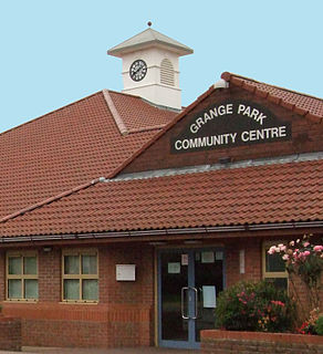
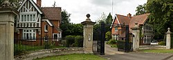
Grange Park is an affluent large village just outside Northampton in West Northamptonshire.

Fulwell is a neighbourhood of outer South West London in the historic County of Middlesex and the London Borough of Richmond upon Thames. It straddles the west of the generally firmer borders of Twickenham and Teddington, reinforced as local postcode districts. The name is first known in documents of the fifteenth century. It may be from a reliably full well or a corruption of foul well.
Wootton Brook is a tributary of the River Nene which runs through Northamptonshire, England.

St. James End also known as simply St. James and historically St James's End is a district west of the town centre in Northampton, England. The area developed from the mid to late 19th century particularly with the expansion of the shoe manufacturing and engineering industries, and also the extension of the railway from London in June 1882.
Northampton Town Council is the parish council covering the majority of the town of Northampton, England. The council is the largest parish level authority in England by population served. The council has its headquarters at Northampton Guildhall.