Cotton End, Northampton

Last updated

Cotton End
Cotton End, Northampton, England.jpg
View from West Cotton Close, Cotton End looking east towards the White Hart pub on the road 'Cotton End'
Northamptonshire UK location map (2021).svg
Red pog.svg
Cotton End
Location within Northamptonshire
OS grid reference SP750596
  London 67 miles
District
Shire county
Region
Country England
Sovereign state United Kingdom
Post town NORTHAMPTON
Postcode district NN4 8B_ and NN4 8R_
Police Northamptonshire
Fire Northamptonshire
Ambulance East Midlands
UK Parliament
  • Northampton South
List of places
UK
England
Northamptonshire
52°13′19″N0°54′14″W / 52.222°N 0.904°W / 52.222; -0.904

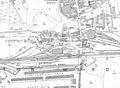
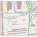
Cotton End is a small district of the town of Northampton, England, about half a mile south of the town centre, north of the area known as Far Cotton and west of the road from South Bridge to Ransome Road known as Cotton End. [1] The district population is included in the Delapre and Briar Hill Ward of Northampton Council.

Contents

History

The area was established as a small industrial site in the late 19th century. On the 1899 1:2500 Ordnance Survey map the site is located to the west and south of South Bridge over the River Nene between the river and the former Bedford to Northampton railway line and north of the Old Towcester Road and the former Bridge Street railway station (opened 1845). [2] The area appears to have been entirely industrial in contrast to the area south of the railway line which is the residential area of Far Cotton.

In the 1990s the area was cleared and used for housing with the name of Old Towcester Road changed to West Cotton Close.

The area to the east of the original Cotton End is shown on the old Ordnance Survey map as having some industrial units close to the south bank of the river with a goods shed, other railway works and a pub and offices fronting the main road. This area was also referred to as Cotton End and became entirely industrial with removal of the railway sidings. During the 1990s part of this site fronting the river was also developed as housing off a new road called New South Bridge Road as the Old Towcester Road industrial development was out of date. Part of the site next to the river was occupied by a large iron foundry, Rice & Co, which was on the site from 1928-1997. [3]

The Northampton Branch of the Grand Union Canal from Blisworth runs adjacent to the north of the site, just south of the River Nene, joining with the river via a lock.

1998 floods

In April 1998, many residents of both Far Cotton and Cotton End had to leave their homes and seek temporary accommodation elsewhere, after part of the whole area, along with another part of Northampton, St. James, suffered flooding, when the River Nene broke its banks. Flooding occurred on Good Friday, 10 April 1998, a day which became known locally as "the long Good Friday". Since then river banks have been raised and flood mitigation lakes created west of the town.

Area maps and views

Related Research Articles

<span class="mw-page-title-main">Northampton</span> Town in Northamptonshire, England

Northampton is a market town and civil parish in Northamptonshire, England. It is the county town of Northamptonshire and the administrative centre of the unitary authority of West Northamptonshire. The town is situated on the River Nene, 60 miles (97 km) north-west of London and 50 miles (80 km) south-east of Birmingham. Northampton is one of the largest towns in England; the population of its urban area was recorded as 245,899 in the 2021 census.

<span class="mw-page-title-main">River Nene</span> River in eastern England

The River Nene is a river in the east of England that rises from three sources in Northamptonshire. The river is about 105 miles (169 km) long, about 3.7 miles (6.0 km) of which forms the border between Cambridgeshire and Norfolk. It is the tenth-longest river in the United Kingdom, and is navigable for 88 miles (142 km), from Northampton to The Wash.

<span class="mw-page-title-main">South Northamptonshire</span> Former local government district in England

South Northamptonshire was a local government district in Northamptonshire, England, from 1974 to 2021. Its council was based in the town of Towcester, first established as a settlement in Roman Britain. The population of the Local Authority District Council in 2011 was 85,189.

<span class="mw-page-title-main">Milton Malsor</span> Human settlement in England

Milton Malsor is a village and civil parish in West Northamptonshire, England. The population of the civil parish at the 2011 census was 761. It is 4 miles (6.4 km) south of Northampton town centre, 45 miles (72 km) south-east of Birmingham, and 66 miles (106 km) north of central London; junction 15 of the M1 motorway is 2 miles (3.2 km) east by road. The area of the Milton Malsor civil parish is about 1,650 acres (670 ha), stretching from north of the M1 motorway between junctions 15 and 15A, south to the West Coast Main Line, east to the A508 and A45 roads, and west to the A43 road.

<span class="mw-page-title-main">Blackburn Brook</span> Stream in Sheffield, South Yorkshire, England

The Blackburn Brook is a stream in Sheffield, South Yorkshire, England which flows through the Blackburn Valley along the M1 and Ecclesfield Road and joins the River Don near the Meadowhall shopping centre. Downstream from the A61 road at Chapeltown the Blackburn Brook is defined as a main river by the Environment Agency, which requires new building development to be at least 26 feet (8 m) from the bank side as a flood defence measure and to allow access to the watercourse for maintenance.

<span class="mw-page-title-main">Busby, East Renfrewshire</span> Human settlement in Scotland

Busby is a village in East Renfrewshire, Scotland. Busby is in the same urban area as Glasgow, although it is administratively separate. It lies on the White Cart Water six miles south of Glasgow City Centre and 34 mile northwest of the outskirts of East Kilbride. It directly adjoins the town of Clarkston, with which the village is closely associated.

West Hunsbury is a large housing estate in the south of the town of Northampton, 2 miles (3 km) from the town centre, 0 miles (0 km) from the M1 motorway, junction 15A and 2 miles (3 km) from junction 15. The motorway can be seen and heard as most of the area is elevated and the wind's prevailing direction is westerly. It is part of the Hunsbury residential area, which also constitutes East Hunsbury east of Towcester Road. Shelfleys is an earlier name for the area and still appears on signs, maps and bus destination indicators. However Hunsbury is an old name. Iron ore was formerly quarried in the area. This had begun by 1873 and an ironworks called Hunsbury Ironworks was in the course of being built in that year. The quarries were worked by several companies and individual owners, two of which companies used the name "Hunsbury" in their titles. The area is part of the Borough of Northampton. The area was developed in the 1970s, 1980s, 1990s and 2000s as part of the expansion of Northampton.

<span class="mw-page-title-main">East Hunsbury</span> Human settlement in England

East Hunsbury is a large residential area in the south of the town of Northampton, England, 3 miles (5 km) from the town centre and 1 mile (2 km) from junction 15 of the M1 motorway. For administrative purposes it is part of the unitary authority of West Northamptonshire. It is part of the Hunsbury residential area, which also includes West Hunsbury on the west side of Towcester Road. Shelfleys is the original name for the area of Northampton currently referred to as West Hunsbury. The name of West Hunsbury still appears on maps for the district as Shelfleys. Merefield is the corresponding name for East Hunsbury, together with the name "Blackymore" for the eastern part of East Hunsbury. All three names are still on local direction signs in Northampton, although older references are no longer in use by the local people living there. The areas developed in the 1980s and 1990s as part of the expansion of Northampton. The Northampton loop of the West Coast Main Line railway running between Northampton and London Euston runs under East and West Hunsbury via the Hunsbury Hill Tunnel emerging near Hill Farm Rise which follows the original course of Towcester Road prior to the 1980s. Ventilation shafts are visible in the housing estate in Yeoman Meadow. East Hunsbury was awarded ‘Best Large Village’ in 2019 by NorthantsAcre.

Kislingbury is a village in Northamptonshire, England, about 4 miles (6 km) west of Northampton town centre, and close to junctions 15A and 16 of the M1 motorway.

<span class="mw-page-title-main">Lea Valley Walk</span> Long-distance footpath in South East England

The Lea Valley Walk is a 50-mile (80 km) long-distance path located between Leagrave, the source of the River Lea near Luton, and the Thames, at Limehouse Basin, Limehouse, east London. From its source much of the walk is rural. At Hertford the path follows the towpath of the River Lee Navigation, and it becomes increasingly urbanised as it approaches London. The walk was opened in 1993 and is waymarked throughout using a swan logo.

<span class="mw-page-title-main">Far Cotton</span> Human settlement in England

Far Cotton is a district of Northampton and former civil parish, now in the parish of Far Cotton and Delapre, in the West Northamptonshire district, in the ceremonial county of Northamptonshire, England. It was once a village in its own right.

Wootton Brook is a tributary of the River Nene which runs through Northamptonshire, England.

<span class="mw-page-title-main">Rochdale Branch Canal</span>

The Rochdale Branch Canal was a branch of the Rochdale Canal in north-west England which led close to Rochdale Town Centre. It was in use from 1794, and was bordered by the landscaped gardens of Lark Mill House on the western bank until the 1850s. A number of industries grew up around the branch, ranging from cotton mills and an iron and brass foundry in the early years, to a bakery and jam manufactory, woollen mills and sawmills later on. The branch declined with the main canal, and was little used after the 1920s, although not officially abandoned until 1952. It was filled in during the 1960s, and the site of the main basins now lies beneath the car park of a retail shopping centre.

<span class="mw-page-title-main">River Hipper</span> River in England

The River Hipper is a tributary of the River Rother in Derbyshire, England. Its source is a large expanse of wetlands, fed by the surrounding moors between Chatsworth and Chesterfield, known as the Hipper Sick on Beeley Moor, which is part of the Chatsworth Estate. It then passes through Holymoorside and down into Chesterfield, just south of the town centre, before flowing into the River Rother. In July 2007, parts of Chesterfield flooded when the River Hipper burst its banks during a substantial storm that caused extensive flooding in North Derbyshire and South Yorkshire. The surrounding landscape is known as the Hipper Valley.

<span class="mw-page-title-main">River Drone</span> River in Derbyshire, England

The River Drone is a river which flows south from its source on the Sheffield, South Yorkshire, border. It flows through Dronfield, Unstone and Unstone Green in Derbyshire before merging at Sheepbridge to the north of Chesterfield with the Barlow Brook. Below the junction, it is often referred to as the River Whitting. It then flows south-east till it merges with the River Rother at Brimington Road North (B6050) at Chesterfield. It is one of the three main tributaries of the Rother.

<span class="mw-page-title-main">Stoneferry</span>

Stoneferry is a suburb of Kingston upon Hull, East Riding of Yorkshire, England. It was formerly a small hamlet on the east bank of the River Hull, the site of a ferry, and, after 1905, a bridge. The area is primarily industrial, and is situated on the east bank of the river, as well as close by areas on the west bank.

<span class="mw-page-title-main">Easton Neston</span> Human settlement in England

Easton Neston is situated in south Northamptonshire, England. Though the village of Easton Neston which was inhabited until around 1500 is now gone, the parish retains the name. At the 2011 Census the population of the civil parish remained less than 100 and was included in the town of Towcester.

<span class="mw-page-title-main">St. James End, Northampton</span> Human settlement in England

St. James End, also known as St. James, colloquially as Jimmy's End, and historically as St James's End, is a district west of the town centre in Northampton, England. The area developed from the mid to late 19th century particularly with the expansion of the shoe manufacturing and engineering industries, and also the extension of the railway from London in June 1882.

<span class="mw-page-title-main">Victoria Park, Northampton</span>

Victoria Park is a public green space in St. James End, Northampton, England, south of Spencer Bridge Road. The park has open grass areas and lines and belts of trees. A stream, a tributary of the River Nene flows from north to south through the park on the east side next to the railway line. A small stream, Dallington Brook, also flows through the park from the north-west joining the Nene tributary. The park has an area of about 6.5 hectares.

Northampton Greyhound Stadium was a greyhound racing and speedway stadium located on what was South Bridge Road, Northampton, Northamptonshire, East Midlands.

References

  1. Brown, Cynthia (7 December 1990). Northampton 1835-1985. Phillimore & Co Ltd. ISBN   0-8503-3767-4.
  2. Page, William (1930). A History of the County of Northampton. Vol. 3. Phillimore & Co Ltd. pp. 1–26. ISBN   0-8503-3767-4. Archived from the original on 24 October 2012. Retrieved 6 January 2014.
  3. Rice's Foundry History on Far Cotton History site, Accessed 6 January 2014