Confidence, West Virginia

Last updated

Confidence
USA West Virginia location map.svg
Red pog.svg
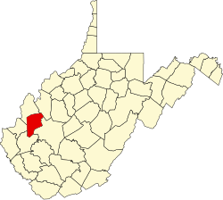
Confidence
Location within the state of West Virginia
Usa edcp location map.svg
Red pog.svg
Confidence
Confidence (the United States)
Coordinates: 38°34′21″N81°49′43″W / 38.57250°N 81.82861°W / 38.57250; -81.82861
Country United States
State West Virginia
County Putnam
Time zone UTC-5 (Eastern (EST))
  Summer (DST) UTC-4 (EDT)
GNIS feature ID1554182 [1]

Confidence is an unincorporated community in Putnam County West Virginia, United States, located on WV 34. The community is served by Confidence Elementary School. Confidence is a part of the Huntington-Ashland Metropolitan Statistical Area (MSA). As of the 2010 census, the MSA had a population of 287,702. New definitions from February 28, 2013 placed the population at 363,000. [2]

Related Research Articles

<span class="mw-page-title-main">Greater Richmond Region</span> Metropolitan statistical area in the United States

The Greater Richmond Region, the Richmond metropolitan area or Central Virginia, is a region and metropolitan area in the U.S. state of Virginia, centered on Richmond. The U.S. Office of Management and Budget (OMB) defines the area as the Richmond, VA Metropolitan Statistical Area, a Metropolitan Statistical Area (MSA) used by the U.S. Census Bureau and other entities. The OMB defines the area as comprising 17 county-level jurisdictions, including the independent cities of Richmond, Petersburg, Hopewell, and Colonial Heights. As of 2020, it had a population of 1,314,434, making it the 44th largest MSA in the country.

<span class="mw-page-title-main">Blacksburg–Christiansburg metropolitan area</span>

The Blacksburg-Christiansburg Metropolitan Statistical Area, formerly the Blacksburg-Christiansburg-Radford Metropolitan Statistical Area, is a Metropolitan Statistical Area (MSA) as defined by the United States Office of Management and Budget (OMB) located in the New River Valley of Southwest Virginia. As of the 2020 census, the MSA had a population of 181,863.

<span class="mw-page-title-main">Winchester, VA–WV MSA</span> Metropolitan area in the United States

Winchester, VA–WV MSA is a U.S. metropolitan statistical area (MSA) as defined by the United States Office of Management and Budget (OMB) as of June, 2003. This should not be confused with the City of Winchester, Virginia, the most populous community within this MSA. The population of the MSA as the 2015 U.S. Census Bureau estimates is 133,836.

Ona is a small unincorporated community along US 60 in Cabell County, West Virginia, United States. It is situated roughly halfway between the towns of Barboursville to the west and Milton to the east.

<span class="mw-page-title-main">East Lynn, West Virginia</span> Unincorporated community in West Virginia, United States

East Lynn is an unincorporated community in Wayne County, West Virginia, United States, located along the banks of Twelvepole Creek, approximately eight miles south of the county seat, Wayne. It was also known as Mouth of Little Lynn. East Lynn is a part of the Huntington-Ashland Metropolitan Statistical Area (MSA). As of the 2010 census, the MSA had a population of 287,702. New definitions from February 28, 2013 placed the population at 363,000.

<span class="mw-page-title-main">Charleston metropolitan area, West Virginia</span> Metropolitan statistical area in West Virginia, United States

The Charleston Metropolitan Statistical Area, as defined by the United States Census Bureau, is an area consisting of three counties in West Virginia, anchored by the city of Charleston. It is the largest metropolitan area entirely within the state of West Virginia. While the Huntington Metro Area is more populous, it spans three states, and the core county of the Charleston area, Kanawha County, is more populous than the West Virginia portion of the Huntington area.

<span class="mw-page-title-main">Venezuelan Americans</span> Americans of Venezuelan birth or descent

Venezuelan Americans are Americans who trace their heritage, or part of their heritage, to the nation of Venezuela. The word may refer to someone born in the U.S. of Venezuelan descent or to someone who has immigrated to the U.S. from Venezuela.

The Wheeling, WV-OH Metropolitan Statistical Area, as defined by the United States Census Bureau, is an area consisting of two counties in the Northern Panhandle of West Virginia and one in eastern Ohio, anchored by the city of Wheeling. As of the 2010 census, the MSA had a population of 147,950. This represents a decline of 3.4% from the 2000 census population of 153,172.

<span class="mw-page-title-main">Lesage, West Virginia</span> Census-designated place in West Virginia, United States

Lesage is a census-designated place (CDP) on Ohio River Road in Cabell County, West Virginia, United States. As of the 2010 census, its population was 1,358. It is the nearest community to Clover site, a National Historic Landmark.

<span class="mw-page-title-main">Morgantown metropolitan area</span>

The Morgantown Metropolitan Statistical Area, as defined by the United States Census Bureau, is an area consisting of two counties in North-Central West Virginia, anchored by the city of Morgantown. As of the 2020 census, the MSA had a population of 140,038. The MSA is part of the larger Morgantown–Fairmont Combined Statistical Area.

<span class="mw-page-title-main">Weirton–Steubenville metropolitan area</span> Metropolitan statistical area in the United States

The Weirton–Steubenville, WV–OH Metropolitan Statistical Area, also known as the Upper Ohio Valley, is a metropolitan statistical area consisting of two counties in the Northern Panhandle of West Virginia and one in Ohio, anchored by the cities of Weirton and Steubenville. As of the 2020 census, the MSA had a population of 116,903. This puts it at 334th largest in the United States. It is also included in the larger Pittsburgh–New Castle–Weirton, PA–OH–WV Combined Statistical Area.

The Parkersburg–Vienna metropolitan area, officially the Parkersburg–Vienna, WV Metropolitan Statistical Area as defined by the United States Census Bureau, is an area consisting of two counties in West Virginia, anchored by the cities of Parkersburg and Vienna. As of the 2020 census, the MSA had a population of 89,490. Prior to the 2020 census, the metro area included the city of Marietta, Ohio and Washington County, which has since been redefined as its own micropolitan area. They now form the Parkersburg–Marietta–Vienna, WV-OH Combined Statistical Area.

Sod is an unincorporated community in northeastern Lincoln County, West Virginia, United States. It lies along West Virginia Route 214 east of the town of Hamlin, the county seat of Lincoln County. Sod's elevation is 781 feet (238 m). It has a post office with the ZIP code 25564.

<span class="mw-page-title-main">Dayton metropolitan area</span> Metropolitan area in Ohio, United States

The Dayton, OH Metropolitan Statistical Area, also known as Greater Dayton and the Miami Valley, as defined by the United States Census Bureau, is an area consisting of three counties in the Miami Valley region of Ohio and is anchored by the city of Dayton. As of 2020, it is the fourth largest metropolitan area in Ohio and the 73rd largest metropolitan area by population in the United States with a population of 814,049.

<span class="mw-page-title-main">Madison metropolitan area, Wisconsin</span> Metropolitan statistical area of the United States

The Madison, Wisconsin, metropolitan area, also known as Greater Madison, is the metropolitan area surrounding the city of Madison, Wisconsin. Madison is the state capital of Wisconsin and is Wisconsin's second largest city, and the metropolitan area is also the state's second largest.

<span class="mw-page-title-main">Poughkeepsie–Newburgh–Middletown metropolitan area</span> Metropolitan statistical area in New York, United States

The Poughkeepsie–Newburgh–Middletown Metropolitan Statistical Area, as defined by the United States Census Bureau, is an area consisting of two counties in New York's Hudson Valley, with the cities of Poughkeepsie, Newburgh, and Middletown as its principal cities. As of the 2020 census, the MSA had a population of 679,221. The area was centered on the urban area of Poughkeepsie-Newburgh.

The Hagerstown–Martinsburg Metropolitan Area, officially designated by the United States Office of Management and Budget (OMB) as Hagerstown–Martinsburg, Maryland–West Virginia Metropolitan Statistical Area (MSA), constitutes the primary cities of Hagerstown, Maryland; Martinsburg, West Virginia; and surrounding areas in three counties: Washington County, Maryland; Berkeley County, West Virginia; and Morgan County, West Virginia. The metro area lies mainly within the rich, fertile Cumberland and Shenandoah valleys, and is approximately a 60–90 minute drive from Washington, D.C.; Baltimore, Maryland; and Harrisburg, Pennsylvania; Hagerstown is approximately 75 miles (121 km) driving distance from all three cities. The population of the metropolitan area as of 2008 is 263,753.

Wilsondale is an unincorporated community located in southern Wayne County, West Virginia, United States. Wilsondale has a post office with ZIP code 25699; as of the 2000 Census, the population of this ZIP Code Tabulation Area was 74. It is a part of the Huntington-Ashland, WV-KY-OH, Metropolitan Statistical Area (MSA). As of the 2000 census, the MSA had a population of 288,649.

References

  1. U.S. Geological Survey Geographic Names Information System: Confidence, West Virginia
  2. "Population statistics" (PDF). Archived from the original (PDF) on March 19, 2013.