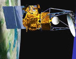
Envisat is a large Earth-observing satellite which has been inactive since 2012. It is still in orbit and considered space debris. Operated by the European Space Agency (ESA), it was the world's largest civilian Earth observation satellite.

The Upper Atmosphere Research Satellite (UARS) was a NASA-operated orbital observatory whose mission was to study the Earth's atmosphere, particularly the protective ozone layer. The 5,900-kilogram (13,000 lb) satellite was deployed from Space Shuttle Discovery during the STS-48 mission on 15 September 1991. It entered Earth orbit at an operational altitude of 600 kilometers (370 mi), with an orbital inclination of 57 degrees.

Jason-1 was a satellite altimeter oceanography mission. It sought to monitor global ocean circulation, study the ties between the ocean and the atmosphere, improve global climate forecasts and predictions, and monitor events such as El Niño and ocean eddies. Jason-1 was launched in 2001 and it was followed by OSTM/Jason-2 in 2008, and Jason-3 in 2016 – the Jason satellite series. Jason-1 was launched alongside the TIMED spacecraft.

Deep Space Climate Observatory is a National Oceanic and Atmospheric Administration (NOAA) space weather, space climate, and Earth observation satellite. It was launched by SpaceX on a Falcon 9 v1.1 launch vehicle on 11 February 2015, from Cape Canaveral. This is NOAA's first operational deep space satellite and became its primary system of warning Earth in the event of solar magnetic storms.

Space-based radar or spaceborne radar is a radar operating in outer space; orbiting radar is a radar in orbit and Earth orbiting radar is a radar in geocentric orbit. A number of Earth-observing satellites, such as RADARSAT, have employed synthetic aperture radar (SAR) to obtain terrain and land-cover information about the Earth.

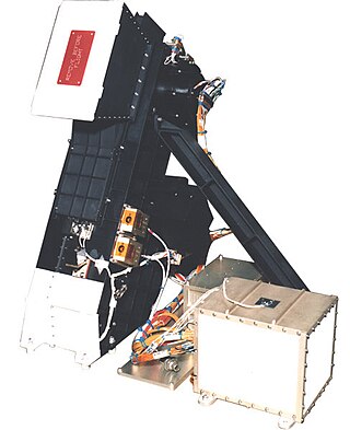
The Array of Low Energy X-ray Imaging Sensors X-ray telescope featured curved mirrors whose multilayer coatings reflected and focused low-energy X-rays or extreme ultraviolet (EUV) light the way optical telescopes focus visible light. The satellite and payloads were funded by the United States Department of Energy and built by Los Alamos National Laboratory (LANL) in collaboration with Sandia National Laboratories and the University of California-Space Sciences Lab. The satellite bus was built by AeroAstro, Inc. of Herndon, VA. The Launch was provided by the United States Air Force Space Test Program on a Pegasus Booster on April 25, 1993. The mission was entirely controlled from a small groundstation at LANL.
A scatterometer or diffusionmeter is a scientific instrument to measure the return of a beam of light or radar waves scattered by diffusion in a medium such as air. Diffusionmeters using visible light are found in airports or along roads to measure horizontal visibility. Radar scatterometers use radio or microwaves to determine the normalized radar cross section of a surface. They are often mounted on weather satellites to find wind speed and direction, and are used in industries to analyze the roughness of surfaces.

Interstellar Boundary Explorer is a NASA satellite in Earth orbit that uses energetic neutral atoms (ENAs) to image the interaction region between the Solar System and interstellar space. The mission is part of NASA's Small Explorer program and was launched with a Pegasus-XL launch vehicle on 19 October 2008.

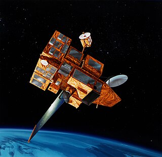
NOAA-19, known as NOAA-N' before launch, is the last of the American National Oceanic and Atmospheric Administration (NOAA) series of weather satellites. NOAA-19 was launched on 6 February 2009. NOAA-19 is in an afternoon Sun-synchronous orbit and is intended to replace NOAA-18 as the prime afternoon spacecraft.
The Special Sensor Ultraviolet Limb Imager (SSULI) is an imaging spectrometer that is used to observe the earth's ionosphere and thermosphere. These sensors provide vertical intensity profiles of airglow emissions in the extreme ultraviolet and far ultraviolet spectral range of 800 to 1700 Angstrom and scan from 75 km to 750 km tangent altitude. The data from these sensors will be used to infer altitude profiles of ion, electron and neutral density.
The Space Test Program (STP) is the primary provider of spaceflight for the United States Department of Defense (DoD) space science and technology community. STP is managed by a group within the Advanced Systems and Development Directorate, a directorate of the Space and Missile Systems Center of the United States Space Force. STP provides spaceflight via the International Space Station (ISS), piggybacks, secondary payloads and dedicated launch services.
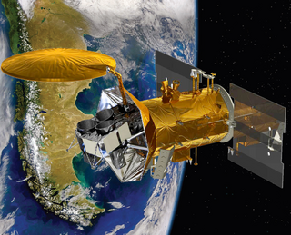
Aquarius was a NASA instrument aboard the Argentine SAC-D spacecraft. Its mission was to measure global sea surface salinity to better predict future climate conditions.
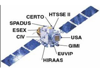
The Advanced Research and Global Observation Satellite (ARGOS) was launched on 23 February 1999 carrying nine payloads for research and development missions by nine separate researchers. The mission terminated on 31 July 2003.

C/NOFS, or Communications/Navigation Outage Forecasting System was a USAF satellite developed by the Air Force Research Laboratory (AFRL) Space Vehicles Directorate to investigate and forecast scintillations in the Earth's ionosphere. It was launched by an Orbital Sciences Corporation Pegasus-XL launch vehicle at 17:02:48 UTC on 16 April 2008 and decayed on 28 November 2015.

OSO 7 or Orbiting Solar Observatory 7, before launch known as OSO H is the seventh in the series of American Orbiting Solar Observatory satellites launched by NASA between 1962 and 1975. OSO 7 was launched from Cape Kennedy on 29 September 1971 by a Delta N rocket into a 33.1° inclination, low-Earth orbit, and re-entered the Earth's atmosphere on 9 July 1974. It was built by the Ball Brothers Research Corporation (BBRC), now known as Ball Aerospace, in Boulder Colorado.

An X-ray astronomy satellite studies X-ray emissions from celestial objects, as part of a branch of space science known as X-ray astronomy. Satellites are needed because X-radiation is absorbed by the Earth's atmosphere, so instruments to detect X-rays must be taken to high altitude by balloons, sounding rockets, and satellites.

The history of X-ray astronomy begins in the 1920s, with interest in short wave communications for the U.S. Navy. This was soon followed by extensive study of the earth's ionosphere. By 1927, interest in the detection of X-ray and ultraviolet (UV) radiation at high altitudes inspired researchers to launch Goddard's rockets into the upper atmosphere to support theoretical studies and data gathering. The first successful rocket flight equipped with instrumentation able to detect solar ultraviolet radiation occurred in 1946. X-ray solar studies began in 1949. By 1973 a solar instrument package orbited on Skylab providing significant solar data.
ADEOS II was an Earth observation satellite (EOS) launched by NASDA, with contributions from NASA and CNES, in December 2002. and it was the successor to the 1996 mission ADEOS I. The mission ended in October 2003 after the satellite's solar panels failed.

ADEOS I was an Earth observation satellite launched by NASDA in 1996. The mission's Japanese name, Midori means "green". The mission ended in July 1997 after the satellite sustained structural damage to the solar panel. Its successor, ADEOS II, was launched in 2002. Like the first mission, it ended after less than a year, also following solar panel malfunctions.
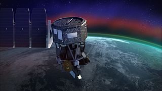
Ionospheric Connection Explorer (ICON) is a satellite designed to investigate changes in the ionosphere of Earth, the dynamic region high in our atmosphere where terrestrial weather from below meets space weather from above. ICON studies the interaction between Earth's weather systems and space weather driven by the Sun, and how this interaction drives turbulence in the upper atmosphere. It is hoped that a better understanding of this dynamic will mitigate its effects on communications, GPS signals, and technology in general. It is part of NASA's Explorer program and is operated by University of California, Berkeley's Space Sciences Laboratory.