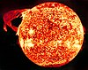
Sunlight is a portion of the electromagnetic radiation given off by the Sun, in particular infrared, visible, and ultraviolet light. On Earth, sunlight is scattered and filtered through Earth's atmosphere, and is obvious as daylight when the Sun is above the horizon. When direct solar radiation is not blocked by clouds, it is experienced as sunshine, a combination of bright light and radiant heat (Atmospheric). When blocked by clouds or reflected off other objects, sunlight is diffused. Sources estimate a global average of between 164 watts to 340 watts per square meter over a 24-hour day; this figure is estimated by NASA to be about a quarter of Earth's average total solar irradiance.

The Laboratory for Atmospheric and Space Physics (LASP) is a research organization at the University of Colorado Boulder. LASP is a research institute with over one hundred research scientists ranging in fields from solar influences, to Earth's and other planetary atmospherics processes, space weather, space plasma and dusty plasma physics. LASP has advanced technical capabilities specializing in designing, building, and operating spacecraft and spacecraft instruments.

The solar constant (GSC) measures the amount of energy received by a given area one astronomical unit away from the Sun. More specifically, it is a flux density measuring mean solar electromagnetic radiation per unit area. It is measured on a surface perpendicular to the rays, one astronomical unit (au) from the Sun.

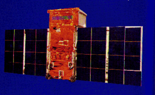
The Upper Atmosphere Research Satellite (UARS) was a NASA-operated orbital observatory whose mission was to study the Earth's atmosphere, particularly the protective ozone layer. The 5,900-kilogram (13,000 lb) satellite was deployed from Space Shuttle Discovery during the STS-48 mission on 15 September 1991. It entered Earth orbit at an operational altitude of 600 kilometers (370 mi), with an orbital inclination of 57 degrees.

Solar irradiance is the power per unit area received from the Sun in the form of electromagnetic radiation in the wavelength range of the measuring instrument. Solar irradiance is measured in watts per square metre (W/m2) in SI units.

The Solar Dynamics Observatory (SDO) is a NASA mission which has been observing the Sun since 2010. Launched on 11 February 2010, the observatory is part of the Living With a Star (LWS) program.

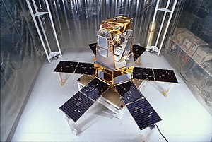
The Active Cavity Radiometer Irradiance Monitor Satellite, or ACRIMSAT was a satellite carrying the ACRIM-3 instrument. It was one of the 21 observational components of NASA's Earth Observing System program. The instrument followed upon the ACRIM-1 and ACRIM-2 instruments that were launched on multi-instrument satellite platforms. ACRIMSAT was launched on 20 December 1999 from Vandenberg Air Force Base as the secondary payload on the Taurus launch vehicle that launched KOMPSAT. It was placed into a high inclination of 98.30°, at 720 km. Sun-synchronous orbit from which the ACRIM-3 instrument monitored total solar irradiance (TSI). Contact with the satellite was lost on 14 December 2013.

NOAA-17, also known as NOAA-M before launch, was an operational, polar orbiting, weather satellite series operated by the National Environmental Satellite Service (NESS) of the National Oceanic and Atmospheric Administration (NOAA). NOAA-17 also continued the series of Advanced TIROS-N (ATN) spacecraft begun with the launch of NOAA-8 (NOAA-E) in 1983 but with additional new and improved instrumentation over the NOAA A-L series and a new launch vehicle.

NOAA-16, also known as NOAA-L before launch, was an operational, polar orbiting, weather satellite series operated by the National Environmental Satellite Service (NESS) of the National Oceanic and Atmospheric Administration (NOAA). NOAA-16 continued the series of Advanced TIROS-N (ATN) spacecraft that began with the launch of NOAA-8 (NOAA-E) in 1983; but it had additional new and improved instrumentation over the NOAA A-K series and a new launch vehicle. It was launched on 21 September 2000 and, following an unknown anomaly, it was decommissioned on 9 June 2014. In November of 2015 it broke up in orbit, creating more than 200 pieces of debris.

NOAA-18, also known as NOAA-N before launch, is an operational, polar orbiting, weather satellite series operated by the National Environmental Satellite Service (NESS) of the National Oceanic and Atmospheric Administration (NOAA). NOAA-18 also continued the series of Advanced TIROS-N (ATN) spacecraft begun with the launch of NOAA-8 (NOAA-E) in 1983 but with additional new and improved instrumentation over the NOAA A-M series and a new launch vehicle. NOAA-18 is in an afternoon equator-crossing orbit and replaced NOAA-17 as the prime afternoon spacecraft.

NOAA-15, also known as NOAA-K before launch, is an operational, polar-orbiting of the NASA-provided Television Infrared Observation Satellite (TIROS) series of weather forecasting satellite operated by National Oceanic and Atmospheric Administration (NOAA). NOAA-15 was the latest in the Advanced TIROS-N (ATN) series. It provided support to environmental monitoring by complementing the NOAA/NESS Geostationary Operational Environmental Satellite program (GOES).
ADEOS II was an Earth observation satellite (EOS) launched by NASDA, with contributions from NASA and CNES, in December 2002. and it was the successor to the 1996 mission ADEOS I. The mission ended in October 2003 after the satellite's solar panels failed.
TD-1A, or Thor-Delta 1A, was a European astrophysical research satellite which was launched in 1972. Operated by the European Space Research Organisation, TD-1A made astronomical surveys primarily in the ultraviolet, but also using x-ray and gamma ray detectors.

The SOLRAD 8,Explorer 30 or SE-A satellite was one of the NASA SOLRAD program that began in 1960 to provide continuous coverage of solar radiation with a set of standard photometers. SOLRAD 8 was a spin-stabilized satellite oriented with its spin axis perpendicular to the sun-satellite line so that the 14 solar X-ray and ultraviolet photometers pointing radially outward from its equatorial belt viewed the sun on each revolution. Data were transmitted in real time by means of an FM / AM the satellite's telemetry system and were recorded by the stations on the Spacecraft Tracking and Data Acquisition Network (STADAN) tracking network.

Student Nitric Oxide Explorer, was a NASA small scientific satellite which studied the concentration of nitric oxide in the thermosphere. It was launched in 1998 as part of NASA's Explorer program. The satellite was the first of three missions developed within the Student Explorer Demonstration Initiative (STEDI) program funded by the NASA and managed by the Universities Space Research Association (USRA). STEDI was a pilot program to demonstrate that high-quality space science can be carried out with small, low-cost free-flying satellites on a time scale of two years from go-ahead to launch. The satellite was developed by the University of Colorado Boulder's Laboratory for Atmospheric and Space Physics (LASP) and had met its goals by the time its mission ended with reentry in December 2003.
Explorer 55, also called as AE-E, was a NASA scientific satellite belonging to series Atmosphere Explorer, being launched on 20 November 1975 from Cape Canaveral Air Force Station (CCAFS) board a Thor-Delta 2910 launch vehicle.

NOAA-9, known as NOAA-F before launch, was an American weather satellite operated by the National Oceanic and Atmospheric Administration (NOAA) for use in the National Environmental Satellite Data and Information Service (NESDIS). It was the second of the Advanced TIROS-N series of satellites. The satellite design provided an economical and stable Sun-synchronous platform for advanced operational instruments to measure the atmosphere of Earth, its surface and cloud cover, and the near-space environment.
NOAA-10, known as NOAA-G before launch, was an American weather satellite operated by the National Oceanic and Atmospheric Administration (NOAA) for use in the National Environmental Satellite Data and Information Service (NESDIS). It was the third of the Advanced TIROS-N series of satellites. The satellite design provided an economical and stable Sun-synchronous platform for advanced operational instruments to measure the atmosphere of Earth, its surface and cloud cover, and the near-space environment.
NOAA-11, known as NOAA-H before launch, was an American weather satellite operated by the National Oceanic and Atmospheric Administration (NOAA) for use in the National Operational Environmental Satellite System (NOESS) and for support of the Global Atmospheric Research Program (GARP) during 1978–1984. It was the fourth of the Advanced TIROS-N series of satellites. The satellite design provided an economical and stable Sun-synchronous platform for advanced operational instruments to measure the atmosphere of Earth, its surface and cloud cover, and the near-space environment.

Judith L. Lean is an Australian-American solar and climate scientist. She is a senior scientist at the United States Naval Research Laboratory. Lean is a three time recipient of the NASA Group Achievement Award and an elected member and fellow of several academic societies.