South Eastern Freeway is a 73 km (45 mi) freeway in South Australia (SA). It is a part of the National Highway network linking the state capital cities of Adelaide, SA, and Melbourne, Victoria. It is signed as the M1. It carries traffic over the Adelaide Hills between Adelaide and the River Murray, near Murray Bridge, where it is connected via the Swanport Bridge to the Dukes Highway, which is the main road route to Victoria.

The Adelaide Hills region is located in the southern Mount Lofty Ranges east of the city of Adelaide in the state of South Australia. The largest town in the area, Mount Barker is one of Australia's fastest-growing towns. Before British colonisation of South Australia, the area was inhabited by the Peramangk people.
Waterfall Gully is an eastern suburb of the South Australian capital city of Adelaide. It is located in the foothills of the Mount Lofty Ranges around 5 km (3.1 mi) east-south-east of the Adelaide city centre. For the most part, the suburb encompasses one long gully with First Creek at its centre and Waterfall Gully Road running adjacent to the creek. At the southern end of the gully is First Falls, the waterfall for which the suburb was named. Part of the City of Burnside, Waterfall Gully is bounded to the north by the suburb of Burnside, from the north-east to south-east by Cleland National Park, to the south by Crafers West, and to the west by Leawood Gardens and Mount Osmond.

Mount Lofty is the highest point in the southern Mount Lofty Ranges. It is located about 15 km (9.3 mi) east of the Adelaide city centre, within the Cleland National Park in the Adelaide Hills area of South Australia.
The Mount Lofty Ranges are a range of mountains in the Australian state of South Australia which for a small part of its length borders the east of Adelaide. The part of the range in the vicinity of Adelaide is called the Adelaide Hills and defines the eastern border of the Adelaide Plains.
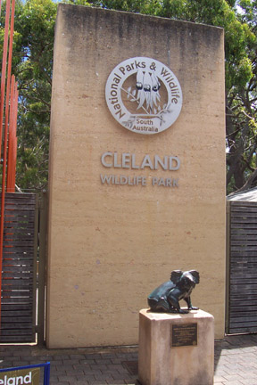
Cleland National Park, formerly Cleland Conservation Park, is a protected area located in the Adelaide Hills, South Australia about 22 kilometres (14 mi) south-east of the Adelaide city centre. It conserves a significant area of natural bushland on the Adelaide Hills face, including Mount Lofty Summit and Waterfall Gully.

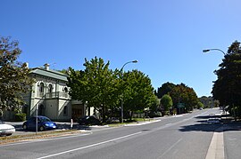
Stirling is a town in the Adelaide Hills, South Australia, approximately 15 km from the Adelaide city centre. It is administered by the Adelaide Hills Council. Neighbouring townships are Crafers and Aldgate. Other nearby towns are Heathfield and Bridgewater. Of those five, Stirling has by far the largest commercial strip, with the greatest number and widest variety of shops, and the only banks. Stirling East, a similar sized area towards Aldgate, is home to several schools.
Mount Osmond is a small suburb of 2,497 people in the South Australian capital city of Adelaide. It is part of the City of Burnside local government area and located in the foothills of the Adelaide Hills, five kilometres south east of the city centre. The suburb is high on the hill of the same name, which is the last hill on the right when approaching Adelaide down the South Eastern Freeway before the road levels out onto the Adelaide Plains. It is bounded to the north by the suburb of Beaumont, to the north-east by Burnside, to the east by Waterfall Gully, to the south by Leawood Gardens/Eagle On The Hill, to the south-west by Urrbrae, to the west by Glen Osmond and to the north-west by St Georges.

Eagle On The Hill is an unbounded locality in the Australian state of South Australia located in the suburb of Crafers West on the western face of the Adelaide Hills overlooking the Adelaide metropolitan area.

Aldgate is a South Australian village and a suburb of Adelaide, located 21 km (13 mi) south-east of the Adelaide city centre, in the Adelaide Hills.

The history of the City of Burnside, a local government area in the metropolitan area of Adelaide, spans three centuries. Prior to European settlement Burnside was inhabited by the Kaurna people, who lived around the creeks of the River Torrens during the winter and in the Adelaide Hills during the summer.

Heathfield is a township in the Adelaide Hills of South Australia near Stirling. It is home to Heathfield High School, Heathfield Primary School, Heathfield Oval, the Heathfield Waste Depot, Mount Lofty Sand and Metal, Masonic homes, a biodynamic farm and a proposed service station development, along with numerous walking trails. Heathfield is also located close to Mount Lofty Ranges. The small country suburb of Heathfield also contains a small conservation park known as Woorabinda. This is used daily by residents to walk their dogs; and ducks to receive free food.

Piccadilly is a small town in the Adelaide Hills of South Australia, Australia. At the 2006 census, Piccadilly had a population of 509.

The Heysen Tunnels are twin tube road tunnels which carry the South Eastern Freeway under Eagle On The Hill in the Mount Lofty Ranges in South Australia. The tunnels were excavated using a tunnelling machine normally used in heavy-duty mining operations which tunnelled through 500 metres (1,600 ft) of rock for each tunnel at an average rate of 3 metres (9.8 ft) per day. The tunnels were completed in 1998 and opened on 5 March 2000. Each tunnel carries three lanes of traffic. As at 2015, 45,700 vehicles passed through them daily. The maximum height of vehicles permitted in the tunnels is 5.3 metres (17 ft), the same as the Crafers and Mt Osmond interchanges. Laser height detectors monitor traffic to provide warnings to drivers before they attempt to enter the tunnel.
Crafers West is a suburb of Adelaide in the Adelaide Hills Council. Located on Peramangk land, it was formally named in 1985 as a separate address from Crafers. Crafers West contains the headwaters of Brown Hill Creek and is dominated by steep terrain and native scrub. It is bounded by Mount Barker Road on the northeast and the Bridgewater railway line on the south. The Eagle Mountain Bike Park is in the north of the suburb. Popular tourist spots include Clealand Conservation Park, Mt Lofty Botanic Gardens, and Belair National Park Holiday Park.
Transitplus was a privately owned public transport company which operated bus services from the South Australian capital Adelaide, to the Adelaide Hills, mainly Mount Barker area. It is part of the Adelaide Metro network. It was a joint venture between TransAdelaide, which also operates the train system in Adelaide and Australian Transit Enterprises. Transitplus was based in Aldgate in the Adelaide Hills and had two depots located in Aldgate and Mount Barker.
Mount Barker Road was once the main road from Adelaide through the Adelaide Hills to Mount Barker on the eastern slopes of the Mount Lofty Ranges. The main route has now been replaced, or subsumed into, the South Eastern Freeway, but two sections of it remain, and are still classified as state roads.

Cleland is a suburb in South Australia located in the Adelaide metropolitan area about 10 kilometres south-east of the Adelaide city centre. Its boundaries were created in October 2001, with additional land being added in 2010 from the adjoining suburb of Crafers. Its name is derived from the former Cleland Conservation Park.
Mylor Conservation Park is a protected area located in the Australian state of South Australia in the suburb of Mylor in the Adelaide Hills state government region about 19 kilometres (12 mi) south-east of the state capital of Adelaide and about 1 kilometre (0.62 mi) north-east of the town of Mylor.