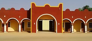
Yola, meaning 'Great Plain' or 'Vast Plain Land', is a large city, capital city and administrative centre of Adamawa State, Nigeria. It is located on the Benue River, and it has a population of over 336,648 (2010). Yola is split into two parts. The old town of Yola where the Lamido resides is the traditional city and the new city of Jimeta is the administrative and commercial centre. They are generally referred to as Yola.

Bauchi is a city in northeast Nigeria, the Administrative center of Bauchi State, of the Bauchi Local Government Area within that State, and of the traditional Bauchi Emirate. It is located on the northern edge of the Jos Plateau, at an elevation of 616 m. The Local Government Area covers an area of 3,687 km2 and had a population of 493,810 in 2006.

Ningi is a town, a local government area, and an emirate in Bauchi State, Nigeria. The Ningi emirate comprises two local government areas, Ningi and Warji, with a combined area of 5,250 km2 and a population of 501,912 according to the 2006 Census. The Ningi local government area covers an area of 4,625 km2 with a population of 387,192 at the 2006 Census. The area is inhabited mostly by hausa people, Duwa, Ningawa.Yunusa Muhammadu Danyaya is the current Emir of Ningi.
Alkaleri is a Local Government Area of Bauchi State, Nigeria. Its headquarters are in the town of Alkaleri on the A345 highway in the north of the area at10°15′58″N10°20′07″E.The northeasterly line of equal latitude and longitude passes through the Local Government Area.

Bogoro is a Local Government Area of Bauchi State, Nigeria. Its headquarters are in the town of Bogoro. Za’ar or Sayawa people are the majority of its inhabitants.
Darazo is a Local Government Area of Bauchi State, Nigeria, Its headquarters are in the town of Darazo. Darazo is mainly dominated by Fulani and Karai-karai people.
Dass is a Local Government Area of Bauchi State, Nigeria. Its headquarters are in the town of Dass.

Gamawa is a Local Government Area of Bauchi State, Nigeria, bordering Yobe State in the east. Its headquarters are in the town of Gamawa.
Giade is a Local Government Area of Bauchi State, Nigeria. Its headquarters are in the town of Giade. It become local government in 1996. The most dominantly spoken languages in the area are Fulani, Hausa and Karai-karai.
Itas/Gadau is a Local Government Area of Bauchi State, Nigeria. Its headquarters are in the town of Itas Itesiwaju. The town of Gadau is in the east of the area at 11°50′08″N10°10′02″E.
Kirfi is a Local Government Area of Bauchi State, Nigeria, bordering Gombe State in the east. Its headquarters are in the town of Kirfi. The northeasterly line of equal latitude and longitude passes through the Local Government Area.
Misau is a Local Government Area of Bauchi State, Nigeria. Its headquarters are in the town of Misau. The people of Misau are mostly Fulani, Karai-karai, Kanuri and Hausa by tribe.
Shira is a Local Government Area of Bauchi State, Nigeria. Its headquarters is in the town of Yana.

Toro is a Local Government Area of Bauchi State, Nigeria. Toro local government headquarters is in the town of Toro. The local government has three districts: Toro, Jama'a and Lame district. The local government is the largest local government in Nigeria and west Africa in particular. It has an area of 6,9322km and a population of 350,404 at the 2006 census. The postal code of the area is 740.
Warji is a Local Government Area of Bauchi State, Nigeria. Its headquarters is in the town of Warji.
Zaki is a Local Government Area of Bauchi State, Nigeria. Its headquarters are in the town of Katagum.
Ise/Orun is a Local Government Area of Ekiti State, Nigeria. Its headquarters are in the town of Ise Ekiti.
Kaltungo is one among the 11 Local Governments Area of Gombe State, Nigeria. Its headquarters is in the town of Kaltungo in the western part of the Local Government Area on the A345 highway at 9°48′51″N11°18′32″E.
Tafawa Balewa is a local government area in the Southern part of Bauchi State in northern Nigeria. Its headquarters was in the town of Tafawa Balewa, but has no being shifted to Bununu town in 2011 due to constant unrest in the former.
Yana is a town and the headquarters of Shira Local Government Area in Bauchi State, Nigeria. Jaka, Bela, Jalingo, and Gabali are among the towns, cities, and locations close to Yana.


