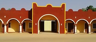
Bauchi is a city in northeast Nigeria, the Administrative center of Bauchi State, of the Bauchi Local Government Area within that State, and of the traditional Bauchi Emirate. It is located on the northern edge of the Jos Plateau, at an elevation of 616 m. The Local Government Area covers an area of 3,687 km2 and had a population of 493,810 in 2006.

Bauchi State is a state in the North-East geopolitical zone of Nigeria, bordered by Jigawa to the north, Yobe to the northeast, Gombe to the east, Taraba and Plateau to the south, Kaduna to the west and Kano to the northwest. It takes its name from the historic town of Bauchi, which also serves as its capital city. The state was formed in 1976 when the former North-Eastern State was broken up. It originally included the area that is now Gombe State, which became a distinct state in 1996.

Ningi is a town, a local government area, and an emirate in Bauchi State, Nigeria. The Ningi emirate comprises two local government areas, Ningi and Warji, with a combined area of 5,250 km2 and a population of 501,912 according to the 2006 Census. The Ningi local government area covers an area of 4,625 km2 with a population of 387,192 at the 2006 Census. The area is inhabited mostly by hausa people, Duwa, Ningawa.Yunusa Muhammadu Danyaya is the current Emir of Ningi.

Katagum is a town, a local government area and a traditional emirate in Bauchi State of north eastern Nigeria. The town is located on the northern bank of the Jama'are River, which is a tributary of the Hadejia. Most of the inhabitants are peoples from the Fulani, Kanuri, Karai-karai and Hausa tribes. The chief agricultural products include peanuts (groundnuts), sorghum, millet, rice, cowpeas, cotton, indigo, and gum arabic. Livestock include horses, cattle, goats, sheep, donkeys and a lot of poultry.

The Jama'are River, also known as the Bunga River in its upper reaches, starts in the highlands near Jos, Plateau State, Nigeria and flows northeast through Bauchi State and Yobe State before joining the Hadejia River to form the Yobe River. There has recently been controversy over a plan to build the Kafin Zaki Dam on this river, with concerns over the effect on seasonal flooding and the water table.
Alkaleri is a Local Government Area of Bauchi State, Nigeria. Its headquarters are in the town of Alkaleri on the A345 highway in the northern part of the Local Government Area.
Darazo is a Local Government Area of Bauchi State, Nigeria, Its headquarters are in the town of Darazo. Darazo is mainly dominated by Fulani and Karai-karai people.

Gamawa is a Local Government Area of Bauchi State, Nigeria, bordering Yobe State in the east. Its headquarters are in the town of Gamawa.
Giade is a Local Government Area of Bauchi State, Nigeria. Its headquarters are in the town of Giade. It become local government in 1996. The most dominantly spoken languages in the area are Hausa and Fulfulde.
Itas/Gadau is a Local Government Area of Bauchi State, Nigeria. Its headquarters are in the town of Itas Itesiwaju. The town of Gadau is in the east of the area at 11°50′08″N10°10′02″E.
Kirfi is a Local Government Area of Bauchi State, Nigeria, bordering Gombe State in the east. Its headquarters are in the town of Kirfi. The northeasterly line of equal latitude and longitude passes through the Local Government Area.
Misau is a Local Government Area of Bauchi State, Nigeria. Its headquarters are in the town of Misau. The people of Misau are mostly Fulani, Karai-karai, Kanuri and Hausa by tribe.
Shira is a Local Government Area of Bauchi State, Nigeria. Its headquarters is in the town of Yana.

Kaltungo is one among the 11 Local Governments Area of Gombe State, Nigeria. Its headquarters is in the town of Kaltungo in the western part of the Local Government Area on the A345 highway at 9°48′51″N11°18′32″E.

Kafin Hausa is a Local Government Area of Jigawa State, Nigeria. Its headquarters are in the town of Kafin Hausa.
Guri is a Local Government Area of Jigawa State, Nigeria. Its headquarters are in the town of Guri. [The big town of guri local government is] KADIRA.
Kankia is a Local Government Area in Katsina State, Nigeria. and has its headquarters is in the town of Kankia on Kano - Katsina road A9 highway at12°32′57″N7°49′31″E.. Towns and villages that make up Kankia Local Government Area include Kafin Dangi, Sukuntuni, Rimaye, Sabuwar Duniya, Tafashiya, Gaza, Kafin-soli, and Kankia. The population of Kankia Local Government Area is estimated at 151,434 inhabitants at the 2006 census with the majority of the area’s dwellers being members of the Hausa and the Fulani ethnic divisions. The Hausa and the Fufulde languages are widely spoken in the area with Islam as the LGA’s most practiced religion. The paramount traditional ruler in Kankia LGA is the Hakimi Kankia while notable landmarks in the area include the Kankiya Iro School of Hecalth Technology, Kankia and the Kankia General Hospital. The postal code of the area is 822
Kauru is a Local Government Area in southern Kaduna State, Nigeria. The area is 3,186 km2. Its headquarters are in the town of Kauru. The postal code of the area is 811.
Bade is a Local Government Area in Yobe State, Nigeria. It has its headquarters in the town of Gashua. Most of the people living in Bade are farmers and businessmen.
Jakusko is a Local Government Area in Yobe State, Nigeria. Its headquarters are in the town of Jakusko in the west of the area at 12°22′09″N10°46′23″E.


